Road Trip Postscript: People Along the Way

Michael Hasch, a seasonal National Park Service ranger and battlefield interpreter at the Little Bighorn National Monument, during a talk on September 4, 2021.

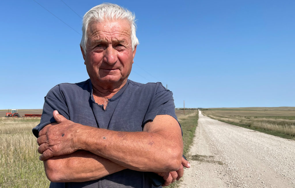
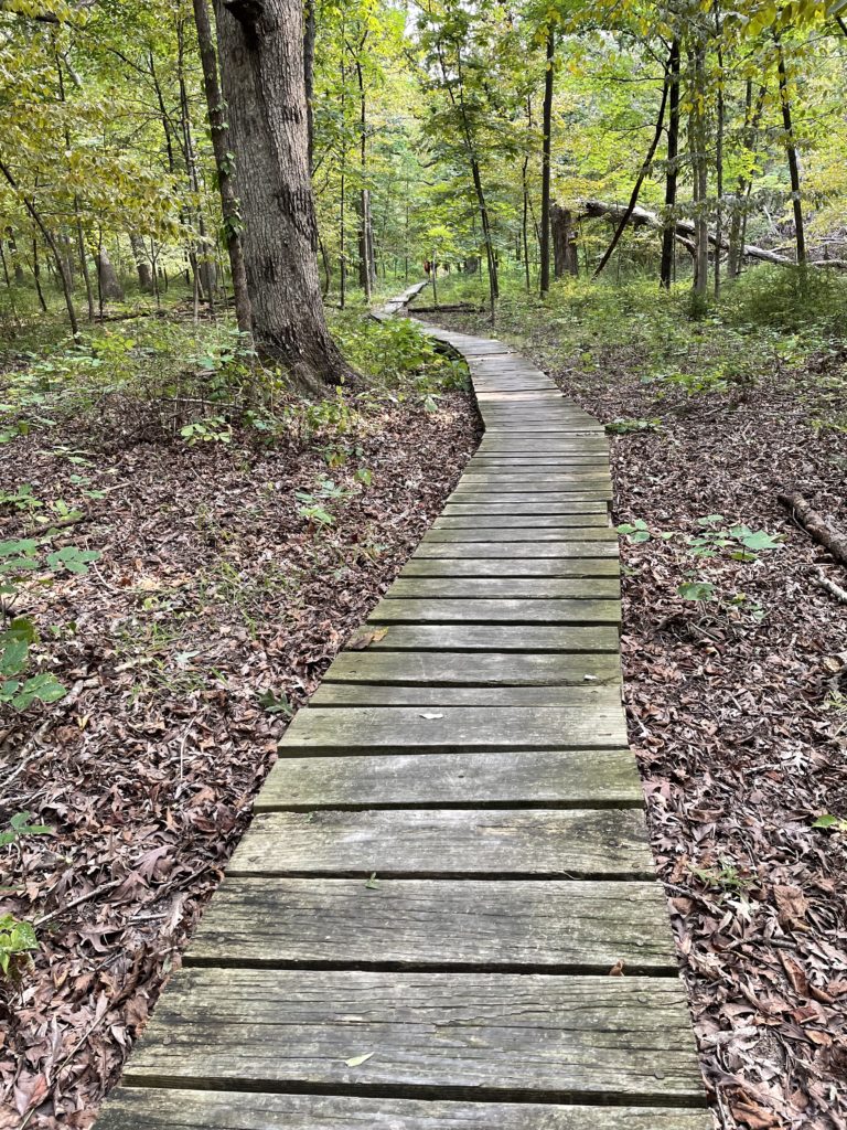
I wish I could say that in a trip that covered something like 6,000 miles over 23 days that we met lots of people and had deep conversations that led to profound personal discovery. We didn’t. And maybe the stats mentioned in that first sentence explain part of the reason. We were actually actively traveling for just 15 or 16 days, which means we were covering 400 miles a day on average. That’s nothing for The Great American Road Warrior, for whom 500 or 600 or even 1,000 miles a day is routine (I once took a trip back to Chicago from Berkeley with my son Eamon that covered 2,100 miles in all of 40 hours, even with an overnight stop in Cheyenne, Wyoming). The point being: Even at 400 miles a day, the modern traveler isn’t going to spend a lot of time in intimate conversation with random acquaintances on the road. Even if you’re the kind of person who easily strikes up a conversation with a total stranger, which mostly I am not.

On the other hand, the conversations that do happen tend to stand out.

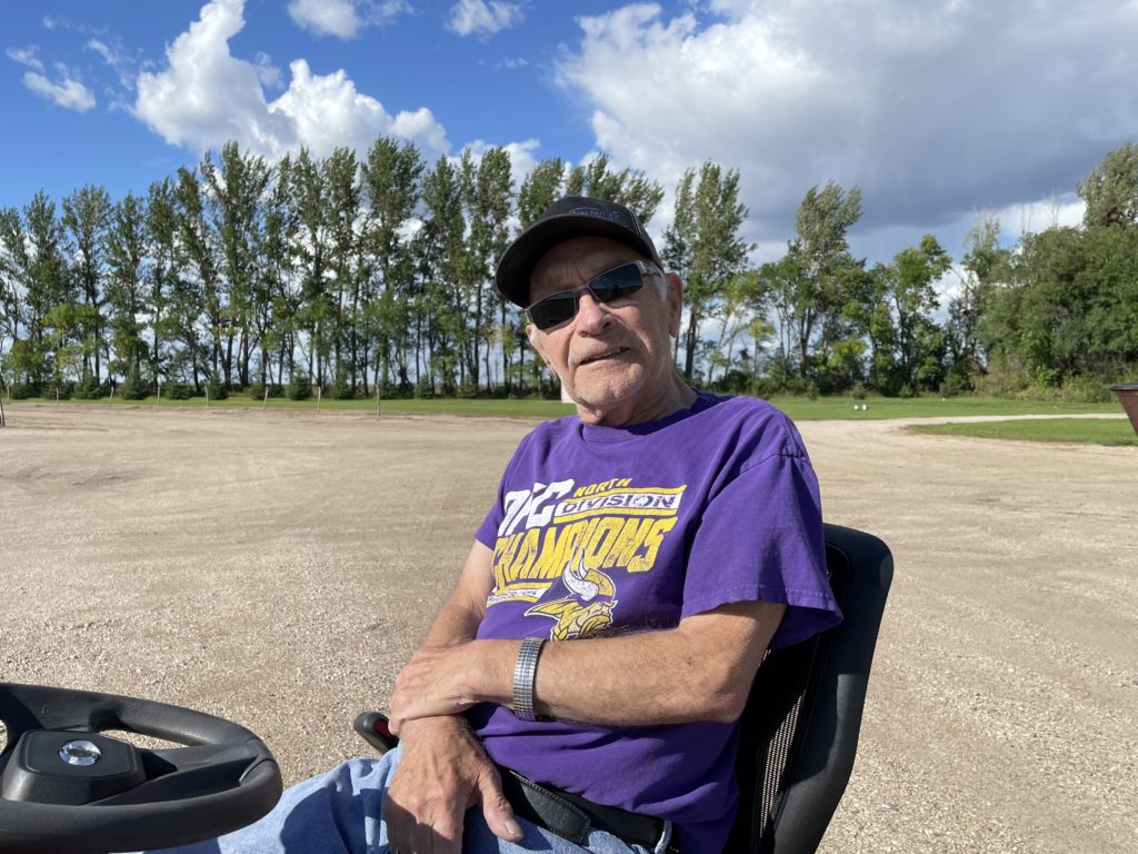
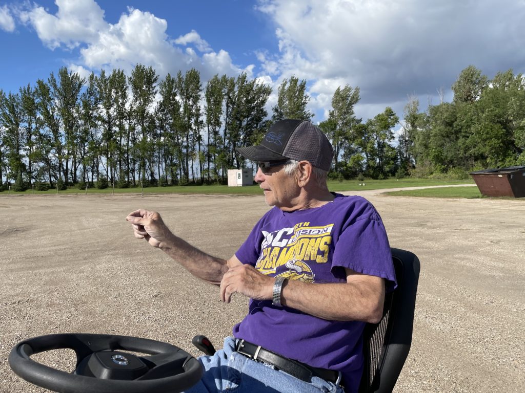
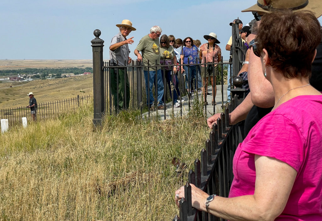
When John and I stopped at the Little Bighorn Battlefield National Monument in Montana, one of the main destinations on our trip, we encountered a group at the top of what has long been known as Last Stand Hill, the place where Lt. Col. George A. Custer and the remnants of his command died together on June 25, 1876. People were listening to a ranger named Michael Hasch recount the progress of the battle. I was impressed by Hasch’s command of the lore surrounding the battle, including the many first-person accounts from Native American participants. One moment I remember in particular from his talk: The moment when a Cheyenne named Lame White Man rallied fellow warriors to the attack by shouting, “Come! We can kill them all!” Hasch has a deep voice, and it carries. He spoke slowly, deliberately, and when he intoned those words, it was like the moment was coming alive again. After his presentation, I talked to Hasch and discovered he is a former Pittsburgh newspaper reporter who began volunteering at the battlefield a decade ago. One of the people listening to that conversation was a woman who used to be a local news anchor in San Francisco, and that led to yet another conversation with a stranger. But that’s another story.

So, that’s one encounter during our trip across the country. Here are a couple of others:

Laura and Jamie at the top of Teton Pass, Wyoming.

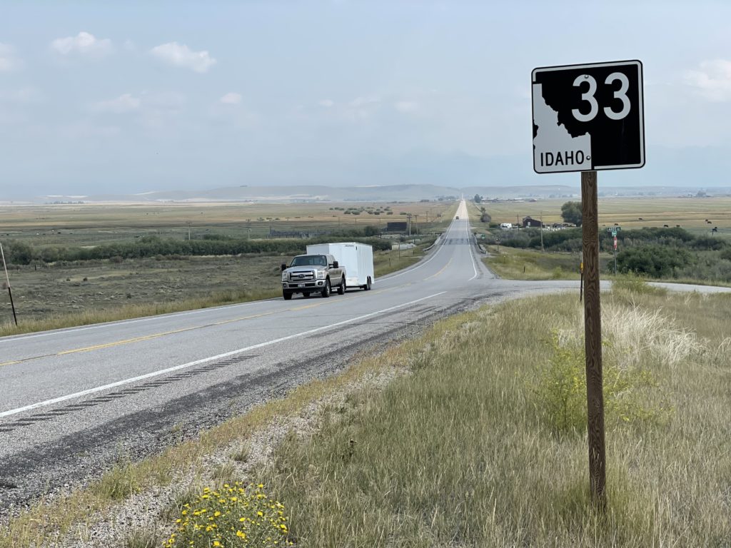
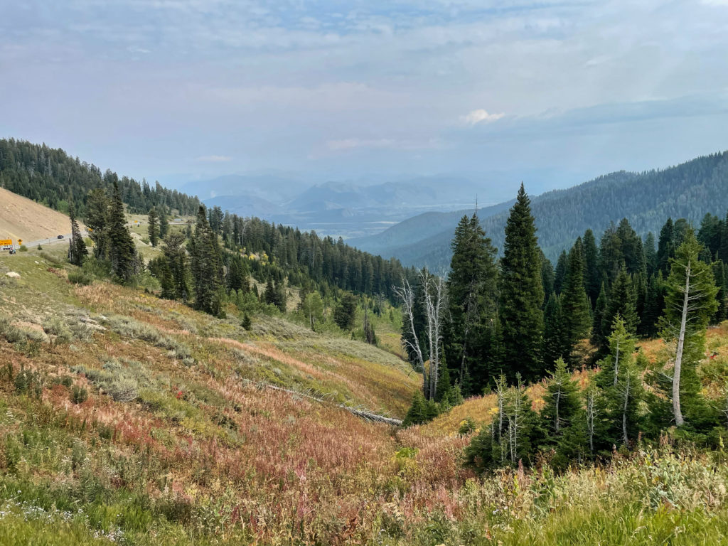
We met Laura and Jamie at the top of Teton Pass, Wyoming (elevation 8,432 feet above sea level). We had driven up the west side on our way from Idaho to the Grand Tetons and Yellowstone. They arrived pushing a heavily-laden tandem bike up the east side.

Jamie and Laura’s custom-built tandem, complete with trailer. I believe they said the total weight of their outfit was about 200 pounds — no joke when climbing steep mountain roads.

What was their story? They said they had both quit their jobs, sold their home and most of their belongings and had a custom tandem built. Their plan was (presumably still is) to spend five years cycling around, mostly in Europe. They had ridden from Connecticut by way of Louisiana to get to this spot on Wyoming Highway 22, and planned to cycle up the west flank of the Tetons before heading east into Yellowstone. After that, they’d make their way east and south to Florida, where they planned to spend the winter before heading to Europe. The biggest impression they made on me was how cheerful they were after pushing their machine up the last two miles of busy roadway up to the pass. I, too, have pushed my bike up steep mountain roads, and I’m not sure I was smiling all the way.

What more can I say about these two? Godspeed, Laura and Jamie.

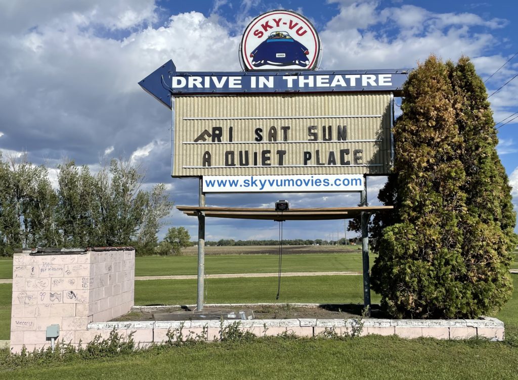
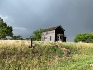
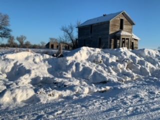
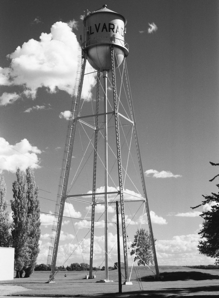
The motive for our road trip (or excuse, maybe) was to commemorate what would have been our dad’s 100th birthday in early September by visiting his birthplace and first hometown in northwestern Minnesota. We got to Marshall County a few days after the actual centennial, and spent much of the day taking pictures at a rural Lutheran church where our grandfather, Sjur Brekke, was pastor a century ago. The we headed to Alvarado, population 300, where Sjur, our grandmother, Otilia, and dad lived (and where Sjur saw to another Lutheran congregation). After that, we drove the five or six miles east on Minnesota Highway 1 to Warren, the county seat, where Dad was actually born. One thing I had discovered about Warren during a 2018 trip through the area (and somehow had missed during a couple of much earlier visits) is that the town’s drive-in theater, the Sky-Vu, is still in business.

John and I pulled in to the Sky-Vu to take a look. Like everyplace else where we stopped for more than a couple of minutes, we brought out cameras and started strolling around taking pictures. Next door, a man on a riding mower was cutting the grass on a sprawling lawn in front of a big ranch-style house painted the same pink color as the concession stand/projection booth at the theater. After about five minutes, he drove the mower over to see what we were up to.

“Your place?” I said. Or something like that. And it was. His name: Leonard Novak, and he said he’d bought the Sky-Vu in the early 1970s and that he and his family have been running it since; a grandson is doing most of the work now. As it happens, KFAI in Minneapolis did a nice radio documentary about 10 years ago featuring the Novaks and the Sky-Vu in which Leonard says he doesn’t foresee the theater closing, ever: “We’re the only one (drive-in) between Winnipeg and Minneapolis.” And judging from the fact it’s still open, and still showing first-run movies, maybe he’s right.

Leonard Novak. Owner, Sky-Vu Theater, Warren, Minnesota.

Road Trip Postscript: Once It Held Laughter, Once It Held Dreams

Near Rushville, Sheridan County, Nebraska.
"You can find all kinds of ruins on the Great Plains; in dry regions, things last a long time. When an enterprise fails on the plains, people usually just walk away and leave it. With empty land all around, there is not much reason to tear down and rebuild on the same site. ..." — Ian Frazier, "Great Plains"
"For every surviving ranch, I passed a dozen ruined houses. The prairie was dotted about with wrecks. Their windows, empty of glass, were full of sky. Strips of ice-blue showed between the rafters. Some had lost their footing and tumbled into their cellars. ... Skewed and splayed, the derelicts made up a distinctive local architecture." — Jonathan Raban, "Bad Land"

In mid-September, my brother John and I drove west from Chicago on our return trip to California. We didn’t follow anything like a standard route. From western Illinois across the prairies and into the plains of eastern Wyoming we stuck almost exclusively to two-lane roads, or at least non-interstates: U.S. 30 and 20 across Iowa; Nebraska Highway 12 and U.S. 20 again (after veering briefly into South Dakota along the Missouri River) across the Cornhusker State; and U.S. 20 once more until it merged with Interstate 25 near Casper, Wyoming. (Here’s a collection of pictures from both the east- and westbound legs of the trip.)

One morning along the way, we backtracked from Chadron, Nebraska, to Rushville, then headed north toward the Pine Ridge Oglala Sioux Reservation just across the South Dakota border. The site of the 1890 Wounded Knee massacre is on the reservation; it’s a spot I’ve long wanted to visit, and it was sort of an obvious bookend for our eastbound stop at the Little Big Horn battlefield.

A few miles up the road toward Pine Ridge we passed the house above. Both John and I, who had brought film cameras to record our travels, said we needed to remember to stop at the place on the way back from Wounded Knee. Three or four hours later, I was speeding back south when John said, “There it is.” “Really? Are you sure? I don’t think so. That doesn’t look like the same place to me.” “No — that’s the place.”

I hit the brakes hard, and we turned onto a dirt road adjacent to the house. I took note of a man on a tractor about a quarter-mile away and wondered whether he had some connection to the house. But I didn’t think about that for long. We broke out our cameras, including John’s 5-by-7 pinhole camera, a couple of older Nikons, and one of several rangefinder models I had brought along.

After about 15 minutes, I saw that the man on the tractor had stopped his plowing, climbed down, and was walking toward the house. I more than half-expected he would ask what the heck we were doing on his land. Instead, he said something like, “Picture day, huh, fellas?” Yes, the house was on his family’s land, but he was pretty genial and really just curious about what we were doing. It turned out that this was far from the first time he’d encountered passers-by who had stopped to photograph the house.

And about the house: The farmer/rancher, who told us his family name was Viher and that he’d been born here just after World War II , said it had been owned by a family named Rush (maybe the Rushes of Rushville?) and was last occupied in the 1940s. Mr. Viher said there was a problem with occasional vandalism on the property — at some point, someone had come along and burned down a barn adjacent to the house; a half-burned shed still stood.

On the Viher Ranch, Sheridan County, Nebraska.

There’s probably an essay waiting to be written here about why ruins like this attract our attention, but given the fact it’s taken me four months to sit down and write even a bare description of the visit, this is not it.

I did think to ask Mr. Viher if I could take his picture before he went back to plowing. He was agreeable.

Mr. Viher, September 2021.

Afterward, I did something I’d never done before: I had the picture printed, figured out the Vihers’ address on their ranch, and sent it to him. I didn’t hear back for a while and wouldn’t have been too surprised to get no response. But on New Year’s Eve, I got an email thanking me for the picture and respondng with a collection of snapshots of the house and other ranch scenes.

And those shots, if nothing else, show me that that picturesque wreck of a house out there on the plains speaks just as much to at least some of the folks living out there as it does to the random traveler with a camera.

Road Trip Notebook: A Town in Minnesota

Water tower, Alvarado, Minnesota.

Alvarado is a town of about 300 souls, 18 miles northeast of Grand Forks, North Dakota, on the exceedingly flat plain that spreads out from the Red River of the North. (No, not all plains are pool-table flat. Just ask the ones that call themselves “Great.”)

The water tower is right down the street from our dad’s first boyhood home. And that house is across the street from the site of Bethlehem Lutheran Church, where his father, the Rev. Sjur J. Brekke, was minister. All of that was a while ago. Dad was born in 1921, and his father was called to a congregation on the South Side of Chicago, Ebenezer Lutheran, in 1925 or ’26.

I’ve been to this place several times. Once with Dad, in 1988, when we were headed back to Chicago from a trip that had taken us to the Little Big Horn. Once the weekend before Christmas in 1998, when winter had really set in and high temperatures was in minus single digits Fahrenheit. Once in 2018, on a family heritage adventure with Kate, Eamon and Sakura. And again last month with my brother John.

We did have one conversation with someone in town on this last trip. A neighbor of the house where our dad’s family lived stopped as she was driving by and asked, “What’s up, guys?” So we told her our story of century-old roots — it was just a few days after what would have been Dad’s 100th birthday — and I had pictures of the house as it looked back then all queued up on my phone to show if anyone asked. But there wasn’t much to the conversation, really — I think the neighbor wanted to satisfy herself that these two incipient senior citizens perusing the premises next door were on the up and up.

We took some pictures and moved on to the next town down the road, Warren, where our dad was actually born and they still have a drive-in theater and weekly newspaper, among other attractions.

Road Blog: Continuation of the Foregoing

Moonrise on Interstate 15 south of Nephi, Utah.

Well, my brother John and I got back to our starting point here in Berkeley a few days ago. So the travelogue here is a little fractured. I have told myself that maybe if I could limit my road trip postings to a single paragraph, then maybe I could keep up a daily record. But one thing usually leads to another in the narrative that forms in my head. And brevity poses its own challenges.

So here we are. I last posted a week ago yesterday, Friday, September 17, from Chadron, Nebraska, after crossing the 100th Meridian. What happened after that?

Wounded Knee, South Dakota, on the Oglala Sioux’s Pine Ridge Reservation. Fort Robinson, Nebraska. Casper, Wyoming. Interstate 80 and Interstate 15 on a long drive from Casper to Las Vegas. A tough Sunday drive down I-15 and associated superhighways to Los Angeles. A couple of relaxed days in L.A. hanging out with my son Thom. Then a drive through Kern County backroads and oil fields, then I-5 up the San Joaquin Valley and across the passes and valley back to the bay shore and Berkeley.

I’ll circle back to some of that. There’s much more to say, including this one observation after three weeks and two days away from home: No matter how much time I give myself to explore this world of ours, I want more.

Road Blog: The 100th Meridian

Nebraska Highway 12, the “Outlaw Trail Scenic Byway,” in Keya Paha County. Everyone we encountered seemed law-abiding. Someone stopped while we were taking pictures of the sign to make sure we were OK.

We left Chicago on Wednesday morning and made it to Sioux City, Iowa, following what’s become a typical late-ish start (10:30, say, due to how slow I am to get ready) and quitting just at dark. It means we’re on the road for 10 or 11 hours each day.

Thursday we left Sioux City at about the usual time and spent the day zig-zagging back and forth across the Nebraska and South Dakota border as we headed west on two-lane roads, mostly on Nebraska’s Highway 12 and, further west, on U.S. 20. Four hundred miles or so later, we wound up in Chadron, Nebraska.

Someone — one would guess tourism-minded state and local officials and hopeful Chamber of Commerce folks — has styled Highway 12 “the Outlaw Trail Scenic Byway.” I can attest that the route is scenic, with sweeping vistas of the rolling country along the Missouri River on the road’s eastern end that transition slowly into the high plains and beginning of the Sand Hills on the western end. My only complaint, and you knew there had to be one, is that there’s no ready explanation along the road or on the Outlaw Trail websites about why, precisely, it’s called that.

One of the sites advertises an “adventure of friendly people, scenic sights and the history of Native American Tribes, outlaws, cowboys and pioneers. … Communities have museums waiting to be explored and murals waiting to be viewed. This region offers seasonal opportunities to hunt fauna or flora with arms or camera.  Please check on the current Covid situation.”

Highway 12 crosses the 100th Meridian west of Greenwich in Keya Paha County (‘keya paha is “turtle hill” in the Dakota language, per what I see online). I have an app on my phone that gives a very precise reading (to four decimal places) of latitude and longitude. When we got to the approximate locale, we parked at a crossroad and I walked about 1,000 feet back to the spot the app indicated was very nearly precisely the exact location of the meridian (“very nearly precisely” because the app would jump between 99.9996 and 100.0005 degrees with a single stride east or west).

John and I both took pictures to commemorate the spot. I wish I’d taken a shot of the little mark I gouged out on the road’s shoulder to mark the location.

See that fencepost? It’s just about exactly on the 100th Meridian.
Nebraska Highway 12, looking east into the humid eastern lowlands from the 100th Meridian.
My brother John lining up a pinhole camera 100th Meridian shot on sparsely traveled Nebraska Highway 12.

Why bother with the 100th Meridian? In the late 19th century, John Wesley Powell, the early explorer of the Grand Canyon and first head of the U.S. Geological Survey, proposed that line of longitude as marking the boundary between the wetter more humid areas of the eastern United States and the more arid regime of the West. Subsequent research found Powell’s observation to be spot on — though his other important ideas about the implications for development of the western United States have been largely ignored. More recently, scientists have been assessing how the dry transition that occurs along the 100th Meridian appears to be moving east due to the influence of climate change. You can read more here: “Whither the 100th Meridian? The Once and Future Physical and Human Geography of America’s Arid–Humid Divide. Part I: The Story So Far.

I’ll also note before posting that we have not one but two 100th Meridian museums on the Plains: one in Cozad, Nebraska, one in Erick, Oklahoma. Next time I’m roaming around out here. …

Road Blog: Heading West

Bell tower. St. Paul’s Lutheran Church, near Stanhope, Iowa.

We left my sister’s house on Chicago’s North Side at what I consider to be a humane hour, 10 a.m., headed across the northwestern suburbs to the series of toll roads that would lead us out of the metropolis and toward the Mississippi River. We got off the interstate routes in western Illinois and took U.S. 30, part of the old Lincoln Highway, across Iowa. We made a stop at the country church north of Des Moines where my father’s father’s parents and some distant cousins are buried. Then we raced across western Iowa to Sioux City, where we are tonight.

Our route after leaving the church — St. Paul’s Lutheran — took us through Stanhope, a little town I am sure my great-grandparents, my grandfather and my dad knew. We stopped at the one gas station in town to fill up. I walked in to the small store attached to the station to get a cold drink. There was a tall, gray-haired woman working at the counter.

“Hi, there,” I said.

“Hi,” she answered.

“How are you?” I asked.

“Great,” she said. “How about you?”

“Same. Beautiful day,” I replied.

“Yes it is,” she said. “Just like it was thirty-one years ago.”

“Thirty-one years ago,” I said. “1990. What happened on September 15, 1990?” I half expected to hear that a tornado or some other misfortune had befallen the town.

“I got married,” she said.

“That is a great thing to celebrate,” I said. And deciding to ignore the possibility that that marriage was over for one reason or another, I added, “Are you doing anything? Going out to dinner tonight?”

“No, not tonight,” she said. “Had to work. And so did he. But we’ll do something this weekend.’

And that was our conversation. Then we were back on the road and rolling through towns with names I wouldn’t have believed if I hadn’t seen them and double-checked them.

Road Blog: Stopping by Woods

Thorn Creek Woods, just outside Park Forest in Chicago’s southernmost suburbs.

My siblings and I were lucky to grow up in a place, just at the outer edge of Chicago’s southern suburbs, where nature was close by. For a crucial period of our growing-up years, we lived in a house my parents had built on a one-acre lot in the middle of a forest. During the summers, especially, we almost lived out of doors — camping, exploring and even learning a little about the life of the woods.

Until last weekend, I hadn’t taken a long walk in the woods in decades. Most of my visits to the area have involved checking out our old house and marveling at the fact that a good-sized residence on a wooded acre could be on the market for the low six figures (or even less; the place sold for $99,000 about three years back).

But since my brother John and I are here on our long road trip, we had the rare circumstance of all four siblings being in town together. So we got together and drove down to the woods on Saturday afternoon. The immediate purpose: to do something to remember our mom, who had a significant hand in the campaign to stop the nearly one thousand acres of forest from being knocked down for tract housing in the late 1960s.

Strolling an old haunt.

A lot has changed out there. Instead of walking out into the woods from our backyard, we accessed them by way of a trail that starts at a nature center just outside Park Forest. (The center building is an 1860-vintage Lutheran church that was moved about four miles in the mid-1960s to serve a new congregation, then later repurposed for the forest preserve.)

The woods themselves look different. Some areas are densely overgrown, others have little vegetation (but plenty of poison ivy) under the forest canopy. So ravines and gullies that used to be pretty much obscured by undergrowth are much more obvious.

A stand of fir trees that was apparently planted in the 1940s or ’50s has bolted. When we were kids, our neighbors and others used to go out and cut some of the firs for Christmas trees; now many of those trees appear to be seventy or eighty feet tall.

The Will County Forest Preserve District has installed wooden walkways through areas that are typically wet and put up a series of bridges over Thorn Creek. There are signs now marking trails through the trees. And a nice viewing platform on the edge of a seasonal wetland.

None of the improvements felt intrusive, and plenty of what we remember is intact. For instance, much of the gravel road that used to wind its way from just below our house to a Remington Arms plant on the other side of the woods is still there.

Probably the best measure of how satisfying it was to be back in the woods is that we continued walking and talking and exploring until it was nearly dark. Just as we did when we were kids.

The sibs (Ann, John and Chris) and me.

Road Blog: Dad

December 26, 1921: Stephen Brekke, nearly four months old, with his mother, Otilia Sieverson Brekke.

Is there an organizing principle to this trip?

Well, yes, sort of. Our dad was born a century ago — 100 years ago today, as a matter of fact, in a little town in northwestern Minnesota. We’re headed there now in honor of the occasion.

The observance will be a low-key one, perhaps befitting the mostly low-key nature of the honoree. One of my motives was to drag my siblings up to this corner of the country—Alvarado, the town of 300 where my dad and his parents lived until he was four years old, and Warren, the slightly larger town and seat of Marshall County where he was born. I was partly successful — my brother John is with me, and we’re making slow, picture-taking progress east. I’ll wait until another time to get my brother Chris and sister Ann to journey up to the distant upper Midwest.

So: Happy birthday, Pop. We remember.

Road Blog: The Murk, Continued

Sept. 2: Highway 33, near Tetonia, Idaho, looking toward Grand Tetons from the west.
April 2018: Google Streetview image of the same stretch of Highway 33 in image above, near Tetonia, Idaho, looking toward Grand Tetons from the west.
Sept. 2: Jackson Hole from Teton Pass.
Sept. 2: Grand Teton National Park
Sept. 2: Yellowstone Lake, Wyoming,
Sept. 1: U.S. 93, north of Ely, Nevada.
August 31: Along Nevada Highway 376.

Moving East With the Murk

A predictable circumstance of this trip: that we’d see at least patches of wildfire smoke as we travel east. I mean, we’ve all seen the stories this summer, and the fires in California and elsewhere are still putting out major volumes of particulate matter. Even so, the image above, a screenshot of the map at fire.airnow.gov, is sobering. (That little blue dot at left center of the image is where we are now.)

Beryl Markham’s memoir “West With the Night,” an account of her history-making career as an aviator (including the first solo east-to-west crossing of the Atlantic) came to mind.

We’re now traveling east with the murk. Not nearly as hypnotically poetic as the image of flying into the twilight and the unknown. But we’re chasing our own sort of twilight adventure.