Well, my brother John and I got back to our starting point here in Berkeley a few days ago. So the travelogue here is a little fractured. I have told myself that maybe if I could limit my road trip postings to a single paragraph, then maybe I could keep up a daily record. But one thing usually leads to another in the narrative that forms in my head. And brevity poses its own challenges.
So here we are. I last posted a week ago yesterday, Friday, September 17, from Chadron, Nebraska, after crossing the 100th Meridian. What happened after that?
Wounded Knee, South Dakota, on the Oglala Sioux’s Pine Ridge Reservation. Fort Robinson, Nebraska. Casper, Wyoming. Interstate 80 and Interstate 15 on a long drive from Casper to Las Vegas. A tough Sunday drive down I-15 and associated superhighways to Los Angeles. A couple of relaxed days in L.A. hanging out with my son Thom. Then a drive through Kern County backroads and oil fields, then I-5 up the San Joaquin Valley and across the passes and valley back to the bay shore and Berkeley.
I’ll circle back to some of that. There’s much more to say, including this one observation after three weeks and two days away from home: No matter how much time I give myself to explore this world of ours, I want more.
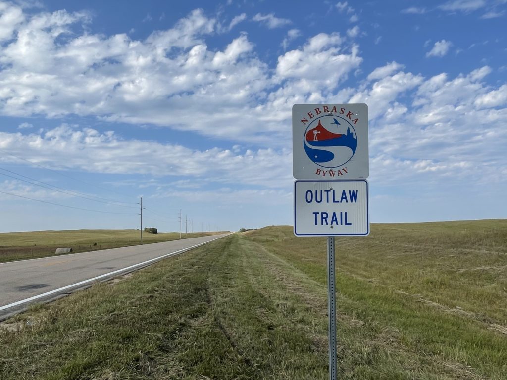
Nebraska Highway 12, the “Outlaw Trail Scenic Byway,” in Keya Paha County. Everyone we encountered seemed law-abiding. Someone stopped while we were taking pictures of the sign to make sure we were OK.
We left Chicago on Wednesday morning and made it to Sioux City, Iowa, following what’s become a typical late-ish start (10:30, say, due to how slow I am to get ready) and quitting just at dark. It means we’re on the road for 10 or 11 hours each day.
Thursday we left Sioux City at about the usual time and spent the day zig-zagging back and forth across the Nebraska and South Dakota border as we headed west on two-lane roads, mostly on Nebraska’s Highway 12 and, further west, on U.S. 20. Four hundred miles or so later, we wound up in Chadron, Nebraska.
Someone — one would guess tourism-minded state and local officials and hopeful Chamber of Commerce folks — has styled Highway 12 “the Outlaw Trail Scenic Byway.” I can attest that the route is scenic, with sweeping vistas of the rolling country along the Missouri River on the road’s eastern end that transition slowly into the high plains and beginning of the Sand Hills on the western end. My only complaint, and you knew there had to be one, is that there’s no ready explanation along the road or on the Outlaw Trail websites about why, precisely, it’s called that.
One of the sites advertises an “adventure of friendly people, scenic sights and the history of Native American Tribes, outlaws, cowboys and pioneers. … Communities have museums waiting to be explored and murals waiting to be viewed. This region offers seasonal opportunities to hunt fauna or flora with arms or camera. Please check on the current Covid situation.”
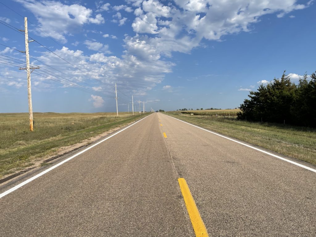
Highway 12 crosses the 100th Meridian west of Greenwich in Keya Paha County (‘keya paha is “turtle hill” in the Dakota language, per what I see online). I have an app on my phone that gives a very precise reading (to four decimal places) of latitude and longitude. When we got to the approximate locale, we parked at a crossroad and I walked about 1,000 feet back to the spot the app indicated was very nearly precisely the exact location of the meridian (“very nearly precisely” because the app would jump between 99.9996 and 100.0005 degrees with a single stride east or west).
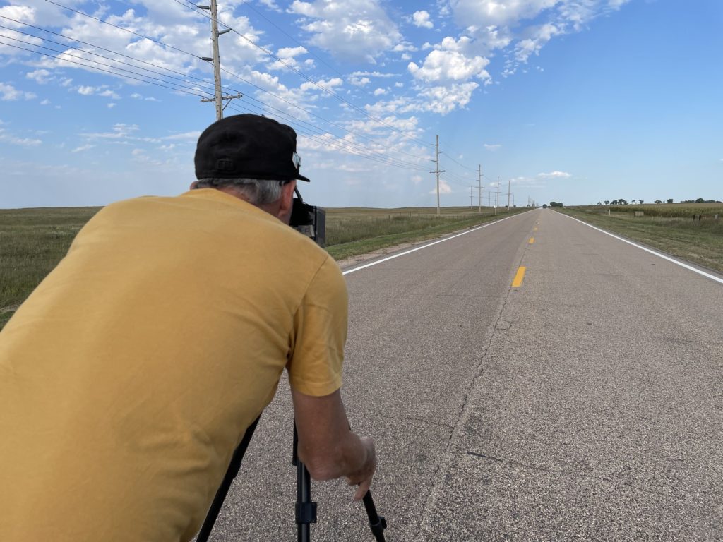
John and I both took pictures to commemorate the spot. I wish I’d taken a shot of the little mark I gouged out on the road’s shoulder to mark the location.
See that fencepost? It’s just about exactly on the 100th Meridian. Nebraska Highway 12, looking east into the humid eastern lowlands from the 100th Meridian.My brother John lining up a pinhole camera 100th Meridian shot on sparsely traveled Nebraska Highway 12.
Why bother with the 100th Meridian? In the late 19th century, John Wesley Powell, the early explorer of the Grand Canyon and first head of the U.S. Geological Survey, proposed that line of longitude as marking the boundary between the wetter more humid areas of the eastern United States and the more arid regime of the West. Subsequent research found Powell’s observation to be spot on — though his other important ideas about the implications for development of the western United States have been largely ignored. More recently, scientists have been assessing how the dry transition that occurs along the 100th Meridian appears to be moving east due to the influence of climate change. You can read more here: “Whither the 100th Meridian? The Once and Future Physical and Human Geography of America’s Arid–Humid Divide. Part I: The Story So Far.“
I’ll also note before posting that we have not one but two 100th Meridian museums on the Plains: one in Cozad, Nebraska, one in Erick, Oklahoma. Next time I’m roaming around out here. …
Bell tower. St. Paul’s Lutheran Church, near Stanhope, Iowa.
We left my sister’s house on Chicago’s North Side at what I consider to be a humane hour, 10 a.m., headed across the northwestern suburbs to the series of toll roads that would lead us out of the metropolis and toward the Mississippi River. We got off the interstate routes in western Illinois and took U.S. 30, part of the old Lincoln Highway, across Iowa. We made a stop at the country church north of Des Moines where my father’s father’s parents and some distant cousins are buried. Then we raced across western Iowa to Sioux City, where we are tonight.
Our route after leaving the church — St. Paul’s Lutheran — took us through Stanhope, a little town I am sure my great-grandparents, my grandfather and my dad knew. We stopped at the one gas station in town to fill up. I walked in to the small store attached to the station to get a cold drink. There was a tall, gray-haired woman working at the counter.
“Hi, there,” I said.
“Hi,” she answered.
“How are you?” I asked.
“Great,” she said. “How about you?”
“Same. Beautiful day,” I replied.
“Yes it is,” she said. “Just like it was thirty-one years ago.”
“Thirty-one years ago,” I said. “1990. What happened on September 15, 1990?” I half expected to hear that a tornado or some other misfortune had befallen the town.
“I got married,” she said.
“That is a great thing to celebrate,” I said. And deciding to ignore the possibility that that marriage was over for one reason or another, I added, “Are you doing anything? Going out to dinner tonight?”
“No, not tonight,” she said. “Had to work. And so did he. But we’ll do something this weekend.’
And that was our conversation. Then we were back on the road and rolling through towns with names I wouldn’t have believed if I hadn’t seen them and double-checked them.
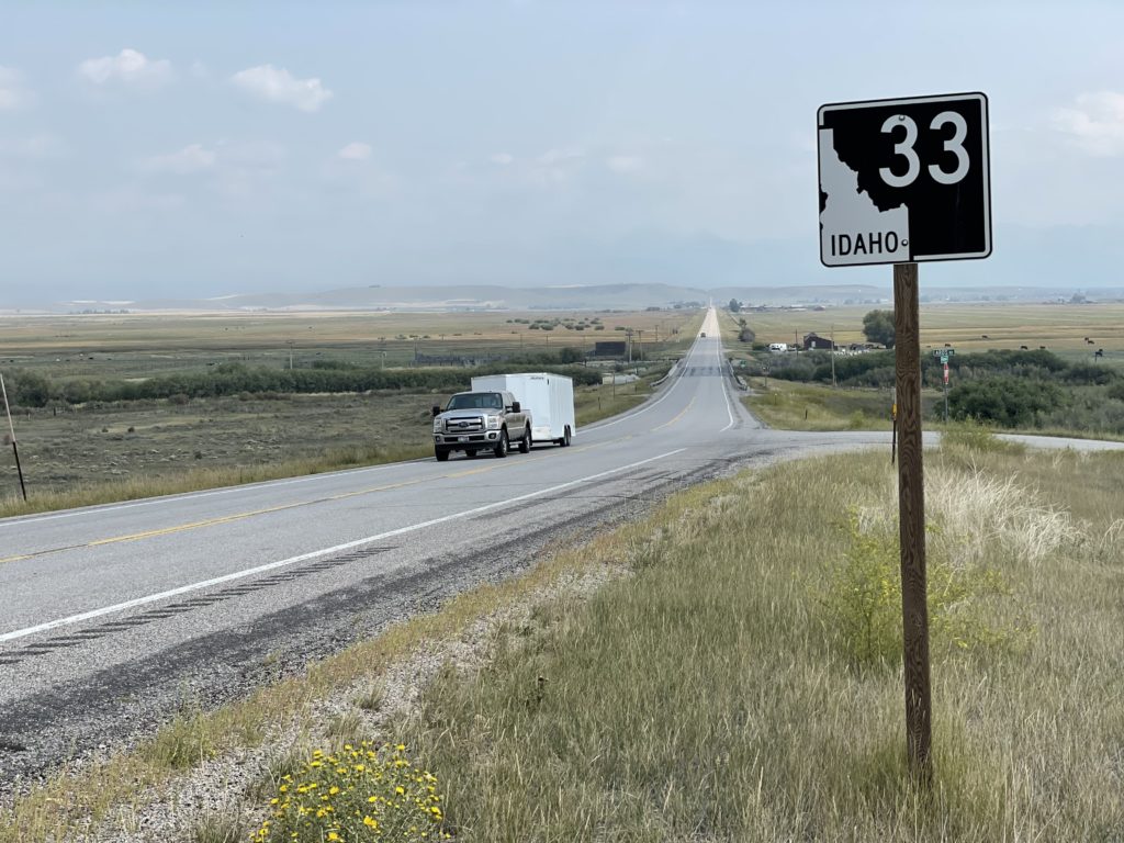
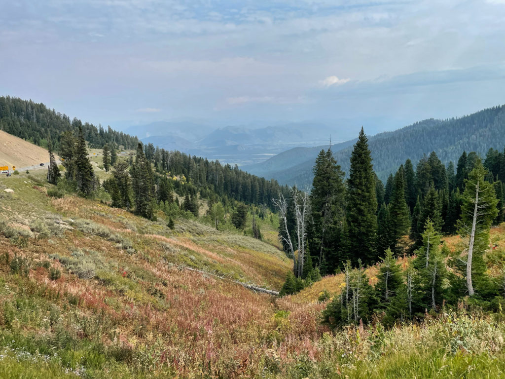
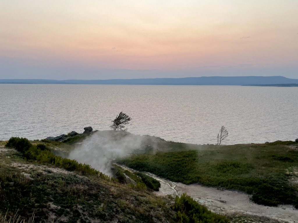
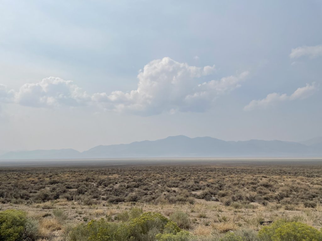
Sept. 2: Highway 33, near Tetonia, Idaho, looking toward Grand Tetons from the west. April 2018: Google Streetview image of the same stretch of Highway 33 in image above, near Tetonia, Idaho, looking toward Grand Tetons from the west. Sept. 2: Jackson Hole from Teton Pass.Sept. 2: Grand Teton National ParkSept. 2: Yellowstone Lake, Wyoming,Sept. 1: U.S. 93, north of Ely, Nevada.August 31: Along Nevada Highway 376.
A predictable circumstance of this trip: that we’d see at least patches of wildfire smoke as we travel east. I mean, we’ve all seen the stories this summer, and the fires in California and elsewhere are still putting out major volumes of particulate matter. Even so, the image above, a screenshot of the map at fire.airnow.gov, is sobering. (That little blue dot at left center of the image is where we are now.)
Beryl Markham’s memoir “West With the Night,” an account of her history-making career as an aviator (including the first solo east-to-west crossing of the Atlantic) came to mind.
We’re now traveling east with the murk. Not nearly as hypnotically poetic as the image of flying into the twilight and the unknown. But we’re chasing our own sort of twilight adventure.
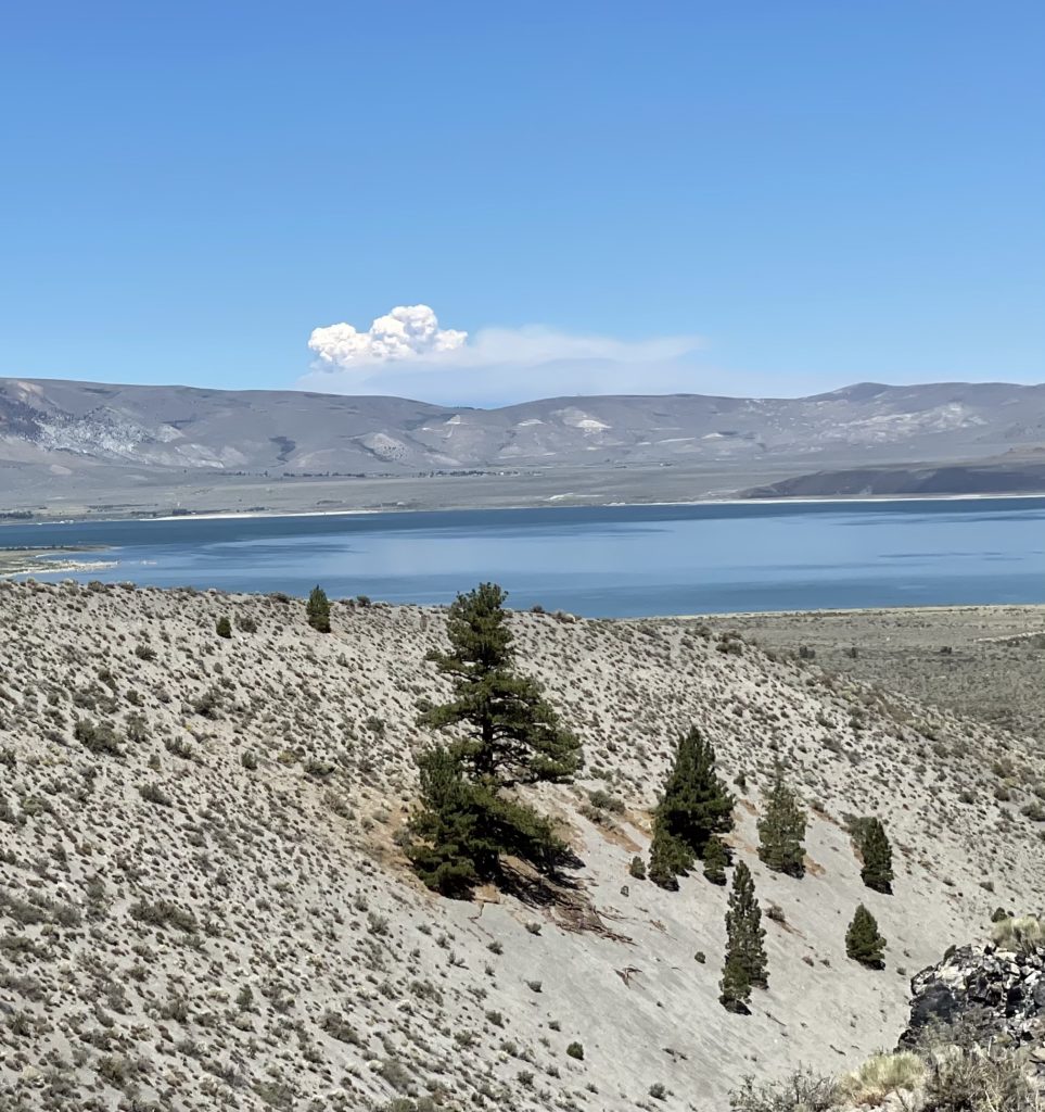
A pyrocumulus cloud rises above the Caldor Fire near Lake Tahoe — 85 miles from this vantage point at Panum Crater and Mono Lake.
I started out last night with a mini-exploration of the names of the towns where we started and ended, Berkeley and Lee Vining.
Lee Vining is known to lovers of the eastern Sierra and habitues of the greater Yosemite region as the town that’s perched just above the shore of Mono Lake and at the foot of the road across Tioga Pass, the highest highway route across the Sierra. According to one local account, the name Lee Vining had its origins in real estate marketing. A landowner in the area was subdividing his property for home lots and didn’t think the existing name of the place, Poverty Flat, would do much for his venture’s prospect. He wanted to call the community Lakeview, but the Post Office informed him the name was already in use. His next choice was Lee Vining, a Gold Rush-era prospector who had operated in the area.
I’m recapitulating all of that just to say there is no neatly tied-up story to explain the name of Ely, Nevada, where I am tonight. “Ely,” pronounced “EE-lee,” not “EE-lie,” could refer to any number of men who had some influence hereabouts in the late 19th century. It’s late, and I’m not up to weighing in on who might have had the strongest claim. The rest of what I can tell you about Ely is that it’s a mining town — copper mining has been its mainstay since the first decade of the 20th century, and one of the landmarks you encounter as you approach town on U.S. 50/The Loneliest Road in America from the west is a series of immense man-made mountains consisting of mine spoils. They suggest the bases of incomprehensibly large, unfinished pyramids, mostly dun-colored but with variations in the shading of the earth packed into the towering, symmetrical slopes. Somehow, those gigantic, well-sculpted features had not made an impression on me during past trips through the area. They did today.
***
The daily highlight: John and I ate breakfast at the Mobil gas station in Lee Vining — it’s a well-known destination for trans-Sierra travelers — then spent a couple hours hiking around Panum Crater, near the south shore of Mono Lake. The landscape is austere and exciting, and for John, who is a glass blower by profession and vocation, it was extra-cool to see the all the obsidian, black volcanic glass, strewn in huge masses in the crater’s center.
One startling sighting was a rapidly growing mass of pyrocumulus generated by the Caldor Fire, a good 85 miles away near Lake Tahoe. We didn’t encounter smoke ourselves until we were well on the way to Tonopah. From there, we drove up Highway 376 through the Big Smoky Valley, which was too socked in by wildfire smoke to see more than the dim silhouettes of mountains on either side of us.
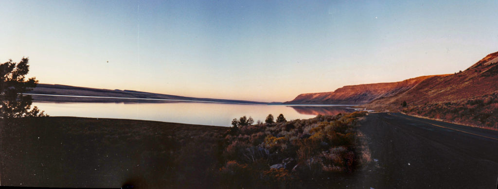
Lake Abert, above, is along U.S. 395 in southern Oregon, about 80 miles east of Klamath Falls and 75 miles north of Alturas, California. I passed by during a trip with my dad in October 1990. I remember it was a Friday evening, and we’d had a full day of traveling south from Lewiston, Idaho, with one significant misadventure along the way. We’d locked the keys in our rental car when we were about 50 miles from the nearest town. It was cold and starting to snow a little. My solution, which I’m not too sure I’d improve upon now, was to break one of the rear windows to get back in. One discovery that led to was that our Ford Taurus got about half the normal gas mileage when you drove at highway speeds with a broken-out window. The effects of increased drag, I guess. We stopped at a town along the way — John Day, maybe — and got a piece of cardboard that we taped in the window opening. That was enough of a closure that the mileage went back almost to normal for the rest of the trip.
We stopped at Lake Abert, which for a long time I believed was Lake Albert, around sunset. We had a ways to go, since the next motel was in Alturas. The light was beautiful, of course, and the way I remember the scene, it was completely still and silent. I took eight shots for a panorama with whatever little film camera I was carrying. The developed prints have been shuffled from one drawer to the next for 30 years. But in a fit of archival exploration, I grabbed them, scanned them (30 years of dust and grunge included) and panaroma-ized them in an application called Hugin (neither Lightroom nor Photoshop recognized all eight shots as part of the same scene for whatever reason).
I didn’t realize until just now, as I looked for information on the lake, that the moment we captured was in a sense a fortuitous one. In the early ’90s, Lake Abert went into a decline attributed to agricultural water diversions and climate change. Water levels have dropped; salinity levels — Lake Abert is Oregon’s only “hypersaline” saltwater lake — have risen. That’s a combination that caused a sharp drop in brine shrimp and other organisms in the lake’s waters; that in turn triggered a decline in the number of water birds visiting and nesting at the lake.
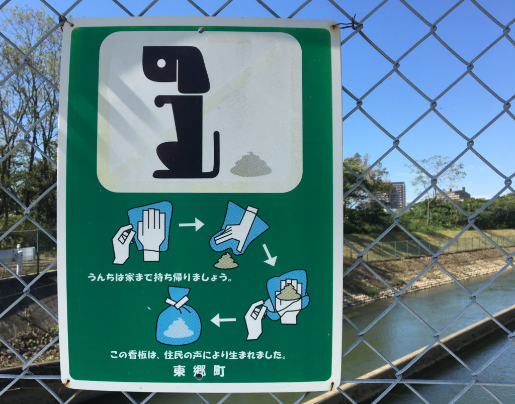
Directions for cleaning up after your stylized dog, outside the city of Nagoya, Japan.
In our Berkeley dog-walking days (2006-18), I often considered the ethical and practical dimensions of dealing with canine excrement. It turns out lots of other people do, too, as evidenced by the advice posted – for free! – I see during my urban strolls.
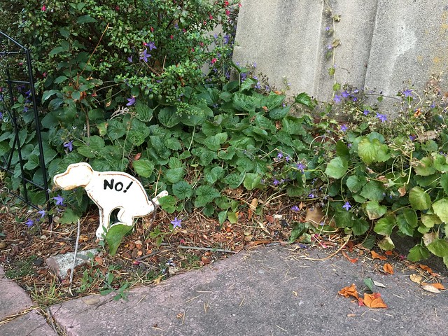
Above is a sign I saw just outside Nagoya, Japan, during a visit a while back. It made me wonder how many of these advisories I’ve recorded over the years. The answer isn’t astronomical – 20 or so, after a quick look through my Flickr camera roll. Most are from Berkeley, but a handful come from elsewhere in the U.S. – San Francisco, Los Angeles, Chicago, New York City – with a few entries from Japan and Italy.
The Flickr album is below. If you’ve got a shot for me to add, send it my way.
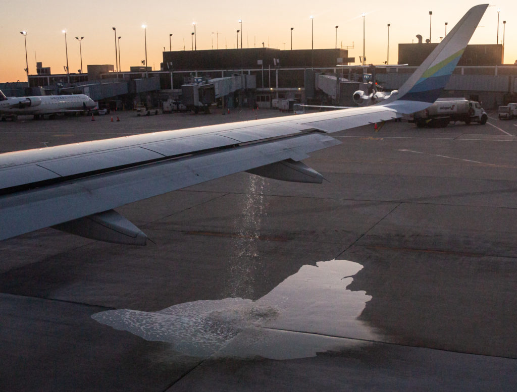
Jet fuel leaks from the starboard wing of Alaska Airlines Flight 1213 at O’Hare International Airport, Sept. 23, 2019.
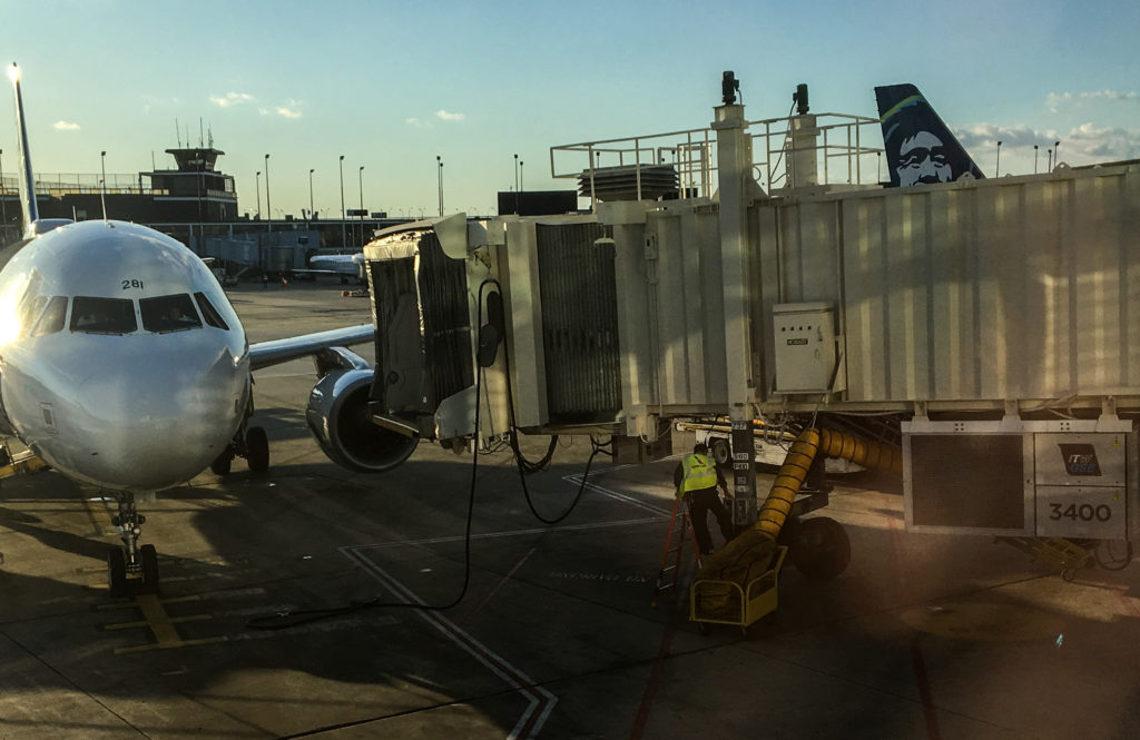
We were in Chicago for a wedding last week and flew back to San Francisco on Monday. We got to the airport in plenty of time and discovered our flight was a little late. No worries.
We found a place to sit that had a view of the plane’s parking space and of the jetway at our gate. The incoming flight was later than advertised, finally pulling up and shutting down maybe 25 minutes late. I watched as the jetway was extended toward the plane to allow the arriving passengers to escape their confinement. But the apparatus stopped about 10 feet short of its target. The ground crew tried to retract it and re-extend it. They couldn’t get it to close the gap.
As the minutes went by, I was imagining the slow burn the passengers stuck on the plane were doing. I was wondering whether someone would appear with a couple of planks for people to walk across from jet to jetway.
What actually happened , after 20 minutes or so, was that two guys from American Airlines showed up. One of them got a step ladder and set it up adjacent to what looked like an electrical box on the jetway. Then he climbed up, took a “hundreds of Americans die every year doing stunts like this” stance, with one foot on the ladder and the other on the electrical box, and fiddled for about 10 seconds with a switch. He climbed down and signaled to someone to give the jetway a try. This time it worked. So at about 5:50, roughly 35 minutes after the plane parked, and about the exact time Flight 1213 was scheduled to pull away from the gate for the trip to San Francisco, the arriving passengers could get off.
An American Airlines technician climbs up a ladder to fiddle with a switch on a non-functioning jetway at O’Hare Gate G6.
It took about 30 minutes for everyone to make their way off the airliner and for a cleaning crew to race through the aircraft and straighten it up. Then it was our turn to get on, and I’m guessing another 20 minutes or so to hustle everyone on board. We pulled back from the gate at about 6:40, 50 minutes late, but not a disaster.
Once we were pointed toward the taxiway, but still just 50 yards or so from the gate, we had to sit for awhile to get in the takeoff queue. I was sitting pretty far back, looking out the window on the plane’s right side. Suddenly, liquid began spouting out of the wing. A lot of fluid. It kept going. What was it? Water? That didn’t make sense. Jet fuel? that wouldn’t be good. While I was pondering this mystery, which I thought someone ought to point out to the crew, someone else a few rows ahead of me said, “Hey! Look at this! Something’s coming out of the wing!”
That got a flight attendant’s attention. She looked out a window. Another crew member said, “Call them and tell them.” One of the flight attendants reassured us that there was nothing to worry about.
The liquid kept cascading to the ground. The flow gradually slowed, then stopped. Hard to say how much spilled onto the tarmac. One hundred gallons? Five hundred? Eventually, the flight’s captain got on the PA and confirmed that we had been seeing jet fuel spilling. More than once, he suggested that it had been a normal occurrence and tried to explain what happened. I’m not sure I understood, but it sounded like an issue with having failed to properly balance the fuel load between the aircraft’s tanks and that a valve had opened — to relieve fuel line pressure? — and released fuel onto the ground. (As I say, I’m not sure I understood the details. I’d love to have an Airbus mechanic explain it again.)
In any case, we had to go back to the gate so maintenance technicians could check out the issue. Then the plane took on additional fuel. Then paperwork had to be done. The plane was opened up so people could wander around the terminal if they liked — but not too far! — and maybe grab a snack. The woman setting next to Kate and me came back with pizza slices.
All of that consumed another two hours. Kate and I did not leave the plane, though we got up a couple times to stretch. Finally, all the checking and rechecking was done, the wandering passengers were called back, and at 8:40 — now nearly three hours after our scheduled departure, we again pulled back from the gate.
All that stood between us and actual flight now was the long line of airliners waiting to take off ahead of us. The wait for our turn turned out to be another 40 minutes, making our departure nearly three hours and 20 minutes late. I was hoping Alaska would spring for free beer, or at least beer nuts, as compensation for the delay. No such luck.
Long story short: We made good time to SFO, and were off our plane by 11:35 p.m. (1:35 a.m. Chicago time). I had visions of making the last cheapskate BART train back to the East Bay. But by the time we had collected our bags and made it up to the AirTrain for the ride to the BART stop, it was too late. We wound up taking a Lyft ride instead — kind of a treat, actually, and we didn’t have to schlep our bags the last couple blocks home from the station.
I was thinking about complaining to Alaska as all this was unfolding. But then I got a personal message from the airline that came in just as our plane landed. It made me feel kind of … well, see for yourself.