At some point in the not so ancient past — July 1986 — Life magazine off-handedly dubbed U.S. 50 across Nevada “the loneliest road in America.” The picture caption that included that phrase also quoted an auto club official as saying of the highway: “It’s totally empty. There are no points of interest. We don’t recommend it. We warn all motorists not to drive there unless they’re confident of their survival skills.”
The road already had a reputation as a sort of an outback adventure. Life’s portrait of the highway drew the curious and prompted Chamber of Commerce types to embrace the “loneliest” title and try to turn the highway into an attraction. Somewhere at home we have a passport booklet full of stamps we collected during a trip across Nevada in 2007 — part of a promotion for U.S. 50 travelers. It turns out there are plenty of attractions, including the experience of being out in the middle of shocking expanses of sky and sage and mountain ranges stretching out to forever.
Among the features that U.S. 50 shares with many highways in the back-of-beyond West are long, long stretches of perfectly straight road — stretches that run away across a limitless expanse of valley, then rise up a distant ridge and disappear. And one of the many highways that shares those attributes is U.S. 6, which starts east across Nevada a bit further south than U.S. 50, then makes a turn to the northeast and meets 50 in Ely.
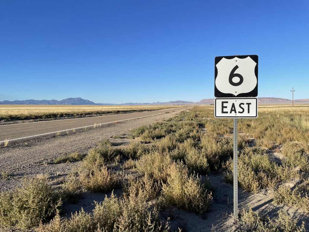
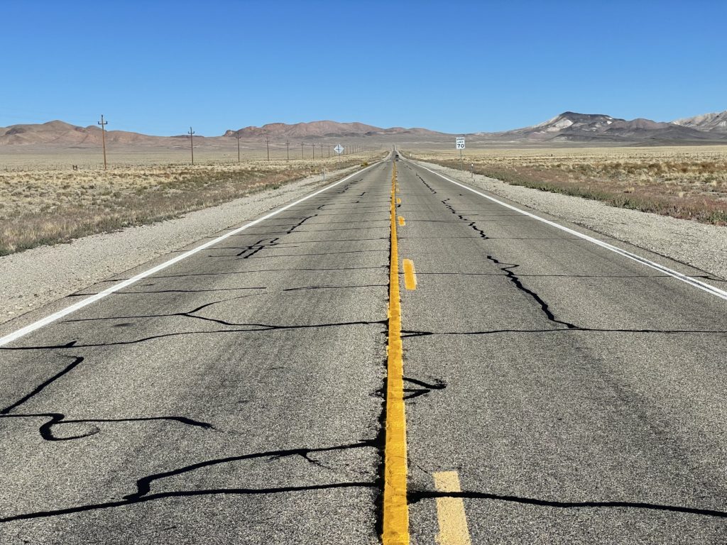
There is a whole story about why roads go where they go, why they take the paths they take. I’m not telling that here. What I do want to relate is how remarkably empty Route 6 was Friday once I left Tonopah in west central Nevada. It started with the sign just outside town saying, “Next Gas: 163 miles.” And it continued, across mountains, road summits and long intervening valleys. I was carrying a camera with a long lens, and occasionally I’d pull over on the arrow-straight sections to try to capture a sense of the scene. Most of the time, no other vehicles were in sight, so I could stand on the center line and shoot away. On one piece of highway, I stopped at the top of the rise and looked back across the valley I had just crossed — the valley pictured above. I had been watching my odometer, and I was staring down the middle of at least 17 miles of pavement. There wasn’t a single vehicle in sight.
U.S. 6, near Tonopah, Nevada. There is a vehicle in sight in this iPhone photo.
Lake Don Pedro — the reservoir that captures the Tuolumne River downstream of Hetch Hetchy — along Highway 120.
Day One of an n-day trip to Salt Lake City and destinations still undetermined. I’m in Lee Vining now after driving from sea-leval Berkeley out of the Bay Area, across the Valley, through the foothills and Yosemite and up the Tioga Road to Tioga Pass, elevation 9,945 feet. It was dark when I got to the top. I stopped for a few minutes to take in the stars and planets — Jupiter scraping the top of Mount Dana as it rose — and spotted the International Space Station making a pass almost directly overhead. Then it was back in the car for the plunge down through canyon to Lee Vining, where I’m staying tonight. I walked up the road to the region’s most famous Mobil gas station to have dinner (well, the gas station is part of a roadside stop with a store and a better-than-you-could-possibly-have-expected-in-these-parts restaurant. Tonight they had carnitas tacos. Really good).
It does occur to me that sometime maybe I’d like to take a whole trip in daylight. My brother John was just telling me tonight from Montana that he just went over a stretch of road the two of us drove after dark last year and he was staggered at how beautiful it was. All I can tell you about that piece of highway is that it had all the standard lines and markings.
Today, driving after dark was pretty much inevitable because I didn’t leave home until a bit after 2 p.m. I think sunset was about 6:30. Why start after 2? See the headline above. It’s all the stuff the got compressed into a few hours before departure. One would think I’d learn at some point. But not yet.
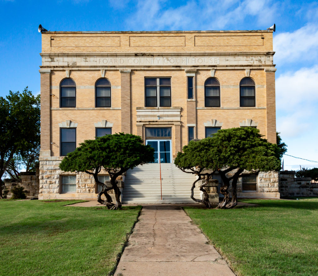
Going through some pictures I took on a quick drove around North Texas four years ago. This is the Foard County Courthouse — humble and lacking in the architectural fancies that characterize some of the other courthouses I’ve seen in the Lone Star State. The plainness appeals to me. It’s even more pronounced in the Google Streetview of the spot
The town of Crowell, 65 miles west of Wichita Falls, is the seat of the county, which according to the 2020 census had a population of 1,095 — a steep decline from the 1,336 reported in 2010.
I haven’t delved into the county’s history at all. It has one literary claim to fame, though. It’s home to Thalia, the name Texas novelist Larry McMurtry adopted for the setting of several novels, including “The Last Picture Show” and “Horseman, Pass By.”
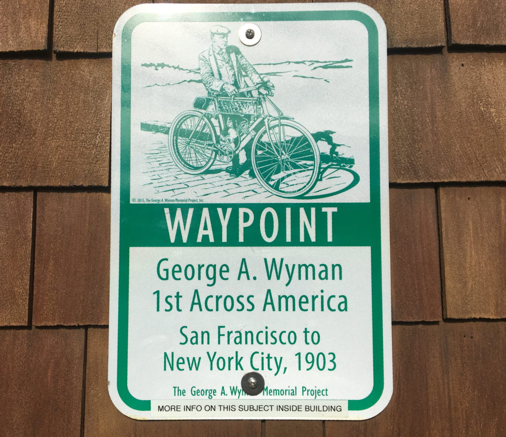
George A. Wyman waypoint, Emigrant Gap, California, August 2017.
We happened across the sign above along Interstate 80 west of Donner Summit at the beginning of a road trip to see the August 2017 solar eclipse.
It took me nearly five years and a chance encounter with this image to actually look up George A. Wyman and what the whole “1st Across America” thing is about.
In short: Back in 1903, he made what is said to have been the first trip across the United States via motorized vehicle — in his case, a motorized bicycle produced by a company in San Francisco. Wyman’s journey began in the city, too: at Lotta’s Fountain, on Market Street. The fountain became famous three years after Wyman’s departure as a meeting place in the aftermath of the 1906 Great San Francisco Earthquake, a bit of history that’s commemorated with a pre-dawn ceremony every April 18, the anniversary of the catastrophe.
Naturally, you’ll want to read more about George A. Wyman and his machine.
If I’m right, you’ll want to check out the George A. Wyman Memorial Project, which has published a day-by-day account of the adventurer’s cross-country journey. The site includes a pretty good tale, too, about how the late publisher of the Los Angeles Times found and restored a 1902-vintage motor bicycle that he believed to be the one Wyman rode.
The day-by-day account mentioned above is drawn from Wyman’s dispatches — including pictures — to a publication called Motorcycle Magazine, which sponsored the trip. The story that unfolds in those reports shows Wyman to have been unflinching in the face of often hostile conditions along his route and the frequent breakdowns of his 90-pound, 1.25-horsepower machine. Especially in the West, he regularly found the bone-rattling ride along railroad ties — yes, he was riding on the railroad— preferable to the deep sand or intractable mud that made it miserable to travel on what passed for roads. When the trip was over, he estimated he’d ridden 1,500 miles on the cross-ties; on several occasions, he had close calls with trains that overtook him when he was on the tracks.
Occasionally, Wyman turned in truly dramatic accounts of his travels. His June 4, 1903, entry, describing his trip through a mountain downpour between Laramie and Cheyenne, Wyoming, is a must-read.
But mostly, he was matter-of-fact about most of his difficulties. Here he is a few days later, mentioning a piece of equipment had broken:
“One more cyclometer was sacrificed on the ride from Ogallala to Maxwell (Nebraska), snapped off when I had a fall on the road. I do not mention falls, as a rule, as it would make the story one long monotony of falling off and getting on again. Ruts, sand, sticks, stones and mud, all threw me dozens of times. Somewhere in Emerson I remember a passage about the strenuous soul who is indomitable and ‘the more falls he gets moves faster on.’ I would like to see me try that across the Rockies. I didn’t move faster after my falls. The stones out that way are hard.”
He frequently commented on the reception he got along the way — which was mostly amazement at both the length of his journey and the technology he was using. On June 24, he stopped for the night in Ligonier, Indiana, a town about halfway between Chicago and Toledo:
“I thought that when I got east of Chicago folks would know what a motor bicycle is, but it was not so. In every place through which I passed, I left behind a gaping lot of natives, who ran out into the street to stare after me. When I reached Ligonier I rode through the main street, and by mistake went past the hotel where I wanted to stop. When I turned and rode back the streets looked as though there was a circus in town. All the shopkeepers were out on the sidewalks to see the motor bicycle, and small boys were as thick as flies in a country restaurant. When I dismounted in front of the hotel the crowd became so big and the curiosity so great that I deemed it best to take the bicycle inside. The boys manifested a desire to pull it apart to see how it was made.“
Wyman’s motor bicycle was a sort of hybrid, consisting of what looked like a conventional bicycle frame fitted with a small gas tank and motor. A leather drive belt — which broke and required mending constantly — ran between the motor’s crank shaft and a pulley on the rear wheel. The motor and transmission apparatus had given out as Wyman neared the end of his journey. Luckily, he could simply pedal the bike, and pedal he did, riding the last 150 miles from Albany to New York City without stopping overnight to sleep:
“I made frequent stops to rest and I attracted more than a little attention but I was too tired to care. I can smile now as I recall the sight I was with my overalls on, my face and hands black as a mulatto’s, my coat torn and dirty, a big piece of wood tied on with rope where my handlebars should be, and the belt hanging loose from the crankshaft. I was told that I was ‘picturesque’ by a country reporter named ‘Josh,’ who captured me for an interview a little way up the Hudson, and who kept me talking while the photographer worked his camera, but to my ideal, I was too dirty to be picturesque. At any rate, I was too tired then to care. All I wanted was a hot bath and a bed. ”
Wyman’s arrival in New York after his 50-day epic attracted little attention, it seems. A scattering of papers across the country carried a brief Associate Press story that hailed him as “the first man to cross the American continent on a power-propelled road vehicle.” Motorcycle Magazine suggests one reason the feat may not have gained wider attention: Wyman himself didn’t boast about it.
“Now that the narrative has been completed and a review of the whole trip can be taken, it stands out in its entirety as a supreme triumph for the motor bicycle,” the magazine said. “It was not only the most notable long distance record by a motorcycle, but also it was the greatest long trip made in this country by any sort of a motor vehicle. This is a fact to which attention was not called by Wyman in his story and it is one that should be emphasized. In fact, Wyman’s story was altogether too modest throughout.”
Back when San Francisco Bay Area Rapid Transit trains had fabric-covered uplholstery , the seating inspired a story: “On BART Trains, the Seats Are Taken (by Bacteria).” That piece was published in 2011 by The Bay Citizen, a short-lived regional news site that partnered with The New York Times, and it disclosed that the fabric seats were crawling with the nastiest-sounding of microbes. Soon thereafter, BART installed vinyl-covered upholstery— easier to clean, when you get around to cleaning it — on all trains.
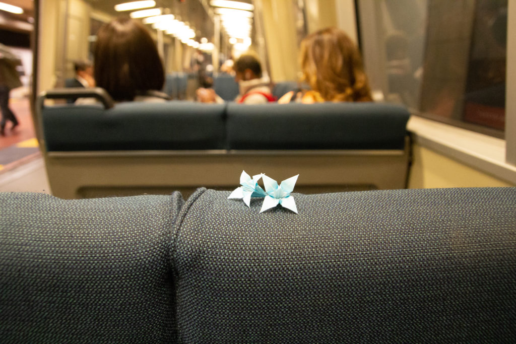
Of course, the fabric seats, whose reported rampant filth I was blissfully unaware of and thus unconcerned about after 35 years riding the system, wasn’t why I took this shot back in 2012. Those origami flowers someone left behind were one of the nicest things I’ve ever seen on BART or any public transit. They also remind me of “Blade Runner.”
We’re down in Los Angeles for a few days. The quickest way of getting here, obviously, is to fly. It’s a one-hour flight. But we generally drive, and that’s mostly because we like seeing the country along the way.
However.
The main route between the Bay Area and L.A. is Interstate 5. And while a lot of the territory between metropolises is interesting and picturesque, and all of it is worth seeing and contemplating, that particular highway is a real drag. The volume of traffic can be intense, for one thing. For another, many, many, many, many drivers tend to camp out in what is known unironically in much of California as “the fast lane.” That’s especially true if a driver sees a truck somewhere up ahead — “up ahead” meaning “within sight.” The appearance of truck traffic, which in California has a 55 mph maximum speed limit, causes many drivers to get over into the left (a.k.a. “passing”) lane minutes before they will actually overtake the truck. Once past a truck, many drivers will sight another truck up ahead and figure they might as well just stay over there in that left lane until they pass that one, too. The result is long strings of vehicles lined up in the left lane, even when the right lane is empty. Not only are the lines of “fast lane” traffic long, they usually feature dramatic slowdowns and speed-ups as more cautious drivers brake to maintain some sort of minimum distance between them and the vehicle they’re following; sometimes the slowdowns occur because faster traffic has come up in the right lane and merges into the long line of left-lane traffic; sometimes the trucks get into the act when a slightly faster-moving truck moves to the left to pass a slow-poke semi.
That’s pretty much the way I-5 works most of the 275 or 300 miles or so down the west side of the San Joaquin Valley, and it’s kind of a drag. Yesterday, with less than half of that part of the drive done, I commented to Kate that I wished there was an alternative. Of course there are alternatives if you’re willing to take a much less direct (more time-consuming) route. But having voiced the thought of taking another way, we acted on it. I got off I-5 at Highway 41, the main route between Fresno and Paso Robles and the coast, took it west to Highway 33, then headed south through the Kern County oilfields, and across the Coast Ranges to Ojai and Ventura. I rode the same route on my bicycle years ago, and the memory of the trip across the mountains is vivid. The road did not disappoint yesterday, either.
We finished by taking 101 from Ventura into L.A., arriving early in the evening and well after the most excruciating hours of Friday afternoon traffic. We may have spent an extra couple of hours on the way than we would have if we had stayed on I-5, in part because we could stop as often as we wanted along the way and there was nothing pushing us (me) to go fast. We got where we were going, not necessarily soul-refreshed, but maybe a little less beat up from the tension of a long drive.
Like everyone else who’s walking around with one of these “phones” equipped with a high-quality camera (or are they really decent cameras with mediocre-quality phones?), I take lots of pictures. Sometimes I try to discover a theme in what attracts my attention, but aside from “landscapes” or “birds” or “infrastructure” or “stuff on the street,” I would struggle to name any real thread that ties any of my images together.
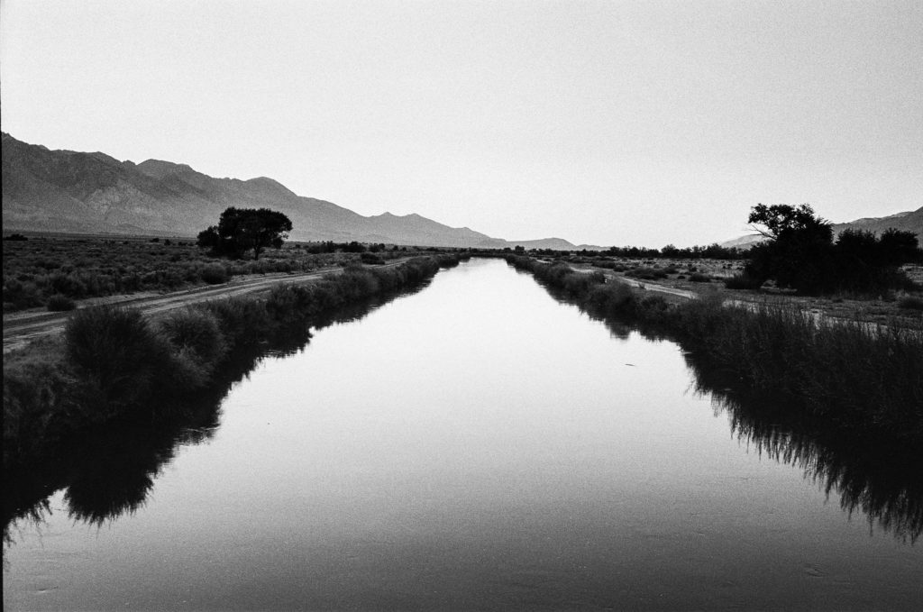
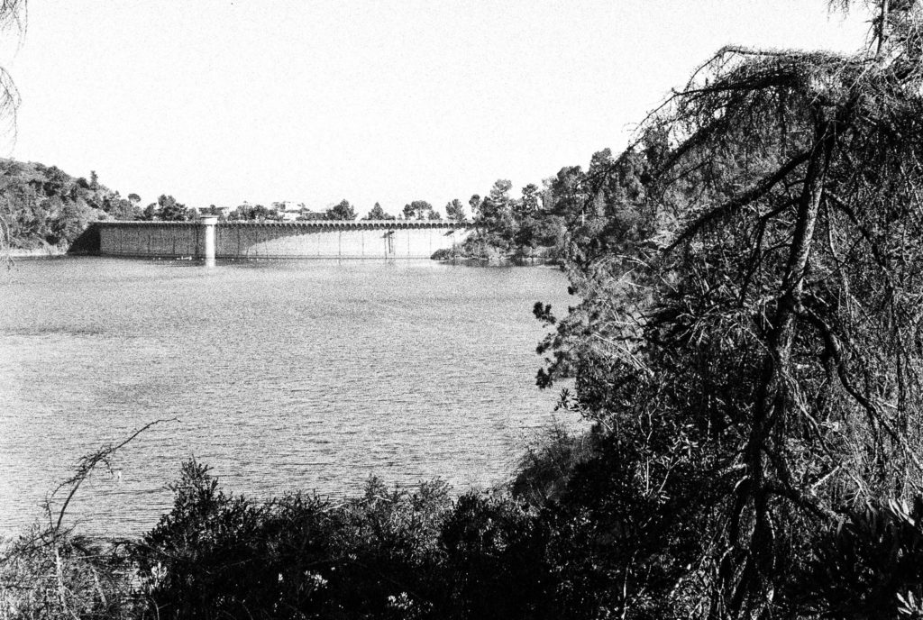
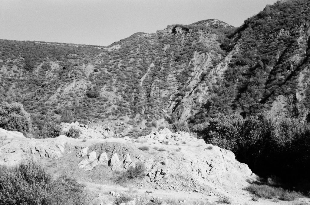
But a couple of days ago I was looking a few pictures — just three — I had taken on three separate trips to other parts of California over the last few years and was surprised to see something of a story there.
Here are the images:
That first shot is the Los Angeles Aqueduct, in the Owens Valley just across the highway from Manzanar, the site of the internment camp where thousands of Japanese Americans were incarcerated during World War II. Kate and I camped nearby, just outside the town of Independence, in 2018. After spending a beautiful September afternoon touring Manzanar, we wandered down to the aqueduct as the sun was setting.
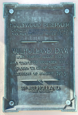
The second shot is the Hollywood Reservoir and Mulholland Dam in Los Angeles. I had wanted to see this place for years, and we made it up on a Sunday afternoon last June while visiting our son Thom.
The third shot shows part of the wreckage of the St. Francis Dam, in San Francisquito Canyon, in northwestern Los Angeles County. The dam collapsed in March 1928, killing about 450 people downstream. You have to hunt a little for the site of the dam, which Kate and I did on the same 2018 trip that took us to Manzanar.
I like the fact all three images were shot on film using relatively antique (1970s-era) Japanese rangefinder cameras. But what ties them together, perhaps obviously, is the connection to Los Angeles, water, and L.A. Department of Water and Power chief William Mulholland.
Mulholland was the principal architect of the Los Angeles water system: He played a leading role in helping secure (or steal, depending on your perspective) the Owens Valley water rights for the city. He engineered the aqueduct that brought the water to Los Angeles. Although he was initially reluctant to build dams and reservoirs to store that water, he designed and supervised the construction of Mulholland Dam, which took all of 16 months to complete in 1923-24. He used that structure as a sort of template for the St. Francis Dam, which was completed in 1926. Mulholland visited St. Francis Dam just hours before it disintegrated and pronounced it sound; the catastrophe ended his career. Although he apparently believed Owens Valley saboteurs were responsible, as they had been for the destruction of some of the aqueduct facilities in the eastern Sierra, he took public responsibility for the tragedy. “Don’t blame anybody else,” he told a coroner’s inquest. “You just fasten it on me. If there is an error of human judgment, I was the human.”
As I say, I just happened to look at the three photographs together the other day and see a story. If I ever have a show, I thought, I’d want to present them as a group. For some reason, I thought a presentation like that would be more complete with a fourth image. I remembered a 2017 visit to Los Angeles during which we stopped at the Department of Water and Power building (a.k.a. the John Ferraro Building), at the corner of First and Hope streets, and just across the way from the Dorothy Chandler Pavilion, the former home of the Oscars.
I took some pictures when we were at the DWP building — all with a digital SLR, not film. Looking back, I found one that I thought I could add to the group — post-processed from color to black and white. It’s looking up from a corner of the building up toward the roof, with the sun just obscured:
What kind of statement is that making? I haven’t come up with words yet, though I like the image. And as I say, if there ever is a show, this one’s going in.
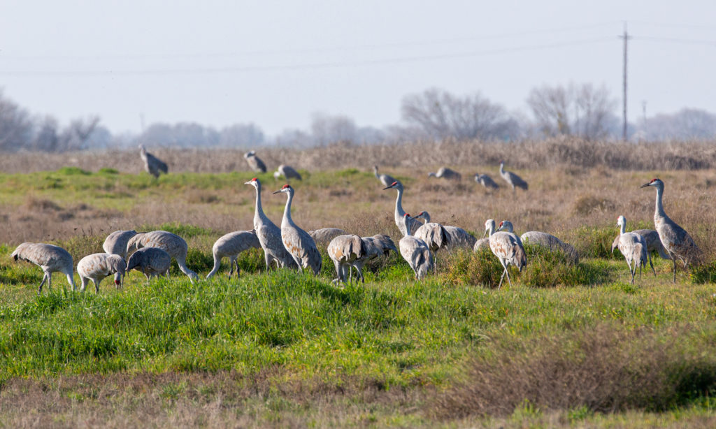
Sandhill cranes at Merced National Wildlife Refuge. February 14, 2022.
We spent last weekend in the San Joaquin Valley looking at birds. Thousands and thousands of birds — snow geese and white-fronted geese, shovelers, pintails and teals, killdeer and meadowlarks, avocets and ibises, stilts and wrens, red-winged blackbirds and red-tailed hawks, tundra swans and sandhill cranes.
Part of the experience of entering into the world of the birds is the sound. Actually: part of the experience? Visiting these places where tens or hundreds of thousands of migrating birds have gathered is mesmerizing, electric, sometimes overpowering, utterly enveloping and at moments gives a hint of what this place we live was like before we began the project of radically reshaping it.
Here are three snippets of that sound. The first is from Super Bowl Sunday, when Kate and I found ourselves virtually alone — except for the birds — in the 10 square miles of the Los Banos National Wildlife Refuge. After that clip are a couple from the Merced National Wildlife Refuge — the crazily energetic stylings of a marsh wren and a surprise overflight of about 300 sandhill cranes at midday on Valentine’s Day.
bSandhill cranes at San Luis National Wildlife Refuge
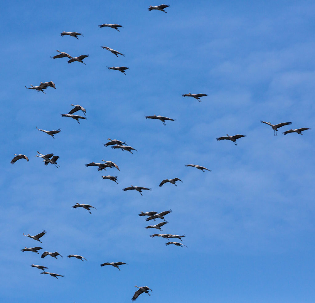
The title overpromises. Here’s just one bird in review from a weekend in the valley: the sandhill crane, Antigone canadensis. Among many other things one might write about the bird is the fact the original English common name assigned to these creatures in the mid-18th century was “the brown and ash-colour’d crane.”
Where can you see them? Over the late fall and winter, we’ve encountered them at several wildlife refuges: Llano Seco (near Chico), Cosumnes, Merced, and San Luis. There were small groups at most of these places when we visited. At Merced, we saw thousands.
More sandhill crane lore (and birds to be reviewed) later.
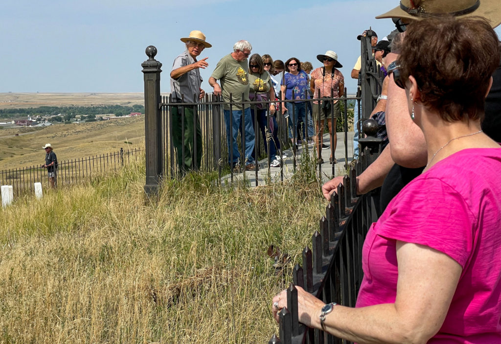
Michael Hasch, a seasonal National Park Service ranger and battlefield interpreter at the Little Bighorn National Monument, during a talk on September 4, 2021.
I wish I could say that in a trip that covered something like 6,000 miles over 23 days that we met lots of people and had deep conversations that led to profound personal discovery. We didn’t. And maybe the stats mentioned in that first sentence explain part of the reason. We were actually actively traveling for just 15 or 16 days, which means we were covering 400 miles a day on average. That’s nothing for The Great American Road Warrior, for whom 500 or 600 or even 1,000 miles a day is routine (I once took a trip back to Chicago from Berkeley with my son Eamon that covered 2,100 miles in all of 40 hours, even with an overnight stop in Cheyenne, Wyoming). The point being: Even at 400 miles a day, the modern traveler isn’t going to spend a lot of time in intimate conversation with random acquaintances on the road. Even if you’re the kind of person who easily strikes up a conversation with a total stranger, which mostly I am not.
On the other hand, the conversations that do happen tend to stand out.
When John and I stopped at the Little Bighorn Battlefield National Monument in Montana, one of the main destinations on our trip, we encountered a group at the top of what has long been known as Last Stand Hill, the place where Lt. Col. George A. Custer and the remnants of his command died together on June 25, 1876. People were listening to a ranger named Michael Hasch recount the progress of the battle. I was impressed by Hasch’s command of the lore surrounding the battle, including the many first-person accounts from Native American participants. One moment I remember in particular from his talk: The moment when a Cheyenne named Lame White Man rallied fellow warriors to the attack by shouting, “Come! We can kill them all!” Hasch has a deep voice, and it carries. He spoke slowly, deliberately, and when he intoned those words, it was like the moment was coming alive again. After his presentation, I talked to Hasch and discovered he is a former Pittsburgh newspaper reporter who began volunteering at the battlefield a decade ago. One of the people listening to that conversation was a woman who used to be a local news anchor in San Francisco, and that led to yet another conversation with a stranger. But that’s another story.
So, that’s one encounter during our trip across the country. Here are a couple of others:
Laura and Jamie at the top of Teton Pass, Wyoming.
We met Laura and Jamie at the top of Teton Pass, Wyoming (elevation 8,432 feet above sea level). We had driven up the west side on our way from Idaho to the Grand Tetons and Yellowstone. They arrived pushing a heavily-laden tandem bike up the east side.
Jamie and Laura’s custom-built tandem, complete with trailer. I believe they said the total weight of their outfit was about 200 pounds — no joke when climbing steep mountain roads.
What was their story? They said they had both quit their jobs, sold their home and most of their belongings and had a custom tandem built. Their plan was (presumably still is) to spend five years cycling around, mostly in Europe. They had ridden from Connecticut by way of Louisiana to get to this spot on Wyoming Highway 22, and planned to cycle up the west flank of the Tetons before heading east into Yellowstone. After that, they’d make their way east and south to Florida, where they planned to spend the winter before heading to Europe. The biggest impression they made on me was how cheerful they were after pushing their machine up the last two miles of busy roadway up to the pass. I, too, have pushed my bike up steep mountain roads, and I’m not sure I was smiling all the way.
What more can I say about these two? Godspeed, Laura and Jamie.
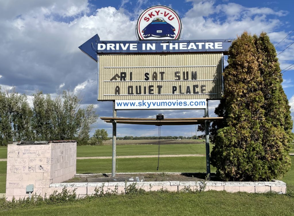
The motive for our road trip (or excuse, maybe) was to commemorate what would have been our dad’s 100th birthday in early September by visiting his birthplace and first hometown in northwestern Minnesota. We got to Marshall County a few days after the actual centennial, and spent much of the day taking pictures at a rural Lutheran church where our grandfather, Sjur Brekke, was pastor a century ago. The we headed to Alvarado, population 300, where Sjur, our grandmother, Otilia, and dad lived (and where Sjur saw to another Lutheran congregation). After that, we drove the five or six miles east on Minnesota Highway 1 to Warren, the county seat, where Dad was actually born. One thing I had discovered about Warren during a 2018 trip through the area (and somehow had missed during a couple of much earlier visits) is that the town’s drive-in theater, the Sky-Vu, is still in business.
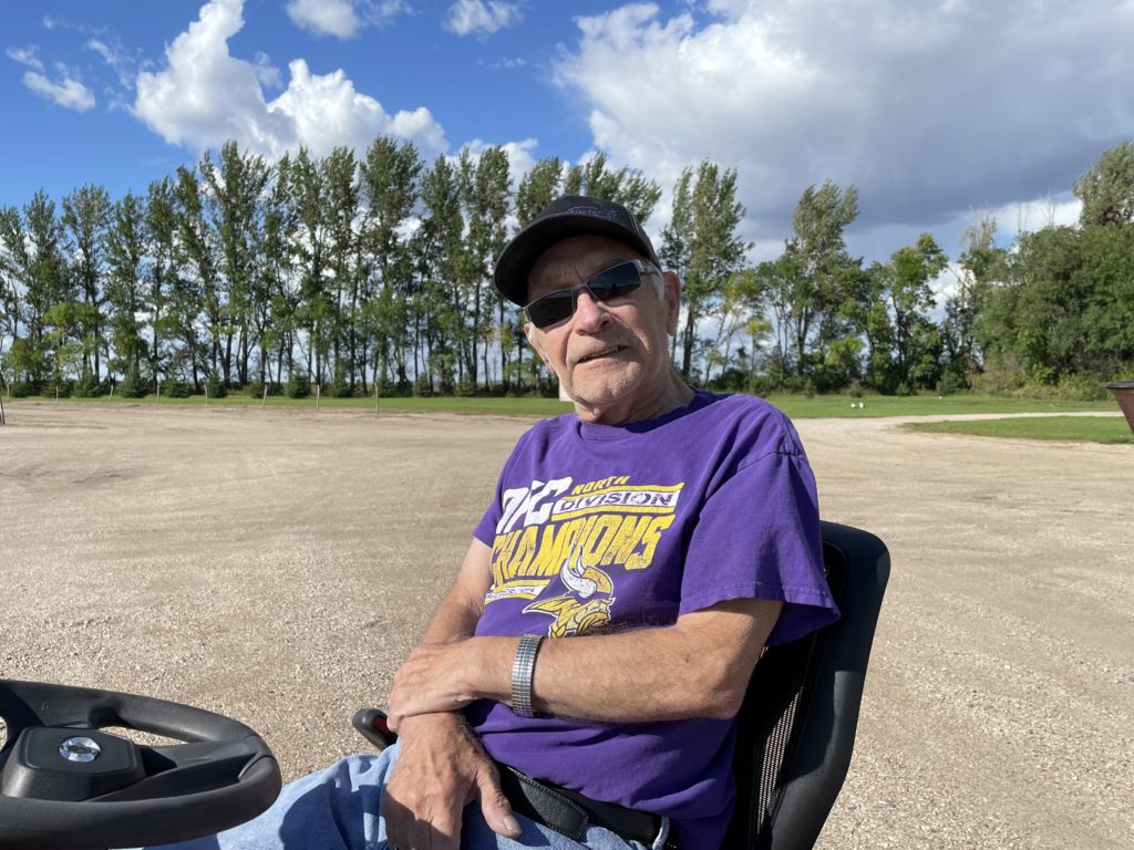
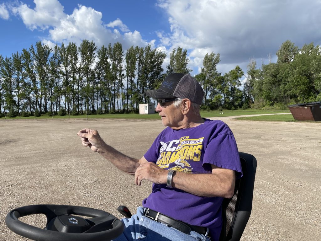
John and I pulled in to the Sky-Vu to take a look. Like everyplace else where we stopped for more than a couple of minutes, we brought out cameras and started strolling around taking pictures. Next door, a man on a riding mower was cutting the grass on a sprawling lawn in front of a big ranch-style house painted the same pink color as the concession stand/projection booth at the theater. After about five minutes, he drove the mower over to see what we were up to.
“Your place?” I said. Or something like that. And it was. His name: Leonard Novak, and he said he’d bought the Sky-Vu in the early 1970s and that he and his family have been running it since; a grandson is doing most of the work now. As it happens, KFAI in Minneapolis did a nice radio documentary about 10 years ago featuring the Novaks and the Sky-Vu in which Leonard says he doesn’t foresee the theater closing, ever: “We’re the only one (drive-in) between Winnipeg and Minneapolis.” And judging from the fact it’s still open, and still showing first-run movies, maybe he’s right.
Leonard Novak. Owner, Sky-Vu Theater, Warren, Minnesota.