Flying Back

There will be plenty of East Coast trip postscripts to come, but for now: We’re sitting in a terminal at Kennedy airport; outside, it’s about 100, and even people who have been working inside all day are complainng about the heat. Outside, one big difference between city dwellers and suburban folk shows itself. The urban types are out on the streets, walking to the subway, shopping, whatever they have to do. It’s not like the sidewalks were packed in my brother’s neighborhood, but people were out and about, even if lots of us looked a little wilted. Out in the suburbs: No one on the street, anywere; people out there — and "out there" is probably any suburb you can think of — live strictly a doorway to doorway existence during the worst weather. Glad the power grid is holding up for everyone so far.

This morning, getting ready to leave John and Dawn’s place, we were talking about the latest bicycle fatality in the Oakland Hills. A guy out for a ride was hit head on up there on Skyline Boulevard, within a half mile or so of where I crashed in June, by a motorcyclist; the cyclist died of his injuries, the motorcyclist apparently walked away from the wreck. Not to place blame without knowing what really happened, but one of the risks bicyclists take riding up in the hills, a risk that’s increased a lot in the last 20 years, is that we share the road with motorcycle riders and motorists who treat the twisting roads like a raceway challenge. I’ve often worried about getting hit up there.

Anyway. At one point, John said, "Hey, did you hear about that Wired editor who died during the marathon?" I hadn’t. I looked up "wired editor marathon" onlne, and found a story on Wired News. The editor who died during the marathon was a guy named Bill Goggins. I knew him from my stint at the magazine in 1998 and from my days freelancing for the magazine. Bill was 43, and the news accounts say that he collapsed at mile 24 of the San Francisco Marathon last weekend and couldn’t be revived. A friend who saw him at mile 21 said he was smiling and running strong, and a mutual friend had seen him twice in recent days and said he seemed fine. The thing about Bill, whom I never got to know well enough, was that he was brilliant and funny and charming and had a big heart that was right there for anyone to see. Forty-three. Hard to believe. See you, Bill, wherever you are.

Continue reading “Flying Back”

Forza Italia: Bath-Towel Edition


Italia

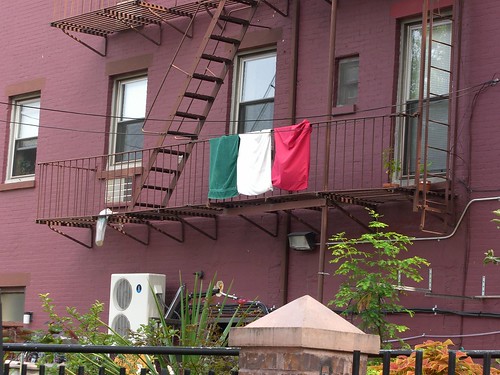
John and Dawn (my brother and sister-in-law) live in Carroll Gardens, an old Italian neighborhood southwest of downtown Brooklyn. Italy’s victory in the World Head-Butt Cup last month sparked outpourings of joy ("I’m so happy!" John recalls one guy telling him. "I’m from Italy!" To which John comments: "No, you’re not — you were born in the Bronx"). Team Italy’s success also prompted the appearance of even more than the usual generous display of Italian flags in the neighborhood. The pizzeria across the street has one on the sidewalk. My favorite is one around the corner — green, white, and red bath towels hanging from a fire-escape railing.

Heat, a Re-examination

Cimg0856

The last day of July, the first of August, it’s supposed to be hot. Today, it’s an unremarkable 90 or so here in Brooklyn. I’m sitting in my brother and sister-in-law’s unairconditioned kitchen about a mile south and east of the Brooklyn Bridge. Not suffering. But tomorrow we’ll be getting what folks to the west have been dealing with for the last couple of days (112 in Bismarck?!). The National Weather Service is warning it will get up to about 100 Tuesday and Wednesday, that it will be plenty humid, and that we’ll have high ozone levels as the air in the region stagnates. (Add rum and guns, then stir for a swell party!)

The last few days, Kate and I have been staying in a friend’s house  near the northern New Jersey shore. It’s got central air conditioning, and the system has been running ever since we arrived there last Thursday. It struck me this morning as I walked outside for the first time and shut the sliding glass door behind me that around here, the ability to cool the air in homes and cars and public places of all kinds is just as vital as the ability to heat it in the winter. In the suburbs, anyway, you don’t see homes open to the elements on a hot day any more than you’d see a place with its windows flung open when it’s zero outside. Yet, the weather’s the weather. It may be incrementally hotter on average than it was a generation or two or three ago, but everyone here endured long, stifling stretches of heat then without refrigerating every living space, just as most of the world’s people do today. (We went to France in August 2003 at the tail end of the country’s extended heat wave; I knew air conditioning was uncommon there, but I hoped against hope that somehow our little hotel would be an exception; instead, when we got to our room, we found that the windows hadn’t been opened for days and the place was like an oven — and what was worse was that for several days afterward, there wasn’t enough of a breeze to cool anything off.)

I’m not arguing for some kind of sweaty, hair-shirt virtue in living without air conditioning. Just makes me wonder sometimes what would happen if we all suddenly had to do without (which ties into my fear for the next couple of days; I’m concerned that the power demand here will cause a blackout and shut down the air-traffic-control system and keep us from flying back Wednesday to our effete little climate back in Berkeley). I do remember that before we had our first air conditioners, in 1966, the remedy for hot nights was staying up late watching movies with our mom and taking cool showers before we headed off to bed. Somehow, we slept.

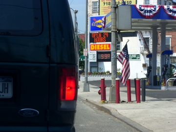
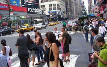
(Picture: Hamilton Avenue and West 9th Street, Brooklyn. It wasn’t really 99 degrees.)

Saturday Night, Sunday Morning

After a day spent near the Delaware River, then with Kate’s cousin’s family north of Philadelphia, we decided to take an impromptu sidetrip to Gettysburg (how impromptu? We didn’t bring a change of clothes). So tonight, we’re camped out in a motel just outside Harrisburg and about 30 miles (an exhausting day’s march or a half-hour air-conditioned drive) from Gettysburg. I haven’t been here since 1971; Kate’s visiting the battlefield for the first time. Oh, and our rental car has South Carolina license plates.

More tomorrow.

Summer, EDT

We landed in New York, JFK, on Wednesday evening. Remind me to relate sometime the story of the large model airplane that someone flew by remote control up to our jet’s altitude as we landed. We got our rental car and drove slowly to my bro’s place in Brooklyn and had a nice cookout with him and his wife and daughter on their rooftop patio. A true NYC experience.

Yesterday — Thursday — we drove across the ungainly mass of the Verrazano Narrows Bridge, past Staten Island’s artificial mountains, and over the Outerbridge Crossing to New Jersey. It’s summer — Bahama high summer — here. The air so humid that it looks thick; even the sunlight is muddy. We visited with Kate’s mom and sister — indoors, where one can do more than just sweat — then drove out to Atlantic Highlands for a beer at an outdoor place next to the bridge that goes over to Sandy Hook. During dinner later, at a garish, bare little Italian place whose owner wanted to know all about the wine we brought to have with our pizza, a big thunderstorm came in from the west. As I said to Kate later, "That didn’t resolve anything." The night was muggy, hot and still after the rain passed.

Today: The same. Driving on one of the jughandled New Jersey four lanes with the windows open, I asked Kate if she was too hot. She said no. "I was just thinking of what Andre Gregory said in ‘My Dinner with Andre.’ ‘If you’re cold, don’t get under an electric blanket to feel an artificial blanket. What’s wrong with really feeling cold and having that experience of being really cold?’ So now I’m just having the experience of being hot and humid."

Me, too. Summer, Eastern Daylight Time. Not bad. Different from what I’ve gotten used to.

July, California

Pleasantsa070706 Pleasants070706

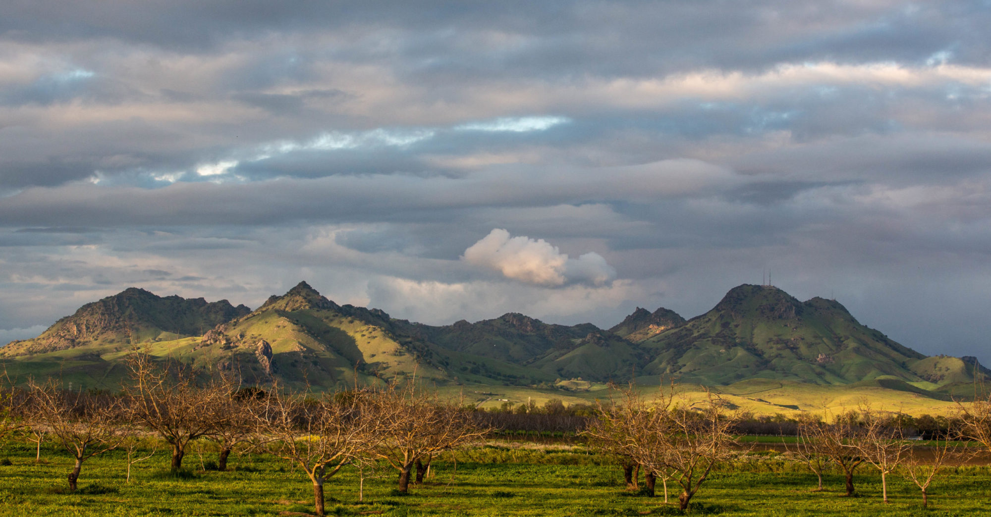
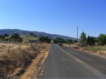
One of my favorite landscapes: Pleasants Valley Road, running north from the Fairfield/Vacaville area, just north of Interstate 80, up to pretty close to nowhere on state Highway 128. This is one of the places I think of as a real California place: hills and low mountains folded up, the winter’s green grass turned golden in the heat of the early summer, and just three or four miles to the east, the table-flat margin of the Sacramento Valley.

Kate and I were going up to some friends in Fair Oaks, east of Sacramento, on Friday. I took the afternoon and early evening to ride from Berkeley to Davis, about 100 miles the way I go. In the summer, you can count on much warmer weather as you travel from the coast to the interior here. Define “much warmer.” It might be in the low 60s at the beach, low 70s around the shore of San Francisco Bay, and in the low 90s to low 100s as you move from the valleys east of the coastal mountains into the Central Valley. In Berkeley, the transition happens as you cross the hills headed east; there’s a short stretch on one of the roads up there where in the space of 100 yards or so the marine influence vanishes, the temperature rises, the humidity drops, and you’re in the interior.

I could tell Friday’s ride would be warm. It was pushing 80 in Berkeley when I left at 12:30 p.m. I couldn’t have told you how hot it was later, just that it was. Later I saw that the official temperature was in the mid to upper 90s along the route I took; my bike computer’s thermometer, which gets the sun-affected, on-the-asphalt reading, recorded a high of 115.

On my route, you hit Pleasants Valley Road after 65 miles or so. It marks the only place along the way where you have an extended feeling of having left the sprawl truly behind: 13 rolling, twisting miles, orchards giving way to ranches, deluxe estates, and then ranches with orchards. Beautiful even in the heat, though I was less inclined than usual to just drink in the scene.

Technorati Tags: , , ,

In Which We Gather by the River

A story in four parts.

I. Non-Confluence

Taking up where we left off last August, my dad and I — this time with my brother Chris — drove out to southwestern Will County on Monday to see if we could see the place where the Des Plaines and Kankakee rivers meet to form the Illinois River. Why? Well, the reason to care about the rivers is that in the mid-19th century they, along with the Illinois and Michigan Canal, represented the link between Lake Michigan, the Great Lakes, and the entire eastern United States and the Mississippi, the Gulf, and the country to the west. On top of that academic-sounding justification, there’s the relative obscurity of it. Who else is driving around the Chicago area looking for this spot? (Some good Web background on the I&M Canal, by the way: from the Chicago Historical Society (including pictures of canal sites in present-day Chicago settings); the Chicago Public Library (part of its “Down the Drain” site on the city’s sewer system); the National Park Service, and Illinois Department of Natural Resources.)

When we visited the area last summer, we hit the towpath along the canal a little too far to the west for it to be a reasonable walk, given my dad’s cantankerous knees. This time, we drove into a county park (McKinley Woods; among other things, the brief history posted at the park  says it was a POW camp during World War II) and started walking east on the towpath. The canal runs to the north of the path, and the rivers to the south.  About a mile from the McKinley Woods parking lot, after passing a little marina on the opposite bank, we came to a what appeared (to me) to be a spit of land that marked the separation of the Des Plaines and Kankakee rivers. Pictures were duly snapped and huzzahs sounded, and we walked back to the parking lot.

Dadtowpath
Cimg0530
Cimg0534

It was only in the course of writing this, though, that I discovered to what an extent I had betrayed the legacy of  Louis Joliet, the 17th century French-Canadian explorer who traveled up the Illinois River to the Des Plaines and then on to the Chicago River and Lake Michigan and quickly realized the feasibility of a canal connecting the lake to the Illinois and Mississippi. The “confluence” I located was in fact just an island in the Des Plaines River. The real merger point was west of the lot where we parked, not east.

I guess we have an excuse to go back and look for the spot a third time. (Pictures, from left: Dad on the Illinois and Michigan Canal towpath; a glimpse of the false confluence; the I&M Canal, with the river bluffs in the distance.)

II. Country Cemetery

From the non-confluence of the rivers, we got on Interstate 55 south, headed for Lexington, about 70 miles away. Our destination was the cemetery in Pleasant Hill, a hamlet two or three miles outside town. My old high school English teacher, G.E. Smith, died in April and was buried there alongside his mother and stepfather. I visited Pleasant Hill once, around 1971 or ’72, when G.E. went down to check up on his family’s old home, which by then amounted to a falling-down house and a cellar with a roof on it. He was attached to the place, but it wasn’t until later that he seemed to act on the interest, writing a column in Lexington’s weekly paper about Pleasant Hill history and then becoming a serious geneaologist and trying to gather all the strands of the family that had wound up out there on the prairie.

The Pleasant Hill cemetery goes back to the first half of the 19th century. The area’s first white settlers, who arrived in 1820, are buried there. It used to serve two congregations in the little town, but those churches are long gone. The grounds are unfenced and merge into the corn and soybean fields. G.E.’s grave is on an east-facing slope; his freshly cut brown-red granite stone announces his middle name, Edward, a matter that he liked to keep to himself. It describes him as “teacher, counselor, writer,” and includes a quote from him: “My highest goal was always and still remains simply this: To be able to look back upon my life, from any point along the way, and be able to say that this little corner of the world that my life touched has been made better, not worse, because I touched it.”

When we arrived, in early afternoon, it was clear and very warm and the caretaker, Ron Eckhart, was watering new sod on G.E.’s grave from a tank on his red pickup. He’s been the caretaker for 26 years — “That’s a lot of grass cut,” was how he put it — and long before that, his dad was pastor at both of the Pleasant Hill churches. Eventually he moved off to another part of the cemetery, and so did we. Up the hill from G.E.’s spot is the oldest section of the cemetery, filled with  people from the days before the Illinois Central bypassed Pleasant Hill and doomed it to perpetual hamlet-hood. With only the graves to go by, you would guess life was hard there. There’s the usual large complement of children who died in their first year or two; but there are also seemed to be a lot of adults who didn’t make it out of their 30s. But maybe life was just hard everywhere when these people were trying to make farms and towns. For one example, take a look at the life of another Prairie Stater, Abraham Lincoln: His sweetheart was carried off by a fever at age 20. Just one of his four children survived to adulthood.

Cimg0542_1Cimg0557
Cimg0562

Looking around the little cemetery, it looked like G.E., who was aged 81 years, three months and a day when he died, might be one of its oldest residents.

III. Wrecked

We drove through Lexington to start the drive back toward Chicago. On the way out to Pleasant Hill, Chris had pointed out the placards on every telephone poll downtown bearing the names of local soldiers serving in Iraq, Afghanistan and elsewhere. Chris counted 19 names. The town has about 2,000 residents, so roughly 1 percent of the population is serving. We fueled up at the Freedom gas station — just $2.899 a gallon — then headed north on old U.S. 66 to Chenoa. I wanted to take U.S. 24 east to Interstate 57 both because I knew there was a Dairy Queen along the way (in Fairbury) — my dad’s favorite road-trip stop — and because I remembered a little piece of local history along the way: the Chatsworth Wreck.

Back in the mid-70s, I stopped to read a historical marker just outside Chatsworth, one of the series of farm towns strung along U.S. 24. It reads:

THE CHATSWORTH WRECK

MIDNIGHT, AUGUST 10-11, 1887

One-half mile north on the Toledo, Peoria & Western Railroad occurred one of the worst wrecks in American rail history. An excursion train – two engines and approximately twenty wooden coaches – from Peoria to Niagara Falls, struck a burning culvert . Of the 500 passengers about 85 perished and scores were injured.

We stopped at the DQ in Fairbury, then continued on through Chatsworth to the wreck marker, which is about two and a half miles east of town, nearly on the Livingston-Ford county line. One thing that’s a little unclear when you’re at the roadside, though, is exactly where the disaster occurred. The TP&W tracks — the railroad still goes by that name — are a half mile north of the highway. I wanted to see if we could find the site of the notorious “burning culvert” — actually, a small wooden trestle. I imagined there could be a memorial or marker at the spot where the train left the tracks.

We parked at an electrical substation near the railroad’s marked but unguarded level crossing. My sense, based on the marker’s placement west of the section road that runs up the county line was that the wreck site was west of the road, too. Chris and I walked along the single track until we got to a culvert maybe a quarter-mile west of the road. It’s not deep — in fact, it’s a narrow ditch that crosses under the track through an 8- or 10-foot-diameter steel pipe. The site is unprepossessing, just like every foot of track east or west of it to the horizon, and there was nothing to suggest we were at the scene of a sensational event.

After we walked back to the car and started east again on 24, Chris and I spotted another culvert — this one an actual trestle — just east of the county line. We turned around and hiked out to it, too. It’s a much more satisfying place for a calamity: The tracks cross a bridge that’s about 75 feet long and a good 20 feet above a sluggish little creek. We agreed that between the two possible sites, this seemed the more likely.

Back at home, I poked around online to see if I could find some account that sheds light on the wreck’s precise location. Chatsworth had a newspaper, the Plaindealer, in 1887, and much more recently, a retired teacher and local historian there, Helen Louise Plaster Stoutemyer, published a book on the disaster, “The Train that Never Arrived.” Eventually, I came across a Chatsworth native’s website that includes the Plaindealer’s first account of the tragedy. The story says the train left the tracks at “the first bridge west of the county line” — the first place Chris and I looked. In addition to offering the salient facts, the writer has a lot to say about the impression the wreck left:

“The sight was most terrible. … It was too horrible to admit of description.  The screams and moans of the wounded were heartrending, and the terror of the sight can not be imagined. … To add to the terror of the scene a heavy thunder and lightening storm came up, and , with heavy rain made such a scene as would appall the bravest hearts. … Even the strongest men were forced to tears as they heard and saw the anguish of the unhappy excursionists.  While many displayed strong courage, grit, and heroism, others were almost frantic, and those in attendence upon them were forced to hold them to prevent acts of insanity and self-destruction.”

If you like the newspaper’s rendition, then you’ll love the song: “The Chatsworth Wreck.”

Cimg0578Cimg0574_1
Cimg0584

(Pictures: Left: The marker, east of Chatsworth on U.S. 24. Middle: Wreck candidate site A  (west of the railroad crossing 2.5 miles east of Chatworth; north end of culvert is just visible on far left). Right: Wreck
candidate site B — east of the crossing.)

IV. Wrecked Again

After investigating the site of the 1887 trackside carnage, we turned east again on U.S. 24. The highway crosses Interstate 57 at Gilman, then crosses Highway 1, which follows an old trapper’s trail from the Wabash River up to Chicago, at a town called Watseka. I was curious to see Watseka, which I’ve passed through exactly once: In the autumn of 1966, when Dad took us on a long-weekend trip down to the Smoky Mountains and back. I remember going through there late on a Thursday night that ended at a Holiday Inn just outside Indianapolis.

As we started to get close, I asked Dad and Chris whether they remembered the big disaster that had happened in Watseka around 1970. It didn’t ring a bell with them. I recounted the big blast and fire in town — apparently some kind of gas explosion — and an image I still vividly remembered. A fireball rising far above the old-fashioned town water tower.

A couple minutes later, a town came into view. There was a newish water tower rising up in the middle of town. I thought I was looking at Watseka, and said something like, “See, that must be the replacement for the old water tower.” Chris was driving, and noticed the town limit sign: Crescent City. He spotted a historical marker on the left side of the road. As we passed, he asked whether we should stop. Yes, let’s. We went back, and the marker turned out to be a small pavilion with some displays. In fact, a big blowup of the picture I had described — water tower, fireball — was the centerpiece in one of the displays. Somehow I had transferred the disaster — which occurred June 21, 1970 — to the next town over.

The cataclysm involved the same railroad that ran its train off the tracks in Chatsworth in 1887, the Toledo, Peoria & Western. Several liquified propane tank cars derailed in the center of Crescent City on Father’s Day morning. The town fire department responded and fought for an hour to prevent an explosion before the first car finally went off. At that point, according to a hand-written reminiscence that’s part of the memorial, “the boys retreated and let fate take its course.” Sixty-four people were hurt (mostly firefighters who suffered second- and third-degree burns), none killed; the center of Crescent City was obliterated. The president of the TP&W issued a statement accepting responsibility for the blast and apologizing for “the inconvenience.”

Cimg0594_1
Cimg0592_1

More on G.E. Smith
Happy 80.5, G.E.
A Teacher
A Teacher (2)

Technorati Tags: , ,

Expressway Summer

Danryan

Expressway reconstruction: a rite of Chicago’s non-winter season. Chicago’s not the only place this happens, but from my outsider’s perspective, late spring/summer/fall-until-it-snows seems to be given over to large-scale highway projects. This year, the Dan Ryan Expressway on the South Side is being rebuilt. Not repaved — reconstructed from the roadbed up. The middle eight lanes — the “express” lanes, four northbound, four southbound — are torn up right now; that leaves three lanes in each direction in the main construction zone (from about 13th Street to 71st Street).

Mid-afternoon Saturday, we got a nice view during our slow-but-not-horrible progress down the Ryan (towards my brother Chris’s suburban manse in far-off Tinley Park). We headed back north Saturday night just before midnight. The work was still going on (what sort of overtime and weird-shift bonuses are these highway workers making?).

Technorati Tags: ,

Aus Chicago

A quick Father’s Day trip to Chicago. I managed to arrive just at the moment Chicagoland transitions from moderate temperatures to a mini-heat wave (high today in the low to mid 90s; tomorrow, we’re supposed to have widespread thunderstorminess and temps in the low 80s; mid-70s on Monday).

The main question with which I come forth to the universe today is: Why would someone take a window seat on an airliner then not look out the window?

I flew out of Oakland at 6 a.m. Friday. The United flight I took used a 757, and every seat was taken. I got a middle seat in row 29. No big deal. For four hours of my life, I can accept living in a semi-reclined coffin position.

My preference, though, is always the window seat. I ignore the flight attendants’ suggestion to pull down the shade so that the icabin video monitors will be glare-free during the in-flight movies and sitcoms. My in-flight entertainment is everything I can see through that little window or window and a half I can see from the coach section. Takeoffs and landings are primo, because you’re close enough to the ground to see details of the landscape or cityscape below. But everything in between is riveting, too, from the Sacramento-San Joaqin Delta to the Mississippi and Wisconsin rivers (if you approach Chicago from the northwest).

Yesterday, a bleached-blonde and pink-topped and coral-fingernailed woman sat squeezed into the window seat on my right. Before we pulled away from the terminal, she was deep into a Danielle Steel novel (“Miracle,” I think it was; I read a passage in which someone named Quinn was realizing that “his life without her was a life sentence. Life without parole”). In the sliver of a view I could see beyond the book, patches of the Bay shore and the hills to the east and the Central Valley slid by). She never once glanced out the window. Of course, she could have just been nervous; she may not have wanted to be reminded how high and fast we were moving. But then: Why take the window seat? If Danielle Steel is what you want, you could pretty much ride in the cargo hold and get your money’s worth.

The little bit of a view I had went away when the flight attendant made the “shut-your-shade-to-avoid-video-glare” announcement. My rowmate pulled down the shades on command and didn’t open them again until we were within about 10 minutes of our landing. That was OK — it gave me a chance to take the nap I would have missed while I stared down at the Sierra, the basin and range of Nevada, the Utah canyon country, the Rockies, the plains and sandhills of Nebraska, the Missouri River, the ethanol-producing Iowa corn country, the Mississippi, the Illinois farmlands giving way to the suburbs and expressways and O’Hare.

Technorati Tags:

North on 5

One last trip up to Eugene on Interstate 5. Someone asked me this morning how many times I’ve made the drive, which is about 1,030 miles round trip. Including today: Seven. At Thanksgiving, I did the trip twice in seven days, driving north on Tuesday, south on Wednesday, north and 40 percent of the way south on Sunday, and back home on Monday.

But the trip might not be as long as it sounds. I mentioned Interstate 5. It’s not an all-out raceway as it is from the Bay Area down to Los Angeles, but it moves right along going up the Sacramento Valley and doesn’t force you to slow down (too much) once you get into the mountains in the north. That’s all by way of saying that 500 miles and change might be a seven-and-a-half or eight-hour drive if you keep your stops short.

I’ll let you do the arithmetic. I’m going to bed.

Technorati Tags: , , , ,