Journal of Airliner Seat Photography

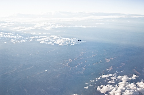
One thing you notice when you spend hours staring out an airliner window in flight is other airliners streaking past. Sometimes you’ll see them headed in the same direction, flying roughly parallel to your path. Mostly, you see them go flashing by in the opposite direction (last week, we saw four in the space of about 30 seconds).

In the shot above, taken July 26, I was on an American Airlines flight headed west from Chicago to San Francisco. The local time, somewhere over Utah, was about 8:20 p.m. Suddenly, I spotted a jet heading north/northeast that appeared to have crossed below and ahead of us. It was there and gone in a few seconds, but I had my camera in hand and shot several frames before it disappeared.

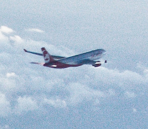
Looking at the pictures afterward, I tried to make out the words and logo pained on the aircraft. After searching for a few minutes, I came up with an answer: Air Berlin. My educated guess, thanks to the airline site and looking for records on FlightAware.com, is that this was Air Berlin Flight 7499, about 46 minutes into a direct from from Las Vegas to Duesseldorf, and that our position at this moment was about 50 miles northeast of Price, Utah.

Below is a cropped image of the airliner, an Airbus 330. And below that is the original image–which among other things makes it clear how late in the day it was–before I started fiddling with it digitally to identify the plane.

Friday Night (Chicago) Ferry

chicagoriver050412.jpg

I’m not in the Bay Area to do our Friday night ferry ritual. So the next best thing was to do a Friday evening boat trip in Chicago. Ann (my sister) and Ingrid (my niece) and I drove downtown and caught a Wendella cruise from a dock just beneath the Michigan Avenue bridge over the Chicago River. The first third of the 90-minute cruise heads west to the South Branch of the river, heads down a little way, and turns around when it’s just below Sears (Willis) Tower. Then it head back out to the lake, goes through the Chicago River lock out to the lake (there’s a two-foot elevation difference between the lake and engineered river), then a short spin north from the mouth of the river, then south toward the planetarium and aquarium, then back into the river.

Yesterday featured shockingly fine mid-spring weather. It was a not-overly-humid 85 with a what we in the Bay Area call an offshore wind–the breeze was coming from the southwest and blowing out over the water, meaning the cooling influence of Lake Michigan was felt (and then only slightly) immediately along the shore. That beautiful day ended in a long evening of lightning, thunder, and pounding rain, and by mid-morning today the wind had turned around and was coming from the northeast, off the lake. The high here today was about 60. And on the boat this evening, it was quite cool. But as long as we were on the river, well below street level, there was hardly any wind. But I noticed that as soon as we headed out toward the lake, the tour guide who had been filling us in on the architectural scene along the river grabbed her gear and headed for the downstairs cabin. “I’ll be back,” she told me. “But the wind is blowing so hard out here you won’t be able to hear me.” The U.S. and Army Corps of Engineers flags flying at the western end of the lock were standing straight out in the breeze as we approached. I saw in the paper today that the lake’s surface temperature is 43 degrees near shore, and as soon as we got out into that wind, it felt–well, pretty cold.

Then we turned around and came out of the tempest, back through the lock, back down the river. The scene above: the new Trump Building (second tallest in Chicago, a sign at its base boasts), with the Wrigley Building at right (decked in blue as part of a commemoration of fallen Chicago Police Department officers).

Air Blog: To Chicago

flight050212.jpg

I managed to miss my scheduled flight earlier today by attempting one too many last-minute tasks before I headed out the door to the airport (including the daily Last Task Before Leaving, walking The Dog). I took BART out to SFO and knew I was kind of cutting it close and got to the baggage counter to check my bag about five minutes after they’d stopped taking luggage for my flight. Since they want you to be on the same plane as your baggage (think about why that is), both I and my bag got moved onto the next flight about an hour later. That was fine by me (though I might have emoted more if the delay had been four or five hours). My substitute flight was late, and for some reason the trip seemed much longer than the three and a half hours it was.

But all that’s ancient history. I’m up on the North Side now, at my sister and bro-in-law’s place in West Rogers Park. It’s one of those perfect nights in Chicago, springtime or anytime: warm until well after midnight, but not humid enough that you feel like the warmth is hanging on you. It’s calm and a little hazy but clear enough to see the brightest stars.

California Salmon: Slideshow of the Day

Some pictures I’ve been sitting on for oh, the last year and a half. The September before last, Kate and The Dog and I took a Sunday field trip to the state fish hatchery just below Oroville Dam. It was a perfect day in the Sacramento Valley, clear and brilliantly sunny but not really hot — maybe 85 degrees. The first decent chinook salmon run in several years was under way, and in the three or four hours we hung around, several hundred people, almost all locals, showed up to take a look at the fish. A quick look at some of what we saw (captions to come): 

Superior Suds

A random Sunday morning find in my 2011 photos–an August street scene in Brooklyn. This was at 5th and Baltic, as Kate and I walked from Court and Warren streets down to Grand Army Plaza to meet our friends Jan and Christian at the Brooklyn Public Library. superiorsuds.jpg

‘A Ruin, Only in Reverse’

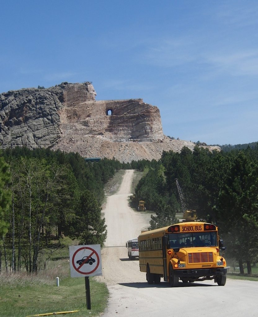
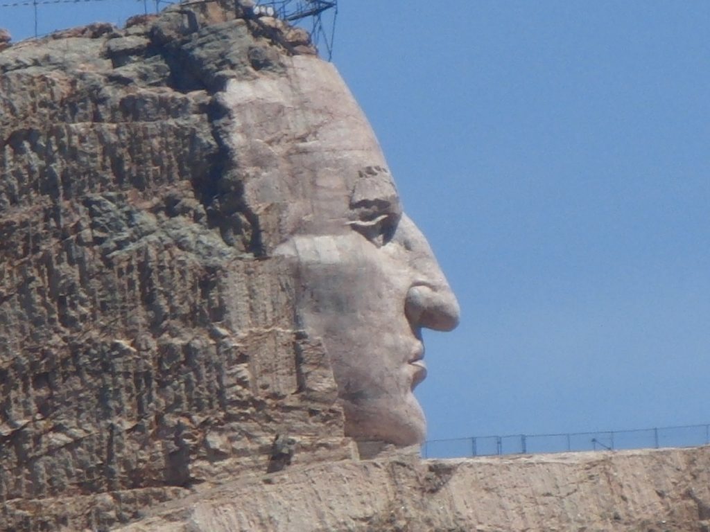
The Ziolkowski monument to Crazy Horse in South Dakota’s Black Hills.

Last June, I drove from Seattle to Omaha with my son Eamon and my daughter-in-law Sakura. Our first day took us into western Montana. The second day saw us get to western South Dakota after a stop at the Little Big Horn. And the third day we started out with a quick blast through the Black Hills. We stopped in Deadwood, then headed to the Crazy Horse monument. That’s the picture above. If you pay a little extra when you visit the memorial, you can take a bus ride right up close to where the work on the monument is going on.

I had been to Crazy Horse once before, back in 1988, with my dad, when we were on our way to the Little Big Horn. Back then, you had to take the artists’ word that something would emerge from the mountain they were blasting away. At the visitors center, we paid a dollar for a chunk of granite from the rubble, faced with mica and shot through with what look like nodules of pyrite. The rock’s here on the dining room table as I write this. Twenty-three years later, something dramatic has been brought out of the mountain, and the scene around the area has changed, too. The site is now approached on a route that’s turned into a major highway, and the turnoff is controlled by the kind of traffic signal you see on expressways in San Jose. There’s an entrance plaza with maybe six lanes, just like going into a stadium parking lot. After that, there’s plenty of parking, a museum, shops, and beyond that, the mountain. Lots of people were visiting the early June day we stopped, though I wouldn’t say the place was overrun.

A few days ago, I came across Ian Frazier’s account of his visit to Crazy Horse, probably within a year or so of when we were there. Here’s what he saw, as recounted in his book “Great Plains“:

“In the Black Hills, near the town of Custer, South Dakota, sculptors are carving a statue of Crazy Horse from a six-hundred-foot-high mountain of granite. The rock, called Thunderhead Mountain, is near Mt. Rushmore. The man who began the statue was a Boston-born sculptor named Korczak Ziolkowski, and he became inspired to the work after receiving a letter from Henry Standing Bear, a Sioux chief, in 1939. Standing Bear asked Ziolkowski if he would be interested in carving a memorial to Crazy Horse as a way of honoring heroes of the Indian people. The idea so appealed to Ziolkowski that he decided to make the largest statue in the world: Crazy Horse, on horseback, with his left arm outstretched and pointing. From Crazy Horse’s shoulder to the tip of his index finger would be 263 feet. A forty-four-foot stone feather would rise above his head. Ziolkowski worked on the statue from 1947 until his death in 1982. As the project progressed, he added an Indian museum and a university and medical school for Indians to his plans for the grounds around the statue. Since his death, his wife and children have carried on the work.

“The Black Hills, sacred to generations of Sioux and Cheyenne, are now filled with T-shirt stores, reptile gardens, talking wood carvings, wax museums, gravity mystery areas (‘See and feel COSMOS–the only gravity mystery area that is family approved’), etc. Before I went there, I thought the Crazy Horse monument would be just another attraction. But it is wonderful. In all his years of blasting, bulldozing, and chipping, Ziolkowski removed over eight million tons of rock. You can just begin to tell. There is an outline of the planned sculpture on the mountain, and parts of the arm and the rider’s head are beginning to emerge. The rest of the figure still waits within Thunderhead Mountain–Ziolkowski’s descendants will doubtless be working away in the year 2150. This makes the statue in its present state an unusual attraction, one which draws a million visitors annually: it is a ruin, only in reverse. Instead of looking at it and imagining what it used to be, people stand at the observation deck and say, ‘Boy, that’s really going to be great someday.’ The gift shop is extensive and prosperous, buses with ‘Crazy Horse’ in the destination window bring tourists from nearby Rapid City; Indian chants play on speakers in the Indian museum; Boy Scouts, Girl Scouts, local residents, and American Indians get in free. The Crazy Horse monument is the one place on the plains where I saw lots of Indians smiling.”

If you happen to go to the monument in the fall, there’s a walk to Korczak Ziokowski’s tomb every year on October 20, the anniversary of his death. Also interred there: his daughter Anne, who died last year just a few week’s before we visited. Her obituary, brief as it is, speaks volumes about the family’s commitment to the Black Hills.

Black Hills Crazy Horse monument in closeup.

On Tenaya Lake

icewhisperer.jpg

The vanity never stops. This is me out on Tenaya Lake in Yosemite the week before last. My nephew Max snapped the picture and titled it “The Ice Whisperer.” What I was after was the sound–a lot like the sound of whale calls–emanating from the lake as the ice expanded and reacted to the strollers and skaters on the surface. You can get a vague idea of the sound, in between passages of me crunching around on the ice, from the audio clip below. Note: I was the only one in shorts out there, prompting one person to say, “I hate you. But thank you, because I think that’s going to make it snow.” The lake is under a couple of feet of snow right now after a series of storms that started last Thursday.

Tenayalake.mp3 by Dan Brekke

Journal of Self-Promotion: ‘Roof of California’

I have a sense of when I’ve stayed on one topic too long, and this is one of those times. But bear with my carrying on about Tioga Pass just a few minutes longer. As mentioned (and pictured) earlier (and then mentioned again, elsewhere), I drove up across the pass last week on a blitz-style Yosemite tour with my nephew Max. I also brought a sound recorder along and wound up talking to people we met along the way, and that led to a radio story that aired Thursday morning on KQED’s “The California Report.”. Oddly, because of a problem with the The California Report site, the link to our airing of the story is still acting weird for me. story. But the piece also aired on KPCC in Los Angeles, and here’s the link to the story as it played there:

Clear skies in the Sierra Nevada open up access to Yosemite.

OK–that is it for now. Until I get the picture that Max shot of me walking around wearing shorts on the frozen lake.

High Country, Out of Character

mountdana011112.jpg

That’s Mount Dana, elevation 13,057 feet above sea level, just south of Tioga Pass in Yosemite National Park. The picture was shot from a ridge above the Gaylor Lakes just north of the pass, elevation about 10,500.

My nephew Max and I drove across the Tioga road on Wednesday, and it’s a trip that will leave an impression for some time. As I’ve said elsewhere, this is country that’s normally far beyond the reach of the casual winter traveler. The Sierra this high up is usually buried in snow. Beyond that, it can be cold and harsh in a way that’s utterly foreign to us Northern California lowlanders. The day we were up there, it felt like the temperature was in the high 40s, at least, and warmer in the sunlight. There was no wind. I was wearing shorts, though that was pushing it a little. Plenty of others have journeyed up to this strangely accessible alpine world. A local outdoors writer did a blog post last week about a couple guys who had driven up to hike Mount Dana–yeah, that peak pictured above–in running shoes.

All the weather forecasts show that this midwinter idyll, made possible by a long, long dry spell accompanied by unusually mild daytime temperatures, is coming to an end. The forecast for the end of the week is blizzardy: snow, then more snow, with high winds. And already, the weather has changed. Today’s high is for a high of about 30, with 50 mph winds gusting to 80 mph. Tonight’s forecast: a low of 10, with a westerly wind of 60-65 mph gusting to 105 mph. I have a picture in my head of being blown clear off this ridge.

More on this later. For a rather short trip–we were only on the road across the high country for a few hours–it filled my head with impressions.

Bolinas Ridge Bovine Encounter

bolinasridge010812.jpg

Today’s outing: To the Bolinas Ridge Trail in West Marin. We got out there to the north end of the trail, at Sir Francis Drake Boulevard, probably an hour, an hour and a half before the sank behind Inverness Ridge, to the west. We found a sort of rocky natural platform overlooking a ravine and the trail we had walked in on, and just stayed there as the sun went down. Soon, the moon rose, and we walked back to the car. This lad (or lass–my non-farm eye didn’t see evidence one way or the other) was one of the many bovines along the trail. Nice place to be a cow, or a bull, or whatever.