I think a lot about homelessness, about what it represents in our society, about our responses to it collectively and individually, about the many encounters — with a man named Charles, instance, and with Eric, and with Perry — with the destitute and down and out I’ve had over the years. And about the meaning of personal gestures.
The New York Times just published excerpts of the prison letters of Nelson Mandela. One, to his son Makgatho, talked about effective responses to poverty:
I have been reminiscing a great deal … Those were the days when you lived a happy life free of problems and fenced from all hardships and insecurity by parental love. You did not work, grub was galore, clothing was plentiful and you slept good. But some of your playmates those days roamed around completely naked and dirty because their parents were too poor to dress them and to keep them clean.
Often you brought them home and gave them food. Sometimes you went away with double the amount of swimming fees to help a needy friend. Perhaps then you acted purely out of a child’s affection for a friend, and not because you had become consciously aware of the extremes of wealth and poverty that characterized our social life. …
It’s a good thing to help a friend whenever you can; but individual acts of hospitality are not the answer. …
This is not a problem that can be handled by individual acts of hospitality. The man who attempted to use his own possessions to help all the needy would be permanently ruined and in due course himself live on alms. Experience shows that this problem can be effectively tackled only by a disciplined body of persons, who are inspired by the same ideas and united in a common cause.
One of the decisions we had to make when we put Scout to sleep a month ago concerned what to do with his body afterward. In the past, we’ve buried our late companions — two cats, a rat, a rabbit, a budgie — in the backyard. But Scout was big enough — 50 pounds or so — that it seemed like it would be a real chore to dig a hole long and wide and deep enough for him.
When the event came to pass, our vet told us we could have him cremated individually if we wanted. Afterward, we could scatter his ashes — the coffee-can scene from “The Big Lebowski” comes to mind — or perhaps stow him on the mantelpiece or have him interred at a pet cemetery. Alternately, we could opt for a group cremation and have his remains buried — OK, I admit that the verb I think of is “dumped” — in a common grave somewhere.
I forget what the price was for the different levels of service, but the group cremation/common grave scenario was much less expensive. With the feeling that the most important part of Scout was not his “remains” but our memories of him and the indelible mark he left on our lives, that’s the option we chose. After the wrenching experience of having The Dog put down, I didn’t dwell on where he’d wind up afterward.
“This certificate will serve to notify its owners that the remains of Scout were interred in a country setting together with the pets of many other loving and appreciative owners such as yourself feel that their pets deserve more than the other alternatives now in practice. “Country burial” is an expression of gratitude for the unselfish devotion and companionship your pet gave you during its entire lifetime.”
A form enclosed with the certificate informs us that we can memorialize Scout in Bubbling Well’s memorial pet register, located at the base of a monument in the park, which overlooks the Napa Valley. Price: $35 or more, by check or money order. The form hastens to advise us “this memorialization is purely voluntarily and there is no compulsion expressed or implied.”
Image of the area near the country burial site for animals handled by Bubbling Well Pet Memorial Park. The spot is in Solano County, east of Suisun City.
Naturally, Kate and I decided we’d like to go and take a look at the pet memorial park — which sooner or later I’ll just call a pet cemetery. Kate had looked up the address and come up with a place on Atlas Peak Road, off Silverado Trail just northeast of Napa. That meant one thing to me: It was likely in an area burned in the terrible North Bay wildfires of last October.
And sure enough, as we ascended the narrow road from the valley, we quickly encountered signs of fire — charred trees and shrubs, lots of construction activity as homes in the area are rebuilt.
The pet cemetery was obvious — the Los Angeles Times described it last fall as “an oasis in a sea of destruction” — for the manicured lawns amid a landscape that’s both burned-over and turning summer gold.
The disaster that swept the countryside also swept across the cemetery. While the “memorial garden” areas are nearly all intact, a home and office on the property burned, as did many large large trees. (The facility’s current proprietor, Dan Harberts, was among those evacuated by helicopter the night of the fire. He was forced to leave his own dog, Drake, a black lab, behind in a pickup truck. When a friend made it into the fire zone the next day, Drake was still waiting, safe and apparently sound.)
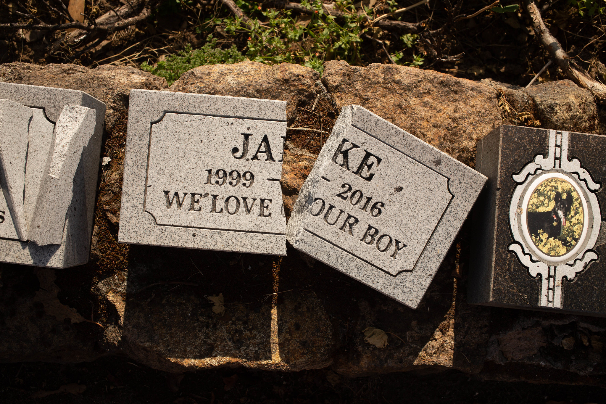
The memorial park is clearly in a state of rehabilitation, with evidence of heavy equipment having driven across parts of the property, a small heap of burned debris in a parking lot, and a collection of broken pet headstones — broken, I’m guessing, during the post-fire recovery — lined up on a wall.
We showed up around 4 p.m. While there was plenty of traffic on the road adjacent to the cemetery, we were the only people there. No staff. No other visitors.
It’s tempting to poke fun at the many, many pet plaques and grave markers at the cemetery and their sometimes maudlin messages. We saw one for a ferret named Bandit, whose human companions averred, “He was our everything.” One memorial includes what appear to be the figures of St. Francis, the Virgin Mary and a plywood golden retriever with a wire halo. A trio of pedigreed German shepherds is buried together under matching tablets saying, “Rest until we are together again.”
It’s tempting to make light of it all, but I won’t. While my sentiments and beliefs may be different — when Kate and I talk about how we’d like to dispose of these bodies of ours when the only show in town is over, I think of sky burials or Walt Whitman — mostly, I’m impressed by how many people will go to such apparent lengths to remember these presences in their lives.
Jake, 1999-2016. ‘We love our boy.’
When we got the Bubbling Wells card in the mail, I was thinking Scout’s “country burial” was in the Napa area. The picture on the card looks sort of like the lowlands south of the city. The difference between that image and the rugged hillside location where the cemetery sits didn’t compute at first. But as we ambled through the property, we came across a sign devoted mostly to explaining what “country burials” are, where they happen and that you can’t visit the burial site because of the conditions of a land-use permit.
Of course, inquiring minds want to know just where this burial site is.
The sign, below, doesn’t quite address the precise location. In a tone that may reflect having heard the question a million times, the cemetery’s proprietors say, “In all honesty, we can tell you that your pet was buried 20 miles east of Bubbling Well near Fairfield in a lovely country setting.”
A sign at Bubbling Well Pet Memorial Park explains the cemetery’s country burials.
After a diligent hour or two of searching public records, that description appears to be more or less accurate.
The site is a little southeast of Fairfield, south of Travis Air Force Base and just north of a range of low hills and, beyond them, the sloughs and wetlands associated with Suisun Bay.
Is it a lovely country setting?
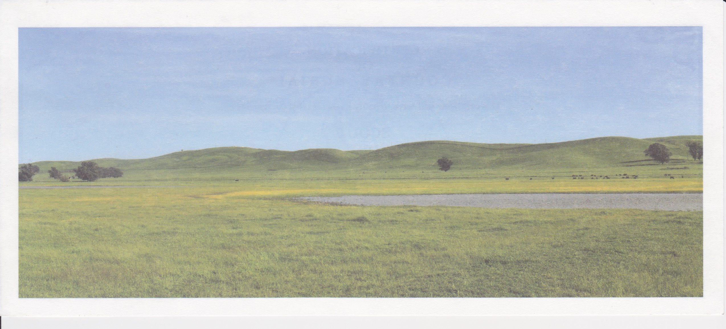
This slice of eastern Solano County is one of the many parts of the greater Bay Area where one can look past all we’ve done to the place and get a glimpse of the intoxicating beauty of California Before Us. That picture on the Bubbling Well card, with the green hills and splash of wildflower gold? It shows the actual place where pet cremains are buried — nearly a cubic yard of them a day on average, coming from hundreds of veterinary and other facilities around the Bay Area. What the picture doesn’t show is the nearby highway, the trucks going back and forth to the county landfill, or the jets coming in and out of Travis. Framing is everything.
How do I feel about Scout’s ashes being out there? It’s hard to say. But he did love every minute he spent outdoors, and I suppose for me there’s a little bit of resolution for me in that.
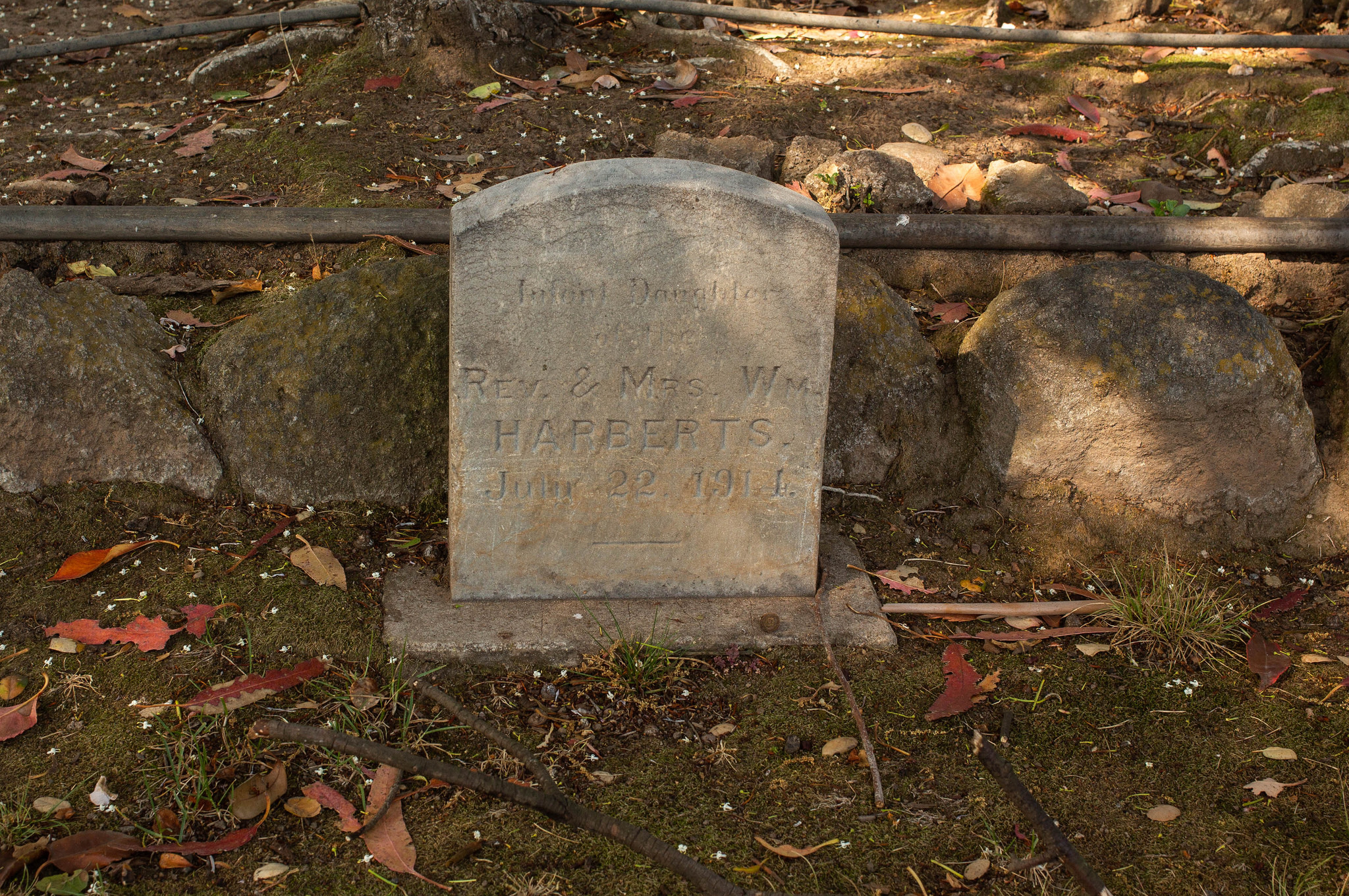
We came across one headstone at Bubbling Well that was for a child, not a pet. It says simply, “Infant daughter of Rev. and Mrs. Wm. Harberts, July 22, 1914.”
An infant’s grave at the Bubbling Well Pet Memorial Park.
That set off some more diligent searching. From the history I can find, the Harberts bought the Bubbling Well property in 1961 — long after the date on the headstone. The history also suggests that the Harberts lived in Iowa or Wisconsin, not California, in 1914. They did come west in the late 1930s and lived in the Los Angeles suburb of Glendale, where William Harberts, a Presbyterian minister, was a pastor. (Lydia died in Alameda in 1960; William died in Berkeley in 1970; one of their sons, Paul, ran Harberts Sporting Goods here and was a member of the East Bay Regional Park board).
William and Lydia Harberts’s oldest surviving child, John Calvin Harberts, was born in 1915, and it was he who bought the Bubbling Well property and started the pet memorial park in 1971. It’s not clear to me why his infant sister’s headstone — and, one assumes, remains — are interred here. My guess is that the family didn’t want to leave her behind in some far-away Midwestern cemetery and brought her to Napa for reburial.
A couple of other finds regarding Bubbling Well. It’s actually the centerpiece of a fairly important piece of American documentary film history: Errol Morris’s first film, “Gates of Heaven.” Roger Ebert called it one of the 10 best films ever made (surprisingly, no, I have never seen it. We can stream it now, and having been up there, we will).
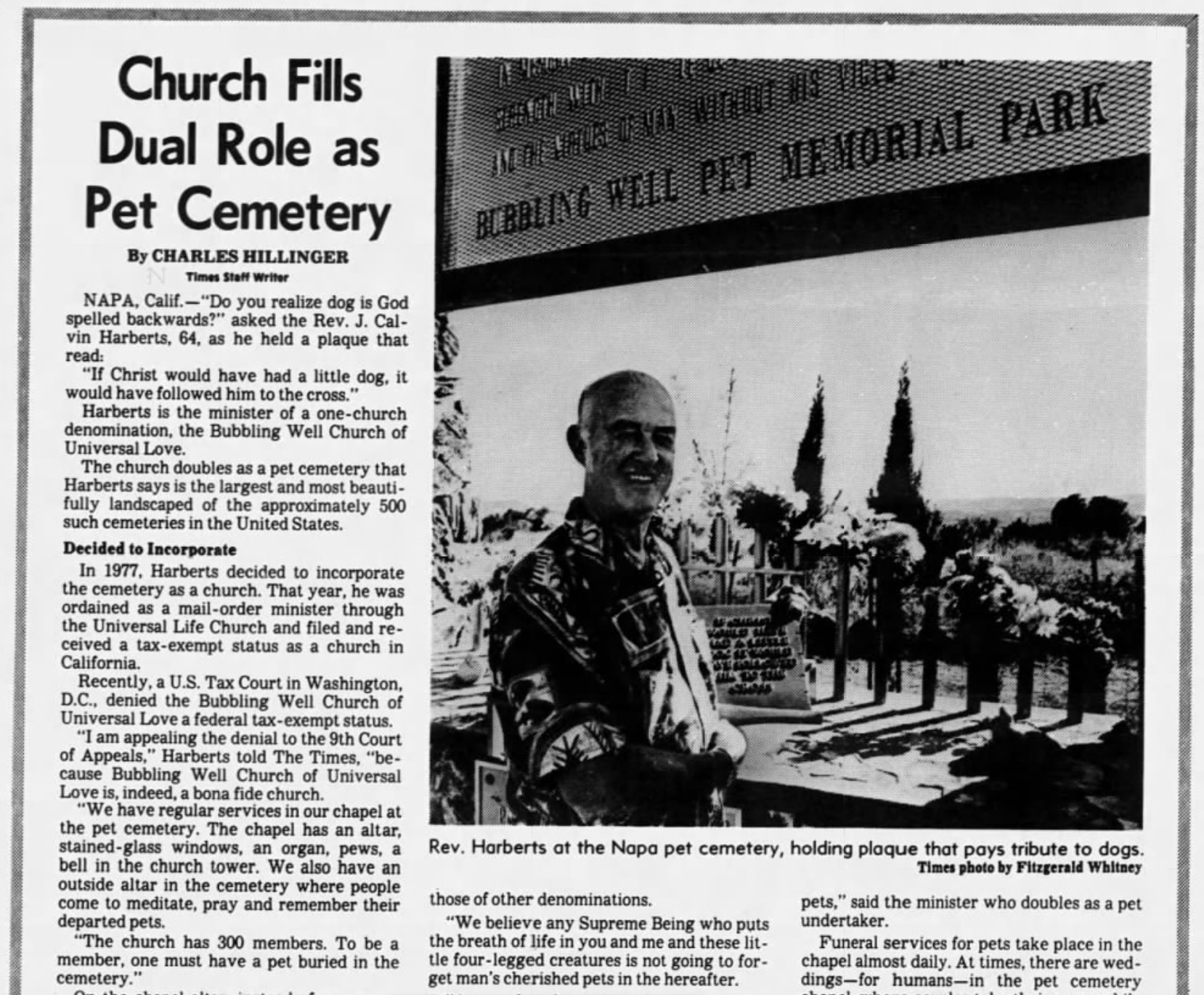
Cal Harberts also got some press back in the late ’70s and early ’80s for attempting to establish his pet memorial operation as a tax-exempt religious institution, The Bubbling Well Church of Universal Love. In July 1980, the Los Angeles Times profiled Harberts and his argument for tax-exempt status.
A 1980 profile of Bubbling Well Pet Memorial Park founder Cal Harberts.
“We believe any Supreme Being who puts the breath of life in you and me and these little four-legged creatures is not going to forget man’s cherished pets in the hereafter. At our church services, the congregation and I say prayers for our departed pets and for sick pets. I read from the Scriptures, recite poetry about pets, talk about the roles pets play in our lives. …
“I spend a good part of my time consoling people, telling them they will see their pets again in heaven. Organized religion doesn’t help them. They have to turn to someone. That is where the religious aspect of the Bubbling Well Pet Memorial Park and the Bubbling Well Church of Universal Love come together.”
“The bay of San Francisco is separated from the sea by low mountain ranges. Looking from the peaks of the Sierra Nevada, the coast mountains present an apparently continuous line, with only a single gap, resembling a mountain pass. This is the entrance to the great bay, and is the only water communication from the coast to the interior country. Approaching from the sea, the coast presents a bold outline. On the south, the bordering mountains come down in a narrow ridge of broken hills, terminating in a precipitous point, against which the sea breaks heavily. On the northern side, the mountain presents a bold promontory, rising in a few miles to a height of two or three thousand feet [Mount Tamalpais, earlier called Table Mountain]. Between these points is the strait — about one mile broad, in the narrowest part, and five miles long from the sea to the bay. Passing through this gate,* the bay opens to the right and left, extending in each direction about 35 miles, having a total length of more than 70 and a coast of about 275 miles. It is divided by straits and projecting points into three separate bays, of which the northern two are called San Pablo and Suisun bays. …”
*Called Chrysopolae (Golden Gate) on the map, on the same principle that the harbor of Byzantium (Constantinople afterwards) was called Chrysoecras (golden horn). The form of the harbor, and its advantages for commerce (and that before it became an entrepôt of eastern commerce,) suggested the name to the Greek founders of Byzantium. The form of the entrance into the bay of San Francisco, and its advantages for commerce (Asiatic inclusive,) suggest the name which is given to this entrance.
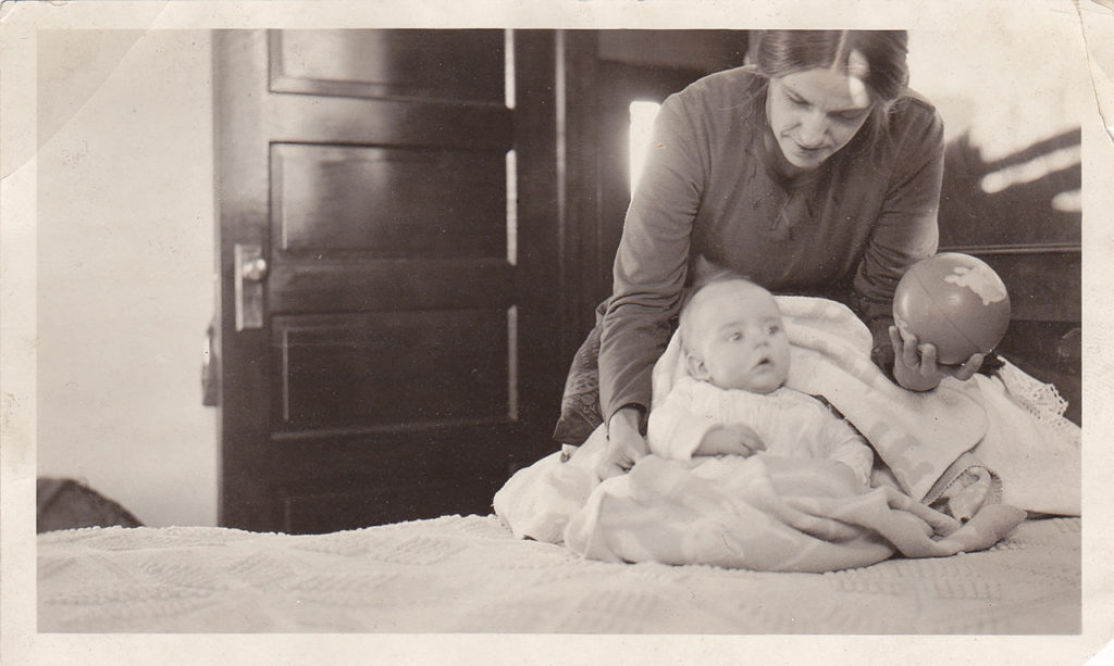
My father at age three and a half months, with his mother in December 1921.
Certain dates have acquired fixed meanings in my head. Family birthdays, for instance. September 3 is one of them — my dad’s.
He died five years ago this summer. He seems to have both vanished and to be as present as ever.
The physical presence is what’s gone, of course; that person about whom we worried, who often baffled and angered us, whom we loved and felt tender toward, was gone just like that. His ashes are in the same grave with our Mom’s — she died suddenly 14 years ago last week, and I still find myself saying “Oh, mom” out loud — and with the casket of our brother Mark, who died just before he turned two. There’s a whole story about that grave site, when and why it was purchased and how three family members wound up there. For another night, maybe. It must be said in the meantime that those remains in that spot were — are — the least of what those people were.
In that sense, in the sense of who Dad was and how he we saw him in life, he seems to be right here with me. I think about him every day. Still remembering a life of light and dark moments. Still trying to figure him out. Still trying to understand the gifts he gave all of us and those that he couldn’t give.
He lived to be nearly 91. If that’s a stake in the ground — I don’t presume much about my own future, but Dad lived nearly exactly as long, within about a week, as his mother — there are decades ahead to try to work all that out.
(The picture above is a favorite: Our grandmother, Otilia Sieversen Brekke, and my dad, at their home in Alvarado, Minnesota, in late December 1921. Dad was a little less than four months old. Grandma shows a warmth and attentiveness in this shot that doesn’t come out in other pictures.)
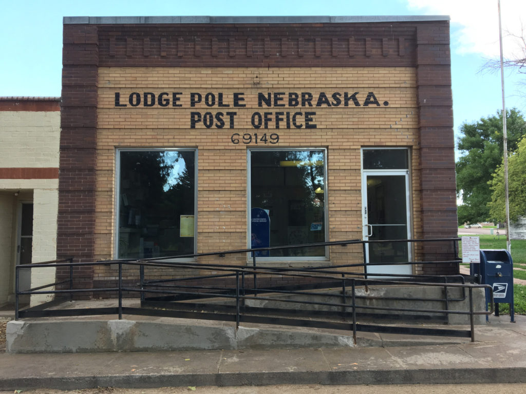
Starting midday Saturday from Sidney, Nebraska — a town of 6,000 just off Interstate 80 in the southwestern corner of the Nebraska panhandle — we drove east on U.S. 30 through the towns of Sunol and Lodgepole (or Lodge Pole, if you believe the lettering on the Post Office building there).
Lodgepole was one of my destinations on this trip. According to letters from one of my great-great-grandfathers, Timothy Jeremiah Hogan, his parents moved their family to this part of Nebraska in the mid-1860s to work on the Union Pacific railroad. Tim suggests they lived first in Lodgepole, then Sidney, 16 miles west, so the family would have the protection from hostile Indians in the area.
We hung around Lodgepole for maybe 30 or 45 minutes. I took pictures, naturally. We cruised by the most substantial building in town, the old brick public school — every small Nebraska town seems to have one. Then we were off again in the rain — we were caught in the beginning of a pretty persistent thunderstorm — and stayed west on Route 30, then turned north on Nebraska 27 to Oshkosh, on the North Platte River.
North of Oshkosh, the state blacktop ends and you begin a 60-mile stretch that begins with well-maintained dirt roads for roughly the first (southern) half of the drive and continues on a single lane of choppy asphalt for the second (northern) half.
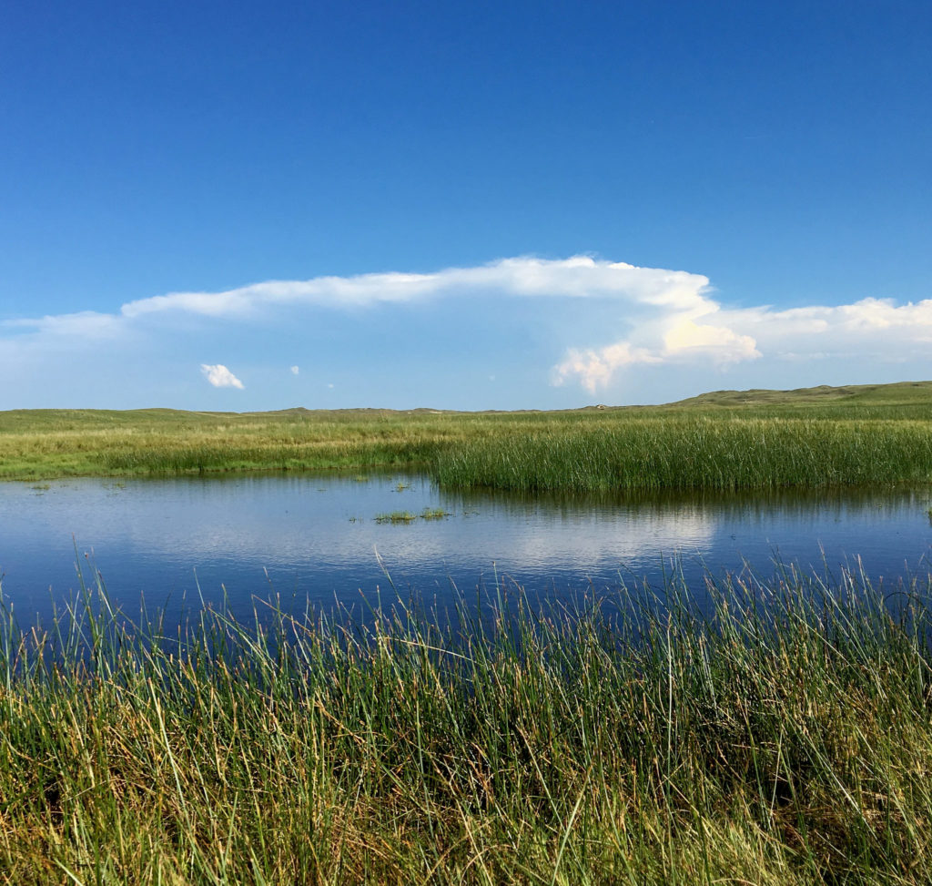
The reason you take that road, which goes through the Crescent Lake National Wildlife Refuge, is that it’s crossing one of the more remote parts of Nebraska’s Sand Hills.
The Sand Hills are a sweeping expanse of grass-covered dunes — about 20,000 square miles — said to have formed after the last ice age. And driving through on a road that twists and turns and somehow always seems to be climbing, it’s apparent you’re traveling through sand dunes being held in place by grasses and wildflowers (chief among the latter: black-eyed susans).
Anyway. I thought the Sand Hills would be the ideal place to watch the eclipse, and yesterday’s drive was to scout out the road. We saw a dozen, maybe 15 other cars, almost all with out-of-state plates, apparently doing the same. Passing ranches along the road, I had the same feeling of eclipse envy I experienced elsewhere on our trip — “Gee, these people live right here where the show is happening. Aren’t they lucky. I wish I could stay here.”
Near Crescent Lake National Wildlife Refuge in the Nebraska Sand Hills.
We got off that Crescent Lake road a little before 6 p.m. — another product of our late start — and headed east on Nebraska Highway 2, which runs for about 125 miles or so right through the heart of the Sand Hills. Our destination was Valentine, on U.S. 20 right up at the top of the state, and adding in that we crossed into Central time and lost and hour, we didn’t get off the road until 10 (it was all beautiful, though — even the lightning show to our east at dusk.
We checked into our hostelry, which I’ll call the Sketchy Rest, walked the dog, and then began checking on the latest Monday morning forecasts for the Sand Hills.
I want to say here that I am an inveterate, if not a sophisticated, reader of weather forecasts of all kinds. As I pored over forecast discussions and graphical forecasts and meteorological whatnot, the consensus from those who study computer models to understand upcoming weather was that it was likely to be cloudy in the Sand Hills on Monday morning. Part of me simply doesn’t want to believe that and found it hard to picture after experiencing one beautifully sunny follow another all the way through our trip. That included Saturday, when the Sand Hills were framed by distant, rising thunderheads but were spectacularly clear along our road.
The forecasts hadn’t improved by this morning (Sunday), so we went looking for options.
The forecast for Casper, Wyoming, was for clear, clear, clear skies. Plus, it’s close to the center of the eclipse path. What if we could find a place there?
I checked motels. There were a few room on offer online — $2,000 for a single night. No.
Kate, whom I believe is both charming and lucky (she wound up with me, after all), started to call motels. She found some friendly innkeepers, but no room.
I checked Craigslist. There was a single listing for a sort of in-law unit near the south end of Casper. No price listed. I got in touch with the person who posted the place. We talked. A price was agreed on (he happened to name the figure that Kate and I had previously agreed would be our maximum; more than I’d pay in any other circumstances, I think, but not a killer — and not anything like $2,000).
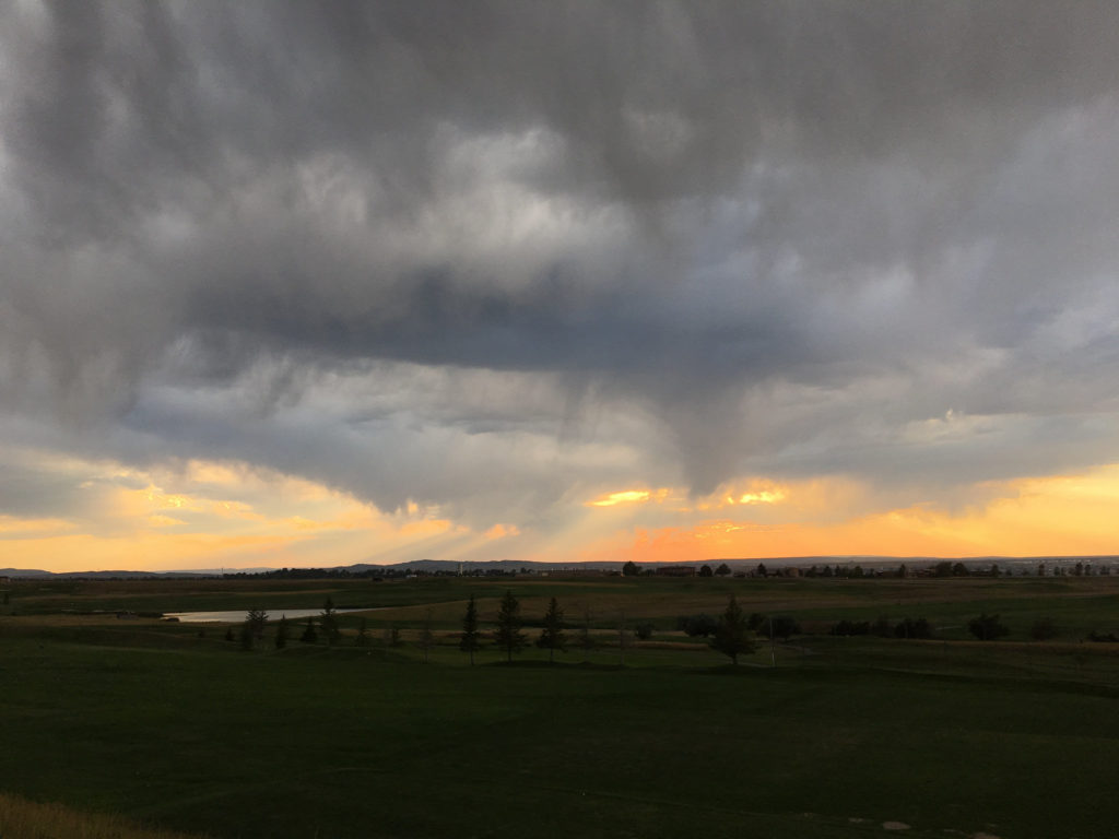
So we hit the road to Casper from Valentine — 325 miles on top of the 2,000 from the previous six days — rolling west on U.S. 20 about 1 p.m. It was a fast trip, with the usual dog- and picture-related stops, and we pulled in here just after (we gained an hour traveling back into Mountain time).
The sky when we got here? Starting to cloud up. Thunder was rolling. The light and storm clouds were beautiful. The stars are out tonight, though, and the forecast is still for sunny (and smoky) skies in the morning. Except for this one note from the regional forecast office, which noted the likelihood of some smoke in the air:
“One other feature to watch is (a) thinning band of higher clouds that is forecast by some of the guidance to be between the Wind River Basin and Casper around totality time. It may be clearing the Wind River Basin/Riverton vicinity in time and then possibly affect the Casper area between 11 and noon. May be a rather narrow band then but there could be some concern for viewing in this narrow cloud feature.”
Kate just reminded me that the moon will start crossing the sun’s disk here at 10:22 a.m MDT. Totality will occur at 11:43 a.m. I wonder where that cloud will be.
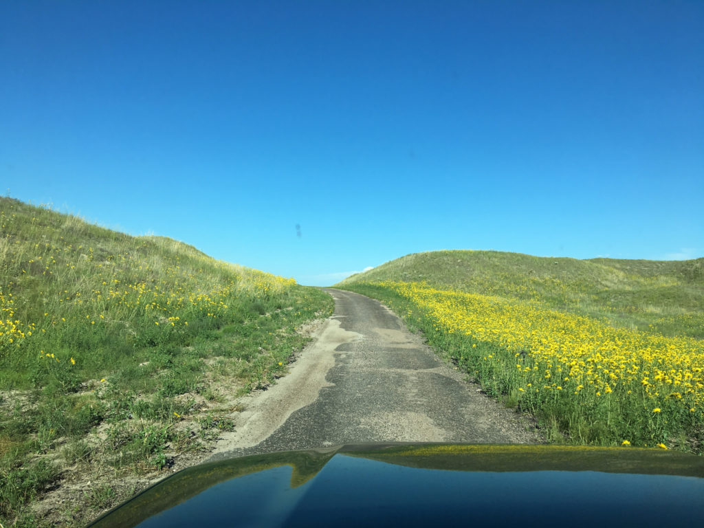
A driver’s seat view of the road from Crescent Lake National Wildlife Refuge up to Lakeside, on Highway 2, in western Nebraska.
Meant to publish this Saturday morning. But here it is at the tail end of Saturday night — we did make it to Valentine after an amazing drive through the Sand Hills (above) — instead:
Don’t have time to say much, because we’re late getting on the road, but: We spent the night in Jackson on Wednesday; Thursday morning, we had breakfast with the parents of our son Thom’s roommate at Oregon, Barb and Tom Dillon, who live just south of town. They invited us to stay Thursday night, so we did — using the daylight hours for a leisurely drive up past the Tetons to Yellowstone and back.
Friday, we drove across Wyoming to Sidney, Nebraska, a town where our family has roots, sort of, that go back to the 1860s. Less than 10 miles outside town, the a tire-pressure indicator light went on in the car. We pulled over and discovered we had picked up a nail and had a leak big enough I could hear it. Since the tire wasn’t too bad yet, we jumped in and made it the rest of the way to our motel, just off Interstate 80, where the tire quickly went flat. I changed it (a chore in a vehicle as large as the 4Runner, but do-able thanks to the aid of a passer-by, a Seattle-ite named Michael). In any case, we got it done.
This morning I drove into Sidney to have the punctured tire fixed. It took a while, so I strolled through town, where a parade was forming up as part of the town’s contribution to Nebraska’s sesquicentennial. Chatted up some of the participants, went back and got the car, and now we’re getting ready to head out with a tentative destination of Valentine, which is a good piece up the road (we’re not far from the Colorado border, and Valentine is close to South Dakota).
The eclipse weather forecast in western Nebraska is not great right now. So we’ll see where we wind up Monday morning.
Last Aug. 20, in a rare example of doing well ahead of a long-contemplated event, I mused about possible destinations to view the Great Solar Eclipse of 2017. One location I pondered — where we’re headed now — is western Nebraska.
(But why western Nebraska? I hear the question even before the final schwa sound of the Cornhusker State’s strangely compelling name fades away. Answer: Decent chances for good viewing weather and good odds of avoiding eclipse country gridlock. On both counts, we’ll see).
I didn’t do a whole lot in the way of eclipse preparation last year beside write that post, order an eclipse atlas, and spend hours poring over pages of Airbnb and VRBO listings. Like most of West Coast humanity, I searched out places to stay in Oregon east of the Cascades. The now-famous municipality of Madras was already booked up (I’m not counting offers to sleep for only $150 a night in prickly pear patches or cow pastures), and other promising places that would have required a drive of some length did not pan out. (I did not consider Bend, a city of some size and reputation, because I could all too easily imagine Eclipse Morning gridlock, or rangelock or whatever you call it when you don’t have a grid, with traffic heading up the road toward the totality zone.)
Thus thoughts turned again to Nebraska. (Why? See above.) I will unfold our ultimate destination, which is currently semi-unknown, as we travel this week. I can, however, share the first leg of the journey.
Our destination was Lake Tahoe, the northwest side, where an old friend is spending a couple weeks and invited us to spend our first night on the road. So We left Berkeley early in the afternoon and drove up Interstate 80. There was sporadic heavy traffic in the usual places — in Fairfield, through Davis — but we sailed for the most part and got to our spot on the lakeshore by 6:30, in time to watch the evening light descend.
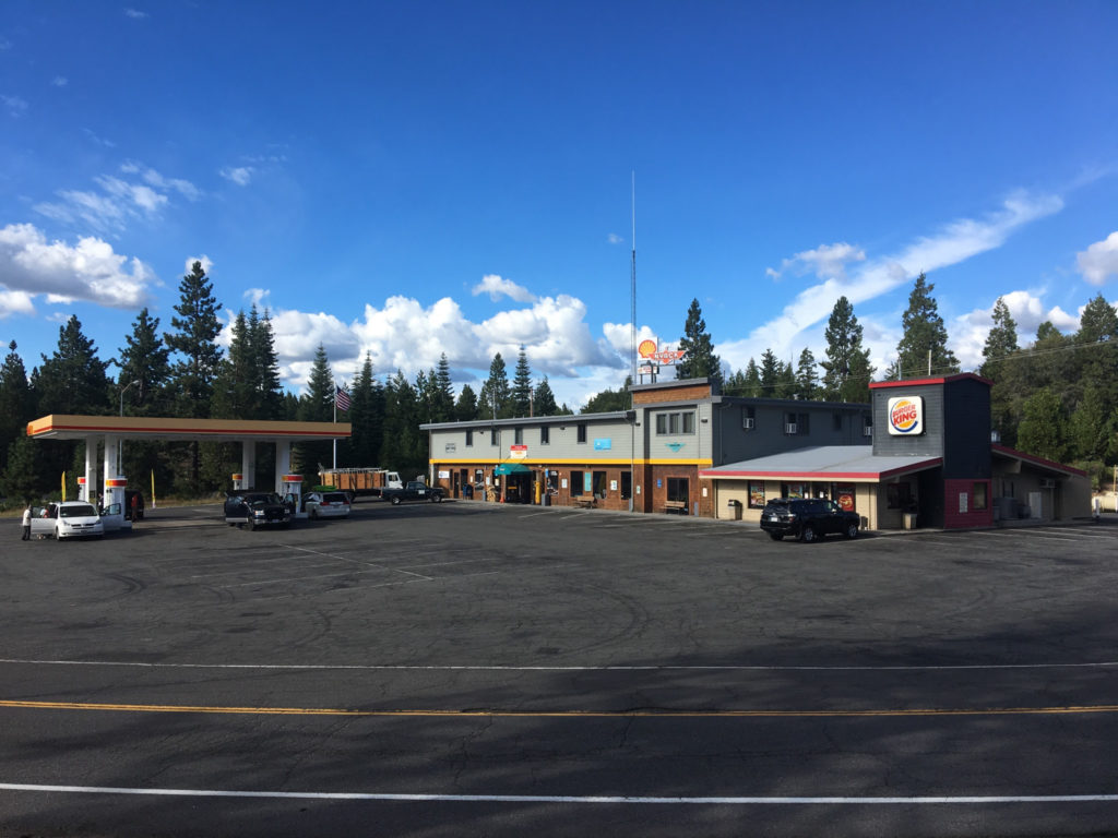
Since the this is a travelogue of sorts, there ought to be a picture. Here’s one of our first and only stop today, at Nyack, about 15 miles west of Donner Summit at an elevation of maybe 5,500 feet above sea level. It’s an unprepossessing image — Shell gas, a convenience store, a tiny Burger King, and a huge expanse of asphalt.
Back in the days when a two-lane road, U.S. 40, ran across the Sierra here, there was a resort called Nyack Lodge. In January 1952, in the middle of a very stormy winter, a westbound passenger train, the City of San Francisco, was halted by snowslides a few miles east of Nyack. Passengers were stranded for three days. When rescuers finally reached the scene, the passengers — cold, hungry, some ill from an episode of carbon monoxide poisoning — were driven to Nyack Lodge. There, they got a nice feed and were put on a rescue train that had come up from Roseville for the trip to Oakland.
Nyack, California, on Interstate 80 west of Donner Summit.
San Luis Reservoir, just west of the San Joaquin Valley town of Los Banos, is one of California’s key water facilities. Pumps in the Sacramento-San Joaquin Delta ship water down two massive canals — the state-owned California Aqueduct and the federal Delta-Mendota Canal — to a holding basin, or forebay, adjacent to the reservoir. From there, another set of pumps lifts water into the reservoir, where it’s stored before being pumped again for delivery to farm and city customers farther south. All reservoirs are artificial creations, but there’s an extra dimension of artificiality here: There’s virtually no natural inflow to the reservoir; it exists only to receive the water pouring down two huge manufactured rivers.
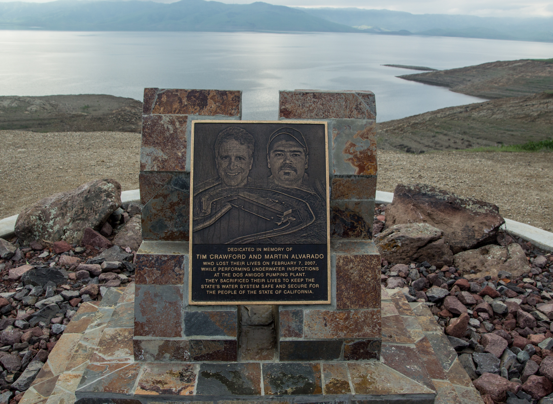
Memorial plaque at San Luis Reservoir to two Department of Water Resources divers who died in a 2007 incident at a nearby pumping plant.
The plaque above is at the Romero Visitors Center, just off Highway 152. There’s something artificial, manufactured — less than truthful — about the memorial to two divers killed at the pumping plant about 10 miles from the dam. But read the plaque first:
The plaque text:
“Dedicated in memory of Tim Crawford and Martin Alvarado, who lost their lives on Feb. 7, 2007, while performing underwater inspections at the Dos Amigos Pumping Plant. They sacrificed their lives to keep the state’s water supply safe and secure for the people of the state of California.”
The wording is curious. These two men “sacrificed their lives to keep the state’s water supply safe and secure”?
It sounds heroic. What happened?
I had no idea. But armed with the two names, it’s easy to find out.
The two divers went into the water to inspect “trash racks” just upstream of the pumps at the Dos Amigos Pumping Plant, apparently looking for invasive mussels. Five of the six pumps at the facility were shut down, and one was running full bore. Somehow the divers wound up near the operating pump. The powerful current there pulled them in and pinned them against the trash rack, a huge steel grate designed to stop large debris from going through the pump.
The untrained fellow Department of Water Resources employee who had been given the job of “tending” the dive soon lost sight of the divers’ bubbles, his only means of tracking the men, but had no idea what to do. By the time he thought to alert anyone in the pumping plant, the divers were probably out of air. It took more than an hour after trouble was detected to shut down the operating pump, and another 35 minutes after that before a recovery diver was in the water. Both divers were found at the bottom of the aqueduct, drowned. Subsequent investigations found a series of missteps, including some by the divers themselves, that contributed to the outcome.
I get the human impulse behind injecting a note of heroism into the plaque’s language. We want to find something to redeem such awful deaths, to give the sacrifice a purpose.
But it might have been more to the point, and a more fitting memorial, to say something like: “Dedicated in hopes that their deaths might serve to prevent future tragedies.” A message like that might serve as a living reminder to those responsible for preventing incidents that they must remain vigilant.
Poring over some doleful but absorbing statistics on U.S. military casualties in our wars going back to the American Revolution, I’m led astray from whatever purpose I had for early Memorial Day morning.
First distraction: It doesn’t seem right that most statistical roundups of American service personnel killed in our wars — like the one linked to above — exclude those who died in our many inter-war military operations. Here’s a separate Pentagon accounting of soldiers, sailors and Marines killed during operations between 1980 and 1996. The list includes:
The eight service personnel who died during the failed 1980 attempt to rescue U.S. hostages from Iran.
The 265 who died during the course of our 1982-84 “peacekeeping” mission in Lebanon (most of those casualties occurred in a single terrorist attack).
Second distraction: I reflect, as many have before me, that there’s hardly been a year in my lifetime — I go back to Eisenhower’s first term — that U.S. troops haven’t been active somewhere in the world. Here’s someone who’s come up with a politically loaded list of U.S. military-related actions, at home and abroad, going back to Wounded Knee.
Third Distraction: In exploring various sets of statistics on U.S. military casualties, I came across the Department of Defense accounting of fatalities among active-duty personnel from 1980 through 2010. (Unfortunately, I can’t find more recent definitive numbers.) In those 31 years, which span “peacetime” (there was just one death attributed to hostile action or terrorist attacks in 1980-81) through the height of the Iraq War (2007), the Pentagon says 48,834 active-duty personnel died. Here’s a breakdown of how they died: Accident: 25,073 (51.3 percent of total). Illness: 8,579 (17.6 percent). Suicide: 6,911 (14.2 percent). Hostile action: 4,814 (9.9 percent) Homicide: 2,329 (4.8 percent) Terrorist attack: 420 (.9 percent) Cause undetermined or pending: 708 (1.4 percent)
The numbers look a little different if you isolate fatalities from ongoing military operations in Iraq and Afghanistan. A recent Congressional Research Service report broke down the causes of death for those two conflicts (including all phases of the Iraq War to date). Some 5,362 (78.5 percent) of the 6,830 deaths were sustained in hostile action; 1,041 (15.2 percent) were attributed to accidents or illness; 350 (5.1 percent) to suicide, and 52 (.8 percent) to homicide (about 25 deaths are listed as “undetermined”).
I find the “self-inflicted” death count most stunning, especially the fact it appears to be so much larger than fatalities suffered in combat. If you follow this issue, you know the number of veterans who take their own lives each year dwarfs the number of service members who kill themselves while on active duty. A Department of Veterans Affairs study published last year found 7,400 veterans committed suicide in 2014, the most recent year for which data was available.
Fourth Distraction: While embarking on my military casualty StatsQuest, hours and hours ago, I came across one particularly startling number in a VA document titled America’s Wars. Page 2 of said document includes a table of veterans and veterans’ dependents currently on VA benefits rolls (“currently” as of April 2017), listed by the war(s) in which veterans served.
The table shows there’s one person out there still getting monthly benefits related to service in the Civil War. Really? Is that possible?
Yes — it turns out it is. The recipient is Irene Triplett, daughter of a man who fought on both sides in the war. She reportedly gets a monthly VA check for $73.13 that goes toward paying for care in a North Carolina nursing home. The Wall Street Journal did a long feature on her and her family a few years ago. Irene Triplett had a very tough life; the piece is well worth reading.
National Geographic followed with its own story on the “fewer than 35” surviving children of Civil War veterans and details a couple of their life stories.
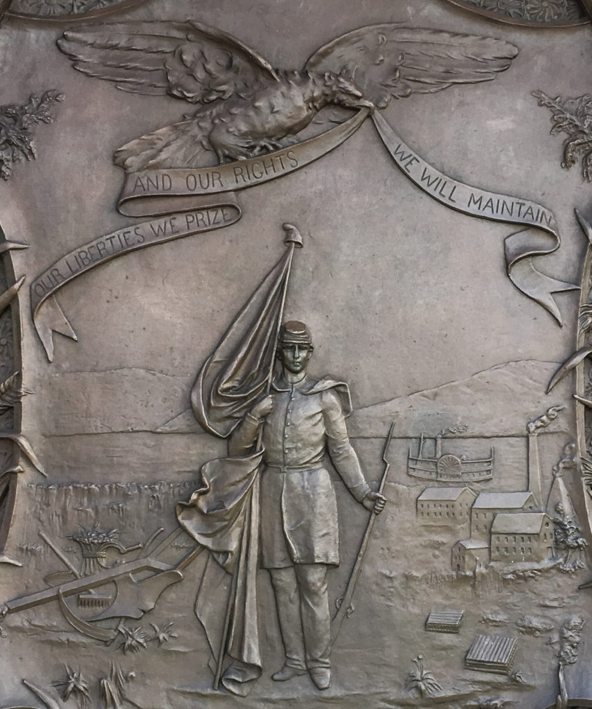
The Great Seal of Iowa, as rendered in a bas relief tablet by Alexander Doyle at the Iowa state capitol.
In 1847, the Iowa Legislature passed a law creating a state seal. More on the wording of the law, which has caused a stir in the state Capitol in recent times, in a moment.
The straightforward part of the seal is the motto: “Our liberties we prize and our rights we will maintain.” I like that: Straightforward. A little militant. No Latin.
However, the Legislature offered only a description of what the seal should look like. Here it is (and as you read it, see if there’s a phrase that kind of sticks out as a little awkward):
“The secretary of state … is … hereby authorized to procure a seal which shall be the great seal of the state of Iowa, two inches in diameter, upon which shall be engraved the following device, surrounded by the words, ‘The Great Seal of the State of Iowa’ – a sheaf and field of standing wheat, with a sickle and other farming utensils, on the left side near the bottom; a lead furnace and pile of pig lead on the right side; the citizen soldier, with a plow in his rear, supporting the American flag and liberty cap with his right hand, and his gun with his left, in the center and near the bottom; the Mississippi River in the rear of the whole, with the steamer Iowa under way; an eagle near the upper edge, holding in his beak a scroll, with the following inscription upon it: ‘Our liberties we prize, and our rights we will maintain.'”
(Yes — the Legislature wrote “with a plow in his rear.” That phrase prompted an Iowa state legislator in 2010 to offer a bill to amend the wording. Lawmakers did not act on the suggestion.)
That 1847 description left a lot to artists’ imaginations and produced a series of rather passive and homely images. Search for “Great Seal of Iowa” in Google images if you’re curious about what I mean.
I didn’t know any of that history when I visited the state capitol grounds in Des Moines last fall (2016). What struck me about the tablet or relief — OK, technically not a plaque — was what I take to be its direct reference to the Civil War. The soldier depicted is dressed as a Union infantryman. The musket he holds on his left side has bayonet fixed. The Stars and Stripes he supports with his right arm is partially draped around him. He is taking a step toward the viewer. His look is resolute and unafraid.
“Our liberties we prize and our rights we will maintain”? The bas relief makes the statement come alive. The soldier embodies the sentiment. Is there a Civil War message here — a reference, perhaps, to how seriously the state took its duty to preserve the Union?
About 75,000 Iowans — more than one in five adult men — served during the war. Some 13,000 of them died and another 8,500 were wounded and survived. Iowa’s experience largely reflected the experience of every state, North and South. In a way that’s hard to imagine today, when so few serve in our armed forces, the war touched everyone.
An entry on an Iowa state government site that describes the monuments on the capitol grounds notes that the Iowa seal tablet was commissioned in the mid-1880s and completed in the early 1890s. The war was still an enduring, dominant memory for a whole generation of Americans then, just as World War II was in the 1960s — when war stories were common prime-time TV fare and a frequent Hollywood subject.
The Iowa state site also mentions the name of the sculptor, Alexander Doyle, who had a national reputation by the time he got the commission for the tablet and a nearby drinking fountain featuring the cast bronze head of a bison.
Doyle’s reputation rested in part on his Civil War sculptures. But he was not a Yankee nationalist. His commissions came from both the North and from the defeated Confederacy — and he was especially active in New Orleans, where he created a series of statues commemorating Southern heroes.
I think if there’s a message in the Iowa Great Seal tablet, it’s that Doyle was an artist who understood the time he was depicting and the emotional expectations of his audience and knew how to translate that understanding into bronze. His was not a common talent.
Note: A version of this post also appears on Read the Plaque.