Road Trip Postscript: Once It Held Laughter, Once It Held Dreams

Near Rushville, Sheridan County, Nebraska.
"You can find all kinds of ruins on the Great Plains; in dry regions, things last a long time. When an enterprise fails on the plains, people usually just walk away and leave it. With empty land all around, there is not much reason to tear down and rebuild on the same site. ..." — Ian Frazier, "Great Plains"
"For every surviving ranch, I passed a dozen ruined houses. The prairie was dotted about with wrecks. Their windows, empty of glass, were full of sky. Strips of ice-blue showed between the rafters. Some had lost their footing and tumbled into their cellars. ... Skewed and splayed, the derelicts made up a distinctive local architecture." — Jonathan Raban, "Bad Land"

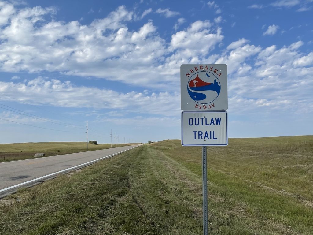
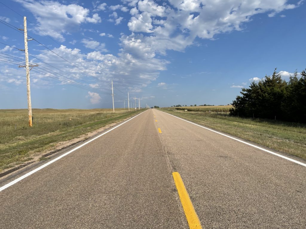
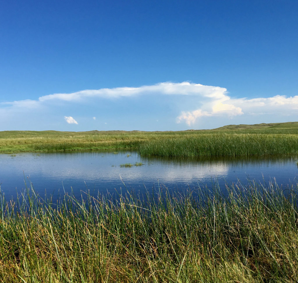
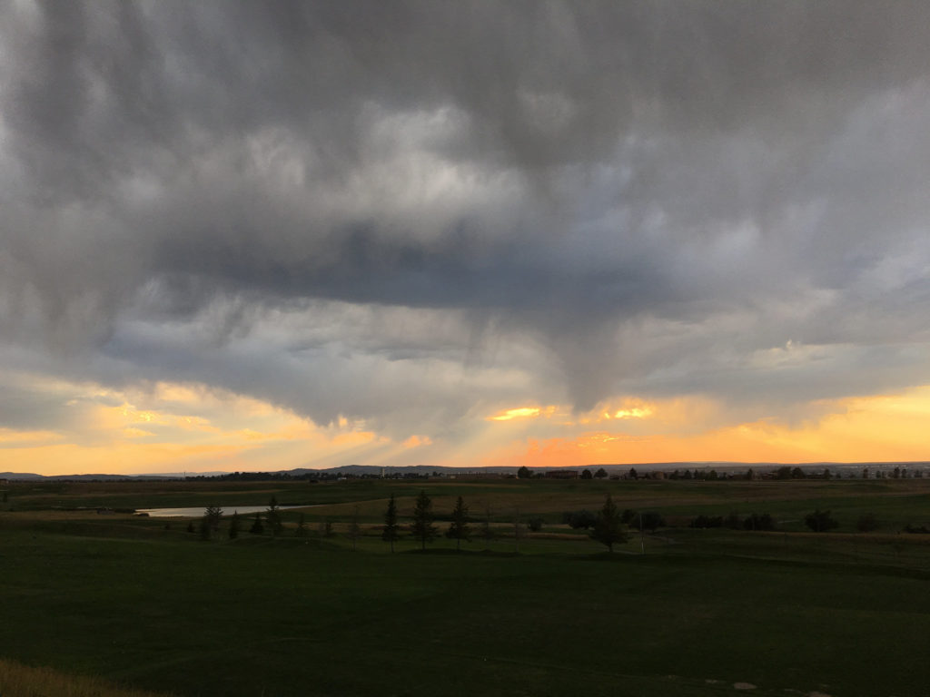
In mid-September, my brother John and I drove west from Chicago on our return trip to California. We didn’t follow anything like a standard route. From western Illinois across the prairies and into the plains of eastern Wyoming we stuck almost exclusively to two-lane roads, or at least non-interstates: U.S. 30 and 20 across Iowa; Nebraska Highway 12 and U.S. 20 again (after veering briefly into South Dakota along the Missouri River) across the Cornhusker State; and U.S. 20 once more until it merged with Interstate 25 near Casper, Wyoming. (Here’s a collection of pictures from both the east- and westbound legs of the trip.)

One morning along the way, we backtracked from Chadron, Nebraska, to Rushville, then headed north toward the Pine Ridge Oglala Sioux Reservation just across the South Dakota border. The site of the 1890 Wounded Knee massacre is on the reservation; it’s a spot I’ve long wanted to visit, and it was sort of an obvious bookend for our eastbound stop at the Little Big Horn battlefield.

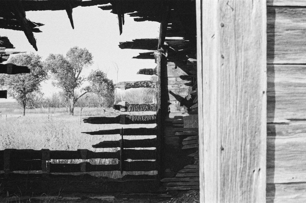
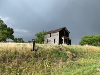
A few miles up the road toward Pine Ridge we passed the house above. Both John and I, who had brought film cameras to record our travels, said we needed to remember to stop at the place on the way back from Wounded Knee. Three or four hours later, I was speeding back south when John said, “There it is.” “Really? Are you sure? I don’t think so. That doesn’t look like the same place to me.” “No — that’s the place.”

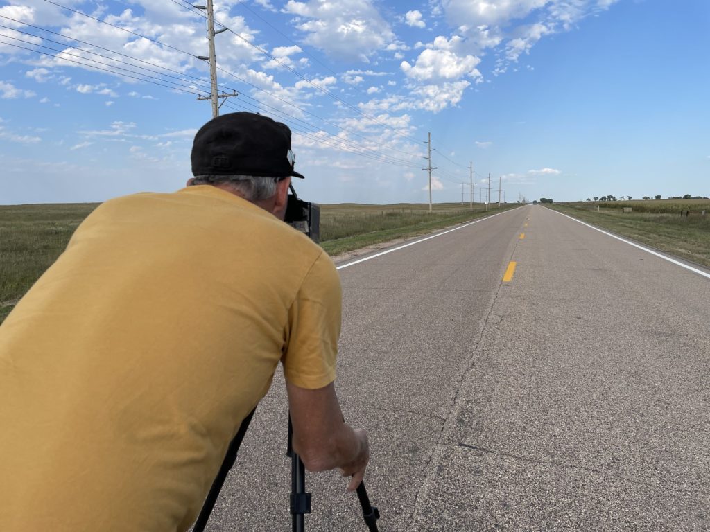
I hit the brakes hard, and we turned onto a dirt road adjacent to the house. I took note of a man on a tractor about a quarter-mile away and wondered whether he had some connection to the house. But I didn’t think about that for long. We broke out our cameras, including John’s 5-by-7 pinhole camera, a couple of older Nikons, and one of several rangefinder models I had brought along.

After about 15 minutes, I saw that the man on the tractor had stopped his plowing, climbed down, and was walking toward the house. I more than half-expected he would ask what the heck we were doing on his land. Instead, he said something like, “Picture day, huh, fellas?” Yes, the house was on his family’s land, but he was pretty genial and really just curious about what we were doing. It turned out that this was far from the first time he’d encountered passers-by who had stopped to photograph the house.

And about the house: The farmer/rancher, who told us his family name was Viher and that he’d been born here just after World War II , said it had been owned by a family named Rush (maybe the Rushes of Rushville?) and was last occupied in the 1940s. Mr. Viher said there was a problem with occasional vandalism on the property — at some point, someone had come along and burned down a barn adjacent to the house; a half-burned shed still stood.

On the Viher Ranch, Sheridan County, Nebraska.

There’s probably an essay waiting to be written here about why ruins like this attract our attention, but given the fact it’s taken me four months to sit down and write even a bare description of the visit, this is not it.

I did think to ask Mr. Viher if I could take his picture before he went back to plowing. He was agreeable.

Mr. Viher, September 2021.

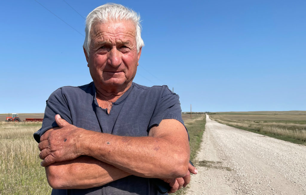
Afterward, I did something I’d never done before: I had the picture printed, figured out the Vihers’ address on their ranch, and sent it to him. I didn’t hear back for a while and wouldn’t have been too surprised to get no response. But on New Year’s Eve, I got an email thanking me for the picture and respondng with a collection of snapshots of the house and other ranch scenes.

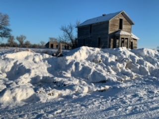
And those shots, if nothing else, show me that that picturesque wreck of a house out there on the plains speaks just as much to at least some of the folks living out there as it does to the random traveler with a camera.

Road Blog: The 100th Meridian

Nebraska Highway 12, the “Outlaw Trail Scenic Byway,” in Keya Paha County. Everyone we encountered seemed law-abiding. Someone stopped while we were taking pictures of the sign to make sure we were OK.

We left Chicago on Wednesday morning and made it to Sioux City, Iowa, following what’s become a typical late-ish start (10:30, say, due to how slow I am to get ready) and quitting just at dark. It means we’re on the road for 10 or 11 hours each day.

Thursday we left Sioux City at about the usual time and spent the day zig-zagging back and forth across the Nebraska and South Dakota border as we headed west on two-lane roads, mostly on Nebraska’s Highway 12 and, further west, on U.S. 20. Four hundred miles or so later, we wound up in Chadron, Nebraska.

Someone — one would guess tourism-minded state and local officials and hopeful Chamber of Commerce folks — has styled Highway 12 “the Outlaw Trail Scenic Byway.” I can attest that the route is scenic, with sweeping vistas of the rolling country along the Missouri River on the road’s eastern end that transition slowly into the high plains and beginning of the Sand Hills on the western end. My only complaint, and you knew there had to be one, is that there’s no ready explanation along the road or on the Outlaw Trail websites about why, precisely, it’s called that.

One of the sites advertises an “adventure of friendly people, scenic sights and the history of Native American Tribes, outlaws, cowboys and pioneers. … Communities have museums waiting to be explored and murals waiting to be viewed. This region offers seasonal opportunities to hunt fauna or flora with arms or camera.  Please check on the current Covid situation.”

Highway 12 crosses the 100th Meridian west of Greenwich in Keya Paha County (‘keya paha is “turtle hill” in the Dakota language, per what I see online). I have an app on my phone that gives a very precise reading (to four decimal places) of latitude and longitude. When we got to the approximate locale, we parked at a crossroad and I walked about 1,000 feet back to the spot the app indicated was very nearly precisely the exact location of the meridian (“very nearly precisely” because the app would jump between 99.9996 and 100.0005 degrees with a single stride east or west).

John and I both took pictures to commemorate the spot. I wish I’d taken a shot of the little mark I gouged out on the road’s shoulder to mark the location.

See that fencepost? It’s just about exactly on the 100th Meridian.
Nebraska Highway 12, looking east into the humid eastern lowlands from the 100th Meridian.
My brother John lining up a pinhole camera 100th Meridian shot on sparsely traveled Nebraska Highway 12.

Why bother with the 100th Meridian? In the late 19th century, John Wesley Powell, the early explorer of the Grand Canyon and first head of the U.S. Geological Survey, proposed that line of longitude as marking the boundary between the wetter more humid areas of the eastern United States and the more arid regime of the West. Subsequent research found Powell’s observation to be spot on — though his other important ideas about the implications for development of the western United States have been largely ignored. More recently, scientists have been assessing how the dry transition that occurs along the 100th Meridian appears to be moving east due to the influence of climate change. You can read more here: “Whither the 100th Meridian? The Once and Future Physical and Human Geography of America’s Arid–Humid Divide. Part I: The Story So Far.

I’ll also note before posting that we have not one but two 100th Meridian museums on the Plains: one in Cozad, Nebraska, one in Erick, Oklahoma. Next time I’m roaming around out here. …

Eclipse Road Trip Day 7: The Loneliness of the Long-Distance Eclipse Chaser

U.S. Post Office in Lodgepole, Nebraska.

Starting midday Saturday from Sidney, Nebraska — a town of 6,000 just off Interstate 80 in the southwestern corner of the Nebraska panhandle — we drove east on U.S. 30 through the towns of Sunol and Lodgepole (or Lodge Pole, if you believe the lettering on the Post Office building there).

Lodgepole was one of my destinations on this trip. According to letters from one of my great-great-grandfathers, Timothy Jeremiah Hogan, his parents moved their family to this part of Nebraska in the mid-1860s to work on the Union Pacific railroad. Tim suggests they lived first in Lodgepole, then Sidney, 16 miles west, so the family would have the protection from hostile Indians in the area.

We hung around Lodgepole for maybe 30 or 45 minutes. I took pictures, naturally. We cruised by the most substantial building in town, the old brick public school — every small Nebraska town seems to have one. Then we were off again in the rain — we were caught in the beginning of a pretty persistent thunderstorm — and stayed west on Route 30, then turned north on Nebraska 27 to Oshkosh, on the North Platte River.

North of Oshkosh, the state blacktop ends and you begin a 60-mile stretch that begins with well-maintained dirt roads for roughly the first (southern) half of the drive and continues on a single lane of choppy asphalt for the second (northern) half.

The reason you take that road, which goes through the Crescent Lake National Wildlife Refuge, is that it’s crossing one of the more remote parts of Nebraska’s Sand Hills.

The Sand Hills are a sweeping expanse of grass-covered dunes — about 20,000 square miles — said to have formed after the last ice age. And driving through on a road that twists and turns and somehow always seems to be climbing, it’s apparent you’re traveling through sand dunes being held in place by grasses and wildflowers (chief among the latter: black-eyed susans).

Anyway. I thought the Sand Hills would be the ideal place to watch the eclipse, and yesterday’s drive was to scout out the road. We saw a dozen, maybe 15 other cars, almost all with out-of-state plates, apparently doing the same. Passing ranches along the road, I had the same feeling of eclipse envy I experienced elsewhere on our trip — “Gee, these people live right here where the show is happening. Aren’t they lucky. I wish I could stay here.”

Near Crescent Lake National Wildlife Refuge in the Nebraska Sand Hills.

We got off that Crescent Lake road a little before 6 p.m. — another product of our late start — and headed east on Nebraska Highway 2, which runs for about 125 miles or so right through the heart of the Sand Hills. Our destination was Valentine, on U.S. 20 right up at the top of the state, and adding in that we crossed into Central time and lost and hour, we didn’t get off the road until 10 (it was all beautiful, though — even the lightning show to our east at dusk.

We checked into our hostelry, which I’ll call the Sketchy Rest, walked the dog, and then began checking on the latest Monday morning forecasts for the Sand Hills.

I want to say here that I am an inveterate, if not a sophisticated, reader of weather forecasts of all kinds. As I pored over forecast discussions and graphical forecasts and meteorological whatnot, the consensus from those who study computer models to understand upcoming weather was that it was likely to be cloudy in the Sand Hills on Monday morning. Part of me simply doesn’t want to believe that and found it hard to picture after experiencing one beautifully sunny follow another all the way through our trip. That included Saturday, when the Sand Hills were framed by distant, rising thunderheads but were spectacularly clear along our road.

The forecasts hadn’t improved by this morning (Sunday), so we went looking for options.

The forecast for Casper, Wyoming, was for clear, clear, clear skies. Plus, it’s close to the center of the eclipse path. What if we could find a place there?

I checked motels. There were a few room on offer online — $2,000 for a single night. No.

Kate, whom I believe is both charming and lucky (she wound up with me, after all), started to call motels. She found some friendly innkeepers, but no room.

I checked Craigslist. There was a single listing for a sort of in-law unit near the south end of Casper. No price listed. I got in touch with the person who posted the place. We talked. A price was agreed on (he happened to name the figure that Kate and I had previously agreed would be our maximum; more than I’d pay in any other circumstances, I think, but not a killer — and not anything like $2,000).

So we hit the road to Casper from Valentine — 325 miles on top of the 2,000 from the previous six days — rolling west on U.S. 20 about 1 p.m. It was a fast trip, with the usual dog- and picture-related stops, and we pulled in here just after (we gained an hour traveling back into Mountain time).

The sky when we got here? Starting to cloud up. Thunder was rolling. The light and storm clouds were beautiful. The stars are out tonight, though, and the forecast is still for sunny (and smoky) skies in the morning. Except for this one note from the regional forecast office, which noted the likelihood of some smoke in the air:

“One other feature to watch is (a) thinning band of higher clouds that is forecast by some of the guidance to be between the Wind River Basin and Casper around totality time. It may be clearing the Wind River Basin/Riverton vicinity in time and then possibly affect the Casper area between 11 and noon. May be a rather narrow band then but there could be some concern for viewing in this narrow cloud feature.”

Kate just reminded me that the moon will start crossing the sun’s disk here at 10:22 a.m MDT. Totality will occur at 11:43 a.m. I wonder where that cloud will be.

Sky above Casper, Wyoming, Aug. 20, 2017.

Eclipse Road Trip Day 2: Tahoe City to Twin Falls

U.S. 93, north of Wells, Nevada.

A quick entry, since I’ve waited until after midnight to sit down and get something down.

As planned — I have never made so many reservations in advance in my life — Tuesday is supposed to be our longest day driving on the way to western Nebraska. We got started from Tahoe City, on the northwest shore of Lake Tahoe, at 9:35 a.m. PDT and pulled in here, about 510 miles later, at about 8:45 MDT — a drive of a little over 10 hours. Things got slow in the last couple hundred miles because I wanted to stop and take pictures at several spots along the way. Like the shot above, looking north on U.S. 93 about 30 miles north of Wells, Nevada, and 85 miles or so south of Twin Falls, Idaho.

A word about eclipse weather: We are now inside the window where the National Weather Service is offering a forecast that includes Monday, Eclipse Day. And what do you know? The outlook is iffy for most of western Nebraska. Of course, there’s not a forecast in the world that can make a call for a two-and-a-half-minute period that’s still six days out. But now we’ve got something to obsess about other than where exactly we’ll be standing when the celestial machinery does its thing.

Tomorrow’s destination: Jackson, Wyoming.

Road Blog: Deer vs. Cars–the Numbers

When you tell people you hit a deer while driving, you find out everyone has their own story. One of my brothers hit a deer he never saw while driving a truck in western New York State (he was checking a mirror when the animal ventured onto the roadway; his passenger explained what the loud bang had been). My other brother was driving behind a pickup that hit a large buck; the animal smashed into the truck’s windshield and the antlers penetrated the glass. My sister’s best friend hit a deer. A coworker of my daughter-in-law hit one on a Bay Area freeway, and the deer came clear through the windshield.

A 1995 study for The Wildlife Society crunched some numbers from earlier studies and came up with an annual estimate of as many as 1.5 million deer-vehicle collisions nationwide. Since then, researchers have even come up with a shorthand term for this phenomenon: DVC. The study was titled “Review of human injuries, illnesses, and economic losses caused by wildlife in the United States,” and the deer-vehicle issue was just part of the overall picture. The study considered everything from Lyme disease to bird-aircraft strikes to wildlife damage to farming and ranching and tried to tote up the cost.

For deer-vehicle collisions, the estimated cost was huge: About 200 deaths, 29.000 injuries, and more than $1 billion in vehicle damage. The study also notes: “Being hit by a vehicle is fatal to deer about 92 percent of the time. These deaths can represent economic loss that we could not estimate.” (A current estimate of overall wildlife-vehicle collisions–crashes involving “large mammals”–puts the annual number at 1 million to 2 million and direct economic losses at $6 billion to $12 billion a year.)

That 1995 report and similar studies prompted researchers at several universities to try to undertake a more systematic way of assessing the million or more crashes happening on the highways every year. One result is the Deer-Vehicle Collision Information and Research Center (you can find it at deercrash.org), which has put some harder numbers to some aspects of the issue. For instance, the DVCIR Center breaks down the number of (human) fatalities in animal-vehicle collisions from 1994 through 2007. The highest death toll was in 2007, with 223 people killed nationwide (second place was 2006, with 222 deaths). The total killed nationwide in that 14-year period: 2,398. Texas led the country in motorist fatalities in animal-vehicle collisions in 12 of those 14 years.

The collision research has also led to testing of a Roadkill Observation Collection System (ROCS), a networked handheld device with GPS that would allow road crews and others to document locations and circumstances of carcasses found on roads and ditches and upload their reports to a centralized database.

And that brings me back to the ditch along that twilight section of Nebraska Route 12 we were traveling last night when we struck a deer. Nebraska recorded 41,028 deer-vehcile collisions from 1998 through 2008 (Dixon County, where we were last night, recorded 215 of those incidents). The Deer-Vehicle Collision Information and Research Center puts the number of Nebraska fatalities at 20 from 1998 through 2007 (and 29 from ’94-’07).

Last: Here’s an unsentimental (and unendorsed) view of all this from Reason magazine, that bastion of libertarianism: North America’s Most Dangerous Mammal.