Back in August, I took a drive along some rural roads in Yolo County, on the edge of the Sacramento Valley, that I’d become familiar with on long bike rides 15 and 20 years ago. Most of the county is on the flat floor of the valley and was given over to agriculture — crops that even a city dweller like me could identify on the move included rice, sunflowers, alfalfa, tomatoes. Some nut and fruit orchards, too. That’s still a lot of what you see.
Northern and western parts of the county are hilly, though, and when I’d ride through, most of those areas appeared to be used for pasture with the occasional appearance of a grain crop wrapped around the hills’ contours.
In August, I was surprised to find that a lot of that former pastureland has been transformed into what I assume are almond orchards. I drove past a spot where, long ago, a couple of other cyclists and I had taken a break from riding against a fierce north wind. Back then, in 2006, it was a big open field with some abandoned-looking farm equipment that we ducked down behind to get out of the wind. Now that spot is all nut trees.
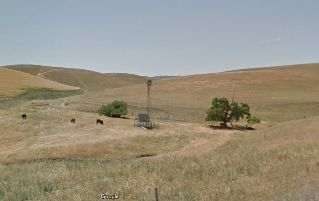
I stopped to take pictures along one of the routes I traveled, Road 6. Looking at the result — it’s the black and white shot below, which I just had developed — I realized that maybe Google Streetview would show the same scene over the years. The most recent shot Google has is from May 2012. Here’s a little of what the change looks like (and a before/after slider of the scene is here).


The transformation is not shocking; it’s part of the vast expansion of almond and pistachio acreage that’s overtaken much of the Central Valley.
If you live here, the puzzling thing about this changed landscape is that the last decade is one of the driest periods, if not the driest, since California was colonized 250 years ago. The state’s water supplies are dwindling, a situation that’s supposed to become more challenging as the effects of climate change accelerate. Given that there’s not a lot of visible irrigation infrastructure here, I assume that water is being pumped out of the ground to support these thirsty orchards. I haven’t looked into who the adventurous growers or hedge-fund investors are who have launched this experiment in the middle of our drought. It’s quite a gamble.

Hi Dan, I was one of those cyclist battling the wind with you. I’ll never forget how you and another friend helped me so much on that difficult day riding north and to the headwinds. I remember how we all hunker down for break from it in those same Dunnigan hills.
Kitty, that was a really memorable ride. A storm had gone through the night before, and a really stiff northwest/north wind was building. The ride had kind of an unusual route, as I remember it. We started at Hercules, rode up through Vallejo and the west end of Fairfield, then through Gordon Valley and over Highway 121 to Moskowite Corner. From there the route went east over Highway 128, past Monticello Dam and on to Winters before turning north. I remember that there was a huge amount of water cascading down Putah Creek from the dam — really impressive.
I was riding with Bruce Berg, as you might recall. We got separated from a group we had started with when Bruce flatted in Vallejo, and rode the rest of the way to Winters on our own. When we got there, we stopped at the Putah Creek Cafe to sit down and eat. It wasn’t until we got back on our bikes that we realized just how hard the wind was blowing — a steady 20+ mph with higher gusts. Heading north up Road 89 from town, we struggled to maintain a pace of 12 miles an hour. Suddenly, the 55 or 60 mostly flat miles up to Williams, where we were supposed to turn around, looked really challenging. Neither Bruce nor I “needed” the ride — it was a 400K, and it wasn’t a qualifier for any other event — and I believe we briefly discussed turning around if wind didn’t let up a little. But we kept on, and soon saw another cyclist who was struggling against the wind, just like us — you. We slowly gained on you, and when we did, I think you were able to draft us a little. The route turned west for a ways, and we tried riding “en echelon” for protection from the crosswind. I suppose it helped a little. Then we headed north again and into the Dunnigan Hills. All I remember was that we were all pretty beat up and agreed to find someplace to rest for a while, then found that open pasture with the farm equipment — there was some sort of long, boxy thing that afforded a windbreak if we sat behind it.
I think this was the ride where the organizer had set up a postcard drop as a control at a post office that did not exist — in College City, east of Arbuckle. I remember being put out at having to ride over there for nothing. There was a consensus among the several riders who had gone over in search of the College City post office to drop the cards in Arbuckle instead. We did that, and then continued on to Williams, arriving just after sunset and an hour or two later than we’d assumed we’d get there at the start of the ride.
The ride back south was as easy as the ride north was hard. With the wind behind us, we just breezed along — maybe a little too fast. At one point before we got back to Dunnigan, you were riding behind me. I didn’t warn you quickly enough about a pretty significant break in the pavement; you hit it and got a flat. I remember more — for instance, the rider waiting for a ride at the Dunnigan Jack in the Box after he’d been injured in a crash on the way south from Williams. But suffice it to say that we made it back to Hercules at 2:15 in the morning — 20 hours and 15 minutes after we started. As I say, one of the more memorable rides I ever went on — and meeting you out there on the road was one of the best parts.