A few weeks ago, I downloaded a Chrome browser extension that, when you open a new tab, shows a current (or at least very recent) view of the full disk of the Earth as captured by Japan’s geostationary Himawari 8 weather satellite. Himawari produces high-resolution images of the Earth — the kind you can lose yourself in for hours if that’s the kind of thing you like.
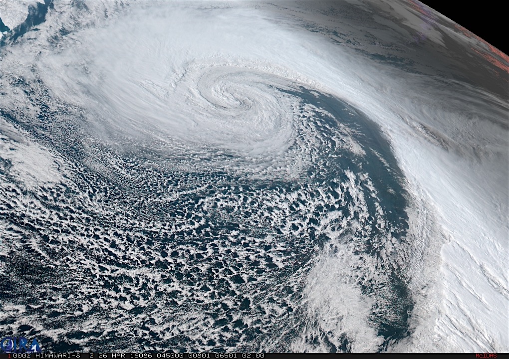
Anyway, I noticed last Friday and Saturday that the full-disk image was showing a huge storm someplace in the northeastern Pacific. I wondered whether I could find a better view of the images online, and sure enough, NOAA’s Regional and Mesoscale Meteorology Branch (RAMMB to its friends), which inventories a lot of satellite images, features a Himawari Loop of the Day.
The loop for Saturday, March 26, was titled “Intense Low in the North Pacific.” Hit that link and it takes you to a movie — you need to have a little patience for the download — of the storm I was seeing in the full-disk picture. The image above is a frame from the movie.
It’s extraordinary. Or maybe everything on Earth is extraordinary if you have a chance to sit back and watch it for a while.(One note on the movie: A shadow crosses toward the end: that’s night falling as the Earth rotates. But the surface details are still visible because of GeoColor, a system that blends visible (daytime) and infrared (nighttime) imagery. GeoColor is also responsible for the reddish appearance of cloud tops in the nighttime images.)
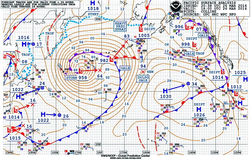
Below is what the storm looked like on a conventional surface weather map: a sprawling, intense system with sustained winds over 60 mph forecast to occur 500 miles and more to the south and southwest of its center. The storm was producing monstrous waves, too, with seas as high 34 feet.

