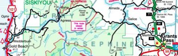
A detail from the official Oregon state road map (PDF) reportedly given to the Kims in Wilsonville, Oregon (click for larger view) the day they became lost. Bear Camp Road (also known as Galice-Agness Road and National Forest Road 23) is the road marked in black with the box noting “this route closed in winter.”
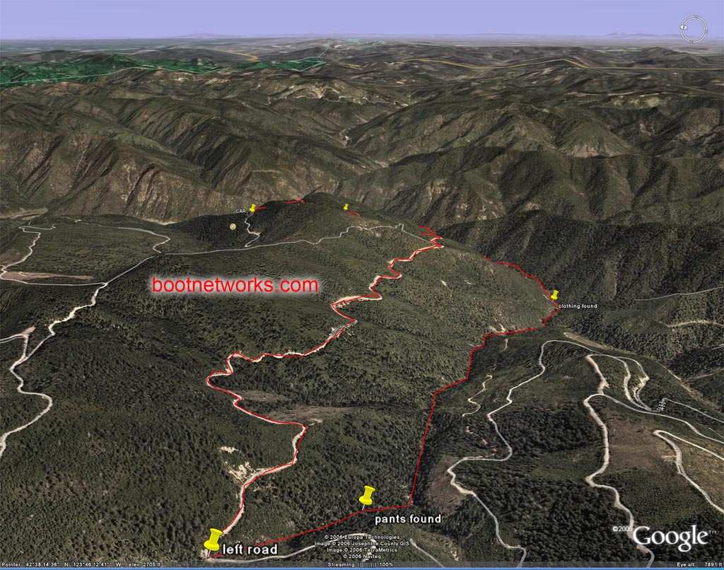
Below is one of a series of 3D images (not clear to me who produced them) that give a feel for the terrain in which Kim was lost and demonstrate more dramatically than other maps I’ve seen how far he traveleled, the degree to which he doubled back in his apparent attempt to get to the Rogue River, and how close he was to safety if he had chosen to go the other way on the road when he left the family car. Again, click for the full-size image (or try the link above for the full series of images).