Road Blog: Stopping by Woods

Thorn Creek Woods, just outside Park Forest in Chicago’s southernmost suburbs.

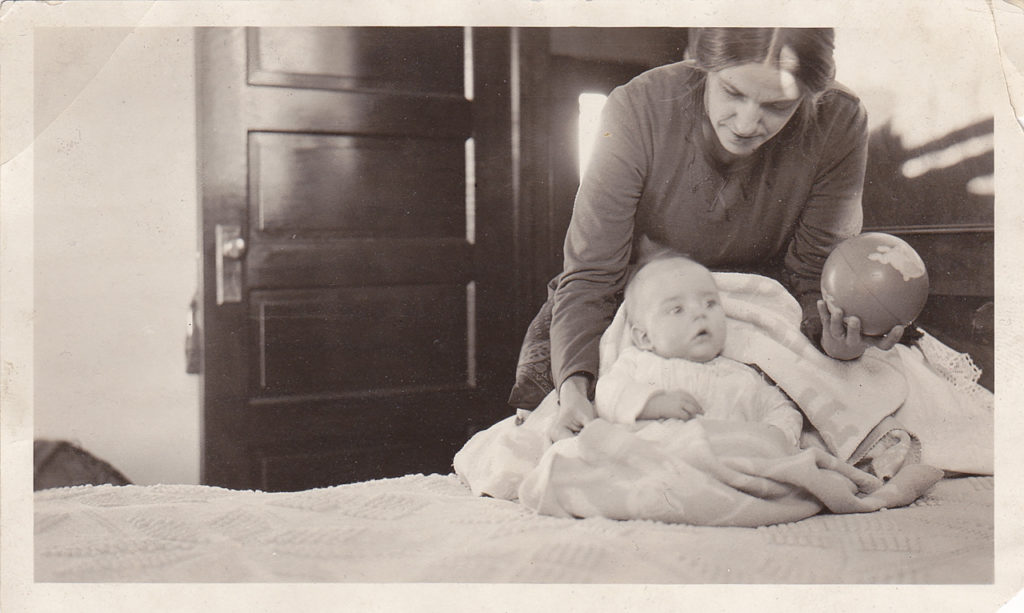
My siblings and I were lucky to grow up in a place, just at the outer edge of Chicago’s southern suburbs, where nature was close by. For a crucial period of our growing-up years, we lived in a house my parents had built on a one-acre lot in the middle of a forest. During the summers, especially, we almost lived out of doors — camping, exploring and even learning a little about the life of the woods.

Until last weekend, I hadn’t taken a long walk in the woods in decades. Most of my visits to the area have involved checking out our old house and marveling at the fact that a good-sized residence on a wooded acre could be on the market for the low six figures (or even less; the place sold for $99,000 about three years back).

But since my brother John and I are here on our long road trip, we had the rare circumstance of all four siblings being in town together. So we got together and drove down to the woods on Saturday afternoon. The immediate purpose: to do something to remember our mom, who had a significant hand in the campaign to stop the nearly one thousand acres of forest from being knocked down for tract housing in the late 1960s.

Strolling an old haunt.

A lot has changed out there. Instead of walking out into the woods from our backyard, we accessed them by way of a trail that starts at a nature center just outside Park Forest. (The center building is an 1860-vintage Lutheran church that was moved about four miles in the mid-1960s to serve a new congregation, then later repurposed for the forest preserve.)

The woods themselves look different. Some areas are densely overgrown, others have little vegetation (but plenty of poison ivy) under the forest canopy. So ravines and gullies that used to be pretty much obscured by undergrowth are much more obvious.

A stand of fir trees that was apparently planted in the 1940s or ’50s has bolted. When we were kids, our neighbors and others used to go out and cut some of the firs for Christmas trees; now many of those trees appear to be seventy or eighty feet tall.

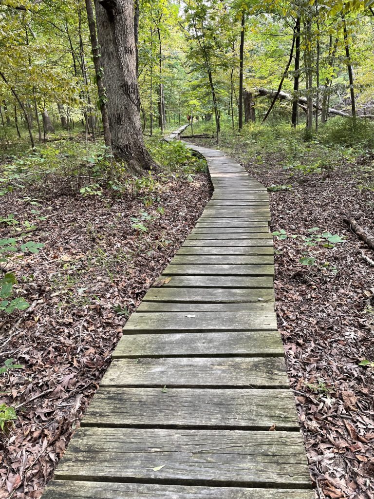
The Will County Forest Preserve District has installed wooden walkways through areas that are typically wet and put up a series of bridges over Thorn Creek. There are signs now marking trails through the trees. And a nice viewing platform on the edge of a seasonal wetland.

None of the improvements felt intrusive, and plenty of what we remember is intact. For instance, much of the gravel road that used to wind its way from just below our house to a Remington Arms plant on the other side of the woods is still there.

Probably the best measure of how satisfying it was to be back in the woods is that we continued walking and talking and exploring until it was nearly dark. Just as we did when we were kids.

The sibs (Ann, John and Chris) and me.

Road Blog: Dad

December 26, 1921: Stephen Brekke, nearly four months old, with his mother, Otilia Sieverson Brekke.

Is there an organizing principle to this trip?

Well, yes, sort of. Our dad was born a century ago — 100 years ago today, as a matter of fact, in a little town in northwestern Minnesota. We’re headed there now in honor of the occasion.

The observance will be a low-key one, perhaps befitting the mostly low-key nature of the honoree. One of my motives was to drag my siblings up to this corner of the country—Alvarado, the town of 300 where my dad and his parents lived until he was four years old, and Warren, the slightly larger town and seat of Marshall County where he was born. I was partly successful — my brother John is with me, and we’re making slow, picture-taking progress east. I’ll wait until another time to get my brother Chris and sister Ann to journey up to the distant upper Midwest.

So: Happy birthday, Pop. We remember.

Road Blog: The Murk, Continued

Sept. 2: Highway 33, near Tetonia, Idaho, looking toward Grand Tetons from the west.
April 2018: Google Streetview image of the same stretch of Highway 33 in image above, near Tetonia, Idaho, looking toward Grand Tetons from the west.
Sept. 2: Jackson Hole from Teton Pass.
Sept. 2: Grand Teton National Park
Sept. 2: Yellowstone Lake, Wyoming,
Sept. 1: U.S. 93, north of Ely, Nevada.
August 31: Along Nevada Highway 376.

Moving East With the Murk

A predictable circumstance of this trip: that we’d see at least patches of wildfire smoke as we travel east. I mean, we’ve all seen the stories this summer, and the fires in California and elsewhere are still putting out major volumes of particulate matter. Even so, the image above, a screenshot of the map at fire.airnow.gov, is sobering. (That little blue dot at left center of the image is where we are now.)

Beryl Markham’s memoir “West With the Night,” an account of her history-making career as an aviator (including the first solo east-to-west crossing of the Atlantic) came to mind.

We’re now traveling east with the murk. Not nearly as hypnotically poetic as the image of flying into the twilight and the unknown. But we’re chasing our own sort of twilight adventure.

Road Blog: Lee Vining to Ely

A pyrocumulus cloud rises above the Caldor Fire near Lake Tahoe — 85 miles from this vantage point at Panum Crater and Mono Lake.

I started out last night with a mini-exploration of the names of the towns where we started and ended, Berkeley and Lee Vining.

Lee Vining is known to lovers of the eastern Sierra and habitues of the greater Yosemite region as the town that’s perched just above the shore of Mono Lake and at the foot of the road across Tioga Pass, the highest highway route across the Sierra. According to one local account, the name Lee Vining had its origins in real estate marketing. A landowner in the area was subdividing his property for home lots and didn’t think the existing name of the place, Poverty Flat, would do much for his venture’s prospect. He wanted to call the community Lakeview, but the Post Office informed him the name was already in use. His next choice was Lee Vining, a Gold Rush-era prospector who had operated in the area.

I’m recapitulating all of that just to say there is no neatly tied-up story to explain the name of Ely, Nevada, where I am tonight. “Ely,” pronounced “EE-lee,” not “EE-lie,” could refer to any number of men who had some influence hereabouts in the late 19th century. It’s late, and I’m not up to weighing in on who might have had the strongest claim. The rest of what I can tell you about Ely is that it’s a mining town — copper mining has been its mainstay since the first decade of the 20th century, and one of the landmarks you encounter as you approach town on U.S. 50/The Loneliest Road in America from the west is a series of immense man-made mountains consisting of mine spoils. They suggest the bases of incomprehensibly large, unfinished pyramids, mostly dun-colored but with variations in the shading of the earth packed into the towering, symmetrical slopes. Somehow, those gigantic, well-sculpted features had not made an impression on me during past trips through the area. They did today.

***

The daily highlight: John and I ate breakfast at the Mobil gas station in Lee Vining — it’s a well-known destination for trans-Sierra travelers — then spent a couple hours hiking around Panum Crater, near the south shore of Mono Lake. The landscape is austere and exciting, and for John, who is a glass blower by profession and vocation, it was extra-cool to see the all the obsidian, black volcanic glass, strewn in huge masses in the crater’s center.

One startling sighting was a rapidly growing mass of pyrocumulus generated by the Caldor Fire, a good 85 miles away near Lake Tahoe. We didn’t encounter smoke ourselves until we were well on the way to Tonopah. From there, we drove up Highway 376 through the Big Smoky Valley, which was too socked in by wildfire smoke to see more than the dim silhouettes of mountains on either side of us.

Tomorrow, maybe: Golden Spike.

Road Blog: Berkeley to Lee Vining

August 30, 2021: Half Dome from Olmsted Point, on the Tioga Road in Yosemite National Park.

From George Berkeley, 18th century philosopher, slaveholder, and eventual inspiration for Manifest Destiny, to Lee (or Lee Roy) Vining, Gold Rush-era prospector and sawmill operator. And now us, tucked away in a little motel at the foot of the Sierra. What a 300 years it’s been.

With just a little packing to do and a few errands in the offing, we cast off our lines at 11:30 a.m. to take to the open road. But first, a couple more errands. Then we returned home a bit later to grab a couple things we had forgotten. Then we cast off again, and the winds, along with Toyota hybrid technology, carried us clear across the state, up and down Yosemite Valley, over Tioga Pass, to this place named after the sawmill guy.

We haven’t been flooded with out-of-town visitors in the last couple of decades, but when someone from back in the heartland or Atlantic seaboard has shown up on our doorstep, I’ve generally had a couple of things I really want them to see: San Francisco Bay from the vantage point of the ferry, the Golden Gate Bridge, the Berkeley Hills and maybe Mount Diablo, the Oakland Coliseum, the Mission (the neighborhood, not the church) in San Francisco. It’s an idiosyncratic list that makes me think about all the cultural treasures I’m leaving out.

Yosemite is another of those “must-see” destinations, though it can be overrun with other folks who have the same idea and could be seen as a bit of a cliche. But I’ve taken a couple nephews who were making their first trip to California up to the national park for a quick look and a short hike up from Tioga Pass, and I’m convinced it’s the kind of experience that will stay with them. In a good way. It certainly sticks with me.

Which brings us to today. The original plan for the launch of our Berkeley-to-Chicago-by-way-of-sugar-beet-Minnesota road trip was to stop at Lake Tahoe. But the lake has been socked in for most of the last month with hazardous or near-hazardous levels of wildfire smoke. And now a wildfire that has spread relentlessly for more than two weeks appears ready to vault the Sierra crest and run down toward the lake shore.

So, ignoring the feeling that this looks like I’m trying to escape facing a disaster that’s threatening tens of thousands of people, I looked for an alternative route east. Yosemite is it. And for the most part, it felt like a better day than anyone has a right to expect in the midst of our multiple calamities (see yesterday’s post). The weather was hot, but once we climbed into the foothills from the San Joaquin Valley, the haze we saw from wildfire smoke grew less and less. Yosemite Valley was magnificent as always, a show of light slowly transforming monumental granite. The drive up to Tioga Pass was sedate and sunset crossed the peaks around us and dusk ascended.

Then a quick run down Lee Vining Canyon to Lee Vining the town and a motel stay. If I haven’t said it clearly: really a fantastic day.

Tomorrow: Tonopah and the Loneliest Road.

My brother John. Olmsted Point, August 2021.

Road Blog: What a Time

What a time to venture out on a trip across the country.

The pandemic rolls on. Those who persist in questioning the gravity of a disease that has killed 638,000 people treat straightforward precautions — masks, vaccines — as political acts that must be challenged.

My adopted home state is in the grip of a vast wildfire disaster, which is being visited upon other parts of the country as a dense layer of smoke and hazardous air .

A catastrophic storm has blown in off the Gulf of Mexico into Louisiana.

A war we’ve walked away from after 20 years has erupted in what could be a bloody finale or an entirely new and dire chapter. Only the human cost is clear.

I could go on. I haven’t even mentioned the seething mess that passes for our politics. But as U.S. tourism boosters have been saying for more than a century: See America first.

My brother John and I are headed out on a cross-country drive in the morning. More on that to come., including why we’re doing this at such a fraught moment.

Inbox: Salmon Extinction Alert

A (slightly edited) email that just landed in my work inbox from John McManus, the president of the Golden Gate Salmon Association:

Dear Reporter:


If you’re covering the news from the California Dept. of Fish and Wildlife documenting the lethal effects of the drought on federally protected winter-run salmon, consider this from CDFW’s updated winter-run data file (which you can download from:  https://www.calfish.org/ProgramsData/ConservationandManagement/CentralValleyMonitoring/CDFWUpperSacRiverBasinSalmonidMonitoring.aspx

7-6-21: Continued hot weather above 100 degrees for periods in late May, early June  and past two weeks continuously will lead to depletion of cold water pool in Shasta Lake sooner than modeled earlier in season.  This hot weather is leading to more demand downstream for water (flows from Keswick Dam from 8,500 to 9,250 cubic feet per second on July 4th).  Previously modeled season long cold water availability scenarios used steady flows in the 7500 cfs range  from Keswick.  Those earlier scenarios had very high expected juvenile mortality due to warm water later in August-October that would be lethal to incubating eggs and alevins in the gravel.  This persistent heat dome over the West Coast will likely result in earlier loss of ability to provide cool water and subsequently it is possible that nearly all in-river juveniles will not survive this season.  Counts of carcasses continue to indicate a large run of winter-run this year. Unspawned fresh females for the season are 71 with an overall percentage of 12.3% of all fresh females this season were unspawned.

If you are looking for a quote for a story, consider this one from me:

“Californians should be alerted that the extinction of a native salmon run is underway right now as a result of government inaction to stop it.  State and federal water managers have apparently decided it’s politically inconvenient to reroute short water supplies to prevent extinction if it means a few less acres of crops.  We’re losing winter run salmon right now and the fall run salmon that supply the sport and commercial fisheries will be decimated too.  Californians who care about the environment need to hold government officials accountable for allowing the loss of the state’s natural resources on their watch.”

What Your Rain Gauge Says About You

The measuring tube from an official CoCoRAHS (Community Collaborative Rain, Hail and Snow Network) rain gauge. There’s nothing in it.

To answer the question implicit in the title: I really have no idea.

But your rain gauge, be it an expensive electronic home weather station variety for which you’ve shelled out many hundreds of dollars or a humble plastic tube that you read manually, will tell you one thing for sure this winter in California: It’s been much drier than normal throughout our rainy season, and it’s dry now.

So far, our backyard gauge has caught 6.83 inches of rain since last July 1 (which is the “rainfall year” that used to be the standard for the National Weather Service in California; a few years ago, the agency switched to the “water year,” which runs from Oct. 1 through Sept. 30. For what it’s worth, I recorded exactly one one-hundredth of an inch (.01 inch) from last July 1 through Sept. 30; the Berkeley normal for that three months totals .31 inch).

Where was I? Right — 6.83 inches of rain since last July 1. The Berkeley “normal” for July 1 through March 8, as calculated for the “official” Berkeley station on the University of California campus, is 21.49 inches. One way to look at that: We’re about 15 inches short of our “normal” wet season rainfall. Another way: We’ve gotten just 31.8 percent of that “normal” precipitation.

I’d love to be able to compare my numbers with that station on campus, which has been keeping records since 1893. But I can’t right now. The Department of Geography employee in charge of the weather station and sending data to the public National Centers for Environmental Information database retired sometime in the last few months, and the most recent available numbers from that station are from last September. I’m told that the later data will be forthcoming … soon.

(Much later: The grad student in charge of collecting the UC Berkeley did get back to me after this was posted. The rainfall at the campus station totaled 7.99 inches at the time this post was published.)

Since the UC Berkeley info isn’t available, I’ve checked to see what other nearby CoCoRAHS (Community Cooperative Rain, Hail and Snow Network) rain watchers have recorded and compared those to the official Downtown San Francisco record for the season.

One gauge, 1.4 miles to the northwest in Albany, has recorded 6.99 inches since July 1 (.16 inch more than my gauge); another, 1.6 miles to the southwest in South Berkeley, has measured 6.39 inches (.44 less than mine). And San Francisco’s Downtown station, which has the longest continuous rainfall record on the West Coast — going back to the summer of 1849 — has picked up all of 7.41 inches since last July 1, or 39 percent of normal.

A look at the California-Nevada River Forecast Center makes it clear that our local percentages of normal — figures in the 30 to 40 percent range — are pretty typical across our slice of Northern California:

Percentage of “normal” seasonal rainfall recorded from Oct. 1, 2020, through March 8, 2021, by way of the California-Nevada River Forecast Center.

One other observation for now, by way of Jan Null, a former National Weather Service forecast who works as a consulting meteorologist. As he noted last week, California is in its second very dry winter in a row and we have a recent historical parallel, from 2013, that we can use to measure advancing drought effects across the state:

Journal of Avian Reproductive Technique and Behavior, Mourning Dove Edition

A mourning dove, with freshly laid egg. On a fence. In the open.

There’s lots of evidence that mourning doves know what they’re doing when they try to reproduce. The Cornell Ornithology Lab says the worldwide breeding population is 120 million. Most of those birds, about 100 million, spend at least part of the year in the United States (where a vast number, perhaps 20 million, are shot by hunters each year). A smaller number — we’ve seen as many as eight at a time — spend at least part of the year in our backyard.

That having been said, as a non-expert, I’ve seen mourning doves do some things as part of their apparent nesting behavior that makes it look like this species doesn’t really have its own future in mind. For instance, we’ve seen a pair of doves that looked like they were determined to build a nest on a telephone line; at least that’s how I interpreted them trying to get twigs and strands of grass to stay in place on a piece of cable about as big around as your pointing finger.

And then there’s the example above. There has been some obviously amorous dove-on-dove activity in the backyard for the last week or so. This morning, Kate saw a pair nestled together on the side fence in the backyard. One of them, we’ll guess it’s a female, started to waggle her tail back and forth. And a few minutes later, we spotted it: an egg laid right out in the open on the two-by-four that serves as the fence’s top rail. The bird shown in the picture is the one we were guessing was a male; the female had sidled off down the fence a ways. They just kind of left it sitting there in the open, and then flew off when I was in the yard.

I figured it was only a matter of time before a) they came back to incubate the egg on the very exposed non-nest or b) a crow, jay or squirrel realized that a delicacy awaited and grabbed the egg. I went out to get more of a close-up before nature took its course.

A mourning dove’s egg. It’s just a little smaller than a pingpong ball.

A while later, a breeze came up and blew the egg a couple of feet along the top of the fence. Then the crow showed up. One pecked at it, then left it alone, which made me wonder if the egg had already been hollowed out. But it was still intact. Immediately after my inspection, the crow came back, speared the egg with its beak, and carried it over to a neighbor’s roof, where it ate the egg whole.