Air Blog: Over the Sierra

french_hellhole141106.jpg

Here’s a shot (click for larger image) from my flight to Chicago last week as the plane headed northeast toward the north end of Lake Tahoe. That’s French Meadows Reservoir, on the Middle Fork of the American River, at the top, Hell Hole Reservoir, on the Rubicon River, at the bottom.

Both reservoirs are at about 25 to 30 percent capacity; Hell Hole is at about 50 percent of its average level for this time of year, French Meadows is at about 66 percent average. Both are operated by the Placer County Water Agency, which supplies or sells water to in much of the Sacramento metropolitan area and northeast along the Interstate 80 corridor.

Besides the signs of drought in the image, one other notable feature: the brown area to the lower left and between the two reservoirs is part of the 97,000 acres burned in the King Fire in September.

Road Blog: Chicagoland

barbershop141112.jpg

Chicagoland. Where did that name come from, anyway? I just submitted that question to WBEZ’s Curious City, which is a really interesting project if you haven’t heard it or seen it, so maybe they’ll investigate. I can tell from a brief scan of Google Books that my main assumption about the history — that it was the post-World War II brainchild of some advertising or marketing ace, is apparently incorrect. The name Chicagoland shows up at least as far back as the late 1920s. The favorite title I’ve found listed so far is 1938’s “Chicagoland Household Pests and How to Get Rid of Them.”

Fast forward to Tuesday, and here were my day’s activities in Chicagoland: I breakfasted with my sister Ann’s family on the North Side. I watched it rain. I drove down to the South Side (and a little beyond) to meet my brother Chris and visit the various Brekke, Hogan, O’Malley and Morans graves at Holy Sepulchre Cemetery. We went to lunch (Smashburger on 95th Street in Oak Lawn). Then I made a slow northward trek to Mount Olive Cemetery, where much of my dad’s family was buried.

I rounded out the excursion with a drive down Irving Park Road to the Dairy Queen near Central Avenue. I had a chocolate malted and actually said aloud, “Here’s to you, Pop.” He was a longtime DQ customer, and he and I visited that location many times in the last few years before he died.

It was cold out, in the 30s and windy, and after dark, but I wanted to check out a taxidermy place across the street from the Dairy Queen to see if I could get a decent shot of specimens in the windows. I don’t think I did. Then I walked west a couple blocks, cross Irving Park, then walk back east, just looking at what was happening in he storefronts along the way.

Dr. Charlemagne Guerrero, M.D. A music store advertising lessons in guitar and music theory. A dance studio with a kids’ ballet class going on. Several bars — Pub OK and The Martini Club and a couple I didn’t get the names of. A Polish antique store. Dr. M.A. Starsiak, general dentistry. A barber shop. A door bearing a sign reading “Emperor’s Headquarters.” Then I was back across the street from the taxidermy shop.

The warm car afterward was nice.

Along the Road

14895206058_1a19222f62_k.jpg

I have just gone an entire calendar month without a post on The Blog. I supposed that’s been a long time coming — I have been more and more occupied by my paid writing activities and have had less and less energy for my spare-time quasi-literary activities. So here it is, the first night of September, and I see that I went 0 for August.

I was on the road a little bit the last few weeks. A trip up to Yosemite to pick up Kate after a weekend science-teacher seminar. A trip down to San Diego to pick her up after a weeklong science-teacher training. Then last week, in a trip that had nothing to do with Kate’s science teaching, I went up to Northern California to do some reporting on a salmon-and-water story. Being up there, I also did some exploring, tracing the Trinity River its entire length below the last dam on its waters, then following the Klamath River as far as the Interstate 5 bridge north of Yreka. That river journey was on two highways — 299, which runs northwest from Redding out to the Humboldt County coast, and 96, which follows the Trinity River north from 299 up to its confluence with the Klamath.

That part of California has been a big blank space in my personal map of California, and I tried to stop and take a look at the countryside and the communities along the way; of course, that was a little bit of a challenge because I had set myself a nearly absurd amount of ground to cover in one day of two-lane driving, something approaching 400 miles. But I did take in towns like Weaverville, where I stayed for one night long ago, and places I had never seen, like Hawkins Bar, Burnt Ranch, Salyer, Willow Creek, Hoopa, Weitchpec, Orleans, Happy Camp, and Seiad Valley. To be honest, I think I’d need to go back again two or three times before any of them is imprinted on my brain, though I can tell you that Hawkins Bar has a saloon named Simon Legree’s. I did not get a picture of the place, and I did not stop to ask for an explanation of how the villain of “Uncle Tom’s Cabin” wound up being the inspiration for a roadhouse.  

I did stop briefly in Willow Creek, where Highway 96 turns north from 299. From the superficial passing-motorist’s glance, it’s a pretty tidy-looking small town with a manicured business district (the town promotes itself as a capital of all things Bigfoot). I stopped because I had seen a couple small roadside memorials — crosses with flowers and other mementos — on the side of the road into town. The first memorial, at an old truck scale on a bluff above the river, included a rubber duck but didn’t have a name visible. The second memorial, about a mile and a half up the road, appeared recent and included a name, Alejandro Garcia.

Here’s the story of what happened to Mr. Garcia, as related by the North Coast Journal in late June:

Willow Creek Hit and Run Victim Identified

The pedestrian killed in a hit-and-run collision in Willow Creek on Saturday has been identified as 22-year-old Manuel Alejandro Garcia.

Humboldt County Deputy Coroner Roy Horton said Garcia appeared to have been walking on the shoulder of the westbound lane of State Route 299, where it makes a sweeping left-hand turn in front of Buddy’s Auto Center, when he was hit. Horton said Garcia lived close by, with his mother and brother, and appears to have been out walking his dog.

“I found a dog leash and chain at the scene,” Horton said, adding that the dog returned to Garcia’s home after the accident, which occurred at about 10 p.m. Saturday.

The California Highway Patrol responded to a call reporting the accident and found Garcia dead, but the driver had fled the scene. A short time later, officers found a car believed to have been involved in the accident parked behind Ray’s Market in Willow Creek. With the help of a dog from the Arcata Police Department, officers spent four hours searching the scene but were unable to locate the driver.

California Highway Patrol officer Michael Berry said officers used the vehicle’s registration information to track down its suspected driver, Daniel Roy Jones, 36, of Arcata, who was arrested at his home without incident at about 11:30 Sunday morning and booked into jail on suspicion of driving under the influence, hit and run, manslaughter and delaying or obstructing an officer. …

That was more than two months ago. The only postscript I find in the local media is that the suspect in the case posted bail, apparently the day after he was arrested. You kind of wonder what the legal consequences will ultimately be.

Air Blog: Utah

utah060514b.jpg

From USAirways Flight 718, en route from San Francisco to Philadelphia at 33,000 feet, somewhere between east of Capitol Reef National Park, west of Canyonlands National Park. I’ve got to see this from ground level sometime.

Tuesday Night Ferry: Seattle

seattle042214.jpg

I’m up in Seattle for a few days with my sister and nephew, who are checking out the campus of The Evergreen State College (note the “The”) in Olympia. We drove down there yesterday, then continued up the west shore of lower Puget Sound to Bremerton to catch the car ferry back to the city.

The day was rainy off and on all day and into the night, but we got a break all the way across the passage to downtown, complete with dramatic banks of cumulus backing the Space Needle.

Nighttime Campground Visitor

moth041714d.jpg

We did a car-camping trip down to Central California last week: spent a night on the shore of Lake Nacimiento on the Monterey-San Luis Obispo county border, then a couple nights at Wheeler Springs, a National Forest campground on Highway 33 a few miles north of Ojai in Ventura County.

The second night at Wheeler, while we got ready to go to bed, the individual above landed on a towel on our picnic table. He tolerated lots of picture taking and stayed on the towel when I carried it into our tent’s front vestibule (he/she flew off, eventually). I’d say the wingspan was an inch and a half or two inches.

Thanks to the excellent iNaturalist site, I’ve got an identification for the creature: Tetracis cervinaria (Tetracis are also called “slant line” moths, it appears). This one’s a native, seen up and down the West Coast from Southern California (Ventura County is near the southern limit of its range, apparently) up to British Columbia and east to the Rocky Mountains.

In looking and photographing a few moths and butterflies, it’s always surprising to me to see how much there is to the organism beyond the wings. In the case of moths, big hairy bodies. I said this guy (or whatever) was tolerant of my picture taking. I happened to have a headlamp on and used it to light up the moth as I shot it from different angles. When I shone the light directly into its eyes, I expected it to react. It didn’t appear to, though if you’re in an anthropomorphizing mood its stare looks a little baleful.

moth041714c.jpg

Last of 2013

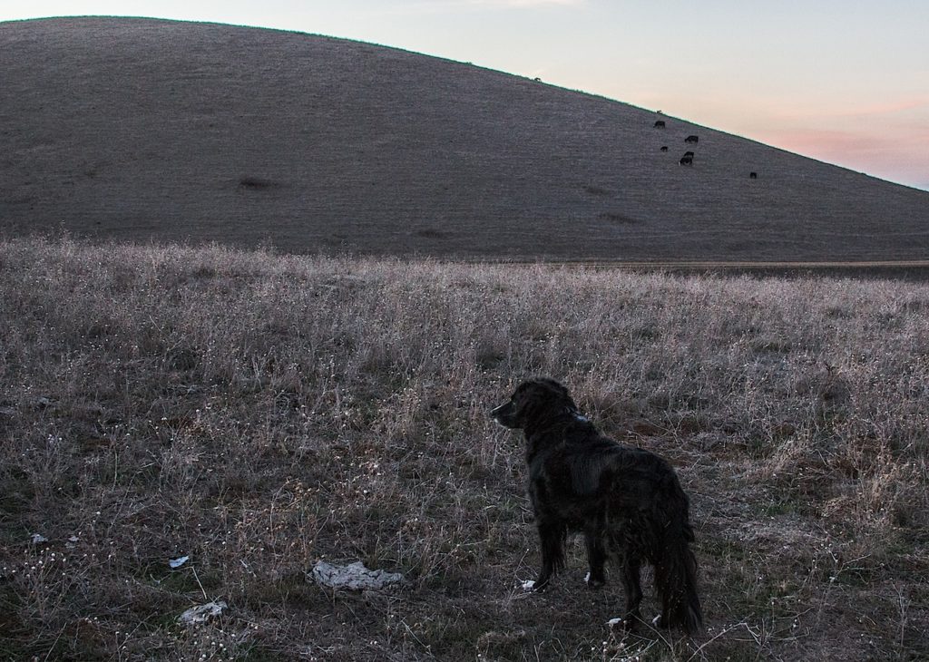
The Dog, watchful as cattle graze and dusk comes down on 2013.

The main outing for the last day of 2013: Kate and I took The Dog out to Carquinez Strait Regional Shoreline, up near Martinez. Having contrived to leave home less than two hours before sunset, we only got a short walk in, up to the top of a ridge with a view out to everywhere — the nearby towns of Martinez and Benicia, the above-mentioned strait and Suisun Bay, Mount Diablo, the mountains in Napa and Solano counties. The light was gorgeous, and as it faded, Scout started studying one of the nearby ridges. There was a cow up there, silhouetted against the twilight. Scout kept his vigil for a couple minutes until the cow ambled off over the hill. Then we all headed back down to the car and into the end of New Year’s Eve.

In Transit: The Audio

Since I’ve been doing the radio thing — actually doing some writing and reporting for the air — I’ve gotten in the habit of recording stuff I hear out there in the world.

Since I got a really capable smartphone a couple years ago, I’ve come to realize what cool little field recorders they can be.

And since I ride public transit (mostly BART) a lot, I’ve long thought about the idiosyncrasies of some of the train operators as expressed in their announcements. The guy who repeats the name of the train and station about six times at every stop. The woman who lectures riders about what station they need to transfer at (I haven’t gotten her recorded yet). The super-happy and the overly dour operators and the ones you can never really understand.

Anyway, I just had a prompt to put together some audio I’ve been gathering over the last few months. It’s not a truly finished radio piece or anything, but it’s got some fun moments in it. Enjoy.

Slideshow: ‘Grandfather Cuts Loose the Ponies’

horse102813.jpg

Another slice of the Great Scablands Tour of 2013 (yes, I’m back home now, sorting through the pile of pictures indiscriminately shot over the five days poring over landscapes). On the third day of the eastern Washington trip, we started in Wenatchee, took a long hike in Potholes Coulee, then headed to the tri-cities of Richland, Pasco, and Kennewick. Before sunset, we stopped at the “Wild Horses” sculpture along Interstate 90, just across the Columbia River from the town of Vantage.

I remembered the spot from driving through here in 2011 with Eamon and Sakura: a string of metal horses dancing along the skyline on a bluff just east of the highway. We had pulled into the parking lot but didn’t have time to stop and hike up to the sculpture. My trip with Randy, though, was more about taking the time to do that (though as always I was a little worried I was holding us up through my repeated insistence on stopping to snap grain elevators, rocks, road cuts, plowed fields, riverscapes, wind turbines, declining small-town Main Streets, and whatever else the terrain offered up).

So we hiked up the steep trail from the parking lot, took some pictures, then hiked to an even higher ridge where we could see how the how the rolling Palouse country came to an abrupt stop as it encountered the flood-sculpted course of the Columbia. Up close, the horses are even more striking than they are from below. The installation is actually called “Grandfather Cuts Loose the Ponies” and is a conception of a Native American creation story by Washington state sculptor David Govedare:

“Creatures of this planet, behold, a Great Basket! I send this basket, bearing the gift of life, to all corners of the universe. Now take these ponies, I am cutting them loose. They will inspire a Spirit of free will. They will be a companion for work and play on this planet. This is a way for you to see how all life depends on all other life. This basket is my heart. You are at one with me. Eagle of the sky, we look to you for vision. Salmon of the water, we look to you for life-giving sustenance. Deer of the land, you provide a bountiful tranquility for our Mother Earth.

“From the center of my Basket burns the fire of our collective souls. Humans, you are responsible. You have the power of reasoning and the gift of free will. Use them wisely. Always be aware of the limitless nature of this ever expanding universe. Let us live to inspire each other.”

A 2008 story in the Seattle Times (“All the pretty horses of Vantage are only half done“) explains that Govedare has been trying for years to raise funds for the Great Basket portion of his installation. Aside from the cost–$350,000–Govedare has encountered skepticism from those who feel the proposed “basket” resembles a giant satellite dish a little too closely.

One other thing to note here: The graffiti. As you’ll see in the slideshow below, lots of visitors have given free rein to their urge to scrawl and doodle. Randy expressed disgust at this and at some level, yeah, it would be nice if people could refrain from leaving their marks. On the other hand, I’m reminded of the multitudes who’ve done the same thing on natural features across the West and the rest of the world–people just have to let you know they were there. (Although sometimes you wonder what’s going on in their heads. Case in point: the two Korean exchange students who were busted after scratching their names into Inscription Rock at New Mexico’s El Morro National Monument. There’s something ironic there, in that the rock has been described as “the sandstone bluff that is the birthplace of graffiti in America.” People have been doodling and scrawling there since long before the first European colonists passed by. As the students found out, now it’s historic, and off-limits to the casual graffitist.)

Road Blog: Hole in the Ground

holeintheground103013.jpg

A short post, since I’ve let it get so late: The next-to-last place we visited on our five-day Ice Age Floods Greatest Hits Tour was Hole in the Ground Coulee, just south of Cheney, the home of Eastern Washington University. Apparently, the area is called “Hole in the Ground” because of a 100-foot deep hole on the floor of the canyon here (one of Randy’s guidebooks says concerned locals filled it with rocks so no one would fall in).

The last stop we made, deep into the dusk, was at the site of a dry cataract not far from the site above, one of the many waterfalls that spilled flood waters south and east toward the Columbia basin when the Lake Missoula ice dams gave way far upstream.

Of course, touring the landscape created by the Big, Big Floods of Yesteryear was just part of what’s been happening the last five days. Randy and I were close during our teenage years — my shorthand for him is “my best friend from high school” — and we spent a lot of the time not filled with talk of lava flows, basalt configurations, receding cataracts, loess and loess islands, mesas, spires, potholes, craters, mima mounds, blades, benches, coulees, and the like reminiscing and catching each other up with what’s been happening in our lives.

It’s been a great five days. More pictures to come.