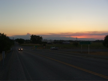
Sunday evening, on the way home from Eugene. We were in the Grand Caravan (174,000 miles); Thom and his friend Elle were driving a U-Haul truck somewhere ahead of us. We got down into the Sacramento Valley just before sunset. On the way north Friday, we had seen a big fire burning in the mountains to the west. A northerly wind had been blowing for several days and carried the smoke well down the valley. By Sunday, the wind had shifted to the southwest, and a long tail of smoke was visible in the northern valley. Just after sunset, a big tower of smoke came up from the fire, and we pulled off to take pictures. This is on Road 7, in Glenn County, just south of the Tehama County line (the “tower” or “puff” or whatever it was is visible in the left center; the clouds in the distance are smoke from the blaze, which I later learned was called the Whiskey fire, near the town of Paskenta, in Mendocino National Forest. It burned about 8,000 acres–a relatively small fire by California wildland standards).
Technorati Tags: california, interstate 5
