My brief stay in Chicago has included a couple of Summer of 2012 heat spikes, interspersed with less radical summer weather, as a frontal boundary oscillates across this part of the Midwest. Today’s National Weather Service forecast map for the Chicago region is orange in every direction, indicating a heat advisory. Temperatures in the city are expected to hit 100. Outside the city, up to 105. (I note that the forecast high in San Francisco today is … 63.)
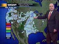
Tom Skilling, the dean of Chicagoland TV weather forecasters, and a meteorologist who is unfailingly informative first and entertaining second, sums up today’s torrid conditions on the WGN/Tribune Chicago Weather Center blog:
“The blisteringly hot air mass responsible for 100-degree or hotter temperatures across sections of 19 states Tuesday re-expands into the Chicago area Wednesday. It’s on track to bring Chicago its fifth triple-digit high temperature of 2012—the most official 100+degree readings here of any year since 1988.
“Temperatures surge past 90-degrees for a 34th time this year at O’Hare and 35th time at Midway—extraordinary when you consider the average since weather records began in 1871 has been only 17 such days at O’Hare and 23 at Midway!
“…This summer’s warmth has been nothing if not persistent. If you needed any additional evidence this weather pattern has been unusual, WGN weather producer Bill Snyder, in surveying the city’s official temperature records, finds Chicago is to log an unprecedented 29th consecutive day of above normal temperatures—making this the most back-to-back days to post a surplus in the 5.5 years since a Dec. 10, 2006 through Jan. 14, 2007 mild spell in which above normal temperatures were recorded over 36 consecutive days.”


 As avid readers of this space are aware, I’m an admirer of Chicago weatherperson Tom Skilling. His work on WGN has always seemed to be well ahead of the curve in terms of graphic presentation. His presentation is fact-rich and thorough (a new wrinkle in coverage of the winter storm hitting Illinois tonight: a discussion of pavement temperatures), yet understated. And his on-air material is supplemented by the best full page of weather I’ve seen in any newspaper, much of which is reproduced in the