Inbox: Salmon Extinction Alert

A (slightly edited) email that just landed in my work inbox from John McManus, the president of the Golden Gate Salmon Association:

Dear Reporter:


If you’re covering the news from the California Dept. of Fish and Wildlife documenting the lethal effects of the drought on federally protected winter-run salmon, consider this from CDFW’s updated winter-run data file (which you can download from:  https://www.calfish.org/ProgramsData/ConservationandManagement/CentralValleyMonitoring/CDFWUpperSacRiverBasinSalmonidMonitoring.aspx

7-6-21: Continued hot weather above 100 degrees for periods in late May, early June  and past two weeks continuously will lead to depletion of cold water pool in Shasta Lake sooner than modeled earlier in season.  This hot weather is leading to more demand downstream for water (flows from Keswick Dam from 8,500 to 9,250 cubic feet per second on July 4th).  Previously modeled season long cold water availability scenarios used steady flows in the 7500 cfs range  from Keswick.  Those earlier scenarios had very high expected juvenile mortality due to warm water later in August-October that would be lethal to incubating eggs and alevins in the gravel.  This persistent heat dome over the West Coast will likely result in earlier loss of ability to provide cool water and subsequently it is possible that nearly all in-river juveniles will not survive this season.  Counts of carcasses continue to indicate a large run of winter-run this year. Unspawned fresh females for the season are 71 with an overall percentage of 12.3% of all fresh females this season were unspawned.

If you are looking for a quote for a story, consider this one from me:

“Californians should be alerted that the extinction of a native salmon run is underway right now as a result of government inaction to stop it.  State and federal water managers have apparently decided it’s politically inconvenient to reroute short water supplies to prevent extinction if it means a few less acres of crops.  We’re losing winter run salmon right now and the fall run salmon that supply the sport and commercial fisheries will be decimated too.  Californians who care about the environment need to hold government officials accountable for allowing the loss of the state’s natural resources on their watch.”

Friday Ferries: Delta Edition

ferry052413.jpg

I’ve known for a while about ferries in the Sacramento-San Joaquin Delta, barge-like little boats that run across the side channels to the main rivers and at a couple of points actually provide continuations for state highways (84, a rather long one, and 220, a very short one). But the Delta isn’t really next door. The closest gateway is Antioch, in eastern Contra Costa County, about 50 miles northeast of Berkeley. So the ferries up there were just little dotted lines on the map.

We both had the day off today, got up late, did a couple chores, and early in the afternoon headed up to the Delta by way of Antioch and Highway 160. We caught the Real McCoy II ferry, which crosses something called Cache Slough (apparently the outflow of Cache Creek, which flows out of Clear Lake, about 80 air miles and a lot more stream miles to the northwest) onto the west bank of Ryer Island. We drove around to the east bank of Ryer Island and took the J-Mack ferry across Steamboat Slough (so called, I’ve heard, because it was the favored route of early river boats that ran from the Bay Area up to Sacramento) to Grand Island. (That’s the picture above, looking east toward Grand Island.)

And then we noodled around a little, stopping in Walnut Grove, a little town on the Sacramento River, and puzzling over the map trying to see a way of getting north from where we were to Davis while avoiding the capital city and suburbs. The only way was to head back down across the ferries to Rio Vista, then double back north to the west of Cache Slough and the Yolo Bypass. We managed that and eventually came to a bridge shown on the map between Liberty Island and Hastings Island. There was a sign declaring the bridge was a private road. I walked across it and saw a couple big signs declaring the road and land beyond to be private. Back at the car, I decided to see if anyone who had come out this far–we were on a gravel road atop a levee, surrounded by fields full of hay, wheat and corn–had posted anything about whether the road ahead was really private. I came across a posting from a hunting club that told visitors to ignore the “no trespassing” signs and just head across the bridge. So, that’s what we did, and drove onto Hastings Island.

After crossing to the west side of the island, we were back up on a narrow levee road with a view of Mount Diablo maybe 30 or 40 miles to the south. We approached a farm, and right there on the side of the road, a horse looked like it was leaning against the side of a red barn. The sun was low and even though I just glanced over, the light and shadow were dramatic. I kept going, but decided to turn around to take another look. And that’s what you see below. I’ll add that the horse looked spent. Old, tired. Skin and bones. Someone’s good friend, I hope. Waiting on sundown.

horse052413.jpg

All-Salmon Weekend

A summary of my weekend-plus at the meeting of the Pacific Fishery Management Council (what I'll describe as akin to an advanced seminar on chinook salmon from a world-class faculty) in Vancouver, Washington:

Day 1: I left home for the Oakland airport at 7:20 a.m. or so. My plane departed at 9 a.m. and landed in Portland at 10:40 or so. I was behind the wheel of a rented car by 11 a.m. and at the Hilton in downtown Vancouver by 11:30. In a hallway, I recognized a voice I'd only heard on the phone before–Barbara Emley, a San Francisco salmon troller who's been fishing salmon since the 1980s. I introduced myself and she invited me to lunch with her and two fishermen, Dave Bitts of Eureka and Joel Kawahara, from Washington's Olympic Peninsula. They filled me in on the morning's proceedings and what was to come in the afternoon, including a discussion of limitations that may be posed on this year's chinook salmon catch to accommodate threatened populations of killer whales, which like to snack on them. I spent the afternoon in a variety of meetings and talking to a variety of people, including Chuck Tracy, the PFMC officer who works on salmon issues. At about 5:45, I headed over to my friend Pete's house in Portland to hang out with him and his boy Niko. 

Day 2: Sunday morning I was at the hotel by 10:30 or so for another day of meetings both on the status of the Sacramento River salmon fishery and on initial suggestions for the 2011 fishing season. I interviewed about half a dozen people, pulled a couple soundbites, wrote up a short story to air on KQED's local news on Monday morning, did a read-through with my editor in the Bay Area. I got out of the hotel about 7:45, went to Pete and Niko's, had a late dinner, then voiced and uploaded my story. Pete and I stayed up talking until about midnight, then he went to bed. Since I had promised a second story, I stayed up and wrote that, pulled another soundbite, and sent it off to one of the editors in San Francisco. 

Day 3: Monday, which at one point in this adventure was penciled in as a day off, I was up at 7:30, drank Pete's excellent coffeed, stayed at the house while Pete took Niko to school, then voiced the second piece I had written the night before, wrote a third piece (these are all very short, like a minute, max), voiced that, then uploaded everything to KQED. I made an attempt to talk the editor of our statewide show to put off a Tuesday morning story I had promised her, because I was hoping to have a pressure-free day before flying back to Oakland in the evening. But my gambit didn't work, and a promise is a promise, so I said I'd have a script to her late in the afternoon. In the meantime, Pete had returned home and we had talked about going to Powell's, the landmark bookstore in Portland, which I had never visited. So we walked to the Lloyd Center "Max" station–about three and a half miles from Pete's, as it turned out–and rode free to the heart of downtown, then walked the rest of the way to Powell's. We hung out there and both bought something–I got a cookbook, which I never do, and a novel by Peter Carey that's supposed to be something of a gloss on Tocqueville's visit to America. Then I bought Pete lunch at Little Big Burger, which was awesome (we each consumed 1.5 cheeseburgers and split an order of fries). Then Pete said, "Well, you feel like walking back?" I did. So we set off across the Pearl District, Old Town/Chinatown, the Burnside Bridge, and up Burnside Avenue to Laurelhurst; we detoured through Laurelhurst Park, with Pete filling me in on details of the neighborhoods we passed through. At 3 o'clock, when we got back to Pete's, in the general vicinity of Mount Tabor, we had walked another four and a half miles or so. The total for the outing came to about nine miles. Back at Pete's I packed up, loaded up the car, took my leave, filled up with gas, and made the short, easy drive to the Portland airport for my 6 p.m. flight. There, I schlepped my stuff to one of the cool little work carrels they have in the terminal buildings and, at about 4:20, began writing my story for Tuesday morning. At about 5:30, I had something that was, if not profoundly insightful, most likely would not provoke shrieks of outrage from editor or listeners. I did a quick read-through with said editor, then packed up my stuff and walked to the gate for my flight, which was due to be boarding. It was a little late, but not by much, and the flight was uneventful. We got to Oakland about 7:30 or so. Kate picked me up. We went home, had dinner, walked the dog, and then I recorded my voice tracks and isolated my soundbites and uploaded all the sound. Lest that all sound real quick, I was done with all that at 12:30 this morning. 

Day 4: This morning, while I was asleep, an engineer mixed the sound, and the piece aired at 5:50 a.m. I caught it during a 6:50 repeat and at some point realized I had made a factual error in the piece. So I wrote a correction for that, too.

Later, I vacuumed the house. 

Filling in the Map

Sunday was spent noodling with HTML in the morning, then in the afternoon getting in the Tiny Car (the Chicago-bred Toyota Echo) and driving from Berkeley out to Antioch, up the Sacramento River to the Delta Cross Channel, then east to where our local utility district stores our water as it flows out of the Sierra Nevada. The destination was chosen because the East Bay Municipal Utility District runs a fish hatchery on the Mokelumne River, and I wanted to see that. The route was dictated because the Delta Cross Channel is the route by which much of the water exported from Northern California down to the San Joaquin Valley and Southern California is diverted from the Sacramento. I’ve driven past and ridden my bike by the Cross Channel gates dozens of times, but, not knowing what the heck they were, I never took note of them. Anyway, the drive was part of a long-term project I think of as filling in my map–touring what is largely terra incognita and figuring out how the pieces relate to each other.

It was a beautiful day, anyway, even with no end in mind. I saw water. I saw levees. I met a lonely bridgetender and photographed him and his antique bridge. I encountered a dead skunk and a curious ostrich. And then when I got out to the hatchery, I was hours too late — it had closed at 3 p.m.

Bypass

Sutterbypass

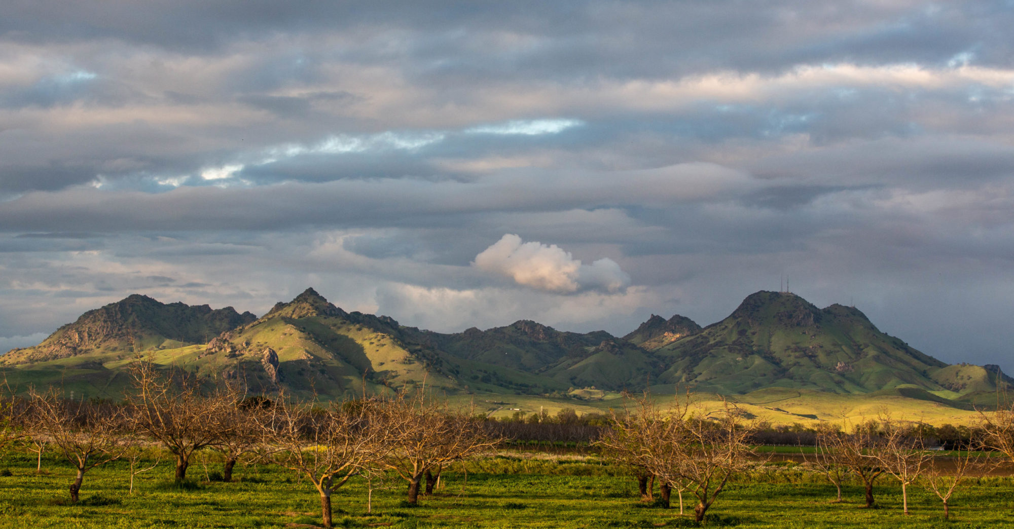
My friend and fellow cyclist Bruce Berg and I took a long driving trip to reconnoiter a route for a 24-hour ride we’re planning for mid-April. Our route takes us across the Sacramento Valley on back roads between the towns of Colusa and Yuba City. Here’s part of the route — Pass Road, about 10 miles west of the little town of Sutter. The suggestion of a mountain rising into the clouds on the left is one of the Sutter Buttes, a pocket mountain range that rises up from the table-flat valley. Needless to say, I hope, we took a look at the road here and decide that even though it didn’t look too deep for the 400 or 500 yards that the pavement was covered, we probably didn’t want to venture in.

Just to be clear: This isn’t the river proper, but the Sutter Bypass, one of a number of engineered channels that divert water from the main stream when the Sacramento is near flood stage. It’s a reminder of the natural state of the valley before settlers arrived and went to work improving it: In the wintertime, all the water running into it from the upland rivers would collect and turn it into a giant shallow sea — hundreds of miles long and as much as 120 miles wide.

An example: We noticed a historical marker yesterday for Johnson’s Ranch, renowned as one of the earliest American settlements in the valley and as the place to which the Donner Party survivors were first brought after their rescue. In looking up some details about that story, I found an account that talked about the flooding in the valley in the late winter and early spring of 1847:

“At Johnson’s Ranch there were only three or four families of poor emigrants. Nothing could be done toward relieving those at Donner Lake until help could arrive from Sutter’s Fort. A rainy winter had flooded Bear River, and rendered the Sacramento plains a vast quagmire. Yet one man volunteered to go to Sacramento with the tale of horror, and get men and provisions. This man was John Rhodes. Lashing two pine logs together with rawhides, and forming a raft, John Rhodes was ferried over Bear River. Taking his shoes in his hands, and rolling his pants up above his knees, he started on foot through water that frequently was from one to three feet deep. Some time during the night he reached the Fort.”

Technorati Tags: ,