Road Blog: Pack, Shop, Get Gas, Shave, Cut Hair, Straighten Up Office, Fill Bird Feeders …

Lake Don Pedro — the reservoir that captures the Tuolumne River downstream of Hetch Hetchy — along Highway 120.

Day One of an n-day trip to Salt Lake City and destinations still undetermined. I’m in Lee Vining now after driving from sea-leval Berkeley out of the Bay Area, across the Valley, through the foothills and Yosemite and up the Tioga Road to Tioga Pass, elevation 9,945 feet. It was dark when I got to the top. I stopped for a few minutes to take in the stars and planets — Jupiter scraping the top of Mount Dana as it rose — and spotted the International Space Station making a pass almost directly overhead. Then it was back in the car for the plunge down through canyon to Lee Vining, where I’m staying tonight. I walked up the road to the region’s most famous Mobil gas station to have dinner (well, the gas station is part of a roadside stop with a store and a better-than-you-could-possibly-have-expected-in-these-parts restaurant. Tonight they had carnitas tacos. Really good).

It does occur to me that sometime maybe I’d like to take a whole trip in daylight. My brother John was just telling me tonight from Montana that he just went over a stretch of road the two of us drove after dark last year and he was staggered at how beautiful it was. All I can tell you about that piece of highway is that it had all the standard lines and markings.

Today, driving after dark was pretty much inevitable because I didn’t leave home until a bit after 2 p.m. I think sunset was about 6:30. Why start after 2? See the headline above. It’s all the stuff the got compressed into a few hours before departure. One would think I’d learn at some point. But not yet.
Road Blog: Lee Vining to Ely

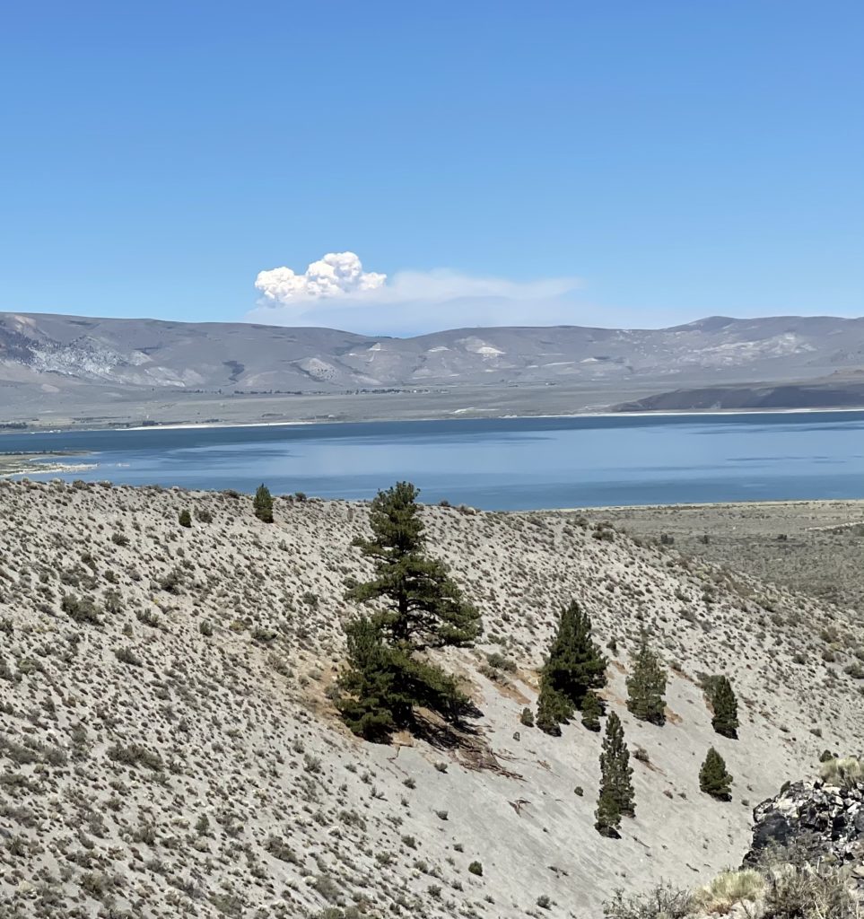
A pyrocumulus cloud rises above the Caldor Fire near Lake Tahoe — 85 miles from this vantage point at Panum Crater and Mono Lake.

I started out last night with a mini-exploration of the names of the towns where we started and ended, Berkeley and Lee Vining.

Lee Vining is known to lovers of the eastern Sierra and habitues of the greater Yosemite region as the town that’s perched just above the shore of Mono Lake and at the foot of the road across Tioga Pass, the highest highway route across the Sierra. According to one local account, the name Lee Vining had its origins in real estate marketing. A landowner in the area was subdividing his property for home lots and didn’t think the existing name of the place, Poverty Flat, would do much for his venture’s prospect. He wanted to call the community Lakeview, but the Post Office informed him the name was already in use. His next choice was Lee Vining, a Gold Rush-era prospector who had operated in the area.

I’m recapitulating all of that just to say there is no neatly tied-up story to explain the name of Ely, Nevada, where I am tonight. “Ely,” pronounced “EE-lee,” not “EE-lie,” could refer to any number of men who had some influence hereabouts in the late 19th century. It’s late, and I’m not up to weighing in on who might have had the strongest claim. The rest of what I can tell you about Ely is that it’s a mining town — copper mining has been its mainstay since the first decade of the 20th century, and one of the landmarks you encounter as you approach town on U.S. 50/The Loneliest Road in America from the west is a series of immense man-made mountains consisting of mine spoils. They suggest the bases of incomprehensibly large, unfinished pyramids, mostly dun-colored but with variations in the shading of the earth packed into the towering, symmetrical slopes. Somehow, those gigantic, well-sculpted features had not made an impression on me during past trips through the area. They did today.

***

The daily highlight: John and I ate breakfast at the Mobil gas station in Lee Vining — it’s a well-known destination for trans-Sierra travelers — then spent a couple hours hiking around Panum Crater, near the south shore of Mono Lake. The landscape is austere and exciting, and for John, who is a glass blower by profession and vocation, it was extra-cool to see the all the obsidian, black volcanic glass, strewn in huge masses in the crater’s center.

One startling sighting was a rapidly growing mass of pyrocumulus generated by the Caldor Fire, a good 85 miles away near Lake Tahoe. We didn’t encounter smoke ourselves until we were well on the way to Tonopah. From there, we drove up Highway 376 through the Big Smoky Valley, which was too socked in by wildfire smoke to see more than the dim silhouettes of mountains on either side of us.

Tomorrow, maybe: Golden Spike.