Dispatch From 1973: Part 2 Postscript

Part 2 of my 1973 train travelogue ended with an uncomfortable episode, and relating it made me uncomfortable all over again, even 50 years later.

Here was the scene: A man in his 40s or 50s, distinguished by his harassed demeanor, single leg and crutches, stops and asks a teenager, a total stranger, to join him in the men’s room “for a smoke.” Why was it uncomfortable? Well, I didn’t smoke, for one thing. For another: Is there any other way to interpret that as something other than a proposition? I thought after I transcribed that passage the other day, “Maybe he just needed some help with his prosthesis or something” or, “Maybe that was just his way of being friendly.” But he didn’t have a prosthesis. And it seemed from his behavior with other passengers as though he were capable of just sitting in the lounge car and striking up a conversation without being creepy about it. I have no idea, though, how many other passengers he might have invited to join him in the men’s room.

Later in that 1973 trip and for much of the rest of the decade, I hitch-hiked a good deal. Maybe it goes without saying, but I experienced this kind of proposition often enough to make me wary. From talking to other hitch-hikers, men and women, I assume that was true for most of us. Getting hit on almost seemed like a feature of that kind of travel, something you almost had to expect and know how to respond to. Still, it could be unsettling, just like the episode with the guy on the train.

Usually the advance was pretty low key — someone picking you up, maybe shaking your hand, and saying something like, “You have a nice firm handshake. Would you like to stop by my trailer for a massage?” Usually the men making the suggestions, and they were always men, were not insistent. “Would you like to party? No — well, OK.” Occasionally, though, they’d be insistent and then some.

Hitch-hiking through Reno late one night — yes, I often hitch-hiked all night, which I don’t hold up as an example of my faultless good sense — a guy picked me up and said he was headed a good distance east. I’d been in the car for only a few minutes, though, when he started to ask me some questions: “Do you like T-shirts?” “Uh … yeah, I like T-shirts OK.” “How about … white T-shirts?” “Um … well, I guess I like colored T-shirts. … ” “You do?”

I’ve always wondered whether “T-shirts” was some sort of code I wasn’t in on. I guess it was, because he told me he’d be getting off the freeway to go to his place and he wanted me to come with him. We were now in the desert and well outside the city limits. Being out in the middle of nowhere with this T-shirt guy and whatever he had in mind? No thanks. I insisted on getting out of the car immediately. He dropped me some distance before the next exit, and drove off. A few minutes later, he pulled up on the other side of the freeway, headed back toward town. He shouted that he had a gun and was going to shoot me.

If the idea was to put a scare into me, it worked. I ran down into the ditch alongside the road and stayed there until I looked over the edge and saw his car was gone — I’m not sure if it was two minutes or five minutes later. I didn’t know what to do after I see he’d left, so I started walking back toward town myself. I figured if I had to walk all the way back to town in the middle of the night — it was a good 10 miles at least — there might be a bus or train or something I could catch. But walking back was scary, too: As every car approached, and there were only a few at this hour, I wondered if it was the T-shirt guy with his gun.

After half an hour, someone did stop. I don’t remember anything about that ride except the driver took me to Lovelock, about 80 miles east, and I was very relieved to be off that stretch of freeway.
Cathedral Window

bikelane030913.jpg

My brother John and I were standing on the platform of the MacArthur BART station in Oakland once, years ago. The platform is set in the midst of a big freeway interchange. It’s got a nice view of towering overpasses in one direction. Since it’s elevated and bounced by four lanes or so of traffic on each side, it actually has an open view to the Oakland Hills on one side and out toward San Francisco Bay on the other. With all the traffic, the soaring, gracefully curved highway structures, the trains coming and going, you’re really conscious of how much industry and energy goes into what we build. And more than that, too. Standing there, John said, “These are out cathedrals.” Not that we build our highways to give expression to our understanding of the divine, but these structures somehow embody both a creative urge and give voice to how we see our connection with the world.

Anyway, yesterday, I was out on a short bike ride (to pick up the A’s tickets featured in another post), and took a bike lane that skirts the Maze, the huge tangle of overpasses and ramps that distribute eastbound traffic from the Bay Bridge south toward San Jose, east and south toward Livermore and Stockton and Walnut Creek and Concord, and north toward Berkeley, Richmond, Vallejo and Sacramento. It was a beautiful early afternoon, and what was most striking was the way the highway structures framed the hills and mountains of Marin County.

PM Getaway, Holiday Eve

holidayeve112311.jpg

I almost never drive to work in the city (San Francisco) at regular commute hours. I go in at midday, usually, and return home well after the last of the evening commute. But today I drove because it was the day before the holiday and the morning rush hour was light. I waited a little too long to start home, till almost 3:30, and this is what happened: a long (but standard) jam on the western approach to the Bay Bridge. The stop-and-go and merge after merge after merge slows you down so you can reflect on why you love living here.

Illinois Wind Turbines

windturbines090511.jpg

One big change in the Midwest landscape I’ve seen on my occasional visits over the last decade: Lots of wind turbines are being installed (hundreds and hundreds of them in Illinois so far, with many more coming). I shot this pair–just off Interstate 80 on the southern outskirts of Geneseo–as we blasted past (my brother Chris was driving) on Labor Day on our way from Iowa City back to the Chicago area.

Chris asked “how much power do those things put out?” My researches have uncovered the following: These two turbines are Vensys 77‘s, each rated with a generation capacity of 1.5 megawatts. How much is that? The math isn’t straightforward: how much power is actually generated depends on weather conditions; the turbines need wind, of course, but they’re apparently also sensitive to high temperatures. In practice, the generators at this site might produced enough power for about 1,000 homes. The city of Geneseo, population roughly 6,500, said before the turbines began operation in October 2009 that it expected the turbines to provide between 12 percent and 15 percent of the electricity the town needs.

And: How big are those things? Big. The rotor diameter, which I take to be the diameter of the circle swept by the turbine blades, is 77 meters. About 240 feet. The top of the tower is about 300 feet.

Overpass World

tofu073010.jpg

Down where the northern slope of San Francisco's Potrero Hill flattens into the southwestern edge of South of Market, two big elevated freeways merge–Interstate 80, which begins its cross-continent trip about a mile west of the Bay Bridge, and U.S. 101, which emerges from its southbound passage on city streets and heads toward San Jose and Los Angeles. Below the freeways are a maze of streets where at least two of the city's clashing grid systems come together. I've worked in the area on and off for nearly a decade, and when I take the North Berkeley casual carpool over to the city, I hike through the heart of the area beneath the freeways–Overpass World, you might call it. It's bordered by an interior design district to the east and to the west by jewelry, antique, and auction houses. Overpass World itself is full of parking lots, invisible clouds of particulates spewed out by the hundreds of thousands of vehicles that pass overhead every day, homeless camp sites, and the occasional attention-grabbing graffito. And regarding those last couple of items, above is a scene from my walk into work on Friday morning, on San Bruno Avenue near 15th Street.


View Underpass World in a larger map

Freeway Overpass

Freeway101708

From Friday night on Potrero Hill. From Utah Street just south of Mariposa, there’s a pedestrian overpass crossing U.S. 101 to Vermont Street on the east side. I can’t quite explain it, but I alway like walking over the freeway there. Something about getting to watch the traffic from so close by without being part of it, maybe. Last night after work I went up there and experimented with some time exposure by placing my camera on one of the railings of the pedestran bridge (there’s a fence to prevent it from falling onto the highway) setting the shutter on delay before releasing it.

This view is looking north. Interstate 80, which goes all the way to New York City, starts where you can see the green highway signs in the left center (if you click for the larger image, you can see that one of the signs directs drivers to the Bay Bridge, which is visible in the right center).

Technorati Tags: ,

Two from the Road

Road012108

As mentioned in a road-addled state earlier this week, I drove up to Eugene on Monday, then drove right back. Not that it was a world-class ironman stunt or anything, but still: 512 miles up there, 512 miles back. We were actually rolling at 9:14 a.m. (projected start: “8 o’clock at the latest”), and we pulled into Thom’s driveway near the University of Oregon at 5:37; that was with one fairly long stop (40 minutes) in Ashland gas up and then sit down and have lunch (Pangea; wraps highly recommended). I got another tank of gas in Eugene and was driving south again at 6:12 p.m. There was no traffic to speak of all the way south, but it started to rain when I got about halfway down the Sacramento Valley. It started to rain, and I started to get tired. Along the way, I experimented with some night-time windshield pictures. The one above is from southwestern Oregon, north of Glendale, Grants Pass and Medford (as the road sign indicates several times). The one below is from Interstate 80 in Vacaville, just after leaving i-505. Things were starting to look a little fractured at that point.

Road012208

Technorati Tags: , , ,

Four Lanes

Fourlanes

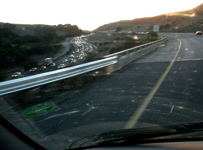
Monday evening, just about to cross the last little pass on westbound Interstate 80 into the town of Vallejo. From the top of the pass — it’s a pass, though I don’t know its name — you catch your first glimpse of bay water. At the end of a 500-mile trip back from western Oregon, or a much shorter one into the Central Valley, the sight says you’re almost home.

It was about 5 o’clock as I drove up this long incline out of the westernmost edge of the valley. The sun, just the other side of that ridge to the right, shockingly brilliant. Just a hint of green coming out across the hills after our foot of rain. The traffic was backed up for miles and miles going the other way, partly because of rush hour, partly because of an accident of some sort down the hill to the east. The volume of traffic on I-80 is always impressive and has been for years and years. I wrote a short editorial for The Examiner in the summer of 1991 describing a Friday night drive from Berkeley up across Donner Pass. It felt like being carried along in the surge of a river, a flow so powerful it bore everyone up-country all the way to the top of the mountains and beyond.

So seeing masses of cars, especially at going-home time: Not a surprise, but always a reminder of how crowded this place has become and how we live amid all this beauty.