We drove from Dad’s place on the far North Side out toward Joliet, southwest of the city, to find the spot where the Des Plaines and Kankakee rivers come together to form the Illinois.
The first 99 percent of the route is straightforward: If you like, you can drive to within a few miles of the spot on Interstate highways. But we got off the expressway and took side roads to follow the dual channels of the Des Plaines and the Chicago Sanitary and Ship Canal. The side roads weren’t pastoral lanes; we drove past tank farms and refineries and generating plants, one after another. Eventually we turned away from the Des Plaines and drove west and south through brand new subdivisions — some half built, some just surveyors’ markers outlining streets and lots for homes that will go up next year. One was a neighborhood with a long curving boulevard of fresh asphalt and a giant new playground and not a single home even under construction yet. We eventually passed through a place called Minooka, which must have been a quiet little crossroads once. We crossed a highway at a strip mall called Mallard Point and drove south about a mile to a T intersection where we met my brother John, his wife, Dawn, and their two kids (Sean and Leah) who had driven over to meet us from my brother Chris’s place in Tinley Park.
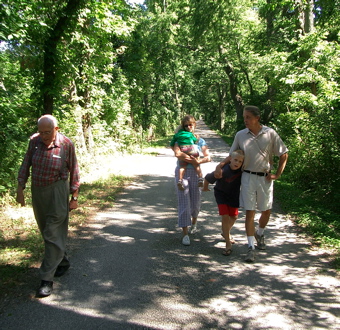
After wandering around on a couple of country roads, we finally figured out that the road to the confluence depicted on one of our maps was actually the towpath to the old Illinois and Michigan Canal — the link that in the mid-19th century connected Chicago and Lake Michigan and all points east to the Mississippi River and beyond that the great western interior of the United States. We hiked down the path for maybe three quarters of a mile, to where the conjoined rivers go through a lock and dam. A little short of the confluence, but close enough for today. Everyone was still smiling on our way back to the cars.