A story in four parts.
I. Non-Confluence
Taking up where we left off last August, my dad and I — this time with my brother Chris — drove out to southwestern Will County on Monday to see if we could see the place where the Des Plaines and Kankakee rivers meet to form the Illinois River. Why? Well, the reason to care about the rivers is that in the mid-19th century they, along with the Illinois and Michigan Canal, represented the link between Lake Michigan, the Great Lakes, and the entire eastern United States and the Mississippi, the Gulf, and the country to the west. On top of that academic-sounding justification, there’s the relative obscurity of it. Who else is driving around the Chicago area looking for this spot? (Some good Web background on the I&M Canal, by the way: from the Chicago Historical Society (including pictures of canal sites in present-day Chicago settings); the Chicago Public Library (part of its “Down the Drain” site on the city’s sewer system); the National Park Service, and Illinois Department of Natural Resources.)
When we visited the area last summer, we hit the towpath along the canal a little too far to the west for it to be a reasonable walk, given my dad’s cantankerous knees. This time, we drove into a county park (McKinley Woods; among other things, the brief history posted at the park says it was a POW camp during World War II) and started walking east on the towpath. The canal runs to the north of the path, and the rivers to the south. About a mile from the McKinley Woods parking lot, after passing a little marina on the opposite bank, we came to a what appeared (to me) to be a spit of land that marked the separation of the Des Plaines and Kankakee rivers. Pictures were duly snapped and huzzahs sounded, and we walked back to the parking lot.
It was only in the course of writing this, though, that I discovered to what an extent I had betrayed the legacy of Louis Joliet, the 17th century French-Canadian explorer who traveled up the Illinois River to the Des Plaines and then on to the Chicago River and Lake Michigan and quickly realized the feasibility of a canal connecting the lake to the Illinois and Mississippi. The “confluence” I located was in fact just an island in the Des Plaines River. The real merger point was west of the lot where we parked, not east.
I guess we have an excuse to go back and look for the spot a third time. (Pictures, from left: Dad on the Illinois and Michigan Canal towpath; a glimpse of the false confluence; the I&M Canal, with the river bluffs in the distance.)
II. Country Cemetery
From the non-confluence of the rivers, we got on Interstate 55 south, headed for Lexington, about 70 miles away. Our destination was the cemetery in Pleasant Hill, a hamlet two or three miles outside town. My old high school English teacher, G.E. Smith, died in April and was buried there alongside his mother and stepfather. I visited Pleasant Hill once, around 1971 or ’72, when G.E. went down to check up on his family’s old home, which by then amounted to a falling-down house and a cellar with a roof on it. He was attached to the place, but it wasn’t until later that he seemed to act on the interest, writing a column in Lexington’s weekly paper about Pleasant Hill history and then becoming a serious genealogist and trying to gather all the strands of the family that had wound up out there on the prairie.
The Pleasant Hill cemetery goes back to the first half of the 19th century. The area’s first white settlers, who arrived in 1820, are buried there. The little town used to have two churches, but those are long gone. The cemetery grounds are unfenced and merge into the bordering corn and soybean fields. G.E.’s grave is on an east-facing slope; his freshly cut brown-red granite stone announces his middle name, Edward, a matter that he liked to keep to himself. It describes him as “teacher, counselor, writer,” and includes a quote from him: “My highest goal was always and still remains simply this: To be able to look back upon my life, from any point along the way, and be able to say that this little corner of the world that my life touched has been made better, not worse, because I touched it.”
When we arrived, in early afternoon, it was clear and very warm and the caretaker, Ron Eckhart, was watering new sod on G.E.’s grave from a tank on his red pickup. He’s been the caretaker for 26 years — “That’s a lot of grass cut,” was how he put it — and long before that, his dad was pastor at both of the Pleasant Hill churches. Eventually Ron moved off to another part of the cemetery, and so did we. Up the hill from G.E.’s spot is the oldest section of the cemetery, filled with people from the days before the Illinois Central bypassed Pleasant Hill and doomed it to perpetual hamlet-hood. With only the graves to go by, you would guess life was hard. There’s the usual large complement of children who died in their first year or two; but there are also seemed to be a lot of adults who didn’t make it out of their 30s. Maybe life was just hard everywhere when these people were trying to make farms and towns. For one example, take a look at the life of another Prairie Stater, Abraham Lincoln: His sweetheart was carried off by a fever at age 20. Just one of his four children survived to adulthood.
Looking around the little cemetery, it looked like G.E., who was aged 81 years, three months and a day when he died, is one of its oldest residents.
III. Wrecked
We drove through Lexington to start the drive back toward Chicago. On the way out to Pleasant Hill, Chris had pointed out the placards on every telephone poll downtown bearing the names of local soldiers serving in Iraq, Afghanistan and elsewhere. Chris counted 19 names. The town has about 2,000 residents, so roughly 1 percent of the population is serving. We fueled up at the Freedom gas station — just $2.899 a gallon — then headed north on old U.S. 66 to Chenoa. I wanted to take U.S. 24 east to Interstate 57 both because I knew there was a Dairy Queen along the way (in Fairbury) — my dad’s favorite road-trip stop — and because I remembered a little piece of local history along the way: the Chatsworth Wreck.
Back in the mid-70s, I stopped to read a historical marker just outside Chatsworth, one of the series of farm towns strung along U.S. 24. It reads:
THE CHATSWORTH WRECK
MIDNIGHT, AUGUST 10-11, 1887
One-half mile north on the Toledo, Peoria & Western Railroad occurred one of the worst wrecks in American rail history. An excursion train – two engines and approximately twenty wooden coaches – from Peoria to Niagara Falls, struck a burning culvert . Of the 500 passengers about 85 perished and scores were injured.
We stopped at the DQ in Fairbury, then continued on through Chatsworth to the wreck marker, which is about two and a half miles east of town, nearly on the Livingston-Ford county line. One thing that’s a little unclear when you’re at the roadside, though, is exactly where the disaster occurred. The TP&W tracks — the railroad still goes by that name — are a half mile north of the highway. I wanted to see if we could find the site of the notorious “burning culvert” — actually, a small wooden trestle. I imagined there could be a memorial or marker at the spot where the train left the tracks.
We parked at an electrical substation near the railroad’s marked but unguarded level crossing. My sense, based on the marker’s placement west of the section road that runs up the county line was that the wreck site was west of the road, too. Chris and I walked along the single track until we got to a culvert maybe a quarter-mile west of the road. It’s not deep — in fact, it’s a narrow ditch that crosses under the track through an 8- or 10-foot-diameter steel pipe. The site is unprepossessing, just like every foot of track east or west of it to the horizon, and there was nothing to suggest we were at the scene of a sensational event.
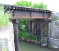
After we walked back to the car and started east again on 24, Chris and I spotted another culvert — this one an actual trestle — just east of the county line. We turned around and hiked out to it, too. It’s a much more satisfying place for a calamity: The tracks cross a bridge that’s about 75 feet long and a good 20 feet above a sluggish little creek. We agreed that between the two possible sites, this seemed the more likely.
Back at home, I poked around online to see if I could find some account that sheds light on the wreck’s precise location. Chatsworth had a newspaper, the Plaindealer, in 1887, and much more recently, a retired teacher and local historian there, Helen Louise Plaster Stoutemyer, published a book on the disaster, “The Train that Never Arrived.” Eventually, I came across a Chatsworth native’s website that includes the Plaindealer’s first account of the tragedy. The story says the train left the tracks at “the first bridge west of the county line” — the first place Chris and I looked. In addition to offering the salient facts, the writer has a lot to say about the impression the wreck left:
“The sight was most terrible. … It was too horrible to admit of description. The screams and moans of the wounded were heartrending, and the terror of the sight can not be imagined. … To add to the terror of the scene a heavy thunder and lightening storm came up, and , with heavy rain made such a scene as would appall the bravest hearts. … Even the strongest men were forced to tears as they heard and saw the anguish of the unhappy excursionists. While many displayed strong courage, grit, and heroism, others were almost frantic, and those in attendence upon them were forced to hold them to prevent acts of insanity and self-destruction.”
If you like the newspaper’s rendition, then you’ll love the song: “The Chatsworth Wreck.”
(Pictures: Left: The marker, east of Chatsworth on U.S. 24. Middle: Wreck candidate site A (west of the railroad crossing 2.5 miles east of Chatworth; north end of culvert is just visible on far left). Right: Wreck
candidate site B — east of the crossing.)
IV. Wrecked Again
After investigating the site of the 1887 trackside carnage, we turned east again on U.S. 24. The highway crosses Interstate 57 at Gilman, then crosses Highway 1, which follows an old trapper’s trail from the Wabash River up to Chicago, at a town called Watseka. I was curious to see Watseka, which I’ve passed through exactly once: In the autumn of 1966, when Dad took us on a long-weekend trip down to the Smoky Mountains and back. I remember going through there late on a Thursday night that ended at a Holiday Inn just outside Indianapolis.
As we started to get close, I asked Dad and Chris whether they remembered the big disaster that had happened in Watseka around 1970. It didn’t ring a bell with them. I recounted the big blast and fire in town — apparently some kind of gas explosion — and an image I still vividly remembered. A fireball rising far above the old-fashioned town water tower.
A couple minutes later, a town came into view. There was a newish water tower rising up in the middle of town. I thought I was looking at Watseka, and said something like, “See, that must be the replacement for the old water tower.” Chris was driving, and noticed the town limit sign: Crescent City. He spotted a historical marker on the left side of the road. As we passed, he asked whether we should stop. Yes, let’s. We went back, and the marker turned out to be a small pavilion with some displays. In fact, a big blowup of the picture I had described — water tower, fireball — was the centerpiece in one of the displays. Somehow I had transferred the disaster — which occurred June 21, 1970 — to the next town over.
The cataclysm involved the same railroad that ran its train off the tracks in Chatsworth in 1887, the Toledo, Peoria & Western. Several liquified propane tank cars derailed in the center of Crescent City on Father’s Day morning. The town fire department responded and fought for an hour to prevent an explosion before the first car finally went off. At that point, according to a hand-written reminiscence that’s part of the memorial, “the boys retreated and let fate take its course.” Sixty-four people were hurt (mostly firefighters who suffered second- and third-degree burns), none killed; the center of Crescent City was obliterated. The president of the TP&W issued a statement accepting responsibility for the blast and apologizing for “the inconvenience.”
More on G.E. Smith
Happy 80.5, G.E.
A Teacher
A Teacher (2)
Technorati Tags: chicago, illinois, travel
Like this:
Like Loading...
