Bike Crashes, Mapped

Russell Neches, a blogger in Davis, California, produced a beautiful and compelling map of bike crashes in the city over four years, 2004 through 2008. He also mapped data from all traffic accidents in the city, including those that did not involve bicycles. The map represents high-accident areas in red, as hot zones. Areas with a lower incidence of accidents are depicted in cooler yellow, green, and blue. The purpose of the exercise is more than a flat informational report. Neches says in an accompanying blog post:

“In particular, this is map is intended to examine bicycle accidents. I hope people will look at this map, and think about how they behave on the roads, weather on foot, on a bicycle, or in a car. How you behave on the road has direct, and sometimes dire, consequences for you and for other people.”

Tour of the Rain

Over the last 10 days, we’ve gone from a dry season, a sort of perpetual autumn, to full Northern/Central California winter. Which means: rain in the lowlands and someplace unseen, far to the east, the Sierra Nevada living up to their name. We have a storm parked offshore now, and the rain has fallen all day without much of a let up. We got out this morning to walk Scout during a break of an hour or so. But a couple of later excursions took place in a pounding-down rain, and the dog was soaked when we got back (he doesn’t seem to mind; and he seems to like the process of us toweling him down before we let him back in the house).

Over in Davis this morning, just this side of Sacramento, Stage 1 of the Tour of California hit the road. The route was 107 miles to Santa Rosa over many of the same roads I’ve ridden on brevets, or centuries or just on rides with friends. The big climb of the day was up Howell Mountain Road. I remember it as a steep 2.5- to 3-mile grind I once did with my friend Pete. The eventual stage winner made one of his big moves on that climb today.

I’ve ridden some of these roads in the rain, but today it looked like the racers got pelted from beginning to end of the stage. You see all everyone wearing rain jackets, shoe covers, tights, and what look like scuba gloves. None if keeps you dry. The longer you’re out in the rain, the more water you get in your shoes, the more sodden your shorts get, the colder you become. Of course, the elite pros in today’s peloton really raced today; it’s very, very rare for weather to interfere with the running of a race (one exception I remember: heavy snow in the mountain passes during a stage of the Tour of Italy maybe 15 years ago caused the race organizers to abbreviate a stage). They raced today, but they were miserable, just like the fraternity and sorority of just regular riding folks.

How bad was it? Here’s the Twitter Lance Armstrong sent out after finishing:

“Holy hell. That was terrible. Maybe one of the toughest days I’ve had on a bike, purely based on the conditions. I’m still freezing.”

More rain in the forecast tomorrow. And some patchy, wild roads, too, including another one I rode with Pete once: Tunitas Creek. It turns into a wild one-lane route through a redwood forest. When we road it, the road was all patches and patches on patches. I saw a report from a local cyclist today that the route had debris on it today. Which makes it kind of amazing to me that the best cyclists in the world are riding it. It’s more than a little like the Yankees showing up to play on your local diamond, complete with pebbles in the infield and potholes in the outfield. Seeing the best on your home field — well, it changes the way you see the field.

July, California

Pleasantsa070706 Pleasants070706

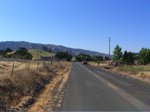
One of my favorite landscapes: Pleasants Valley Road, running north from the Fairfield/Vacaville area, just north of Interstate 80, up to pretty close to nowhere on state Highway 128. This is one of the places I think of as a real California place: hills and low mountains folded up, the winter’s green grass turned golden in the heat of the early summer, and just three or four miles to the east, the table-flat margin of the Sacramento Valley.

Kate and I were going up to some friends in Fair Oaks, east of Sacramento, on Friday. I took the afternoon and early evening to ride from Berkeley to Davis, about 100 miles the way I go. In the summer, you can count on much warmer weather as you travel from the coast to the interior here. Define “much warmer.” It might be in the low 60s at the beach, low 70s around the shore of San Francisco Bay, and in the low 90s to low 100s as you move from the valleys east of the coastal mountains into the Central Valley. In Berkeley, the transition happens as you cross the hills headed east; there’s a short stretch on one of the roads up there where in the space of 100 yards or so the marine influence vanishes, the temperature rises, the humidity drops, and you’re in the interior.

I could tell Friday’s ride would be warm. It was pushing 80 in Berkeley when I left at 12:30 p.m. I couldn’t have told you how hot it was later, just that it was. Later I saw that the official temperature was in the mid to upper 90s along the route I took; my bike computer’s thermometer, which gets the sun-affected, on-the-asphalt reading, recorded a high of 115.

On my route, you hit Pleasants Valley Road after 65 miles or so. It marks the only place along the way where you have an extended feeling of having left the sprawl truly behind: 13 rolling, twisting miles, orchards giving way to ranches, deluxe estates, and then ranches with orchards. Beautiful even in the heat, though I was less inclined than usual to just drink in the scene.

Technorati Tags: , , ,

Ride

Out of the house this morning at 7:30 to lead a ride from Berkeley up to Davis, near the western edge of the Central Valley. It’s 60 miles away by car; 100 miles by my zig-zagging cycling route. The unknown this morning was whether more than one or two other people would show up to ride; the uncertainty was occasioned by a good rain last night that had been forecast to last into the morning. But the weather had cleared by dawn, and I went over to the meeting place hoping maybe three or four or five people might show. Instead, 14 riders appeared, including two pairs on tandems. The roads were wet but the sky was mostly clear and the winds mild all day. Compared to many of the longer rides in this area, which feature lots of hill climbing, this route is mostly rolling. But even the constant up and down of mini-climbs can wear you down, and I was pretty tired when we finally rode east from the last small hill on the route into the flats of the valley (it really is that abrupt). Our goal was to get to Davis in time to get something to eat, then get on a 4:25 p.m. train back to Berkeley. No problem — we ate at a place across the street from the station, rode over and got tickets, waited 10 minutes for the train, quickly loaded the bikes (a large section of one car was devoted to bike racks), and had a fun ride back home as the sun set. Hard to beat.