On the Bike: Ink Grade

Inkgrade031007

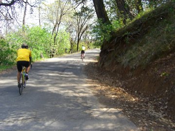
My friends Pete Danko (nearer the camera) and David Darlington (up ahead) during a ride we took Saturday from Yountville (just north of Napa), into the hills east of the Napa Valley up to Pope Valley, then back over the hills to the Napa Valley near Oakville. In the picture, we’re going up Ink Grade on our return–a mostly gentle, narrow, winding, shaded climb with virtually no traffic. We’ve done this ride together before, but yesterday we went out so Dave could take pictures for a Napa Valley cycling article he wrote for Wine and Spirits magazine; Pete and I got to star in lots of pictures (though it’s unclear if any of them will be published, because I think he found some more comely cyclist/models late in the ride). Stopping often to take pictures made us really take it easy for most of the day, which was a great change from my usual “I’ve got to cover X miles today” approach to riding.

Technorati Tags: , ,

On the Bike: Weather Edition

Tomorrow’s event, part two of the qualifying series for this August’s Paris-Brest-Paris exercise in transatlantic self-punishment, is a 300-kilometer ride. That’s 188 miles in universally recognized American distance units. We’ll start at the Golden Gate Bridge at 6 a.m., ride up through the interior valleys of Sonoma County to the town of Healdsburg, head out along the Russian River to the townlet of Jenner, then ride down the coast highway to Point Reyes Station, where we’ll swing inland to go back to the bridge (the foregoing provided for those who want to keep score at home). Based on past experience, this will be something I’ll be doing well into the evening.

The hard part is: rain. The sky is clear out there now. But for the past two or three days, the forecast has predicted rain and, for the return trip on the coast, headwinds. I’ve been meaning to write a little something on the blessing and curse of modern weather forecasting for the modern bicycle rider. By which I mean: The blessing is that the sort of forecasting that’s possible today, along with tools like Doppler radar and satellite water-vapor imagery, can give you a pretty clear idea of what you’re riding into and when; the curse is that you become the prisoner of a prospective and freely revised reality.

Weather forecasting is highly model driven, meaning that a bunch of unimaginably fast and powerful computers are applying sophisticated mathematical models to the wealth of weather data pouring in from all over the globe; when the machines finish their model-assisted number crunching, they spit out a picture of the way the world will look in 12 and 24 and 48 hours and so on. Then forecasters take these visions of the world as the models predict it and try to turn them into forecasts. Except: Sometimes the forecasters are confronted with two or three or six conflicting, or at least significantly varying, takes on what tomorrow and the day after and the day after that, ad infinitum, will look like. Then the humans have to do something that is a cross between highly educated guesswork and astrology: often, based on observations about which models have “verified” recently, they’ll make a prediction based on a compromise reading of models or just lean on the model that seems the most trustworthy in a given set of circumstances.

The curse, more specifically, is that we can all look at the developing forecasts, read the forecasters’ reasoning, even consult the raw data if we think we can handle that. Which means, in the end, we don’t get a minute’s rest thinking about whether it will rain, how much it will rain, how awful the headwinds will be out on the road. On balance, it seems like it would be simpler, and much more peaceful for the soul, to just look out the window before you get on your bike. But that would be much too simple and would fail to make the best use of our high-speed Net connections.

Time for bed now, right after I check the forecast and the radar again.

Technorati Tags: , , , ,

When You Care Enough …

Looking for route information for a Chicago-area bike ride, I came across this dark, ironic and bitterly funny highway-safety site from the Chicagoland Bicycle Federation: drivewithcare.org. It pitches “Bob Fuller’s Roadside Memorials,” a service that promises careless drivers a way to show they regret killing people along the road:

“If you drive carelessly in the City, eventually you’ll kill somebody. When you do, turn to us. Just call from the scene. We’ll deliver a fitting handmade Roadside Memorial in 30 minutes or less. Choose from our handcrafted collection, or personalize your own. A Bob Fuller Roadside Memorial is a tribute to the person you killed. A way to say, ‘I’m sorry.’

Motorist/killers can choose from several themed memorials, including “The Jogger” ($19.95 — comes with a pair of used running shoes draped around a centerpiece cross).

Technorati Tags: ,

On the Bike

Saturday I drove up to Napa to spend the night at my friend Pete‘s house. The idea was to get up there so that we could get an early start for this morning’s Tour of Napa Valley, an annual 100-mile ride up and down the valley and in the hills to the east and west. We hit the road with Pete’s friend and wine-industry colleague Peter Marx at just after 6:30 a.m. Pete’s half-serious goal was to finish the ride in six hours, which is a little faster than I’ve ever done a century.

The route starts with about 10 miles of perfectly flat valley-floor road for a warmup — a warmup needed especially this morning because it was foggy and chilly. Then it heads up Mount Veeder, a long gradual climb (about 1,300 feet in all) that gets steep in the last mile and a half or so. That’s followed by a short descent, short climb, then a long, steep, twisting, technical descent, another very short rise, then a long, straightforward downhill run back into Napa. After that, you cross the valley and head up one of the two main north-south routes, Silverado Trail (the other is Highway 29). It’s a flat to slightly rolling ten miles, followed by a short, gradual climb on Highway 128 up to a small reservoir (Lake Hennessey), then a longer but also gentle uphill along one of the creek’s that flows into the lake. The lunch stop was at mile 66 in Pope Valley, a still pretty remote ranching and wine-growing area; after that, there’s a moderate four-mile climb up a road called Ink Grade (rule of thumb: anything with “grade” in its name means you’re going to work), and after that two or three miles of hilltop rollers before a long, very fast descent back toward the valley. Eventually, you wind up back on Silverado Trail, southbound this time, and it takes you nearly all the way back to the start.

Did we make it in six hours? Not quite. There was just enough hill-climbing to keep the linebacker types, like me, from going real fast. I descend like a safe coming down the road on casters — very elegant. But my advantage comes on long, flat stretches where I can just get out and motor; I’ve gotten pretty good at maintaining a pace — not racing speed; more like taking-care-of-business speed. We all worked pretty hard all day and made it in just over six and a half hours. Bottom line: We were still having fun at the end.

Tonight? Tired, and hungry, too.

Technorati Tags: ,

July, California

Pleasantsa070706 Pleasants070706

One of my favorite landscapes: Pleasants Valley Road, running north from the Fairfield/Vacaville area, just north of Interstate 80, up to pretty close to nowhere on state Highway 128. This is one of the places I think of as a real California place: hills and low mountains folded up, the winter’s green grass turned golden in the heat of the early summer, and just three or four miles to the east, the table-flat margin of the Sacramento Valley.

Kate and I were going up to some friends in Fair Oaks, east of Sacramento, on Friday. I took the afternoon and early evening to ride from Berkeley to Davis, about 100 miles the way I go. In the summer, you can count on much warmer weather as you travel from the coast to the interior here. Define “much warmer.” It might be in the low 60s at the beach, low 70s around the shore of San Francisco Bay, and in the low 90s to low 100s as you move from the valleys east of the coastal mountains into the Central Valley. In Berkeley, the transition happens as you cross the hills headed east; there’s a short stretch on one of the roads up there where in the space of 100 yards or so the marine influence vanishes, the temperature rises, the humidity drops, and you’re in the interior.

I could tell Friday’s ride would be warm. It was pushing 80 in Berkeley when I left at 12:30 p.m. I couldn’t have told you how hot it was later, just that it was. Later I saw that the official temperature was in the mid to upper 90s along the route I took; my bike computer’s thermometer, which gets the sun-affected, on-the-asphalt reading, recorded a high of 115.

On my route, you hit Pleasants Valley Road after 65 miles or so. It marks the only place along the way where you have an extended feeling of having left the sprawl truly behind: 13 rolling, twisting miles, orchards giving way to ranches, deluxe estates, and then ranches with orchards. Beautiful even in the heat, though I was less inclined than usual to just drink in the scene.

Technorati Tags: , , ,

Ride

Out of the house this morning at 7:30 to lead a ride from Berkeley up to Davis, near the western edge of the Central Valley. It’s 60 miles away by car; 100 miles by my zig-zagging cycling route. The unknown this morning was whether more than one or two other people would show up to ride; the uncertainty was occasioned by a good rain last night that had been forecast to last into the morning. But the weather had cleared by dawn, and I went over to the meeting place hoping maybe three or four or five people might show. Instead, 14 riders appeared, including two pairs on tandems. The roads were wet but the sky was mostly clear and the winds mild all day. Compared to many of the longer rides in this area, which feature lots of hill climbing, this route is mostly rolling. But even the constant up and down of mini-climbs can wear you down, and I was pretty tired when we finally rode east from the last small hill on the route into the flats of the valley (it really is that abrupt). Our goal was to get to Davis in time to get something to eat, then get on a 4:25 p.m. train back to Berkeley. No problem — we ate at a place across the street from the station, rode over and got tickets, waited 10 minutes for the train, quickly loaded the bikes (a large section of one car was devoted to bike racks), and had a fun ride back home as the sun set. Hard to beat.

Near the End of the Ride

November26

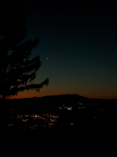
The natural destinations for cyclists in Berkeley often involve riding up into or crossing the hills that rise behind the city to the east. I went out for a kind of standard short ride late this afternoon: Up the west face of the hills on a gentle ascent (though not so gentle in my current state of fitness) called Spruce Street, through Tilden Park, a big regional open space that covers most of the top of the hills, then down to San Pablo Dam Road, which runs along the eastern base of the hills. It’s about nine and a half miles each way, and each way features a climb of seven hundred to eight hundred feet, a rolling section, then a long fast descent. Riding back into Berkeley, I came down into town on Euclid Avenue; near the top of the street, there’s a vacant lot — maybe it’s a park, though I haven’t seen any signs — with a clear view out to the west. Riding down Euclid near sunset, I often see people who have driven or walked or cycled to the spot to take in the vista. Tonight was the same. The weather has taken a cool turn (not to say cold, out of respect for those who live in places where it really does get cold), so people out in the twilight were kind of bundled up. The view here is across the bay to Mount Tamalpais. I’ll never get tired of seeing our mountains and ridges against the sky, especially against the evening sky.

Solstice Ride

The summer solstice occurred at 11:46 p.m. last night, the 20th. I didn’t go out and fire off my handgun, because I forgot to buy one and I don’t have any ammo.

So today: The first full day of summer. The days are just about as long as they’re going to get. I spent the day in my office at the law school, and didn’t think much about the season. But when I got home, I decided to try to fight past my usual evening inertia and go out for a ride.

I didn’t get started till nearly 8 (7:54, actually), but figured I had enough time to make it to the highest point of Grizzly Peak Boulevard in the Berkeley Hills to see the sun go down (according to the online and newspaper almanacs I’ve found, sunset was at 8:35 p.m.).

I made it up to the little pullout where people go to look down on the city and watch the evening come on when the weather’s clear (there are plenty of evenings when the fog cuts visibility to 100 feet or less up in the hills, and I’ve been riding up there then, too). I made it without about three minutes to spare and watched the sun disappear behind a mountain peak somewhere in northwestern Marin County. Then I got on my bike and started to ride away when someone said, “Dan!”

It was my neighbor Piero, with his son Niko. We’d been standing about 10 yards apart, I’d guess. But all of us were so focused on watching this first day of summer close that we never saw each other. They drove back down, and I finished my ride.

Modest Proposal: Cycling Edition

I belong to a bike club here in Berkeley. That is, I pay my dues, subscribe to the email list, and once in a very long while go on a club ride (my riding habit is usually solitary, an effect of taking a long time to get going on weekend mornings).

The club’s email list is mostly informative and entertaining, but sometimes given to extended pissing matches over who knows how much about some arcane (or perfectly ordinary) facet of cycling. The latest example: Member One posted at random about his love of a certain brand of tires for riding in the rain. It’s not the first time he’s touted the brand; I don’t know whether he’s getting a kickback or what. Member Two quickly chimed in, as he did once before, to observe that the tires in question go on the rim very easily — too easily, in fact, because he had one blow off his rim during a ride once. Member Two would never use that brand of tire.

The exchange inspired me. Quoting myself, here’s my contribution to the discussion:

I’ve been experimenting this year with doing away with tires altogether and just riding on some bare old rims that have been lying around the house for years. Straight-away traction, let alone cornering, is a bit tricky until you have a few miles on the unadorned rims. That’s all it takes for the local pavements to roughen the metal surface and give you a secure grip on terra firma. Talk about getting a good feel for the road! But for the lack of a tire, it’s practically like riding sew-ups.

Old steel rims are particularly fun to ride after dark; as a paramedic I met after one ride said, the chro-mo wheels create "quite a light show" as you career down the macadam. And if that’s not enough to persuade you of the virtues of rubber-less riding — shut your ears to the nay-sayers who complain about the slight increase in noise — just think about the weight savings: Since you don’t need to worry about flats (or tires blowing off) anymore, you don’t need spare tubes, patch kit, tire levers, or pump, either (but just as you would on a pneumatically cushioned jaunt, remember to  bring your medical and dental insurance cards with you when you ride rubber-less).

With all these advantages, word on "the street" is that Trek has hooked up with Bridgestone, the Japanese tire and bicycle maker, to develop a more durable "naked" rim for both both road and off-road riding. I’ve also heard that Rivendell is considering offering a new model — tentatively named the "Orc" — equipped with tireless rims and featuring no brakes.

I’ll admit I won’t be satisfied unless at least one club member takes this seriously.