Eclipse Road Trip, Days 8-10: Mountains and Motels and Stuff

Along Highway 487, north of Medicine Bow, Wyoming.

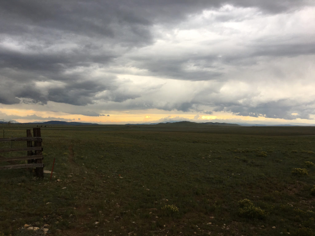
We witnessed the eclipse in Casper, Wyoming, took our time packing up, had an early dinner downtown, and then headed out on an alternate route toward Denver, state highways 220 and 487, thinking to avoid the parking lot that Interstate 25 had become with the Eclipsed Masses heading back to their lives.

In fact, there was very, very little traffic along 487 — although probably a lot by that highway’s standards — and we didn’t see any signs of the masses until we hit the settlement of Medicine Bow, which I recall being the setting, sort of, for the old TV western (and perhaps the movie and novel that preceded it) “The Virginian.” In the dusk, a long line of cars waited to gas up at what looked like a two- or four-pump gas station; a large crowd milled around in the huge parking area outside the adjacent store.

We finally joined the main exodus when we got to Interstate 25 in Cheyenne, and had about 40 miles of stop-and-go traffic down to Loveland, where the first thing we saw when we got off the freeway was a couple fighting on the side of the road (yes, I stopped to see what was happening when the woman appeared to flag us down; seeing that alcohol appeared to be involved, that the parties didn’t appear in danger of doing each other any real physical harm, and that they didn’t want the services of local law enforcement, we went on our way. They turned out to be staying at our motel).

Along U.S. 285 near Fairplay, Colorado.

***

Anyway. I don’t have time this morning — Thursday, in Moab, Utah — to give a blow by blow of what took us from there to here. But Tuesday took us to Denver International Airport, where The Dog and I took leave of Kate, who flew back to the Bay Area so she could be at work on Wednesday.

Then The Dog and I — I did the driving — headed out of the Denver area on U.S. 285, through a couple of pretty vigorous mountain thunderstorms, across Kenosha Pass and South Park and eventually to U.S. 50, where we turned west and stayed the night at a mountain lodge. (My brief adventures trying to find the hotel, just below 11,312-foot Monarch Pass, and my hourlong radio appearance by phone from my Wi-Fi-less, cellphone-less hotel room on KQED’s “Forum” program are entertaining details perhaps to be expanded upon later.)

Along Colorado Highway 145, near Norwood.

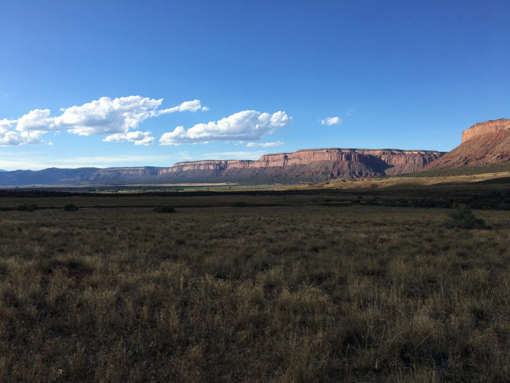
Wednesday we crossed Monarch Pass on U.S. 50, then wound our way south and then west and then north from Montrose, Colorado, to Moab (U.S. 50, U.S. 550, Colorado highways 62, 145 and 90, Utah 46 and U.S. 191 were all encountered in this leg of the journey).

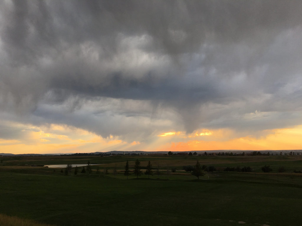
All I can say about this part of the world: It’s insanely beautiful, with virtually every turn revealing something I’m taken aback by. And what a varied landscape, from mountain crags to miles and miles and miles of red rock canyons and from dense conifer forests to oceans of sagebrush.

***

We’re about 900 miles from Berkeley at this point, and I was tempted to try and do it all in one go. But I won’t. Today we’re headed for Ely, Nevada, about 400 miles away. That will leave us with a long but eminently do-able drive tomorrow (I used to drive the 500 miles from Berkeley to Eugene at the drop of a suggestion; traveling solo with The Dog, however, is slower. Plus I’m always stopping to gawk at something or to read a roadside plaque).

More later.

Near the town of Bedrock — seriously — on Colorado Highway 90.

Eclipse Day: Casper, Wyoming

Well, just under over three hours to T-Time. T for totality. The sky is clear but a little smoky here. Off to the north, a bank of high clouds is visible. Is it headed this way?

From the final, very complete forecast discussion published at 2:48 a.m. by the Riverton office of the National Weather Service:

“… Natrona county, including Casper, will lie within the other good area to view the eclipse as it will likely be mostly clear and sunny to begin the day with high clouds not making it into the County until after totality, through the afternoon. There is also one additional caveat to this astronomical event – smoke cover. The forecast area will see another frontal push through the area later this morning perhaps bringing in more wildfire smoke and causing or continuing some visibility decrease (keeping the sky a bit hazy side even without the clouds). Again, none of these factors will keep the eclipse from being viewed – but may somewhat limit how it/what can
be seen around the eclipse itself…especially near/at totality. On the other hand, the colors associated with this kind of filtering could be quite dramatic.”

Eclipse Road Trip Day 7: The Loneliness of the Long-Distance Eclipse Chaser

U.S. Post Office in Lodgepole, Nebraska.

Starting midday Saturday from Sidney, Nebraska — a town of 6,000 just off Interstate 80 in the southwestern corner of the Nebraska panhandle — we drove east on U.S. 30 through the towns of Sunol and Lodgepole (or Lodge Pole, if you believe the lettering on the Post Office building there).

Lodgepole was one of my destinations on this trip. According to letters from one of my great-great-grandfathers, Timothy Jeremiah Hogan, his parents moved their family to this part of Nebraska in the mid-1860s to work on the Union Pacific railroad. Tim suggests they lived first in Lodgepole, then Sidney, 16 miles west, so the family would have the protection from hostile Indians in the area.

We hung around Lodgepole for maybe 30 or 45 minutes. I took pictures, naturally. We cruised by the most substantial building in town, the old brick public school — every small Nebraska town seems to have one. Then we were off again in the rain — we were caught in the beginning of a pretty persistent thunderstorm — and stayed west on Route 30, then turned north on Nebraska 27 to Oshkosh, on the North Platte River.

North of Oshkosh, the state blacktop ends and you begin a 60-mile stretch that begins with well-maintained dirt roads for roughly the first (southern) half of the drive and continues on a single lane of choppy asphalt for the second (northern) half.

The reason you take that road, which goes through the Crescent Lake National Wildlife Refuge, is that it’s crossing one of the more remote parts of Nebraska’s Sand Hills.

The Sand Hills are a sweeping expanse of grass-covered dunes — about 20,000 square miles — said to have formed after the last ice age. And driving through on a road that twists and turns and somehow always seems to be climbing, it’s apparent you’re traveling through sand dunes being held in place by grasses and wildflowers (chief among the latter: black-eyed susans).

Anyway. I thought the Sand Hills would be the ideal place to watch the eclipse, and yesterday’s drive was to scout out the road. We saw a dozen, maybe 15 other cars, almost all with out-of-state plates, apparently doing the same. Passing ranches along the road, I had the same feeling of eclipse envy I experienced elsewhere on our trip — “Gee, these people live right here where the show is happening. Aren’t they lucky. I wish I could stay here.”

Near Crescent Lake National Wildlife Refuge in the Nebraska Sand Hills.

We got off that Crescent Lake road a little before 6 p.m. — another product of our late start — and headed east on Nebraska Highway 2, which runs for about 125 miles or so right through the heart of the Sand Hills. Our destination was Valentine, on U.S. 20 right up at the top of the state, and adding in that we crossed into Central time and lost and hour, we didn’t get off the road until 10 (it was all beautiful, though — even the lightning show to our east at dusk.

We checked into our hostelry, which I’ll call the Sketchy Rest, walked the dog, and then began checking on the latest Monday morning forecasts for the Sand Hills.

I want to say here that I am an inveterate, if not a sophisticated, reader of weather forecasts of all kinds. As I pored over forecast discussions and graphical forecasts and meteorological whatnot, the consensus from those who study computer models to understand upcoming weather was that it was likely to be cloudy in the Sand Hills on Monday morning. Part of me simply doesn’t want to believe that and found it hard to picture after experiencing one beautifully sunny follow another all the way through our trip. That included Saturday, when the Sand Hills were framed by distant, rising thunderheads but were spectacularly clear along our road.

The forecasts hadn’t improved by this morning (Sunday), so we went looking for options.

The forecast for Casper, Wyoming, was for clear, clear, clear skies. Plus, it’s close to the center of the eclipse path. What if we could find a place there?

I checked motels. There were a few room on offer online — $2,000 for a single night. No.

Kate, whom I believe is both charming and lucky (she wound up with me, after all), started to call motels. She found some friendly innkeepers, but no room.

I checked Craigslist. There was a single listing for a sort of in-law unit near the south end of Casper. No price listed. I got in touch with the person who posted the place. We talked. A price was agreed on (he happened to name the figure that Kate and I had previously agreed would be our maximum; more than I’d pay in any other circumstances, I think, but not a killer — and not anything like $2,000).

So we hit the road to Casper from Valentine — 325 miles on top of the 2,000 from the previous six days — rolling west on U.S. 20 about 1 p.m. It was a fast trip, with the usual dog- and picture-related stops, and we pulled in here just after (we gained an hour traveling back into Mountain time).

The sky when we got here? Starting to cloud up. Thunder was rolling. The light and storm clouds were beautiful. The stars are out tonight, though, and the forecast is still for sunny (and smoky) skies in the morning. Except for this one note from the regional forecast office, which noted the likelihood of some smoke in the air:

“One other feature to watch is (a) thinning band of higher clouds that is forecast by some of the guidance to be between the Wind River Basin and Casper around totality time. It may be clearing the Wind River Basin/Riverton vicinity in time and then possibly affect the Casper area between 11 and noon. May be a rather narrow band then but there could be some concern for viewing in this narrow cloud feature.”

Kate just reminded me that the moon will start crossing the sun’s disk here at 10:22 a.m MDT. Totality will occur at 11:43 a.m. I wonder where that cloud will be.

Sky above Casper, Wyoming, Aug. 20, 2017.

Eclipse Road Trip Day 3: Twin Falls to Jackson

Once upon a time — at least 20 pounds and a decent quantity of decent muscle mass ago — I used to do long, long bike rides. The kind where you’d be out all day, sometimes all weekend, sometimes longer. A natural obsession attached to these rides: Would it be raining? Would it be hot? Would there be unfriendly winds. None of those factors would typically dictate whether you’d do a ride or not, but it was an important factor in planning and indulging your worst bad-weather anxiety.

So now, we’re driving across the western United States with the idea that we’ll see the August 21 eclipse in the general area of Nebraska Sand Hills. We’re about halfway there now, and we’re starting to take the weather forecasts seriously. And while I normally wouldn’t care about the weather in a place I’m visiting — It’s cloudy? Is that a problem? — the forecast for Greater Western Nebraska isn’t so sunny right now.

In fact, if you read the forecast discussions for the four National Weather Service offices handling forecast for the area from the Idaho Rockies to the west-central Nebraska, the word “pessimism” has crept into the several-times-daily notes. Three examples (and about the jargon: GFS, ECM and European are all forecaster shorthand for supercomputer-driven numerical weather models; 12Z (or other numbers) refers to the time the most recent model run was completed in UTC (universal) time (Z stands for Zulu, and apparently comes from military usage):

Pocatello, Idaho: GFS and European continue to offer up different
solutions. GFS is more pessimistic for us. It monsoonal moisture into the region Sunday. This could produce viewing issues for the eclipse in terms of scattered areas of clouds and showers. The European on the other hand keeps the monsoonal moisture south of us for Sunday and Monday and provides much better viewing for the eclipse. The forecast favors the pessimistic solution and includes partly cloudy skies with slight chances of showers and thunderstorms. At this point, we do think the eclipse will be viewable, but there may be a few clouds in some areas. However the consensus models are leaning more towards the European solution so hopefully the GFS will move into that direction as well within the next couple of runs. Forecast for Tuesday and beyond continues to look unsettled. Even the European draws monsoonal moisture into our region for midweek.

Riverton, Wyoming: For Monday, Eclipse Day, the 12z model runs still indicate that a weak surface cold front is progged to move into the northwest portion of Wyoming and will bring with it some mid to high clouds into the region during the morning. The models seem to indicate that the frontal boundary should weaken and become diffuse during the day as it attempts to move southeast into the state. The low level southwest flow ahead of the boundary should also result in more low/mid level moisture and partly to mostly cloudy conditions expected across the forecast area from the morning into the afternoon. It is expected that there should be some isolated showers/storms over the western mountains due to expected slight instability.

Cheyenne, Wyoming: It continues to be a tricky cloud forecast for Eclipse Day (Monday) with west-southwest flow aloft and decent H7-H3 [upper atmospheric] moisture. There are still considerable differences though in the RH [relative humidity] fields, so opted to maintain a partly cloudy forecast for most areas.

North Platte, Nebraska: The cloud forecast Monday continues to evaluate the potential for high cloudiness which could partially obscure the eclipse.

The ECM and GFS shows subtropical moisture aloft moving across the Rockies which could produce scattered or broken high cloudiness around noon Monday. The GFS also indicates substantial low level moisture and stratus across Wrn/Ncntl Neb leftover from heavy thunderstorms across Ern Neb Sunday night. The ECM produces the thunderstorms across SD but shows the same moisture in place like the GFS. Thus, it is possible significant cloudiness will occur Monday.

As a result, the sky forecast for noon Monday has been increased from 35-40 percent yesterday, to 40 to 60 percent with the forecast today.

Important to remember: While the forecast models are sometimes shockingly good, they also miss. We’re more than 100 hours out from the eclipse right now, and there’s plenty of time for things to evolve. Right now, though, I’m rooting for monsoonal moisture to keep its ass parked well clear of the eclipse zone; the same for stray moisture and frontal boundaries and all other atmospheric interference with OUR EVENT OF A LIFETIME. You listening, cloudmakers?

***

Anyway. Isn’t this supposed to be a road trip?

We started out in Twin Falls, Idaho, today, walking through a mall to the Petco with, guaranteed, the most scenic view in all of Petco World. Or, it would be the most scenic view if the entrance was at the back of the store, because that’s where you can look down into the Snake River Canyon of Evel Knievel fame.

Alas, Evel is pulling his cheap stunts in the afterlife now (and maybe still getting upstaged by Richard Nixon). But there were base jumpers leaping, one after another, from the big beautiful steel arch bridge that carries U.S. 93 across the canyon. Here’s a video — watch it full screen — that sort of conveys what that was about:

Twin Falls Base Jumpers from Dan Brekke on Vimeo.

At the visitors center, near the Petco and overlooking the bridge, I had a talk with a guy who arrived with a daypack and a longboard-style skateboard who confided early on, “I’m a bum. I live down in the canyon.” But what he really wanted was to talk about losing a camera over the side of the canyon rim earlier in the week. He also confided he was an old time base jumper who had gone off the high bridge outside Auburn many times (OK — he said 1,000 times).

After that, we headed up 93 and saw lots:

An aqueduct that a bunch of kids — wearing personal flotation devices, all of them — were getting ready to jump into for a 20-minute trip downstream.

Untitled from Dan Brekke on Vimeo.

A memorial to a guy who crashed in February off U.S. 26 on the edge of Craters of the Moon National Monument; the debris field from the crash was still present, as was a memorial to “The Highwayman.”

A roadside memorial alongside U.S. 26 near Craters of the Moon National Monument.

Lava. Lots of lava.

Arco, Idaho, which advertises itself as the first place in the world to use electricity generated by atomic power (circa 1955). The proprietor of the Lost River Valley espresso shack served us a latte and a cappuccino. We talked eclipse, since Arco is in the path. Was she bringing on extra help? Her sons would be there, she said. “I started this business for them — they’re both autistic. They’re home today. … They’re anxious about all the people who’ll be showing up. …”

Idaho Falls. Bought gas there. By the way, the mileage on a Toyota 4Runner — the only car Hertz had to give us after I asked for a small SUV — sucks.

The towns of Shoshone, Richfield, Carey …

The Snake River. Swan Valley. The Grand Tetons. Jackson Hole. And that’s where we are tonight.

Tomorrow? We have a reservation in Casper, Wyoming. We’ll be looking at the weather.

Eclipse Road Trip Day 2: Tahoe City to Twin Falls

U.S. 93, north of Wells, Nevada.

A quick entry, since I’ve waited until after midnight to sit down and get something down.

As planned — I have never made so many reservations in advance in my life — Tuesday is supposed to be our longest day driving on the way to western Nebraska. We got started from Tahoe City, on the northwest shore of Lake Tahoe, at 9:35 a.m. PDT and pulled in here, about 510 miles later, at about 8:45 MDT — a drive of a little over 10 hours. Things got slow in the last couple hundred miles because I wanted to stop and take pictures at several spots along the way. Like the shot above, looking north on U.S. 93 about 30 miles north of Wells, Nevada, and 85 miles or so south of Twin Falls, Idaho.

A word about eclipse weather: We are now inside the window where the National Weather Service is offering a forecast that includes Monday, Eclipse Day. And what do you know? The outlook is iffy for most of western Nebraska. Of course, there’s not a forecast in the world that can make a call for a two-and-a-half-minute period that’s still six days out. But now we’ve got something to obsess about other than where exactly we’ll be standing when the celestial machinery does its thing.

Tomorrow’s destination: Jackson, Wyoming.

Solar Eclipse Countdown: Out There in Flyover Country

2017 EclipseLike many another skywatcher who has never seen a total solar eclipse, I’m scouting places to see the big event that will, failing a world-ending electoral event in the interim, occur a year from now.

For Californians, Oregon is the natural eclipse-watching destination. The path of totality will cross the Beaver State just north of Bend, east of the Cascades and an area that’s reliably sunny.

Lots of people have figured out that this part of Oregon is strategically located. The owner of a 72-room motel in Madras, along the line where totality will be longest in the area — 2 minutes and 3 seconds — says his place has been booked for more than three years.

I admit I can imagine a crowd descending on the area and the roads resembling something like rush hour here in the Bay Area. It’s not an inspiring thought. Still, we’re checking to see what lodging alternatives there might be up there.

My thoughts also tend further east. Maybe to the High Plains. It’s a different world out there. In noodling around looking for places one might stay out in flyover country, I happened across the following description of a tiny hostelry in a very small town. It’s one of the best things I’ve read today. Here it is:

There is a very slim chance that you are going to visit the Longhorn Motel in Tryon Nebraska. There are several reasons for this, chief among them that almost no one lives in Tryon, and it is not on the road to anywhere. The Longhorn’s primary mission in life is to serve as an overflow bedroom when more than one relative comes to visit a resident of Tryon at the same time.

You will not break down in or near Tryon because, as noted above, it is not on the road to anywhere.

Should you need to visit in Tryon, the Longhorn is the ONLY place to stay. That is literally the truth. The rooms are quite small but very clean. Your hosts, Mr. and Mrs Pyzer, are without a doubt the friendliest motel hosts in the business, There is a small TV in each room connected to the satellite system, so there is a wide range of programing available. If you want coffee in the morning the Pyzers will give you the fixins before you turn in. Even though they have a bona fide monopoly on rooms to rent, $40 will get you the finest room in the place.

Sadly there is not WIFI hook up, but all is not lost. One block west on the other side of highway 92/97 sits the McPherson County public school. The school has a nice strong signal to which you can connect if you park near the handicapped parking spots along the highway in front of the school.

The Longhorn does not provide breakfast but just a block and a half west you will find Aunt Bea’s Restaurant. Aunt Bea is a middle aged gentleman who fires up the grill about 9 each morning and can whip you up a sausage breakfast that should make Ronald MacDonald hide his head in shame.

As I said before, you are probably not going to be in or near Tryon, but if you are, you will experience first hand the friendly nature of the folks who live in Nebraska’s fabulous Sandhills. If you do not know what the Sandhills are – you do need to get out more.

Room Tip: All the rooms are good but #3 is the best among equals!