Journal of Holiday Greeting Studies, Boxing Day Edition

On Christmas Day, we went out to a spot on the other side of the Richmond-San Rafael Bridge to check out the bird life on a trail around a tidal marsh and channel. There was lots to see — mostly waterfowl and shore birds with the odd raptor and corvid thrown into the mix. We encountered many two-legged mammals, too. Generally speaking, when I find myself passing someone else on a trail, I make it a point to acknowledge the other person in what I hope is a friendly way. That just means saying hi as we pass. If the greeting’s returned, that makes for a small moment of grace in which my fellow walkers and I are no longer strangers. If the greeting’s not returned, I try not to take it personally. Some of the people we passed the other day responded to a “hi” by saying “Merry Christmas.” Nothing wrong with that, but I admit that to me the phrase feels a little stilted, and I didn’t lead with it myself because, you know, not everyone you run into along the way is celebrating that particular occasion. In any case, it was a good walk with lots of birds and perhaps people were feeling a little less shy about greeting each other because of the day.

Then yesterday, December 26, we went for a walk in the Berkeley hills. I turned our conversation toward the topic of two observances that fall on the day after Christmas: St. Stephen’s Day and Boxing Day. Would it be appropriate, I wondered, to wish someone “Happy St. Stephen’s Day”? When one recalls the occasion commemorated by the day — the stoning death of the man reputed to be the first Christian martyr — no. But how about saying “Happy Boxing Day”? It’s a curiosity, for sure, dating back to the 18th century English custom of giving employees and tradespeople gifts or cash the day after Xmas. But despite its obscure origins and non-American provenance, I figure lots of people have heard of it. So I decided to try it out as a greeting for hikers we met along the trail.

And I’m delighted to report that the general reaction (from about 10 parties we passedo n the trail) seemed to be, well, delight. People laughed or smiled and said “happy Boxing Day” in return. Why? I’m thinking because it was unexpected and just arcane enough to be recognized as an attempt at humor, at sharing the fun of being outdoors together on a holiday. Or something. You can try it yourself in 364 days.

In the meantime, Happy National Fruitcake Day.
Growth of the Nut

Back in August, I took a drive along some rural roads in Yolo County, on the edge of the Sacramento Valley, that I’d become familiar with on long bike rides 15 and 20 years ago. Most of the county is on the flat floor of the valley and was given over to agriculture — crops that even a city dweller like me could identify on the move included rice, sunflowers, alfalfa, tomatoes. Some nut and fruit orchards, too. That’s still a lot of what you see.

Northern and western parts of the county are hilly, though, and when I’d ride through, most of those areas appeared to be used for pasture with the occasional appearance of a grain crop wrapped around the hills’ contours.

In August, I was surprised to find that a lot of that former pastureland has been transformed into what I assume are almond orchards. I drove past a spot where, long ago, a couple of other cyclists and I had taken a break from riding against a fierce north wind. Back then, in 2006, it was a big open field with some abandoned-looking farm equipment that we ducked down behind to get out of the wind. Now that spot is all nut trees.

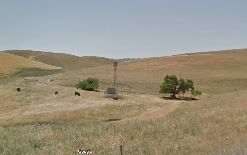
I stopped to take pictures along one of the routes I traveled, Road 6. Looking at the result — it’s the black and white shot below, which I just had developed — I realized that maybe Google Streetview would show the same scene over the years. The most recent shot Google has is from May 2012. Here’s a little of what the change looks like (and a before/after slider of the scene is here).

Along Road 6 in the Dunnigan Hills, Yolo County, May 2012. Credit: Google Streetview.
Along Road 6 in the Dunnigan Hills, Yolo County, August 2022. Credit: Dan Brekke.

The transformation is not shocking; it’s part of the vast expansion of almond and pistachio acreage that’s overtaken much of the Central Valley.

If you live here, the puzzling thing about this changed landscape is that the last decade is one of the driest periods, if not the driest, since California was colonized 250 years ago. The state’s water supplies are dwindling, a situation that’s supposed to become more challenging as the effects of climate change accelerate. Given that there’s not a lot of visible irrigation infrastructure here, I assume that water is being pumped out of the ground to support these thirsty orchards. I haven’t looked into who the adventurous growers or hedge-fund investors are who have launched this experiment in the middle of our drought. It’s quite a gamble.

Dawn of the Toot

Like many others put off or revolted or … — what’s stronger than “revolted”? — by developments at Twitter, I’ve started a Mastodon account — mostly to see if it’s a viable alternative to what I’ve gotten used to over the last 15 years as a news and information tool. This is still Day One, but early signs are that it might.

My major first-day “learning”: Individual messages are “toots,” not tweets. Did Mastodons really sound that way?

Was It Wild?

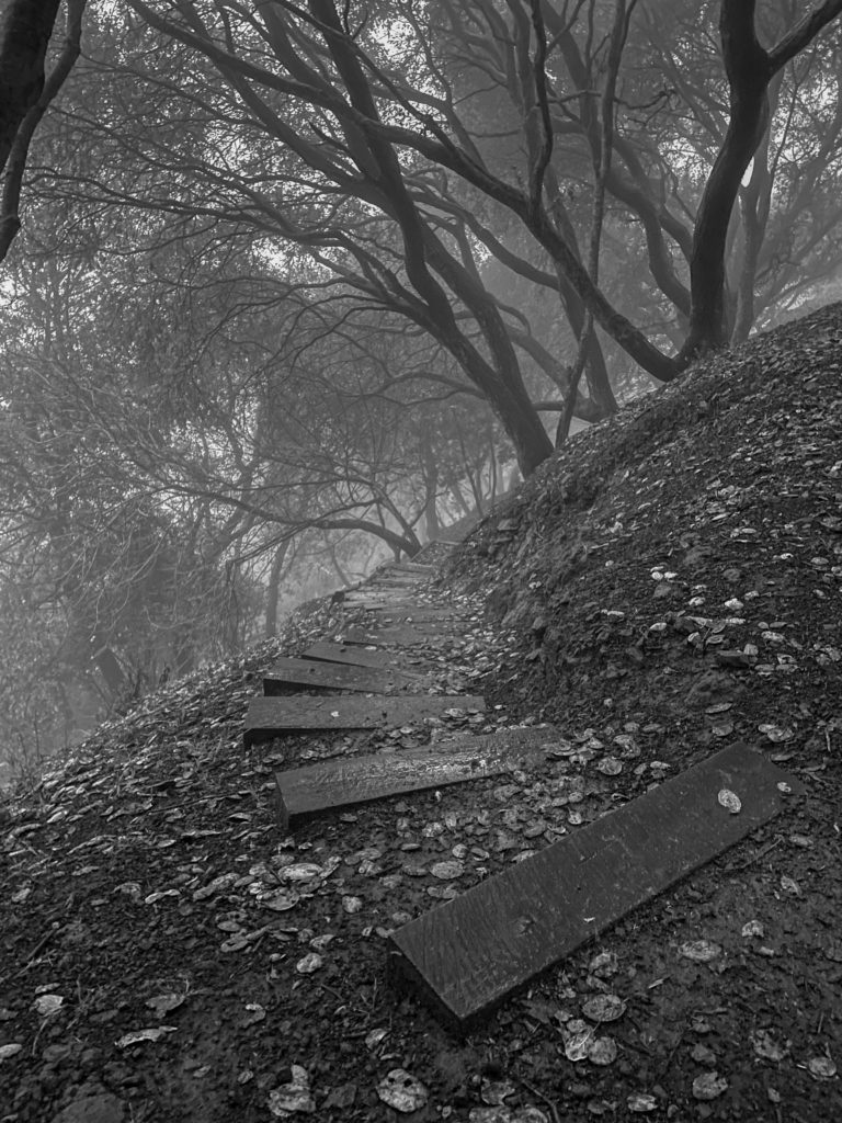
Boy Scout path, La Loma Park, Berkeley.

Late Guy Fawkes afternoon, the last bit of daylight before we turned the clock back an hour from “savings” to standard, I hiked up into the hills. It’s one of the best things about living here in Berkeley, the fact you can stroll out your front door and walk for miles and miles in any direction; and if you choose to head east and up, you’ll soon be far above the grid of city streets.

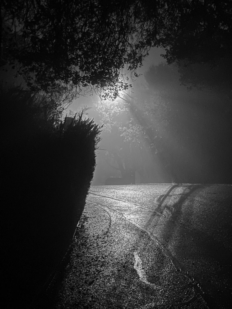
It was a misty, drizzly afternoon, with clouds hanging low. Less than half an hour from home, I reached the point where those clouds manifested themselves as fog and the mist and drizzle turned to on and off rain. I stopped at La Loma Park, an old quarry whose main features are a nice playground and baseball field, a working restroom, and, in clear weather, a view over the town below.

I stayed and listened. The dusk deepened and the fog seemed to dampen the noise that normally would wash up the hills from the freeway and street traffic and trains below. A single bird — a great horned owl if an app is to be believed — began calling.

After 15 or 20 minutes, I continued up the hill as it got dark, taking a series of stairways that bring you all the way up to Grizzly Peak Boulevard. Then it was downhill through the rain and fog in the dark.

All this reminded me of a nighttime walk many years ago, when my friend Gerry and I landed on the doorstep of a distant Irish cousin, Michael Joe O’Malley, for a nearly monthlong stay. This was on an island off the coast of County Mayo where at the time very few dwellings had electricity. There were no paved roads. Streetlights? No. One evening we hiked in the rain over to another cousin’s home. It might have been 10 o’clock when we departed on our return walk. The more civilized route would have been along a shore road to the dock and post office, the center of a little collection of houses. Instead, we walked up the road (a muddy track, really) over a steep ridge that led more directly to Michael Joe’s. I see from the journal I kept that the weather was clearing on the way back, and the moon was up. But on some stretches of the road, the darkness felt close and absolute, so dark, in fact, that I walked straight into a gate across the road without seeing it. It was kind of thrilling to be out alone in such a remote place by ourselves.

When we got back to Michael Joe’s, he was up listening to the BBC, as always.

“Did you walk up?” he asked. “Yeah. Up around the back,” I said.

“Around the dock?” “No, up around the back way.”

“Over the mountain?” “Yes.”

“Was it wild?”

And there was something in the way Michael Joe asked that last question that has stuck in my brain all these years without ever looking at the journal entry from that night. “Was it wild?” The way I heard it, anyway, he was asking whether we recognized what an adventure we’d just had and what we thought of it. My answer, in the moment, was, “It was beautiful.”

I have no way of really remembering what we saw as we walked “over the mountain” that night. My journal talks about moonlight on the sea, clouds scudding past, the sight of the shoreline on the mainland and nearby islands, the sound of the wind.

The Berkeley hills are not the west of Ireland, of course. Too much light. Too many cars with too-bright headlights. Houses crowded one upon the other ablaze with light. Yet that gloom in the city park and in the winding streets was wild in its own way.

Road Blog: Utah Ghost Bike

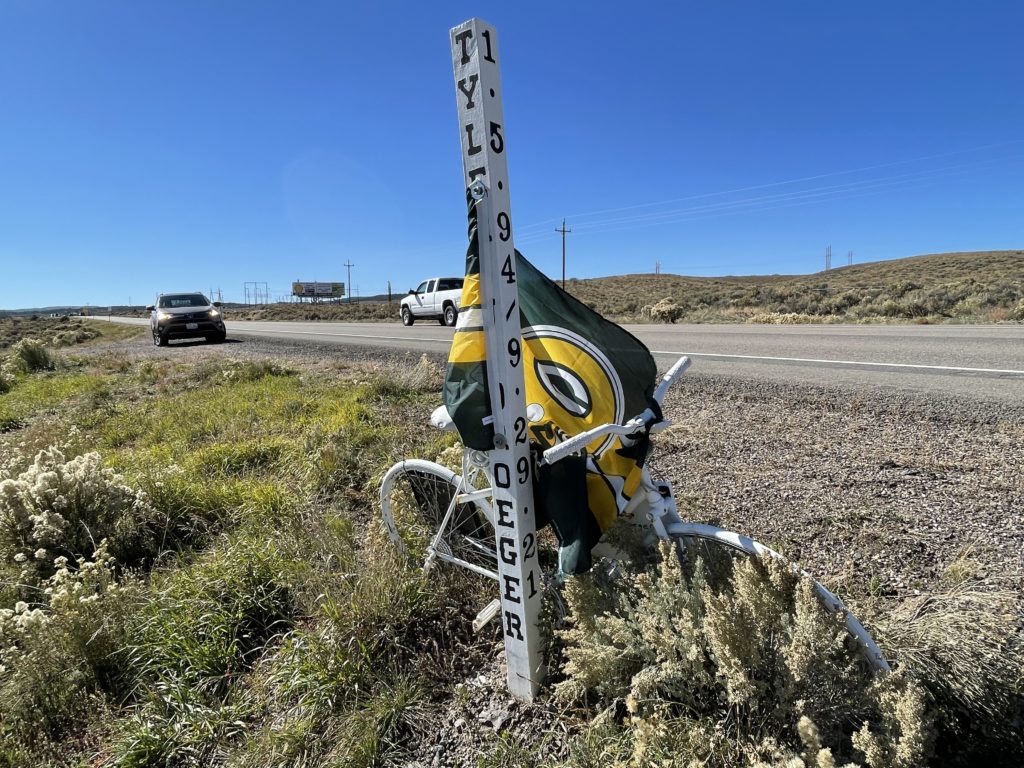
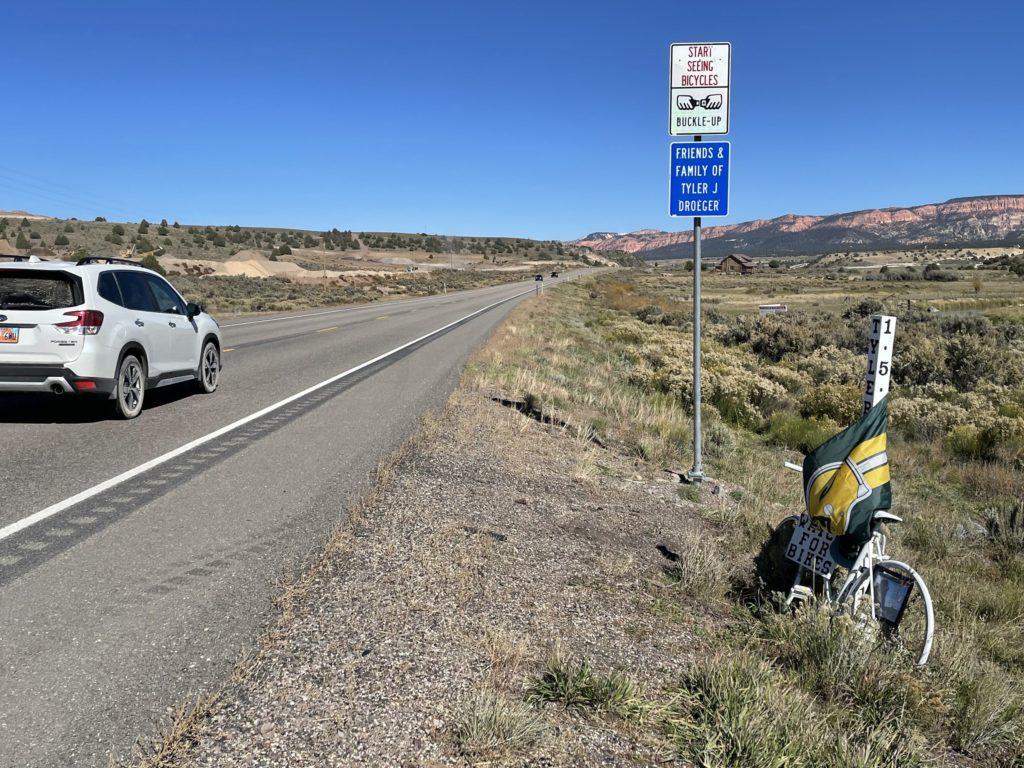
Roadside memorial for Tyler Droeger, killed in September 2021 when a driver drifted off this stretch of U.S. 89 in central Utah.

Along U.S. 89 just north of Hatch, Utah.

Tyler Droeger was riding a 4,000-mile circuit of the West on a fund-raising mission in late September 2021 when he was hit from behind by someone who drifted across a rumble strip and the highway shoulder where the cyclist was riding. There are several news accounts of the incident. For instance: “Cyclist Who Was on a Mission to Help Navajo Nation Struck and Killed by Car in Utah.” Unfortunately, none of the stories I find identify the driver who struck Droeger or say whether there were any legal consequences for killing him. Neither can I find any sign in cases filed by the district attorney for Garfield County, where Droeger was killed, that the driver was charged.

The “ghost bike” memorial was apparently installed by Droeger’s family and is accompanied by an official-looking sign that says simply, “Start Seeing Bikes.”

Roadside memorial for Tyler Droeger, killed in September 2021 when a driver drifted off this stretch of U.S. 89 in central Utah.

More on Tyler Droeger: The GoFundMe page he set up for his fund-raising ride and the Instagram account where he detailed some of his trip.

His last GoFund Me update ended this way: “When I started this I thought I wanted to raise awareness in others to the vast levels of inequality that we have in this country, but I’m now realizing that I wasn’t even aware of the inequality we have here in our homeland. Be good to the strangers you meet. no matter their situation it could just as easily have been you In those shoes.’

Road Blog: Never Rip

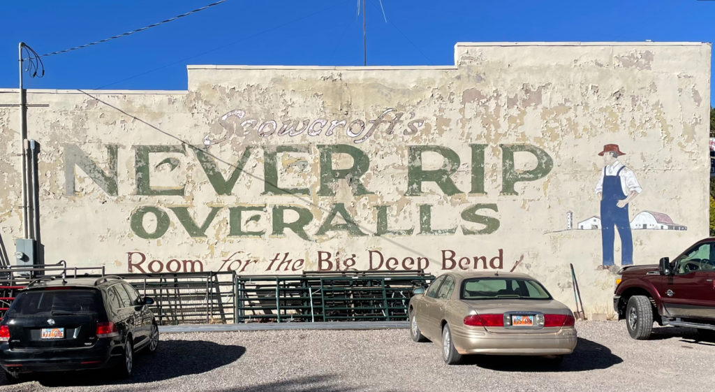
Driving in search of an aspen grove I had read about — more accurately described as a “clone,” a stand of trees generated from a single seed and growing from a single root system — that is alleged to be the world’s most massive organism, I happened across the above, painted on the side of the general store in Koosharem, Utah. That’s about 150 miles south of Salt Lake City and not too awfully far from Interstate 70 (to the north) and Interstate 15 (to the west). Here’s a 2012 image of the same sign, which suggests strongly the piece has been “renewed “over the years.

John Scowcroft and Sons, the Ogden, Utah, firm that made Never Rip Overalls through about 1940, was founded by an English convert to Mormonism who emigrated to Utah in 1880. His commercial endeavors in his new home are reported to have started in the confectionery and bakery business and later expanded into clothing and dry goods.

It’s not clear exactly when Scowcroft and Sons began making “Never Rip Overalls.” ZCMI — Zion’s Cooperative Mercantile Institution, the Utah firm formed in the late 1860s to promote Mormon enterprises and entrepreneurs — marketed “never rip” overalls around the turn of the 20th century, as did a New York-based firm that made Keystone Never Rip Overalls. (And “never rip” was a popular sales claim in this era, as evidenced by the slogan for Ypsilanti Health Underwear: “Never rip and never tear — Ypsilanti Underwear.”)

But based on what you find in the newspaper archives it appears that Scowcroft probably started turning out overalls and started a big advertising push for Never Rip Overalls in 1913. The company’s ads touted the clothes’ durability, of course, but put more emphasis on the fact that its products were made in Ogden and that its workers’ salaries supported other local businesses. It claimed a weekly payroll of $1,200 to $1,500 for 150 “boys and girls” (the latter sometimes described as “Utah maids”) who made the goods. Scowcroft also advertised that it was a union shop — apparently organized by the United Garment Workers Union.

Ogden Standard, June 9, 1913.
Ogden Standard, July 9, 1913.

Based on those payroll numbers, workers were making an average of $8 to $10 a week. If you figure a 50-hour work week, that would put pay at 16 to 20 cents an hour. Since workers at the plant were paid a piece rate, getting compensated for each item they produced rather than for each hour worked, pay probably varied widely. Scowcroft said in a recruitment ad late in the decade that “girls” were started out at $7.50 a week during training but could earn much more — even $27 a week — once they picked up speed. (One government report from this era suggests a typical work week in the garment industry was more like 55 to 60 hours a week. Average wages ranged from 14 to 40 cents an hour depending on the skill involved in the position and workers’ gender — then as now, female workers were paid less than men working in the same positions.)

Loneliest Roads

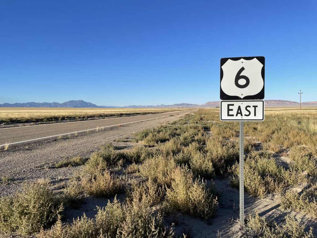
U.S. 6, Nye County, Nevada.

At some point in the not so ancient past — July 1986 — Life magazine off-handedly dubbed U.S. 50 across Nevada “the loneliest road in America.” The picture caption that included that phrase also quoted an auto club official as saying of the highway: “It’s totally empty. There are no points of interest. We don’t recommend it. We warn all motorists not to drive there unless they’re confident of their survival skills.”

The road already had a reputation as a sort of an outback adventure. Life’s portrait of the highway drew the curious and prompted Chamber of Commerce types to embrace the “loneliest” title and try to turn the highway into an attraction. Somewhere at home we have a passport booklet full of stamps we collected during a trip across Nevada in 2007 — part of a promotion for U.S. 50 travelers. It turns out there are plenty of attractions, including the experience of being out in the middle of shocking expanses of sky and sage and mountain ranges stretching out to forever.

Among the features that U.S. 50 shares with many highways in the back-of-beyond West are long, long stretches of perfectly straight road — stretches that run away across a limitless expanse of valley, then rise up a distant ridge and disappear. And one of the many highways that shares those attributes is U.S. 6, which starts east across Nevada a bit further south than U.S. 50, then makes a turn to the northeast and meets 50 in Ely.

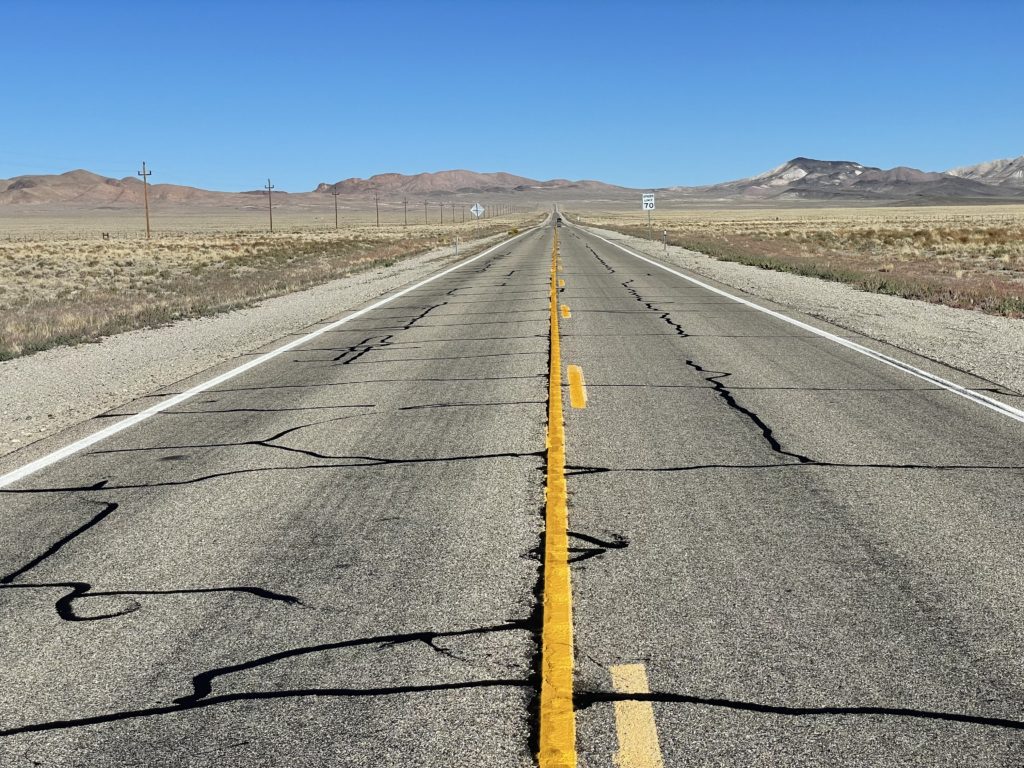
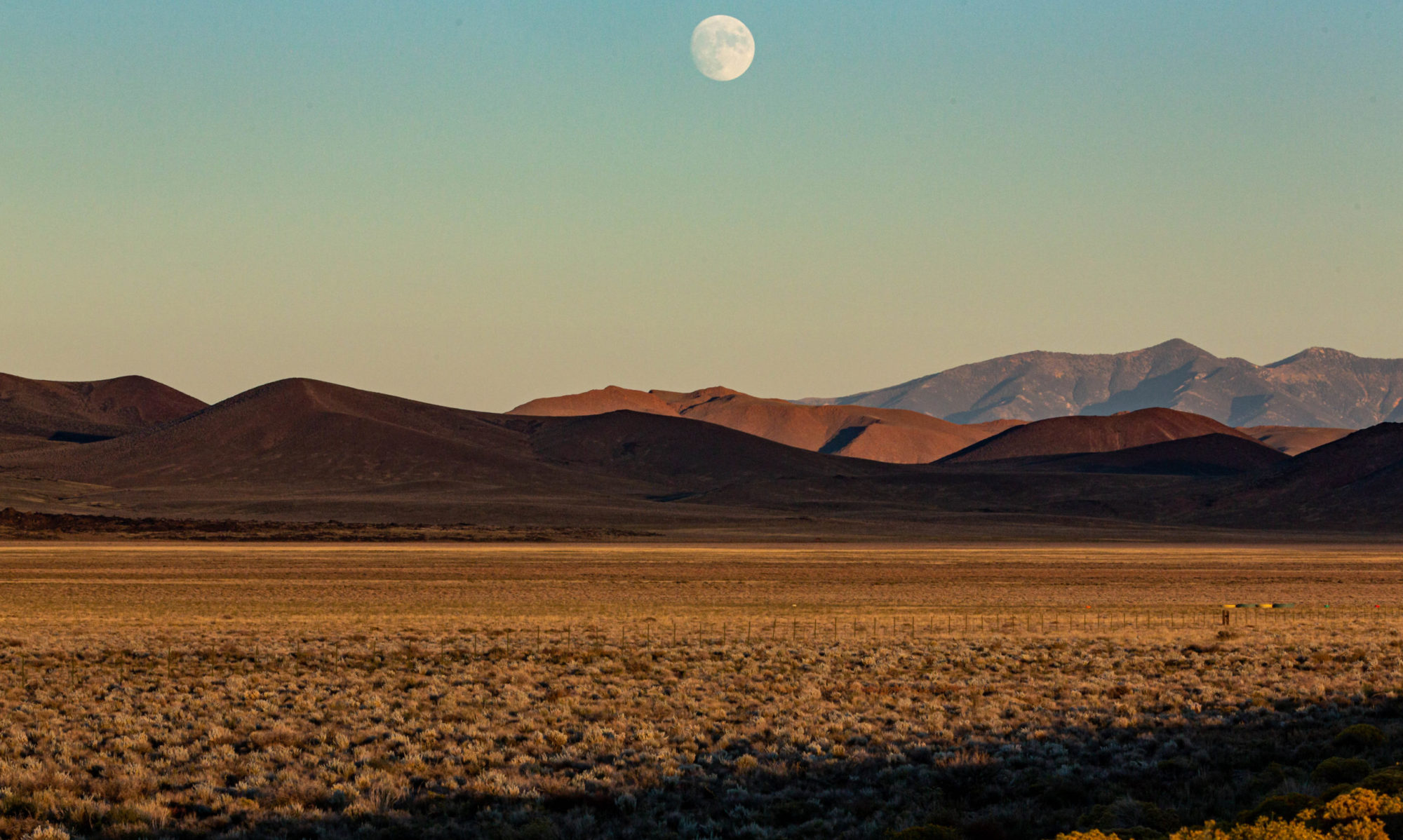
There is a whole story about why roads go where they go, why they take the paths they take. I’m not telling that here. What I do want to relate is how remarkably empty Route 6 was Friday once I left Tonopah in west central Nevada. It started with the sign just outside town saying, “Next Gas: 163 miles.” And it continued, across mountains, road summits and long intervening valleys. I was carrying a camera with a long lens, and occasionally I’d pull over on the arrow-straight sections to try to capture a sense of the scene. Most of the time, no other vehicles were in sight, so I could stand on the center line and shoot away. On one piece of highway, I stopped at the top of the rise and looked back across the valley I had just crossed — the valley pictured above. I had been watching my odometer, and I was staring down the middle of at least 17 miles of pavement. There wasn’t a single vehicle in sight.

U.S. 6, near Tonopah, Nevada. There is a vehicle in sight in this iPhone photo.

Road Blog: Pack, Shop, Get Gas, Shave, Cut Hair, Straighten Up Office, Fill Bird Feeders …

Lake Don Pedro — the reservoir that captures the Tuolumne River downstream of Hetch Hetchy — along Highway 120.

Day One of an n-day trip to Salt Lake City and destinations still undetermined. I’m in Lee Vining now after driving from sea-leval Berkeley out of the Bay Area, across the Valley, through the foothills and Yosemite and up the Tioga Road to Tioga Pass, elevation 9,945 feet. It was dark when I got to the top. I stopped for a few minutes to take in the stars and planets — Jupiter scraping the top of Mount Dana as it rose — and spotted the International Space Station making a pass almost directly overhead. Then it was back in the car for the plunge down through canyon to Lee Vining, where I’m staying tonight. I walked up the road to the region’s most famous Mobil gas station to have dinner (well, the gas station is part of a roadside stop with a store and a better-than-you-could-possibly-have-expected-in-these-parts restaurant. Tonight they had carnitas tacos. Really good).

It does occur to me that sometime maybe I’d like to take a whole trip in daylight. My brother John was just telling me tonight from Montana that he just went over a stretch of road the two of us drove after dark last year and he was staggered at how beautiful it was. All I can tell you about that piece of highway is that it had all the standard lines and markings.

Today, driving after dark was pretty much inevitable because I didn’t leave home until a bit after 2 p.m. I think sunset was about 6:30. Why start after 2? See the headline above. It’s all the stuff the got compressed into a few hours before departure. One would think I’d learn at some point. But not yet.

County Courthouse

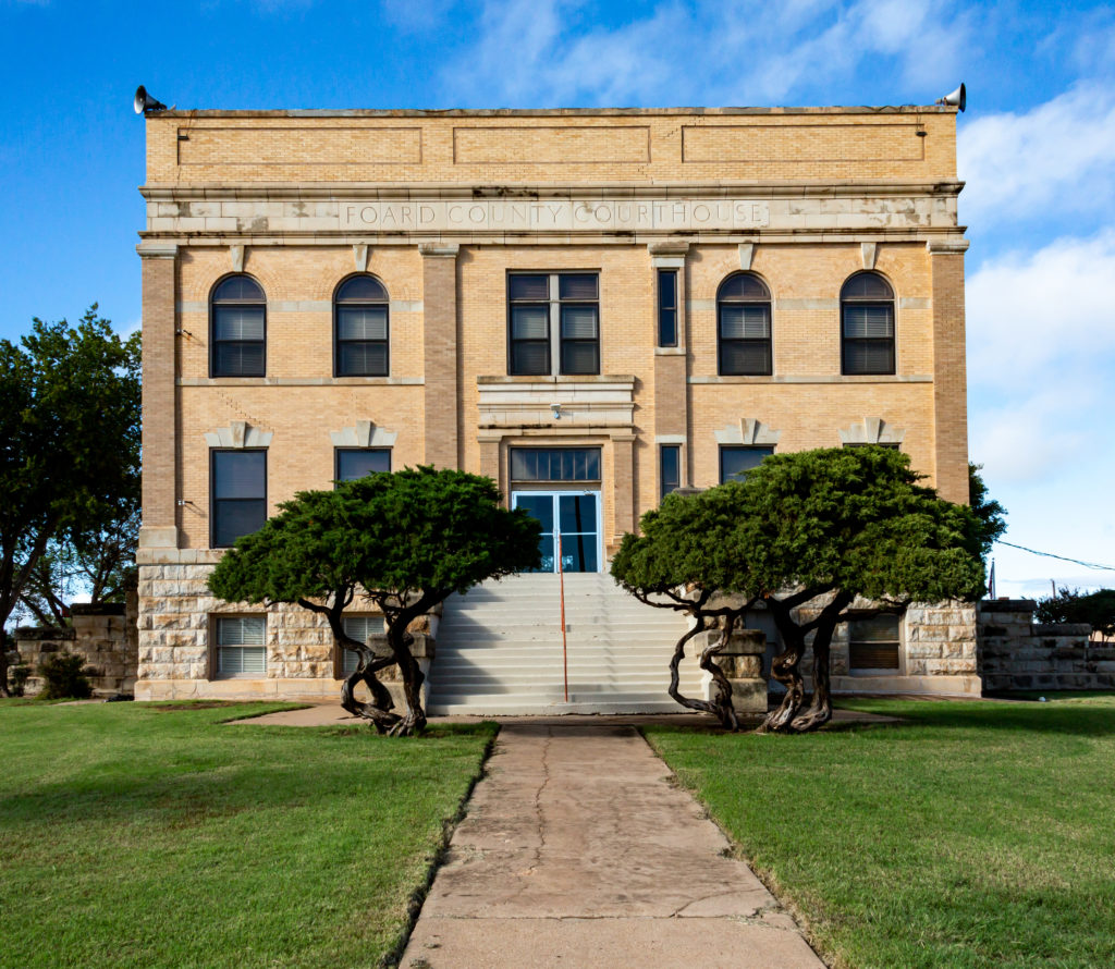
Going through some pictures I took on a quick drove around North Texas four years ago. This is the Foard County Courthouse — humble and lacking in the architectural fancies that characterize some of the other courthouses I’ve seen in the Lone Star State. The plainness appeals to me. It’s even more pronounced in the Google Streetview of the spot

The town of Crowell, 65 miles west of Wichita Falls, is the seat of the county, which according to the 2020 census had a population of 1,095 — a steep decline from the 1,336 reported in 2010.

I haven’t delved into the county’s history at all. It has one literary claim to fame, though. It’s home to Thalia, the name Texas novelist Larry McMurtry adopted for the setting of several novels, including “The Last Picture Show” and “Horseman, Pass By.”

Sunday Storm Report, or Emotional Rain

Rain shower, with scrub jay and stiff breeze.

Well, it’s here. Rain, I mean. Not in copious, toad-strangling, gully-washing volumes. And I just heard a National Weather Service forecaster on the radio counsel patience — more will be coming later today, overnight, tomorrow. As I said the other day, we’ll take what we can get. In drought times, and even just at the end of our long summer dry spells, water falling from the sky carries an emotional weight way out of proportion to what shows up in the rain gauge.