Like everyone else who’s walking around with one of these “phones” equipped with a high-quality camera (or are they really decent cameras with mediocre-quality phones?), I take lots of pictures. Sometimes I try to discover a theme in what attracts my attention, but aside from “landscapes” or “birds” or “infrastructure” or “stuff on the street,” I would struggle to name any real thread that ties any of my images together.
But a couple of days ago I was looking a few pictures — just three — I had taken on three separate trips to other parts of California over the last few years and was surprised to see something of a story there.
Here are the images:
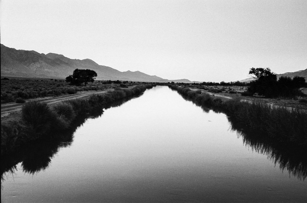
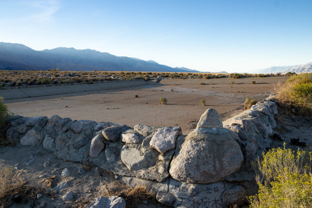
That first shot is the Los Angeles Aqueduct, in the Owens Valley just across the highway from Manzanar, the site of the internment camp where thousands of Japanese Americans were incarcerated during World War II. Kate and I camped nearby, just outside the town of Independence, in 2018. After spending a beautiful September afternoon touring Manzanar, we wandered down to the aqueduct as the sun was setting.
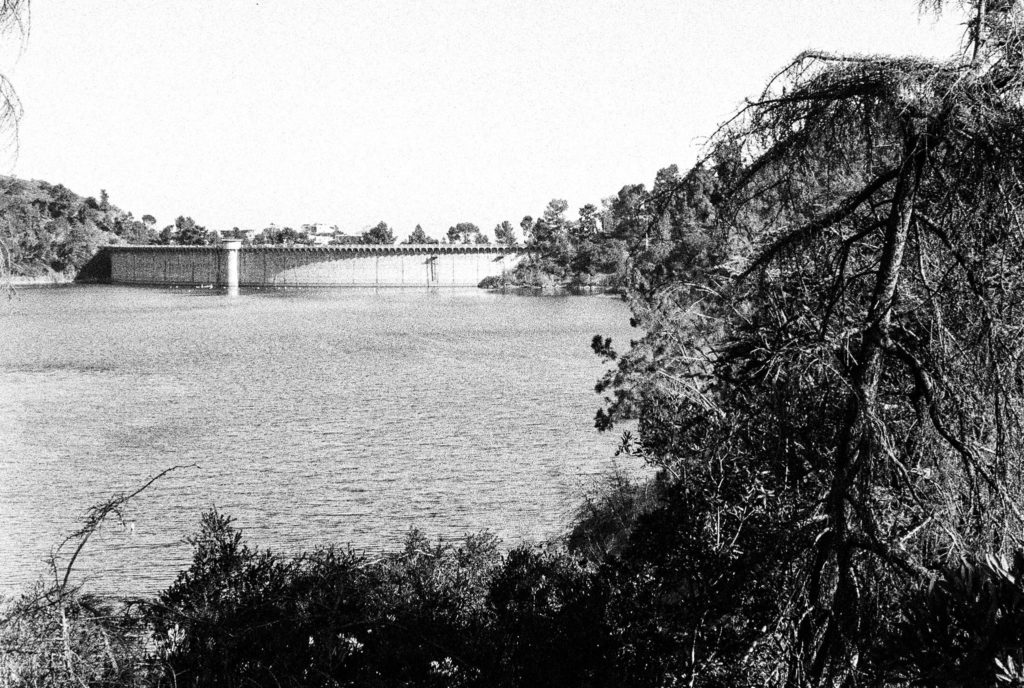
The second shot is the Hollywood Reservoir and Mulholland Dam in Los Angeles. I had wanted to see this place for years, and we made it up on a Sunday afternoon last June while visiting our son Thom.
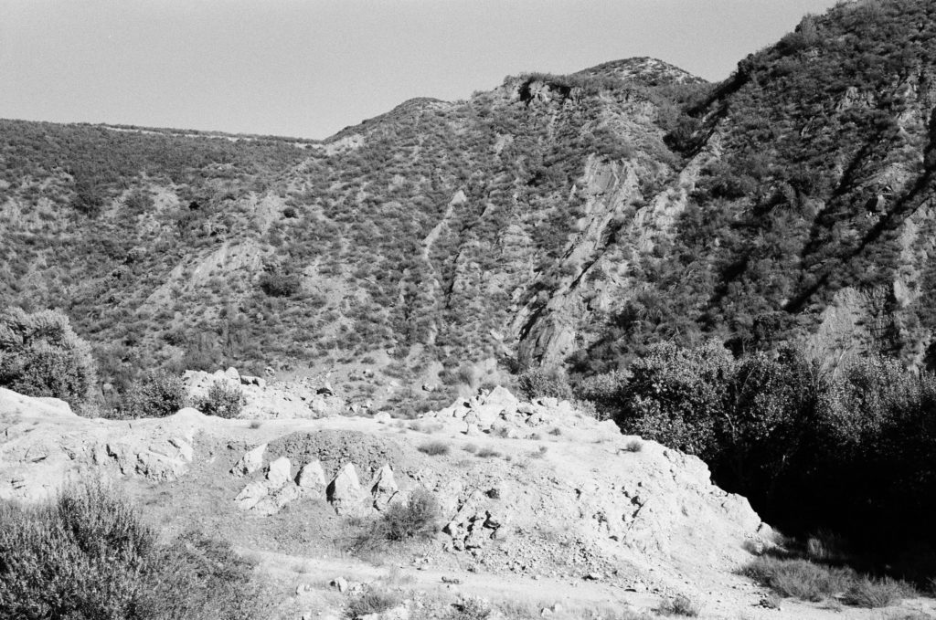
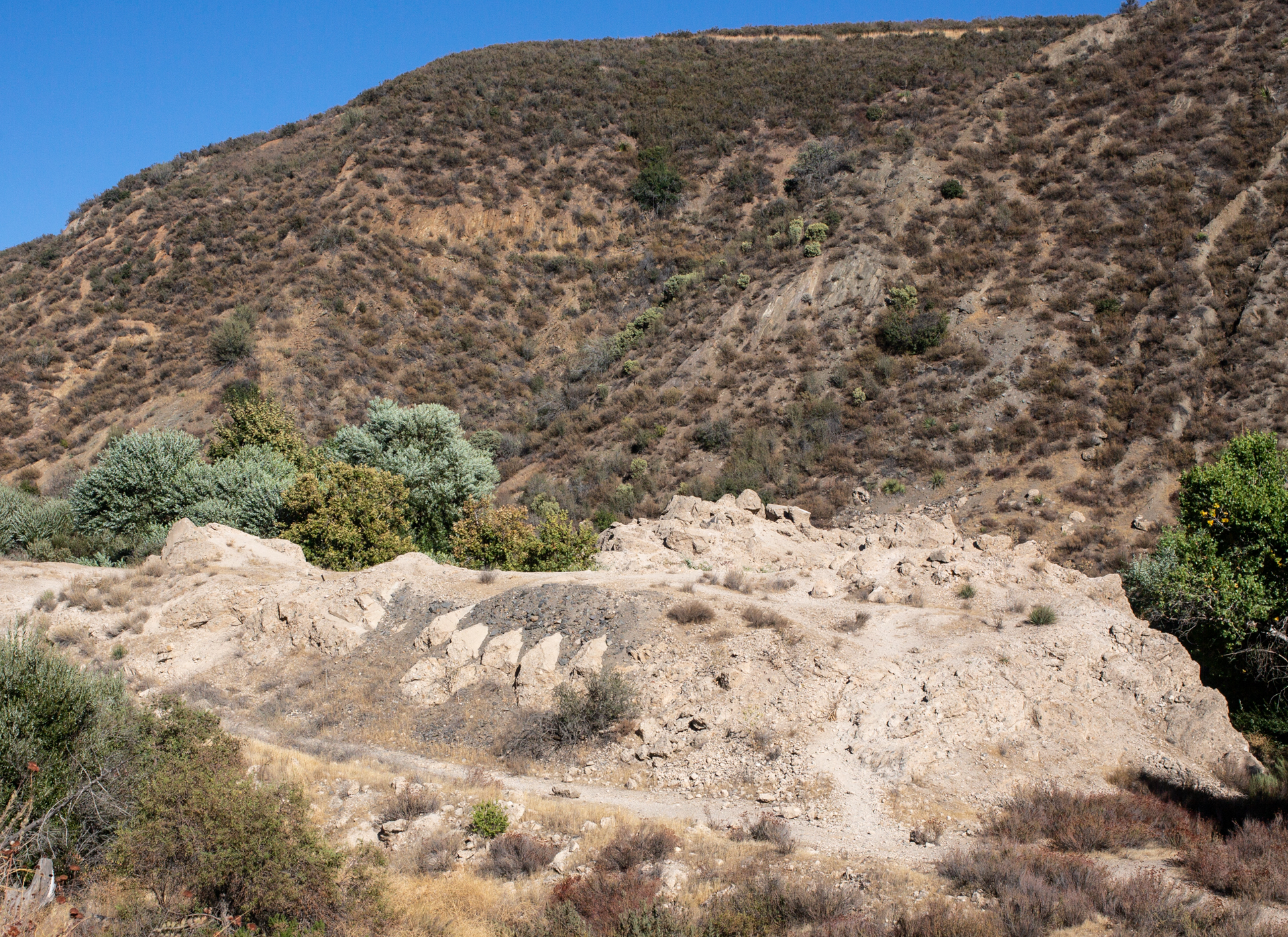
The third shot shows part of the wreckage of the St. Francis Dam, in San Francisquito Canyon, in northwestern Los Angeles County. The dam collapsed in March 1928, killing about 450 people downstream. You have to hunt a little for the site of the dam, which Kate and I did on the same 2018 trip that took us to Manzanar.
I like the fact all three images were shot on film using relatively antique (1970s-era) Japanese rangefinder cameras. But what ties them together, perhaps obviously, is the connection to Los Angeles, water, and L.A. Department of Water and Power chief William Mulholland.
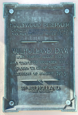
Mulholland was the principal architect of the Los Angeles water system: He played a leading role in helping secure (or steal, depending on your perspective) the Owens Valley water rights for the city. He engineered the aqueduct that brought the water to Los Angeles. Although he was initially reluctant to build dams and reservoirs to store that water, he designed and supervised the construction of Mulholland Dam, which took all of 16 months to complete in 1923-24. He used that structure as a sort of template for the St. Francis Dam, which was completed in 1926. Mulholland visited St. Francis Dam just hours before it disintegrated and pronounced it sound; the catastrophe ended his career. Although he apparently believed Owens Valley saboteurs were responsible, as they had been for the destruction of some of the aqueduct facilities in the eastern Sierra, he took public responsibility for the tragedy. “Don’t blame anybody else,” he told a coroner’s inquest. “You just fasten it on me. If there is an error of human judgment, I was the human.”
As I say, I just happened to look at the three photographs together the other day and see a story. If I ever have a show, I thought, I’d want to present them as a group. For some reason, I thought a presentation like that would be more complete with a fourth image. I remembered a 2017 visit to Los Angeles during which we stopped at the Department of Water and Power building (a.k.a. the John Ferraro Building), at the corner of First and Hope streets, and just across the way from the Dorothy Chandler Pavilion, the former home of the Oscars.
I took some pictures when we were at the DWP building — all with a digital SLR, not film. Looking back, I found one that I thought I could add to the group — post-processed from color to black and white. It’s looking up from a corner of the building up toward the roof, with the sun just obscured:
What kind of statement is that making? I haven’t come up with words yet, though I like the image. And as I say, if there ever is a show, this one’s going in.
The original version of this post was published February 19, 2005
The Writer’s Almanac notes today is the anniversary of the date in 1942 that President Franklin D. Roosevelt signed Executive Order 9066, ordering more than 120,000 Japanese Americans into remote internment camps. It’s an event we all know in the sense we’ve heard of it. Having heard about it, most of us have an opinion about it; the prevailing view, embraced eventually even by a president as conservative and all-American as Ronald Reagan, is that it was a tragic mistake.
In another way, it’s a history we know little about. Especially in a place like Berkeley where more than 1,000 residents (the official number, published in the Berkeley Gazette in April 1942, was 1,319) were forced to leave. Several older Japanese-American couples lived in our neighborhood when we moved here in the late 1980s. They were of a certain age — my parents’ age — that made me wonder not whether their families had been sent to the camps but what their experience of incarceration had been. I never talked to them to find out. But you realize that on this street, or the next one over, and all over town, families were sent packing. To the California deserts, Utah, Wyoming, Arkansas, wherever the camps could be set up quickly.
In San Francisco, the Chronicle ran a story marking the departure of the last “Japanese” from the city.
“For the first time in 81 years, not a single Japanese is walking the streets of San Francisco. The last group, 274 of them, were moved yesterday to the Tanforan assembly center. Only a scant half dozen are left, all seriously ill in San Francisco hospitals. “
At the University of California’s commencement, campus president Robert Gordon Sproul announced that the senior class’s top student “cannot be here today because his country has called him elsewhere.” Three weeks earlier, the student, Harvey Akio Itano, had been sent to the Tule Lake camp in northeastern California. (While his family remained incarcerated, he was released soon afterward and allowed to begin his medical studies in St. Louis. As a researcher after the war, Itano played a key role in discovering the molecular basis for sickle-cell disease and is recognized today as a pioneer in the study of blood diseases.)
Among the other UC seniors forced out of school before graduation was Yoshiko Uchida, who lived with her family on Stuart Street near Shattuck Avenue and kept a scrapbook (online through the University of California) of her new life (and later wrote many books about it).
You can go looking for scraps of the internment history, and sometimes they find you instead.
In October 2004, I was driving back to the Bay Area from Mojave and decided to take the long way, up U.S. 395, at the foot of the Sierra Nevada’s eastern flank. Late in the afternoon, speeding north up the dry floor of the Owens Valley, I passed a sign saying Manzanar was just ahead. I knew the name, that it was one of the camps, that it was out in the middle of the desert someplace, but not much more than that. Suddenly, here it was. So I turned off and spent a while driving around what is now a national historic site.
Sagebrush has claimed most of the camp, though you can see come of its streets leading off into the desert, and several barracks buildings have been rebuilt. The most-frequented place at Manzanar — not counting the visitor center — is the cemetery. The bordering fence is heavily festooned with origami cranes, and lots of impromptu memorial offerings have been left behind. The gleaming white cemetery monument is carved with the kanji “I rei to,” or “soul-consoling tower.”
Reservoir was originally built to serve a nearby agricultural community in the Owens Valley. It was improved and enlarged during World War II by internees. See: Manzanar Reservoir.
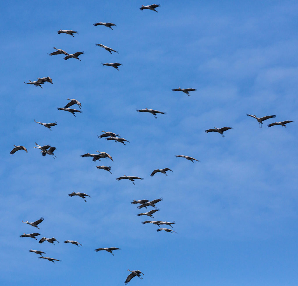
Sandhill cranes at Merced National Wildlife Refuge. February 14, 2022.
We spent last weekend in the San Joaquin Valley looking at birds. Thousands and thousands of birds — snow geese and white-fronted geese, shovelers, pintails and teals, killdeer and meadowlarks, avocets and ibises, stilts and wrens, red-winged blackbirds and red-tailed hawks, tundra swans and sandhill cranes.
Part of the experience of entering into the world of the birds is the sound. Actually: part of the experience? Visiting these places where tens or hundreds of thousands of migrating birds have gathered is mesmerizing, electric, sometimes overpowering, utterly enveloping and at moments gives a hint of what this place we live was like before we began the project of radically reshaping it.
Here are three snippets of that sound. The first is from Super Bowl Sunday, when Kate and I found ourselves virtually alone — except for the birds — in the 10 square miles of the Los Banos National Wildlife Refuge. After that clip are a couple from the Merced National Wildlife Refuge — the crazily energetic stylings of a marsh wren and a surprise overflight of about 300 sandhill cranes at midday on Valentine’s Day.
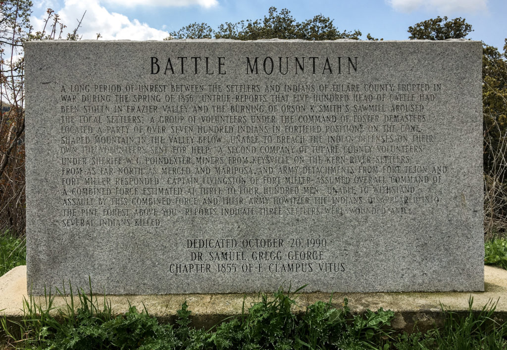
Battle Mountain historical marker, Tulare County, California (see text below).
Kate and I encountered the marker above a few years back while driving on a back road in the southern Sierra Nevada foothills. The text is hard to read, but it’s transcribed in full below.
Battle Mountain
 A long period of unrest between the settlers and Indians of Tulare County erupted in war during the spring of 1856. Untrue reports that five hundred head of cattle had been stolen in Frazier Valley and the burning of Orson K. Smith's sawmill aroused the local settlers. A group of volunteers under the command of Foster DeMasters located a party of over seven hundred Indians in fortified positions on the cone-shaped mountain in the valley below. Unable to breach the Indian defenses on their own, the volunteers sent for help. A second company of Tulare County volunteers under Sheriff W.G. Poindexter, miners from Keysville on the Kern River, settlers from as far north as Merced and Mariposa, and Army detachments from Fort Tejon and Fort Miller responded. Captain Livingston of Fort Miller assumed overall command of a combined force estimated at three to four hundred men. Unable to withstand assault by this combined force and their Army howitzer, the Indians disappeared into the pine forest above you. Reports indicated three settlers were wounded and several Indians killed.
 Dedicated October 20, 1990
Dr. Samuel Gregg George Chapter 1855 of E Clampus Vitus
When it comes to roadside markers, the easiest thing in the world to do is pick apart their abbreviated rendition of past events. There is no way that even a relatively prolix text, such as the one on this marker, can convey much in the way of detail or nuance. Too bad they don’t contain hyperlinks, though now that I’ve had that thought: QR codes. You know: “To read more about the Chicago Fire, or the Haymarket Square affair, or the assassination of Mayor Carter Harrison, scan this code.” (Yes, I know there is history outside my native city.)
So perhaps the highest and best functions of these markers is to awaken someone’s interest to past events and send them looking for more. I know that’s what happened five years ago when I was driving around Oroville, a town that had been evacuated because of fears that part of a dam would give way, and happened across a marker commemorating Ishi.
As I wrote at the time, “Ishi is an instantly recognizable name for those who have spent any time in California. Ishi is the legendary last member of his native tribe, the Yahi. In 1911, he was ‘discovered.’ Meaning: starved and alone, he gave up his home country in the foothills on the northeastern side of the Sacramento Valley and entered “civilized” California.”
Here’s what Ishi’s plaque says:
The Last Yahi Indian
For thousands of years, the Yahi Indians roamed the foothills between Mt. Lassen and the Sacramento Valley. Settlement of this region by the white man brought death to the Yahi by gun, by disease, and by hunger. By the turn of the century only a few remained. Ishi, the last known survivor of these people, was discovered at this site in 1911. His death in 1916 brought an end to Stone Age California.
“His death brought an end to Stone Age California.” An entire people, an entire world, dispatched in one succinct sentence. But stumbling upon the plaque prompted me to finally read a well-known and unwittingly tragic account of Ishi’s life and final years, “Ishi in Two Worlds.” It’s a story I think of often as a reminder of how complex the history around us is and how little I know.
But back to Battle Mountain. What to make of this marker, erected in 1990 by a society dedicated to the lore, if not always the true history, of old California? There are some details in the account that don’t smell right. One I wondered about was the notion that a force of white volunteers encountered “over seven hundred Indians in fortified positions.” The concluding line about casualties — three white settlers wounded “and several Indians killed” also sounds vague and sanitized.
What do other sources say?
Wild West magazine recounts the battle as part of “The Tule River War.” That account suggests a much higher casualty count among the Native Americans — members of the Yokuts group of tribes who also faced some ugly post-battle repercussions.
The Last “End of the Tulare War.’— We have frequently had occasion to remark that the accounts of Indian hostilities, not only in the north, but in the south, are almost invariably exaggerated. A small affair is soon magnified into a battle, and the origin is not unfrequently attributed to Indian outrages, when the account should read “white man’s oppression.” The following extract from a private letter written to a gentleman in San Francisco, from a friend at Fort Miller, and bearing date the 25th of May, is the latest, and it may be one of the most truthful accounts from that quarter:
“The Indian war is defunct. The volunteers from this place have returned, swearing most roundly at the [white] Four Creeks people, whom they term Petticoat Rangers, from a kind of armor made with canvas padded with cotton, which they wear in shape of a frock or blouse around their persons for protection. The whole matter has been a cowardly farce, the threatening legions of Indians turning out to be but about one hundred, seeking refuge in a brush from the rowdies, who, on the least occasion, delight in the sport of shooting them.
“As in all cases of the kind, the fault has been with the whites. The herds of cattle said to have been stampeded, have turned out to be a single calf taken to supply the deficiency of meat during an Indian feast. Retaliation, of a brutal character, for this trifling offense, created all the disturbance.”
There are plenty of other newspaper accounts of the “war” published around the same time. Some contend the tribe’s “depredations” warranted a violent response, but most seem to have held to the view that the initial provocation — the “theft” of a small number of cattle during a time of starvation — served as a pretext for wanton killing of indigenous people wherever they were to be found in the area. It is not a unique story. But it’s disappointing that such a credulous mid-19th century narrative made its way onto a marker placed at the end of the 20th century.
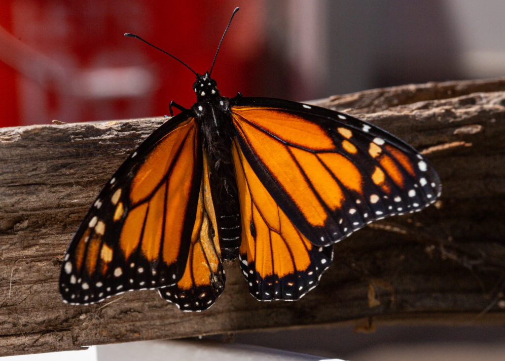
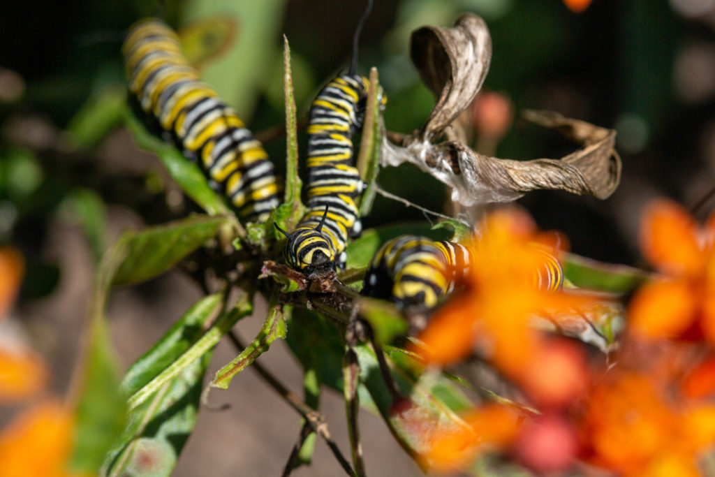
This has been the month of butterflies. We had a stand of milkweed in the front yard, Asclepias curassavica, or what I’ve heard called tropical milkweed. According to this source, it’s native to many islands across the Caribbean and parts of South America and introduced here in California. Monarch butterflies are partial to this plant, as well as other varieties of milkweed. This particular species is believed to pose a problem for the butterflies, though. It doesn’t get cold enough here in the winter to kill the plant. So the leaves and anything living on them survive from one butterfly season to the next.
One of the things that might live on the leaves is a parasitic protozoan called Ophryocystic elektroskirrha. Called OE in the world of monarch studies, the parasite can be debilitating, causing deformed wings in some monarchs and weakening others. The biological consensus seems to be that OE is everywhere. Adult monarchs carry it and deposit it on plants where they feed or lay their eggs. Eggs can be infected. More commonly, monarch caterpillars become infected when they eat infected vegetation, and infected caterpillars metamorphose in their chrysalides to infected adults that continue the cycle.
We didn’t know from OE when I picked up those plants a couple years ago. And we didn’t know about it when I grew a bunch of new plants from seed last year and planted them in the front yard. (We also didn’t know about a lot of the other surprisingly commonplace organisms that can come along and kill monarchs, either, but that’s another story.) By last fall, we had read about OE. But we left the tropical milkweed standing because, well, it was there and no monarchs were around.
But late in the winter, there was some monarch mating activity we didn’t witness. By late March, monarch caterpillars had appeared in the milkweed. I only saw a few at first, but over the coming weeks, we counted about 40 of them in our small milkweed patch, all seemingly at a similar stage of development. They systematically devoured the leaves on one plant after another until they had stripped all the milkweed bare.
Asclepias curassavica, meet Danaus plexippus.
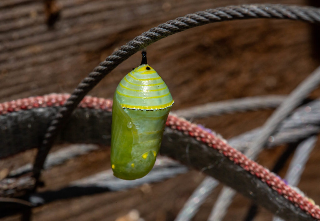
Then the caterpillars migrated to various spots around the front entrance of the house. Kate counted 30 chrysalides by the time the great pupation was finished. The stumpy remains of a pomegranate bush was the most popular chrysalis site. But we also found them on our mailbox, on one of the pillars of our front porch, on the porch stairs, on a stalk of fennel, on random pieces of wood, and next door on a neighbor’s bicycle lock cable, dog leash, fence and gate.
Chrysalis on bike cable; pupated April 19.
A couple weeks ago, they started emerging. Twenty-five so far, we think. (Kate, the science teacher, has mapped and charted the location of each. She’s also interested all the neighborhood kids in what’s going on, so we sometimes have a sort of free-form, socially distanced classroom in the front yard.)
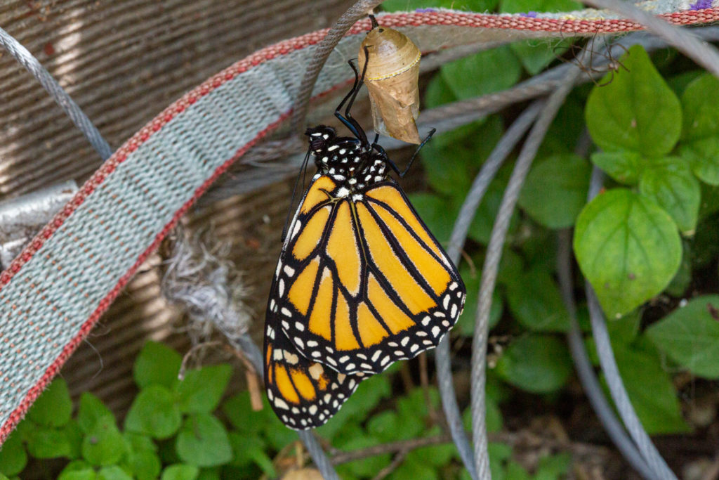
Since we knew about OE and its effects, we were a little concerned about the condition of the butterflies that would emerge from all the chrysalides. All but about five have appeared to be healthy, emerging with no problems, all parts intact, and flying off very quickly after their wings dried.
The bike-cable chrysalis; eclosed on May 7.
What about the rest, the ones that have not appeared healthy or died before they emerged? Well, there’s another story there. Complete with actual butterfly names. To be continued.
***
A couple of days ago, the phrase Rancho Mariposa came into my head while I was describing the parade of monarch’s appearing on the estate here.
“Mariposa” is Spanish for “butterfly,” and it’s a street name here in Berkeley and over in San Francisco and I’m betting in many, many other towns. The name has been stuck on a Sierra foothills county, on that county’s biggest town, and on a creek that runs through both. “Mariposa” was apparently first used as a California place name there.
It’s easy enough to imagine how the name came to be. Someone saw a bunch of butterflies somewhere and was inspired to name the place for the insects. You hope for a more particular story, and there is one in which butterflies aren’t lovely, fragile ephemera but a memorable nuisance.
An 1806 Spanish expedition struggling through an unattractive stretch on the eastern edge of the San Joaquin Valley encountered an unattractive-looking stream. A priest with the party, Pedro Muñoz, recorded what they found there.
September 27: In the morning we crossed the river and, taking a northerly direction, we pushed through about a league of very high, thick tules, in the midst of which could be seen a few clearings well covered with grass. After traveling about three leagues, more or less, we stopped at a stream which runs from east to west. It has no running water, only a few pools, where we were forced to pitch camp. From the point where we left the tule swamps to this place the land is really miserable. Salt flats and alkali patches, with innumerable ground-squirrel burrows are all that one can see. There are at this spot about sixty oak trees and a few willows in the bed of the stream. The forage was extremely scanty, and that the country appeared to have been burned over by the Indians did not conceal the fact that the land is very poor. Consequently there is little pasturage.
This place is called the Mariposas, “the butterflies,” because of their great number, especially at night. In the morning they become extremely troublesome, for their aggressiveness reaches the point where they obscure the light of the sun. They came at us so hard that one of them flew into the ear of a corporal of the expedition. It caused him much discomfort and no little effort to get it out.
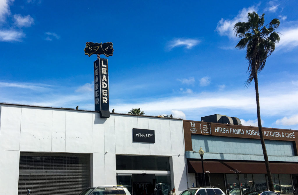
The Leader building on Fairfax Avenue, Los Angeles.
On Fairfax Avenue just north of Beverly Boulevard, Los Angeles. The Leader sign is attention-getting — it got mine, anyway, when Kate and I were strolling past last March —but what is/was it about?
Answer: From 1946 through 1989, the building housed a well-known and very busy beauty shop. The L.A. Times ran a very good story on its closing: Nothing’s Permanent: Fairfax Beauty Shop Closing After 43 Years. If you’re too busy for the link, the driving factor was rising real estate prices, and the family that ran the business cashed in on their property.
The July 1989 story notes that two-bedroom apartments in the neighborhood were going for about $950 a month.
Part of the ruins of St. Francis Dam, northeast of Los Angeles.
We managed to spend a whole day on the road today without getting out of Los Angeles County.
That was partly due to a detour to the Santa Monica Pier as we headed out of town. And then a second detour to the REI in Santa Monica. And then a third detour to Peet’s Coffee in Santa Monica. (We’re allegedly going camping and need to be real prepared.)
The main detour of the day was a search for the site of St. Francis Dam, which collapsed in 1928, killed at least 450 people, ended the career of William Mulholland, and wrought major changes in dam design and engineering.
We finally made it to the dam site in the waning half of the afternoon and spent a half an hour or so hiking part of the area (it’s worth more time; I hope to come back … soon-ish).
There is a lot of great background material on what happened at the dam. The best may be from J. David Rogers, a Berkeley-trained professor of geological engineering at the Missouri University of Science and Technology in Rolla who has spent decades investigating why the dam failed and documenting the disaster’s effect on the practice of engineering.
“The dam failed catastrophically near midnight on March 12/13, 1928, in its second year of operation. … The resulting flood swept down San Francisquito Canyon, with an initial depth of 140 feet above the streambed. About five minutes later, the flood destroyed a powerhouse (and workers’ community) approximately 7,300 feet downstream, killing 126 of the 129 people living there. The flood wave swept on down the canyon, widening considerably at its juncture with the Santa Clara River coming out of Soledad Canyon. It then swept through Castaic Junction and on down the Santa Clara River Valley, blasting a Southern California Edison construction camp (killing 84 of the 140 workers encamped there), thence inundating the migrant farm community at Camulos, before skimming the lower elevations of the established cities of Fillmore, Santa Paula, Saticoy, and Montalvo. The flood waters reached the ocean around 5:30 a.m., after traveling approximately 52 miles. The official death toll was 432 persons, making it the greatest engineering tragedy recorded in America in the 20th century. But those official statistics did not include Mexican migrant farm workers, of which, an unknown number also perished. One hundred seventy-nine of the listed victim’s bodies were never recovered, including those of damkeeper Tony Harnesfaeger and his 6-year-old-son.”
The magnitude of the tragedy is a little hard to grasp standing at the dam site. There are some monumental heaps of rubble. If you look around, you can see evidence that the piles of broken concrete were part of something bigger.
But nature is reclaiming the site. A cool wind blew up through the cottonwoods and maples that have taken over the streambed where the calamity began. San Francisquito Creek sounded fresh and alive.
One note: It’s a little odd that there’s no official recognition of the site beyond a state historical marker about a mile and a half away — at the powerhouse that was destroyed in the 1928 torrent. This is a place — apparently national forest land — that deserves to be remembered and interpreted.
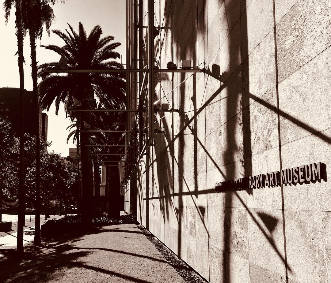
The Eli Broad wing of the Los Angeles County Museum of Art on Wilshire Avenue.
I have spent nearly all of the last 42 years in California, and all of that in the San Francisco Bay Area. I’ve visited Los Angeles about a dozen times. I only get to double figures by counting episodes like the time I delivered a drive-away car, a white Chevy Vega station wagon, to its perhaps rueful owner in Venice Beach; and day trips to do interviews for stories I’ve worked on; and visits to Disneyland, which some may dispute involve a visit to “Los Angeles.” It is not an impressive list, especially considering you can’t have any real idea of California without at least a passing acquaintance with this place.
So here we are on Day Three of dropping in for a visit and just … staying put for the most part.
Example of what I mean by “staying put.” Thom and Megan found an apartment that’s a short walk from the Los Angeles County Museum of Art. Today, we went to check the place out and spent the afternoon there (and spent virtually all of the time visiting one exhibit on the evolution and applications, practical and artistic, of three-dimensional imaging technology.
After that, it was back to the apartment, then a hike to the Los Angeles Farmer’s Market — which is actually a warren of dozens of restaurants and shops, including a couple that sell produce, that is reminiscent of the shopping district adjacent to Tokyo’s Asakusa Shrine — to buy some salad stuff for dinner, which was pizza.
Anyway: This is Night Three in Los Angeles — and I believe it’s the first time I’ve ever spent three nights here in a row.
Tomorrow: Breakfast here, then heading out. Only one stop set on the itinerary: the site of St. Francis Dam, northeast of the city, which collapsed 90 years ago this year and killed about 450 people. Considered by many to be the biggest civil engineering disaster in U.S. history. (William Mulholland, the general manager and chief engineer of L.A. Water and Power, had pronounced the new dam sound 12 hours before it failed.)
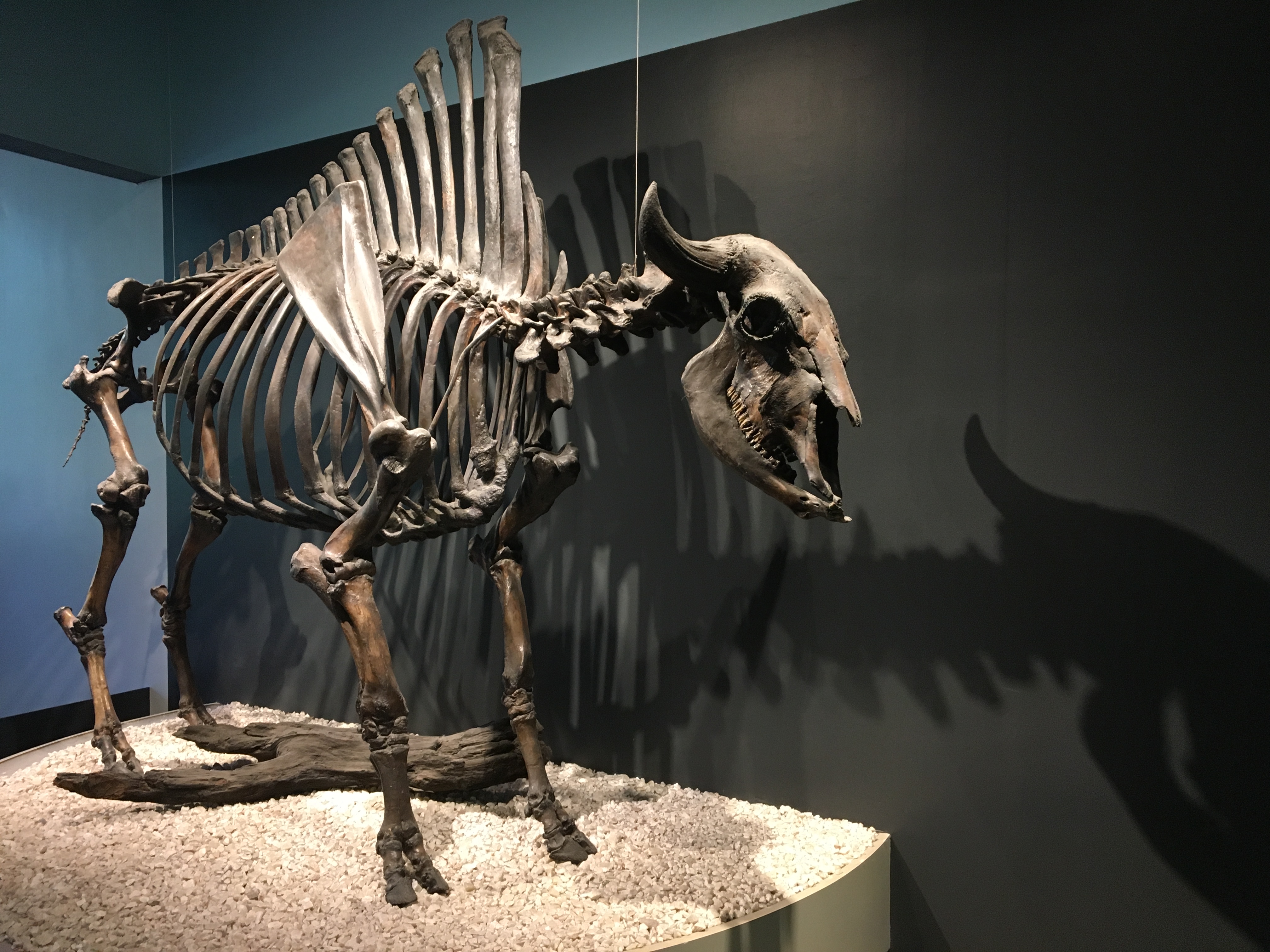
The skeleton of Bison antiquus (Ancient bison) at the La Brea Tar Pits museum.
The tourists in Los Angeles today:
1) Did not fall down on the sidewalk.
2) Went to the La Brea Tar Pits (more below).
3) Watched a painful (for us) college football game.
4) Drove up to the Griffith Park Observatory, along with a huge crowd on hand to mark the equinox. We saw lots of people, lots of lights in the city below, and no parking spaces. We shall return.
About the pits: Growing up, the La Brea Tar Pits seemed to be part of an obscure joke. Visiting today and seeing them in person — the real science growing out of the millions of fossils recovered there and how the place fits into the ancient and modern city — I wondered why I thought so.
In the 1950s, there was a Bugs Bunny cartoon, “My Bunny Lies Over the Sea,” that makes an incidental mention of La Brea. It’s something slight and before my time, so I thought I must have picked up on the joke someplace else.
Johnny Carson came to mind. I don’t doubt that he was just one of many who found something odd and out of place about the asphalt deposits right in the middle of Los Angeles and made them part of a punchline. Having watched Carson many, many times — and given his long tenure here in L.A. — it seems likely that that’s where I picked up on the tar pit jokes.
Thanks to the Sometimes Magic Memory Machine, here’s an extended Carson riff — one bad joke after another — on the La Brea Tar Pits.
One of the decisions we had to make when we put Scout to sleep a month ago concerned what to do with his body afterward. In the past, we’ve buried our late companions — two cats, a rat, a rabbit, a budgie — in the backyard. But Scout was big enough — 50 pounds or so — that it seemed like it would be a real chore to dig a hole long and wide and deep enough for him.
When the event came to pass, our vet told us we could have him cremated individually if we wanted. Afterward, we could scatter his ashes — the coffee-can scene from “The Big Lebowski” comes to mind — or perhaps stow him on the mantelpiece or have him interred at a pet cemetery. Alternately, we could opt for a group cremation and have his remains buried — OK, I admit that the verb I think of is “dumped” — in a common grave somewhere.
I forget what the price was for the different levels of service, but the group cremation/common grave scenario was much less expensive. With the feeling that the most important part of Scout was not his “remains” but our memories of him and the indelible mark he left on our lives, that’s the option we chose. After the wrenching experience of having The Dog put down, I didn’t dwell on where he’d wind up afterward.
“This certificate will serve to notify its owners that the remains of Scout were interred in a country setting together with the pets of many other loving and appreciative owners such as yourself feel that their pets deserve more than the other alternatives now in practice. “Country burial” is an expression of gratitude for the unselfish devotion and companionship your pet gave you during its entire lifetime.”
A form enclosed with the certificate informs us that we can memorialize Scout in Bubbling Well’s memorial pet register, located at the base of a monument in the park, which overlooks the Napa Valley. Price: $35 or more, by check or money order. The form hastens to advise us “this memorialization is purely voluntarily and there is no compulsion expressed or implied.”
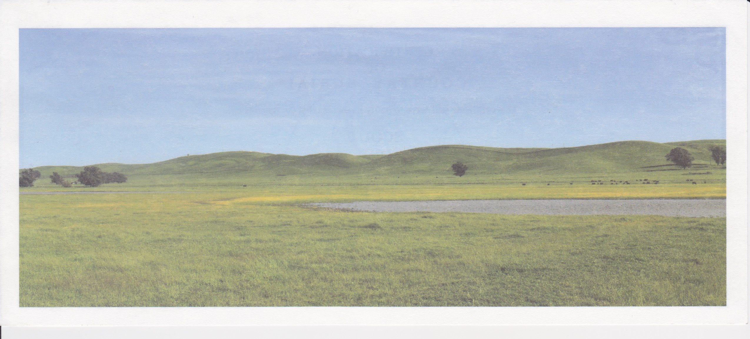
Image of the area near the country burial site for animals handled by Bubbling Well Pet Memorial Park. The spot is in Solano County, east of Suisun City.
Naturally, Kate and I decided we’d like to go and take a look at the pet memorial park — which sooner or later I’ll just call a pet cemetery. Kate had looked up the address and come up with a place on Atlas Peak Road, off Silverado Trail just northeast of Napa. That meant one thing to me: It was likely in an area burned in the terrible North Bay wildfires of last October.
And sure enough, as we ascended the narrow road from the valley, we quickly encountered signs of fire — charred trees and shrubs, lots of construction activity as homes in the area are rebuilt.
The pet cemetery was obvious — the Los Angeles Times described it last fall as “an oasis in a sea of destruction” — for the manicured lawns amid a landscape that’s both burned-over and turning summer gold.
The disaster that swept the countryside also swept across the cemetery. While the “memorial garden” areas are nearly all intact, a home and office on the property burned, as did many large large trees. (The facility’s current proprietor, Dan Harberts, was among those evacuated by helicopter the night of the fire. He was forced to leave his own dog, Drake, a black lab, behind in a pickup truck. When a friend made it into the fire zone the next day, Drake was still waiting, safe and apparently sound.)
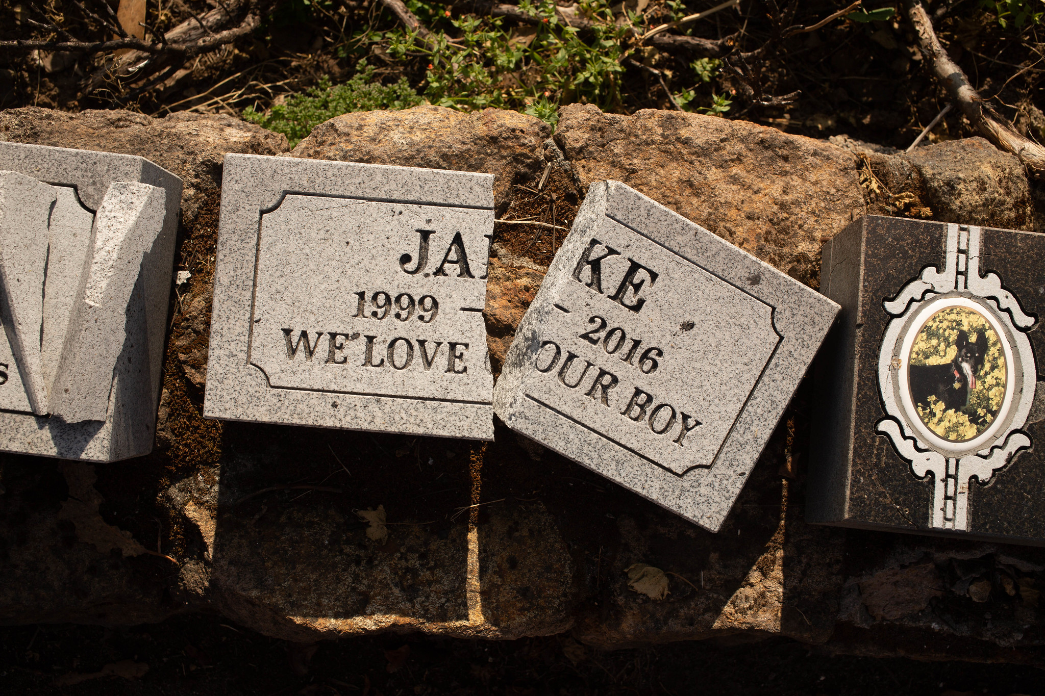
The memorial park is clearly in a state of rehabilitation, with evidence of heavy equipment having driven across parts of the property, a small heap of burned debris in a parking lot, and a collection of broken pet headstones — broken, I’m guessing, during the post-fire recovery — lined up on a wall.
We showed up around 4 p.m. While there was plenty of traffic on the road adjacent to the cemetery, we were the only people there. No staff. No other visitors.
It’s tempting to poke fun at the many, many pet plaques and grave markers at the cemetery and their sometimes maudlin messages. We saw one for a ferret named Bandit, whose human companions averred, “He was our everything.” One memorial includes what appear to be the figures of St. Francis, the Virgin Mary and a plywood golden retriever with a wire halo. A trio of pedigreed German shepherds is buried together under matching tablets saying, “Rest until we are together again.”
It’s tempting to make light of it all, but I won’t. While my sentiments and beliefs may be different — when Kate and I talk about how we’d like to dispose of these bodies of ours when the only show in town is over, I think of sky burials or Walt Whitman — mostly, I’m impressed by how many people will go to such apparent lengths to remember these presences in their lives.
Jake, 1999-2016. ‘We love our boy.’
When we got the Bubbling Wells card in the mail, I was thinking Scout’s “country burial” was in the Napa area. The picture on the card looks sort of like the lowlands south of the city. The difference between that image and the rugged hillside location where the cemetery sits didn’t compute at first. But as we ambled through the property, we came across a sign devoted mostly to explaining what “country burials” are, where they happen and that you can’t visit the burial site because of the conditions of a land-use permit.
Of course, inquiring minds want to know just where this burial site is.
The sign, below, doesn’t quite address the precise location. In a tone that may reflect having heard the question a million times, the cemetery’s proprietors say, “In all honesty, we can tell you that your pet was buried 20 miles east of Bubbling Well near Fairfield in a lovely country setting.”
A sign at Bubbling Well Pet Memorial Park explains the cemetery’s country burials.
After a diligent hour or two of searching public records, that description appears to be more or less accurate.
The site is a little southeast of Fairfield, south of Travis Air Force Base and just north of a range of low hills and, beyond them, the sloughs and wetlands associated with Suisun Bay.
Is it a lovely country setting?
This slice of eastern Solano County is one of the many parts of the greater Bay Area where one can look past all we’ve done to the place and get a glimpse of the intoxicating beauty of California Before Us. That picture on the Bubbling Well card, with the green hills and splash of wildflower gold? It shows the actual place where pet cremains are buried — nearly a cubic yard of them a day on average, coming from hundreds of veterinary and other facilities around the Bay Area. What the picture doesn’t show is the nearby highway, the trucks going back and forth to the county landfill, or the jets coming in and out of Travis. Framing is everything.
How do I feel about Scout’s ashes being out there? It’s hard to say. But he did love every minute he spent outdoors, and I suppose for me there’s a little bit of resolution for me in that.
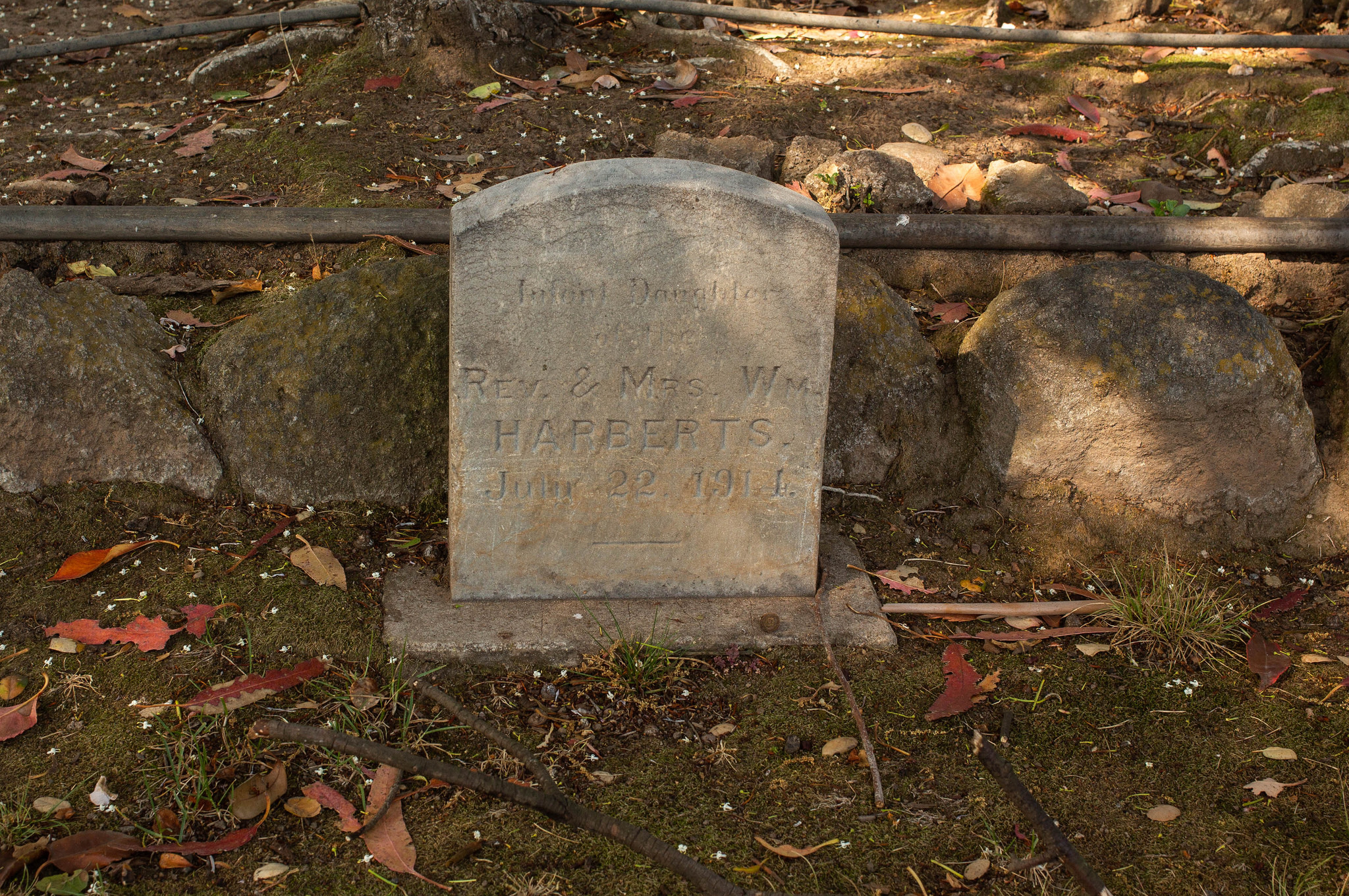
We came across one headstone at Bubbling Well that was for a child, not a pet. It says simply, “Infant daughter of Rev. and Mrs. Wm. Harberts, July 22, 1914.”
An infant’s grave at the Bubbling Well Pet Memorial Park.
That set off some more diligent searching. From the history I can find, the Harberts bought the Bubbling Well property in 1961 — long after the date on the headstone. The history also suggests that the Harberts lived in Iowa or Wisconsin, not California, in 1914. They did come west in the late 1930s and lived in the Los Angeles suburb of Glendale, where William Harberts, a Presbyterian minister, was a pastor. (Lydia died in Alameda in 1960; William died in Berkeley in 1970; one of their sons, Paul, ran Harberts Sporting Goods here and was a member of the East Bay Regional Park board).
William and Lydia Harberts’s oldest surviving child, John Calvin Harberts, was born in 1915, and it was he who bought the Bubbling Well property and started the pet memorial park in 1971. It’s not clear to me why his infant sister’s headstone — and, one assumes, remains — are interred here. My guess is that the family didn’t want to leave her behind in some far-away Midwestern cemetery and brought her to Napa for reburial.
A couple of other finds regarding Bubbling Well. It’s actually the centerpiece of a fairly important piece of American documentary film history: Errol Morris’s first film, “Gates of Heaven.” Roger Ebert called it one of the 10 best films ever made (surprisingly, no, I have never seen it. We can stream it now, and having been up there, we will).
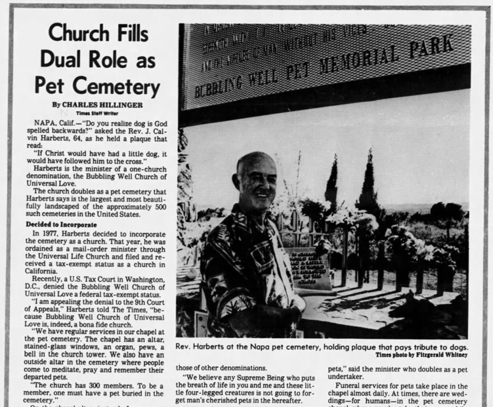
Cal Harberts also got some press back in the late ’70s and early ’80s for attempting to establish his pet memorial operation as a tax-exempt religious institution, The Bubbling Well Church of Universal Love. In July 1980, the Los Angeles Times profiled Harberts and his argument for tax-exempt status.
A 1980 profile of Bubbling Well Pet Memorial Park founder Cal Harberts.
“We believe any Supreme Being who puts the breath of life in you and me and these little four-legged creatures is not going to forget man’s cherished pets in the hereafter. At our church services, the congregation and I say prayers for our departed pets and for sick pets. I read from the Scriptures, recite poetry about pets, talk about the roles pets play in our lives. …
“I spend a good part of my time consoling people, telling them they will see their pets again in heaven. Organized religion doesn’t help them. They have to turn to someone. That is where the religious aspect of the Bubbling Well Pet Memorial Park and the Bubbling Well Church of Universal Love come together.”