How Helper (Utah) Got Its Name, and Other Stories

Helper, Utah, and environs. (this is on the northern outskirts, and according to some maps, this was part of a hamlet, or maybe just a siding on the Denver and Rio Grande Western Railroad, called Martin at some time in the past. Maybe the locals still call it that.

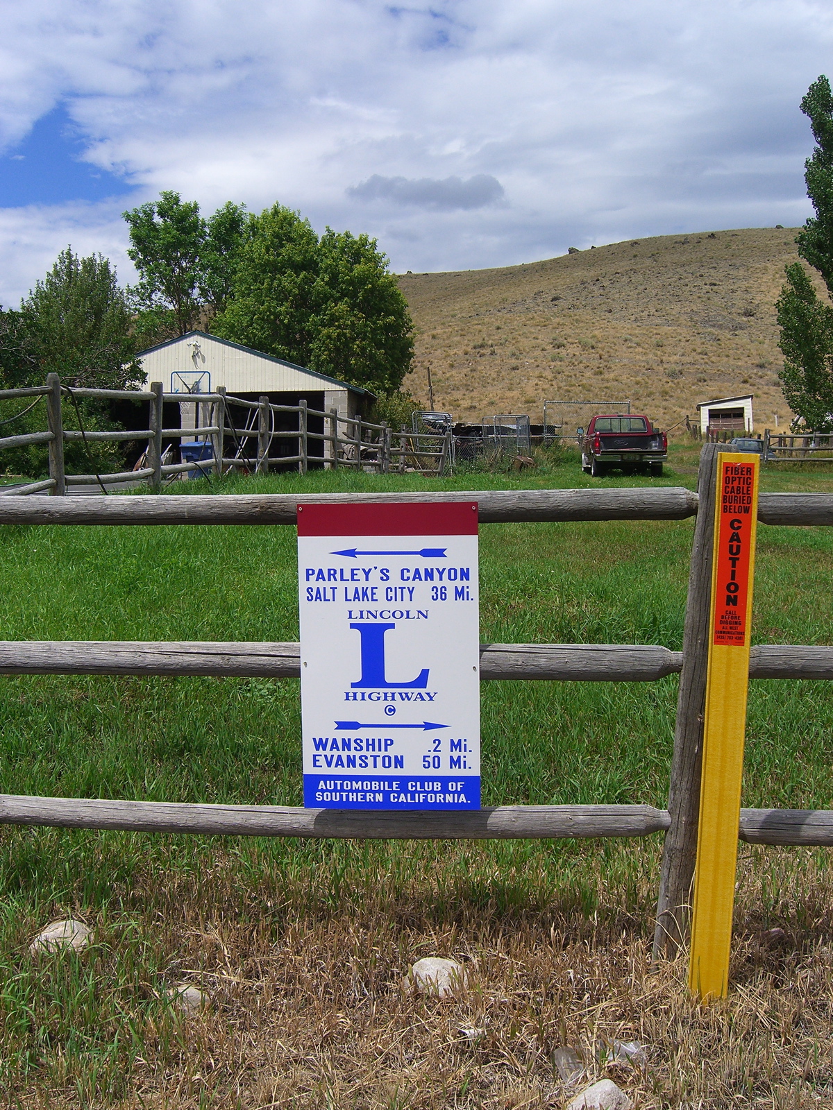
In October 2022, I took a driving trip that took me to Salt Lake City, Moab, and the North Rim of the Grand Canyon, among other stops. I took U.S. 6 between Salt Lake and Moab. The route heads south and east and along one stretch descends through a striking piece of landscape called Price Canyon. At its southern end, the canyon levels off and widens into a valley, where you’ll find the town of Helper. I stopped at the outskirts, walked around a little, and took a few pictures. I posted one to Facebook, and a friend who commented asked where the name of the town came from. Never one to let the opportunity for a bit of research pass me by, here was my answer:

Hi: I took note of your comment on Facebook wondering where Helper, Utah, got its name. It turns out not to be a super-long story, unless I can turn it into one. 

The short version is this: The town started out as a small settlement at the point where a rugged piece of western topography called Price Canyon (and the Price River that flows through it) open into a little valley where Teancum Pratt, the hard-luck son of one of Utah’s Mormon pioneers, settled around 1881. About the same time as Pratt’s arrival (with his two wives and seven children; eventually he and his wives had 17 children, and he did prison time for his plural marriage), the Denver and Rio Grande Western Railroad, was laying out a route down Price Canyon. Trains traveling up the canyon — to the northwest, toward Salt Lake City — faced a long grade, about 1,700 feet in 15 miles. The railroad chose a site near Pratt’s new homestead for a station where it would position extra locomotives — “helper” engines — to enable Salt Lake-bound trains to make it up the canyon. So there it is. “Helper” became the name of the community that grew up around the station. I think it’s at least as good as “Prattville.” 

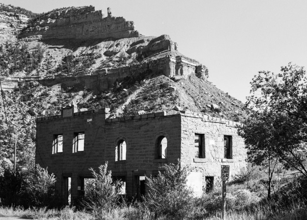
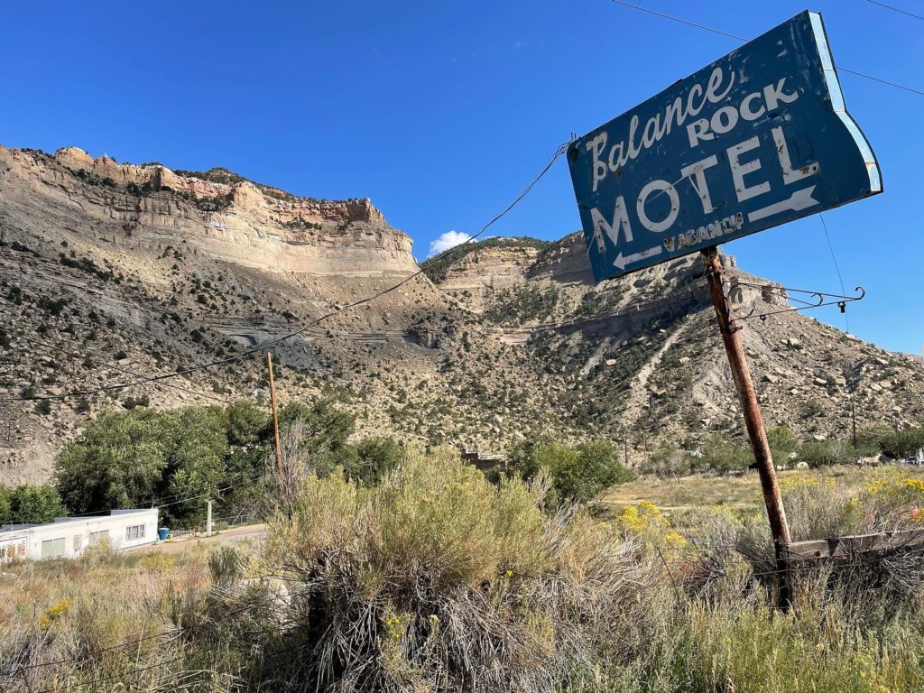
When I drove through there, what I noticed was the spectacular route through the canyon and the striking cliffs surrounding the town (along with the sign of the Balance Rock Motel). It’s almost too much to slow down enough and contemplate how the world we’re moving through was shaped. When I manage to do that, I’m always surprised and often pleased in a way by what I find. 

On the outskirts of Helper, Utah.

For instance, this guy Teancum Pratt. There seem to be lots of little capsule histories that name him in reference to Helper, but none that mention much of his personal experience. I describe him as “hard luck” after reading just a little of his journal. Among the episodes he describes in narrating his life before Helper, here’s one from his teens: 

“In my 15th year, I had the misfortune to lose half of my left foot, which was frozen off while working for George Higginson. I was driving a freight team of 2 yoke of cattle. It was winter. We made it to Salt Lake City before Christmas. Mr. Higginson sent me on to Lehi Fields with both teams of cattle. This took me all day and night, and by morning I was frozen badly. Mr. Higginson treated me badly, being fed on bread alone and not enough of that.”

And here’s a summary of events just before he dragged his clan to what would become Helper: 

“I found that my physical strength was not sufficient to endure hard labor and about the last of June, 1880, I came to the conclusion that I would go out to the frontier and take up land and either sink or swim in the attempt to maintain ourselves. So hearing of Castle Valley, I struck out and came to Price River on the 24th of July, 1880, coming down Gordon Creek from Pleasant Valley and locating at the mouth of Gordon Creek. But the neighbors were hunters, trappers, and bachelors, and soreheads and did not welcome any settlers, so I had a very tough time of it and had to leave that location and moved up to what is now Helper, at that time a lovely wilderness, and commenced anew in 1881.”

Pratt found that the land he had settled wasn’t particularly fertile, and among the various ventures he embarked upon was coal mining. Coal is still a big deal in that area of Utah — Helper is located in Carbon County, which is still a major producer (and has been involved in recent years in trying to build a coal port in Oakland). Mining drew lots of people, money and union organizing to Helper and environs.

And crime, too: In 1897, just up the canyon from Helper, Butch Cassidy and associates managed to hold up the payroll manager of one of the coal companies who had come down on the train from Salt Lake City to pay miners.

And of course, all that just barely scratches the surface of the past of this one place. What transpired here before the “settlers” wandered in? Maybe I’ll get to that. 

Conclusion of seminar. Hope all’s well with you as autumn draws on. … 

Road Blog: Never Rip

Driving in search of an aspen grove I had read about — more accurately described as a “clone,” a stand of trees generated from a single seed and growing from a single root system — that is alleged to be the world’s most massive organism, I happened across the above, painted on the side of the general store in Koosharem, Utah. That’s about 150 miles south of Salt Lake City and not too awfully far from Interstate 70 (to the north) and Interstate 15 (to the west). Here’s a 2012 image of the same sign, which suggests strongly the piece has been “renewed “over the years.

John Scowcroft and Sons, the Ogden, Utah, firm that made Never Rip Overalls through about 1940, was founded by an English convert to Mormonism who emigrated to Utah in 1880. His commercial endeavors in his new home are reported to have started in the confectionery and bakery business and later expanded into clothing and dry goods.

It’s not clear exactly when Scowcroft and Sons began making “Never Rip Overalls.” ZCMI — Zion’s Cooperative Mercantile Institution, the Utah firm formed in the late 1860s to promote Mormon enterprises and entrepreneurs — marketed “never rip” overalls around the turn of the 20th century, as did a New York-based firm that made Keystone Never Rip Overalls. (And “never rip” was a popular sales claim in this era, as evidenced by the slogan for Ypsilanti Health Underwear: “Never rip and never tear — Ypsilanti Underwear.”)

But based on what you find in the newspaper archives it appears that Scowcroft probably started turning out overalls and started a big advertising push for Never Rip Overalls in 1913. The company’s ads touted the clothes’ durability, of course, but put more emphasis on the fact that its products were made in Ogden and that its workers’ salaries supported other local businesses. It claimed a weekly payroll of $1,200 to $1,500 for 150 “boys and girls” (the latter sometimes described as “Utah maids”) who made the goods. Scowcroft also advertised that it was a union shop — apparently organized by the United Garment Workers Union.

Ogden Standard, June 9, 1913.
Ogden Standard, July 9, 1913.

Based on those payroll numbers, workers were making an average of $8 to $10 a week. If you figure a 50-hour work week, that would put pay at 16 to 20 cents an hour. Since workers at the plant were paid a piece rate, getting compensated for each item they produced rather than for each hour worked, pay probably varied widely. Scowcroft said in a recruitment ad late in the decade that “girls” were started out at $7.50 a week during training but could earn much more — even $27 a week — once they picked up speed. (One government report from this era suggests a typical work week in the garment industry was more like 55 to 60 hours a week. Average wages ranged from 14 to 40 cents an hour depending on the skill involved in the position and workers’ gender — then as now, female workers were paid less than men working in the same positions.)

Eclipse Road Trip, Days 8-10: Mountains and Motels and Stuff

Along Highway 487, north of Medicine Bow, Wyoming.

We witnessed the eclipse in Casper, Wyoming, took our time packing up, had an early dinner downtown, and then headed out on an alternate route toward Denver, state highways 220 and 487, thinking to avoid the parking lot that Interstate 25 had become with the Eclipsed Masses heading back to their lives.

In fact, there was very, very little traffic along 487 — although probably a lot by that highway’s standards — and we didn’t see any signs of the masses until we hit the settlement of Medicine Bow, which I recall being the setting, sort of, for the old TV western (and perhaps the movie and novel that preceded it) “The Virginian.” In the dusk, a long line of cars waited to gas up at what looked like a two- or four-pump gas station; a large crowd milled around in the huge parking area outside the adjacent store.

We finally joined the main exodus when we got to Interstate 25 in Cheyenne, and had about 40 miles of stop-and-go traffic down to Loveland, where the first thing we saw when we got off the freeway was a couple fighting on the side of the road (yes, I stopped to see what was happening when the woman appeared to flag us down; seeing that alcohol appeared to be involved, that the parties didn’t appear in danger of doing each other any real physical harm, and that they didn’t want the services of local law enforcement, we went on our way. They turned out to be staying at our motel).

Along U.S. 285 near Fairplay, Colorado.

***

Anyway. I don’t have time this morning — Thursday, in Moab, Utah — to give a blow by blow of what took us from there to here. But Tuesday took us to Denver International Airport, where The Dog and I took leave of Kate, who flew back to the Bay Area so she could be at work on Wednesday.

Then The Dog and I — I did the driving — headed out of the Denver area on U.S. 285, through a couple of pretty vigorous mountain thunderstorms, across Kenosha Pass and South Park and eventually to U.S. 50, where we turned west and stayed the night at a mountain lodge. (My brief adventures trying to find the hotel, just below 11,312-foot Monarch Pass, and my hourlong radio appearance by phone from my Wi-Fi-less, cellphone-less hotel room on KQED’s “Forum” program are entertaining details perhaps to be expanded upon later.)

Along Colorado Highway 145, near Norwood.

Wednesday we crossed Monarch Pass on U.S. 50, then wound our way south and then west and then north from Montrose, Colorado, to Moab (U.S. 50, U.S. 550, Colorado highways 62, 145 and 90, Utah 46 and U.S. 191 were all encountered in this leg of the journey).

All I can say about this part of the world: It’s insanely beautiful, with virtually every turn revealing something I’m taken aback by. And what a varied landscape, from mountain crags to miles and miles and miles of red rock canyons and from dense conifer forests to oceans of sagebrush.

***

We’re about 900 miles from Berkeley at this point, and I was tempted to try and do it all in one go. But I won’t. Today we’re headed for Ely, Nevada, about 400 miles away. That will leave us with a long but eminently do-able drive tomorrow (I used to drive the 500 miles from Berkeley to Eugene at the drop of a suggestion; traveling solo with The Dog, however, is slower. Plus I’m always stopping to gawk at something or to read a roadside plaque).

More later.

Near the town of Bedrock — seriously — on Colorado Highway 90.

Air Blog: Utah

utah060514b.jpg

From USAirways Flight 718, en route from San Francisco to Philadelphia at 33,000 feet, somewhere between east of Capitol Reef National Park, west of Canyonlands National Park. I’ve got to see this from ground level sometime.

Places on a Map

Mexican Hat, Utah: “To start a trip at Mexican Hat, Utah, is to start off into empty space from the end of the world. The space that surrounds Mexican Hat is filled only with what the natives describe as ‘a lot of rocks, a lot of sand, more rocks, more sand, and wind enough to blow it away.’ “

–Wallace Stegner, from “The Sound of Mountain Water,” 1969

Fantasy

I see on the Western States Ride Calendar that there’s a 200-kilometer (125-American Distance Unit) brevet in southern Utah on December 1. It’s a great fantasy: driving out there across central Nevada, maybe doing a little riding along the way, then riding in that beautiful red rock landscape. But it’s a long way to go for a bike ride, especially having driven up to Coeur d’Alene in October. And besides, I’d never get away with it. December 1 is my wedding anniversary.

Technorati Tags: ,

Road Blog: Tiny Ass Ranch

Tinyass080207

Day Two of the Great ’07 Road Trip and Fuel Profligacy Expedition®: Wendover, Utah, to Craig, Colorado. We drove somewhere between 450 and 500 miles today on Interstate 80 (first 120 or so) and U.S. 40 (the rest).

U.S. 40 in Utah and Colorado, like U.S. 50 in central Nevada, lays claim to lying along the route of the original Lincoln Highway; there are signs along the way reminding you. Due to a missed exit — I was preoccupied enough by traffic out of Salt Lake City that I never saw the huge, obvious signs for U.S. 40 — we wound up driving through Wanship, Utah. One of the bonuses was the Lincoln Highway marker below, which carries the name of the Automobile Club of Southern California. The oddity is that it’s on a dead-end stretch of road just outside Wanship, which looks to be a town of about 200 people with an I-80 on-ramp.

The bigger bonus was the sign above. Kate spotted it as I was looking for a turn. We backtracked, then went two blocks west, as the sign suggests, to find the Tiny Ass Ranch. We found a trailer and mailbox with that name emblazoned upon them, but no obvious ranch or roundups in progress. A guy shoveling manure in a barn nearby called, “Can I help you?” when he saw me with my camera. I asked him what the story was with the Tiny Ass Ranch. “Oh — he raises little donkeys.”

Wanship080207

Technorati Tags: , , ,