Loneliest Roads

U.S. 6, Nye County, Nevada.

At some point in the not so ancient past — July 1986 — Life magazine off-handedly dubbed U.S. 50 across Nevada “the loneliest road in America.” The picture caption that included that phrase also quoted an auto club official as saying of the highway: “It’s totally empty. There are no points of interest. We don’t recommend it. We warn all motorists not to drive there unless they’re confident of their survival skills.”

The road already had a reputation as a sort of an outback adventure. Life’s portrait of the highway drew the curious and prompted Chamber of Commerce types to embrace the “loneliest” title and try to turn the highway into an attraction. Somewhere at home we have a passport booklet full of stamps we collected during a trip across Nevada in 2007 — part of a promotion for U.S. 50 travelers. It turns out there are plenty of attractions, including the experience of being out in the middle of shocking expanses of sky and sage and mountain ranges stretching out to forever.

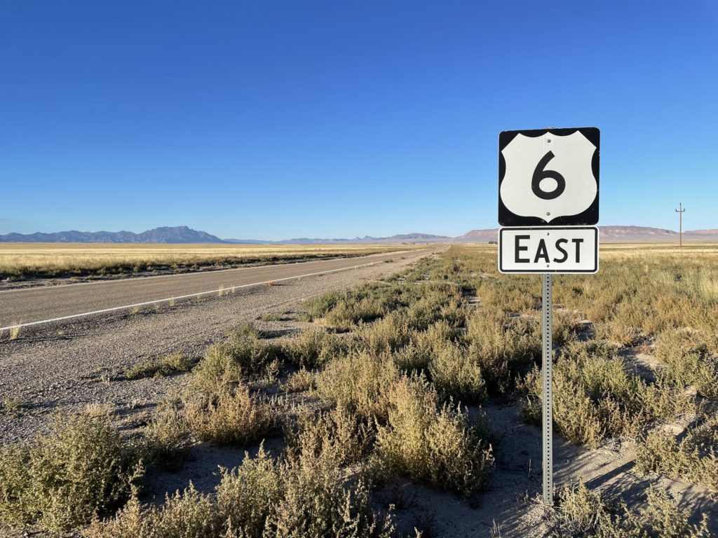
Among the features that U.S. 50 shares with many highways in the back-of-beyond West are long, long stretches of perfectly straight road — stretches that run away across a limitless expanse of valley, then rise up a distant ridge and disappear. And one of the many highways that shares those attributes is U.S. 6, which starts east across Nevada a bit further south than U.S. 50, then makes a turn to the northeast and meets 50 in Ely.

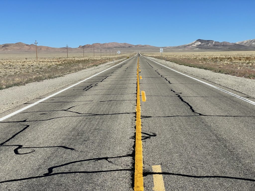
There is a whole story about why roads go where they go, why they take the paths they take. I’m not telling that here. What I do want to relate is how remarkably empty Route 6 was Friday once I left Tonopah in west central Nevada. It started with the sign just outside town saying, “Next Gas: 163 miles.” And it continued, across mountains, road summits and long intervening valleys. I was carrying a camera with a long lens, and occasionally I’d pull over on the arrow-straight sections to try to capture a sense of the scene. Most of the time, no other vehicles were in sight, so I could stand on the center line and shoot away. On one piece of highway, I stopped at the top of the rise and looked back across the valley I had just crossed — the valley pictured above. I had been watching my odometer, and I was staring down the middle of at least 17 miles of pavement. There wasn’t a single vehicle in sight.

U.S. 6, near Tonopah, Nevada. There is a vehicle in sight in this iPhone photo.

Road Blog: Shoe Tree

A beautiful old (and immense) cottonwood east of Fallon, Nevada, that became The Shoe Tree.


On U.S. 50, between Fallon and Austin, Nevada. I noticed a couple cars pulled off the north side of the road; and then I saw why. Thousands of shoes hanging in a big cottonwood. Mostly running and gym-type shoes. A few pairs of work boots. At least one pair of cowboy boots. They’re hung from some of the highest branches, so a lot of climbing goes into this project.

We stopped. There was a couple in an older minivan headed west and a woman in a sedan with New Mexico plates. I asked whether anyone knew the story behind the shoes. The couple shrugged. The New Mexico woman said, “I do.” The legend, as she called it, is that a newlywed couple had a fight and flung their shoes into the tree. “Where did you hear the legend?” I asked. “I’m a tourist,” she said — on her way back to New Mexico after a month on the road. “I found the story in a brochure back in Fernley — this passport thing I got.”

The passport thing turned out to be “The Official Hwy. 50 Survival Guide: The Loneliest Road in America,” a production of the Nevada Commission on Tourism. The guide is an attempt to turn lonely U.S. 50 into a tourist route; you can get a copy at stores along the route, and collect stamps at each of the major towns along U.S. 50’s “loneliest” stretch: from west to east, Fernley, Fallon, Austin, Eureka, and Ely. Kate got one in Austin, and we stopped throughout the afternoon and early evening getting it stamped. Now she can send in a postcard from the guide and get a lovely parting gift from the state tourist people.

Unusual day along 50, by the way: It rained about halfway across the state; at one stop, Cold Springs, the bar/restaurant/motel/RV park proprietor said it was the first rain in four months. And further east, we encountered a road crew cleaning up rock slides on a canyon section of the highway. We wound up in Wendover, Utah, a couple blocks east of the Nevada state line (and a couple blocks into Mountain Time). Left Berkeley at 9:30 this morning, got here at 10:30 (our time). Rain notwithstanding, we drove 650 miles in those 13 hours.

Shoes080107A

Technorati Tags: , ,