Road Trip Postscript: Once It Held Laughter, Once It Held Dreams

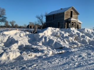
Near Rushville, Sheridan County, Nebraska.
"You can find all kinds of ruins on the Great Plains; in dry regions, things last a long time. When an enterprise fails on the plains, people usually just walk away and leave it. With empty land all around, there is not much reason to tear down and rebuild on the same site. ..." — Ian Frazier, "Great Plains"
"For every surviving ranch, I passed a dozen ruined houses. The prairie was dotted about with wrecks. Their windows, empty of glass, were full of sky. Strips of ice-blue showed between the rafters. Some had lost their footing and tumbled into their cellars. ... Skewed and splayed, the derelicts made up a distinctive local architecture." — Jonathan Raban, "Bad Land"

In mid-September, my brother John and I drove west from Chicago on our return trip to California. We didn’t follow anything like a standard route. From western Illinois across the prairies and into the plains of eastern Wyoming we stuck almost exclusively to two-lane roads, or at least non-interstates: U.S. 30 and 20 across Iowa; Nebraska Highway 12 and U.S. 20 again (after veering briefly into South Dakota along the Missouri River) across the Cornhusker State; and U.S. 20 once more until it merged with Interstate 25 near Casper, Wyoming. (Here’s a collection of pictures from both the east- and westbound legs of the trip.)

One morning along the way, we backtracked from Chadron, Nebraska, to Rushville, then headed north toward the Pine Ridge Oglala Sioux Reservation just across the South Dakota border. The site of the 1890 Wounded Knee massacre is on the reservation; it’s a spot I’ve long wanted to visit, and it was sort of an obvious bookend for our eastbound stop at the Little Big Horn battlefield.

A few miles up the road toward Pine Ridge we passed the house above. Both John and I, who had brought film cameras to record our travels, said we needed to remember to stop at the place on the way back from Wounded Knee. Three or four hours later, I was speeding back south when John said, “There it is.” “Really? Are you sure? I don’t think so. That doesn’t look like the same place to me.” “No — that’s the place.”

I hit the brakes hard, and we turned onto a dirt road adjacent to the house. I took note of a man on a tractor about a quarter-mile away and wondered whether he had some connection to the house. But I didn’t think about that for long. We broke out our cameras, including John’s 5-by-7 pinhole camera, a couple of older Nikons, and one of several rangefinder models I had brought along.

After about 15 minutes, I saw that the man on the tractor had stopped his plowing, climbed down, and was walking toward the house. I more than half-expected he would ask what the heck we were doing on his land. Instead, he said something like, “Picture day, huh, fellas?” Yes, the house was on his family’s land, but he was pretty genial and really just curious about what we were doing. It turned out that this was far from the first time he’d encountered passers-by who had stopped to photograph the house.

And about the house: The farmer/rancher, who told us his family name was Viher and that he’d been born here just after World War II , said it had been owned by a family named Rush (maybe the Rushes of Rushville?) and was last occupied in the 1940s. Mr. Viher said there was a problem with occasional vandalism on the property — at some point, someone had come along and burned down a barn adjacent to the house; a half-burned shed still stood.
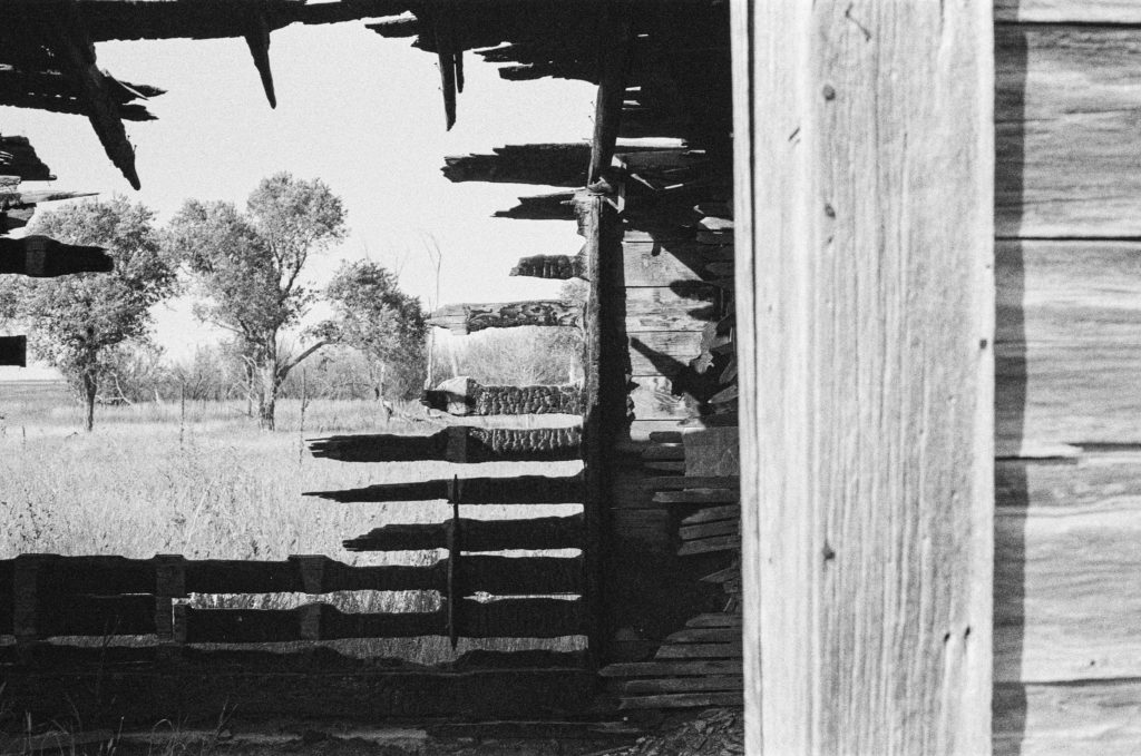
On the Viher Ranch, Sheridan County, Nebraska.

There’s probably an essay waiting to be written here about why ruins like this attract our attention, but given the fact it’s taken me four months to sit down and write even a bare description of the visit, this is not it.

I did think to ask Mr. Viher if I could take his picture before he went back to plowing. He was agreeable.
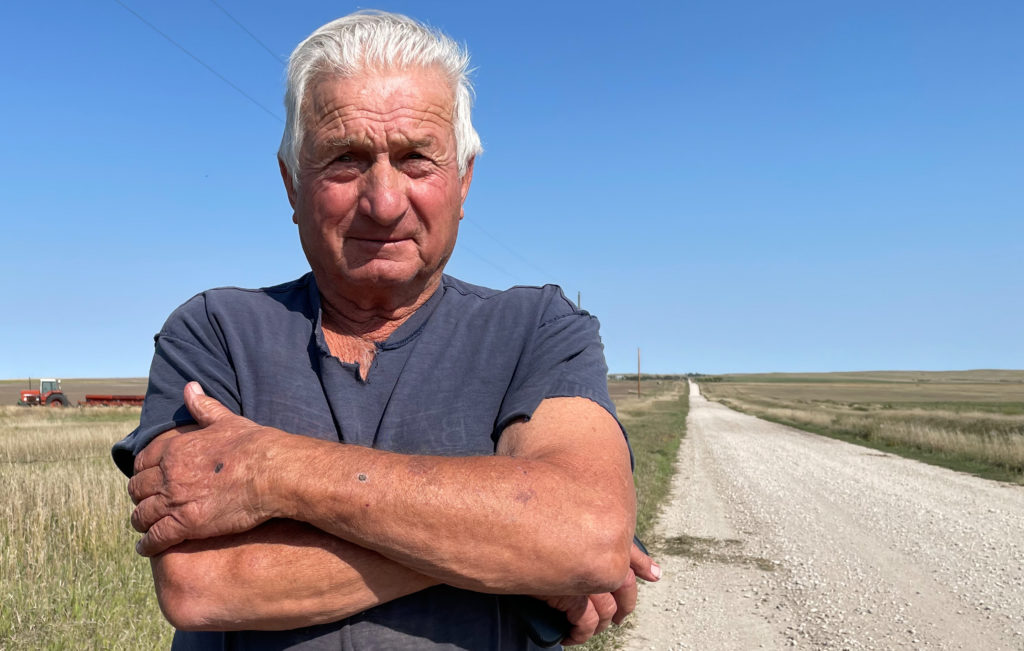
Mr. Viher, September 2021.

Afterward, I did something I’d never done before: I had the picture printed, figured out the Vihers’ address on their ranch, and sent it to him. I didn’t hear back for a while and wouldn’t have been too surprised to get no response. But on New Year’s Eve, I got an email thanking me for the picture and respondng with a collection of snapshots of the house and other ranch scenes.
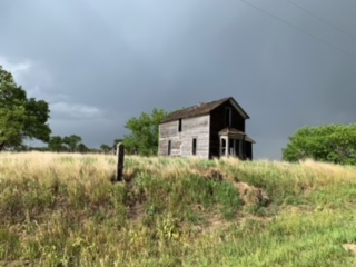
And those shots, if nothing else, show me that that picturesque wreck of a house out there on the plains speaks just as much to at least some of the folks living out there as it does to the random traveler with a camera.
Up There

A nice little piece in The New York Times a few days ago: “Tweaking a Camera to Suit a Hobby.” The hobby in question is launching balloons with point-and-shoot cameras attached and, as far as I can tell, letting them go where they will go. The folks featured in the article, who go by the handle North Iowa Experimental High-Altitude Ballooning (NIXHAB), use balloons that have reached heights around 100,000 feet. That’s far enough up there to give the impression you’re on the edge of space. (My first question: Do these guys need to file flight plans or consult with the FAA?).

The Times story focuses on the software hacks that allow the balloonists and other hobbyists to set up Canon point-and-shoot cameras to record their images. Here’s one from the NIXHAB site (also used in the Times piece):

1951 Buick

It’s a Buick Roadmaster Deluxe. For sale for $4,000 if you’re looking for a project. It’s been parked at various spots around Mariposa and Alabama streets, a couple blocks from where I ply the radio news editor trade, for at least a month. (Those stacks in the background of the top photo–I’ve been looking at them for the last year and I haven’t yet investigated what defunct local manufacturing operation they might have been part of.)

buick040309a.jpg

buick040309.jpg

Whiz

whiz032609a.jpg

At 18th and South Van Ness. I walked by a couple months ago at midday while exploring a different route to work. I haven’t investigated, but maybe the location is part of a bygone chain (on the other hand, the sign says “since 1955”). In any case, it’s the one and only Whiz burger stand I know. I haven’t yet sampled the fare.  

Mission Palms

missionpalms032609.jpg

Last night, at the northeast entrance to the 16th Street BART station. Beautiful, warm afternoon and evening. Lots of people on the street, and the scene at the plaza around the station had a little bit of crazy energy to it at the moment I showed up: some of the homeless and local SRO (single-room occupancy) hotel residents arguing, parents reprimanding kids, a mom yanking her kid by the arm as she took him into Burger King for dinner, people spilling out of a Muni bus that had just pulled up at the corner.

For several blocks, I had watched the light above change and looked for an opportunity to try and catch it. Not that it’s so important; but in a way these pictures are a little like postcards to myself, reminding me of a place, a moment. This was my last look at the street scene before heading down the escalator to the train.  

On the Homefront

enginewoman.jpg

Just noodling around, looking for historical pictures of California for a possible project, I came across the Library of Congress stream on Flickr. Soon, I came across a series of slick, posed images of women at work during World War II in Los Angeles-area aircraft plants. I’m captivated by how much is going on here: high (for its time) technology, the serious industrial setting, the artful setup and shot, the costume, the war-on-the-homefront theme, the intensity of the worker as she does her job (not to mention the conceit that the man in the shot is instructing the little lady on what to do).

The caption: “Women are trained to do precise and vital engine installation detail in Douglas Aircraft Company plants, Long Beach, Calif.” It was shot in October 1942 for the Office of War Information, our domestic propaganda agency, and credited to Alfred T. Palmer, the agency’s chief photographer. Click for larger image.

Space Visitors, Again

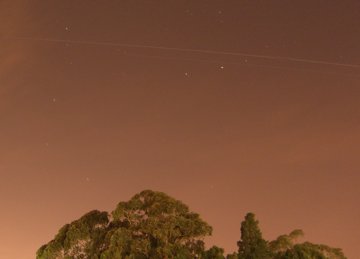
Issshuttle121906

Issshuttle121906A

As I just wrote to my brother John;

“… I wasn’t so lucky with the pictures last night. It

started clouding up about an hour before sunset, and

the space station and ISS were crossing well to the

north (maximum elevation was about 27 degrees). So it

was doubtful they’d be as bright even if they were

visible. At the scheduled time — the shuttle was

supposed to appear at 6:03, the ISS at 6:04 — I

couldn’t see anything, but I released the shutter

anyway. After about 30 seconds, I could see something

moving dimly above the clouds in the northwest. After

the first 60-second shot, I reaimed the camera further

east, and realized there were two objects moving by; I

had missed the first, the shuttle, but both were

clearly visible as they crossed through the north to

the northeast. I tried another 60-second shot and got

both of them, though they don’t look nearly as bright

as they did just looking at them. Looking at the shots

now, there was so much ambient light that the sky

became very washed out, and a shorter exposure might

have shown them better Something to remember for next

time.

“Still — pretty amazing stuff. I was seeing them about

four hours after they had separated; if you assume

they were exactly a minute apart, that means the

distance between them was just under 300 miles (the

distance they travel in 60 seconds at 17,500 mph).

Looks like it will be too cloudy here to see the

shuttle again before it lands.”

Technorati Tags: ,