I once almost visited Atlanta — made it to a vague part of what I recall to be the northwestern outskirts — in 1972. It is an enduring memory, fogged as it is with the exhaustion and anxiety that attended the episode and a certain amount of lingering regret.
You’d like to hear more — exhaustion? anxiety? regret? — but I’m not going to go into all that right this minute.
I’m in Atlanta for real now for the wedding of a former KQED colleague. And while I have not done a lot of exploring as of yet, I can say that I like the woodsy corner of the city I’ve landed in. The neighborhood is called Kirkwood, adjacent (or at least close) to Decatur in Atlanta’s northeastern quadrant.
One notable finding when I walked to breakfast late this morning — a discovery that may be entirely commonplace to the locals — is the profusion of mockingbirds (Mimus polyglottos) hereabouts.
Checking my own mockingbird history, I see I have posted on them before — in 2014 and again last year. So there’s something about the birds, including the poem “Thus Spake the Mockingbird” and my memory of how brilliantly Kate reads it, that stops me and makes me listen. A passage from said verse:
…I am Lester Young’s sidewinding sax, sending that Pony Express
message out west in the Marconi tube hidden in every torso
tied tight in the corset of do and don’t, high and low, yes and no. I am
the radio, first god of the twentieth century, broadcasting
the news, the blues, the death counts, the mothers wailing
when everyone’s gone home. …
So, here is a Kirkwood variation on the mockingbird’s never-ending solo.
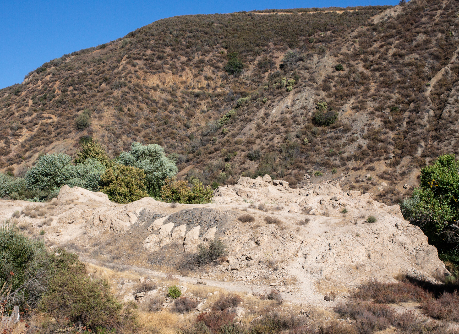
Part of the ruins of St. Francis Dam, northeast of Los Angeles.
We managed to spend a whole day on the road today without getting out of Los Angeles County.
That was partly due to a detour to the Santa Monica Pier as we headed out of town. And then a second detour to the REI in Santa Monica. And then a third detour to Peet’s Coffee in Santa Monica. (We’re allegedly going camping and need to be real prepared.)
The main detour of the day was a search for the site of St. Francis Dam, which collapsed in 1928, killed at least 450 people, ended the career of William Mulholland, and wrought major changes in dam design and engineering.
We finally made it to the dam site in the waning half of the afternoon and spent a half an hour or so hiking part of the area (it’s worth more time; I hope to come back … soon-ish).
There is a lot of great background material on what happened at the dam. The best may be from J. David Rogers, a Berkeley-trained professor of geological engineering at the Missouri University of Science and Technology in Rolla who has spent decades investigating why the dam failed and documenting the disaster’s effect on the practice of engineering.
“The dam failed catastrophically near midnight on March 12/13, 1928, in its second year of operation. … The resulting flood swept down San Francisquito Canyon, with an initial depth of 140 feet above the streambed. About five minutes later, the flood destroyed a powerhouse (and workers’ community) approximately 7,300 feet downstream, killing 126 of the 129 people living there. The flood wave swept on down the canyon, widening considerably at its juncture with the Santa Clara River coming out of Soledad Canyon. It then swept through Castaic Junction and on down the Santa Clara River Valley, blasting a Southern California Edison construction camp (killing 84 of the 140 workers encamped there), thence inundating the migrant farm community at Camulos, before skimming the lower elevations of the established cities of Fillmore, Santa Paula, Saticoy, and Montalvo. The flood waters reached the ocean around 5:30 a.m., after traveling approximately 52 miles. The official death toll was 432 persons, making it the greatest engineering tragedy recorded in America in the 20th century. But those official statistics did not include Mexican migrant farm workers, of which, an unknown number also perished. One hundred seventy-nine of the listed victim’s bodies were never recovered, including those of damkeeper Tony Harnesfaeger and his 6-year-old-son.”
The magnitude of the tragedy is a little hard to grasp standing at the dam site. There are some monumental heaps of rubble. If you look around, you can see evidence that the piles of broken concrete were part of something bigger.
But nature is reclaiming the site. A cool wind blew up through the cottonwoods and maples that have taken over the streambed where the calamity began. San Francisquito Creek sounded fresh and alive.
One note: It’s a little odd that there’s no official recognition of the site beyond a state historical marker about a mile and a half away — at the powerhouse that was destroyed in the 1928 torrent. This is a place — apparently national forest land — that deserves to be remembered and interpreted.
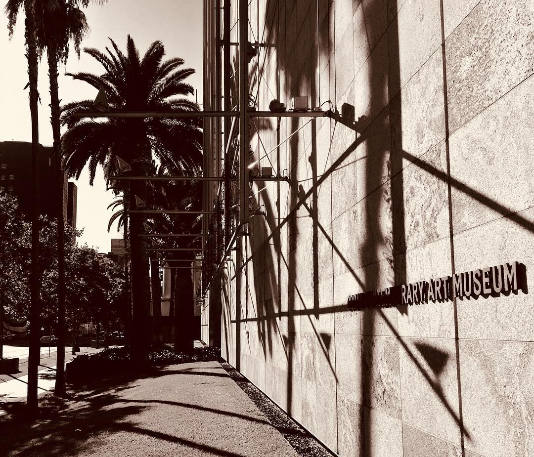
The Eli Broad wing of the Los Angeles County Museum of Art on Wilshire Avenue.
I have spent nearly all of the last 42 years in California, and all of that in the San Francisco Bay Area. I’ve visited Los Angeles about a dozen times. I only get to double figures by counting episodes like the time I delivered a drive-away car, a white Chevy Vega station wagon, to its perhaps rueful owner in Venice Beach; and day trips to do interviews for stories I’ve worked on; and visits to Disneyland, which some may dispute involve a visit to “Los Angeles.” It is not an impressive list, especially considering you can’t have any real idea of California without at least a passing acquaintance with this place.
So here we are on Day Three of dropping in for a visit and just … staying put for the most part.
Example of what I mean by “staying put.” Thom and Megan found an apartment that’s a short walk from the Los Angeles County Museum of Art. Today, we went to check the place out and spent the afternoon there (and spent virtually all of the time visiting one exhibit on the evolution and applications, practical and artistic, of three-dimensional imaging technology.
After that, it was back to the apartment, then a hike to the Los Angeles Farmer’s Market — which is actually a warren of dozens of restaurants and shops, including a couple that sell produce, that is reminiscent of the shopping district adjacent to Tokyo’s Asakusa Shrine — to buy some salad stuff for dinner, which was pizza.
Anyway: This is Night Three in Los Angeles — and I believe it’s the first time I’ve ever spent three nights here in a row.
Tomorrow: Breakfast here, then heading out. Only one stop set on the itinerary: the site of St. Francis Dam, northeast of the city, which collapsed 90 years ago this year and killed about 450 people. Considered by many to be the biggest civil engineering disaster in U.S. history. (William Mulholland, the general manager and chief engineer of L.A. Water and Power, had pronounced the new dam sound 12 hours before it failed.)
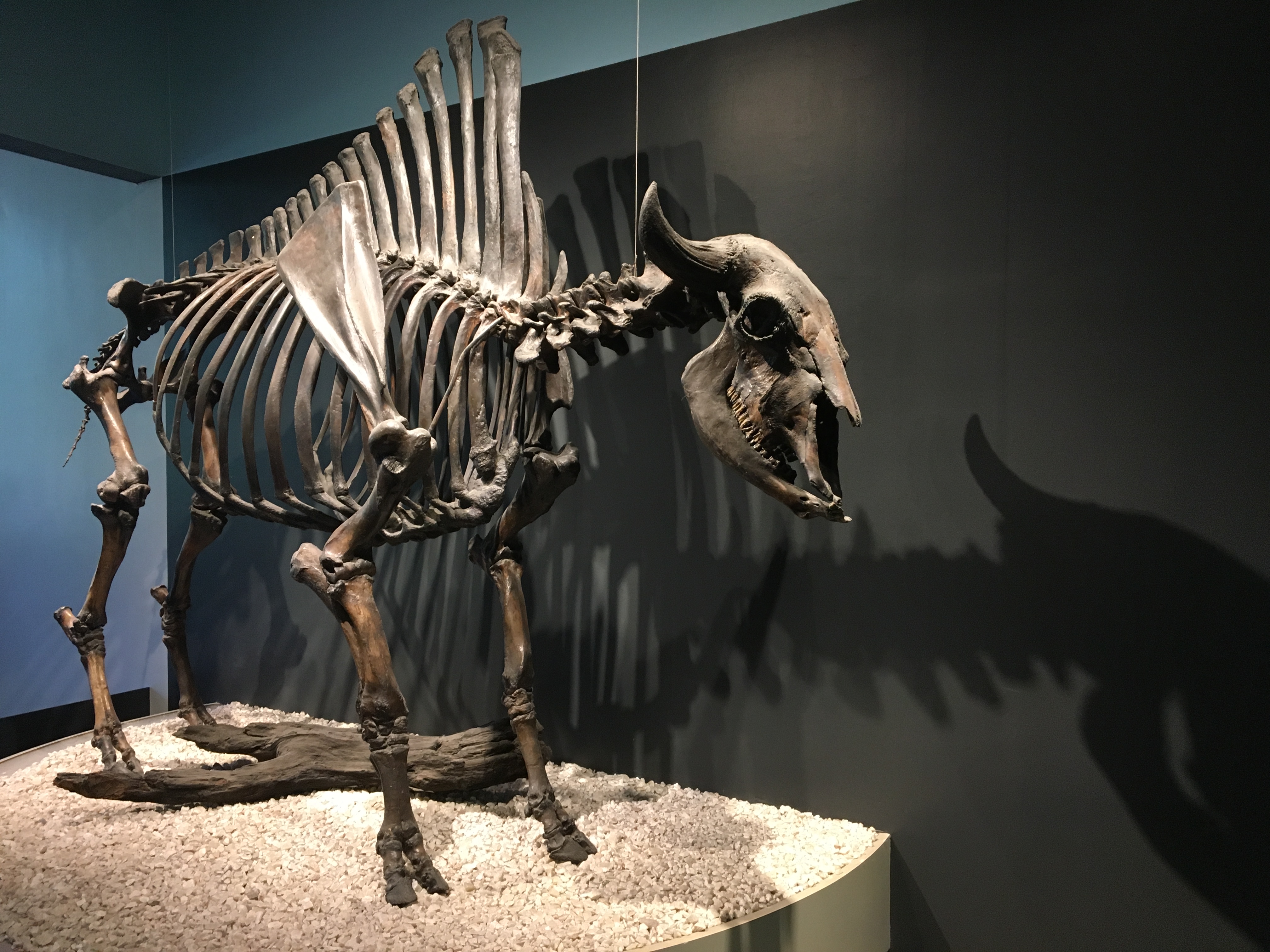
The skeleton of Bison antiquus (Ancient bison) at the La Brea Tar Pits museum.
The tourists in Los Angeles today:
1) Did not fall down on the sidewalk.
2) Went to the La Brea Tar Pits (more below).
3) Watched a painful (for us) college football game.
4) Drove up to the Griffith Park Observatory, along with a huge crowd on hand to mark the equinox. We saw lots of people, lots of lights in the city below, and no parking spaces. We shall return.
About the pits: Growing up, the La Brea Tar Pits seemed to be part of an obscure joke. Visiting today and seeing them in person — the real science growing out of the millions of fossils recovered there and how the place fits into the ancient and modern city — I wondered why I thought so.
In the 1950s, there was a Bugs Bunny cartoon, “My Bunny Lies Over the Sea,” that makes an incidental mention of La Brea. It’s something slight and before my time, so I thought I must have picked up on the joke someplace else.
Johnny Carson came to mind. I don’t doubt that he was just one of many who found something odd and out of place about the asphalt deposits right in the middle of Los Angeles and made them part of a punchline. Having watched Carson many, many times — and given his long tenure here in L.A. — it seems likely that that’s where I picked up on the tar pit jokes.
Thanks to the Sometimes Magic Memory Machine, here’s an extended Carson riff — one bad joke after another — on the La Brea Tar Pits.
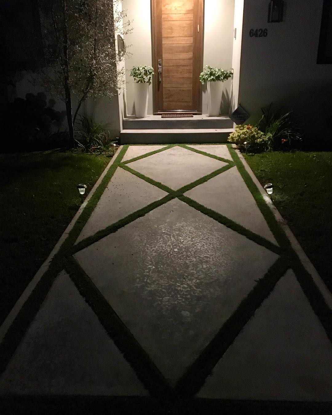
5th Street in Los Angeles, not too far from the La Brea tar pits in one direction and Beverly Hills in the other.
We drove down to Los Angeles from Berkeley today. History was made: Kate drove the first two-thirds of the trip, her first time negotiating the Interstate 5-San Joaquin Valley raceway. (As it happens, we haven’t taken I-5 south through the valley much, even in our 30-some years driving around California together, and when we have, I’ve been at the wheel.)
We’re here to visit Thom and Megan (that’s our son and his girlfriend, if people still say girlfriend), who just moved down here. After we got to our hotel, a little after dark, Kate and I walked over to their place, which is about a mile away. We remarked, as some non-Angelenos do, that there are not a lot of pedestrians on the street, even in this well-groomed old neighborhood. We also noted that some of the sidewalks are in amazingly bad shape, pushed up by tree roots in this well-groomed old neighborhood. I managed to trip on a panel of concrete jutting up a good 3 or 4 inches higher than the preceding slab.
The fall was not graceful, and it hurt enough that I was content to lie on the curb strip for a minute before I got back up. No lasting damage beyond a couple of skinned knees. It wasn’t fun, but once I started walking again and the little bit of adrenaline or endorphins or whatever kicked in, I actually felt oddly exhilarated.
Picture above: a front walk on 5th Street, near where we are staying and not far from where I fell on my face.
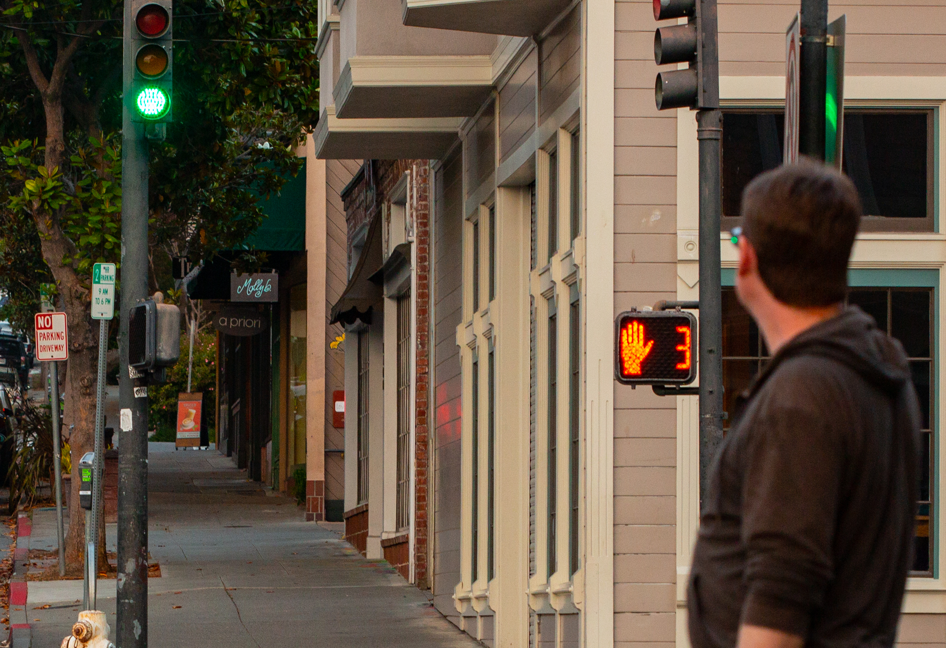
Shattuck Avenue and Walnut Street, Berkeley.Curious fact: Until this year, it was against the law in California to start across a street after the countdown timer started (or when the red “don’t cross” hand appeared).
A state legislator from down there got a bill passed (and the governor’s signature on that bill) that now allows pedestrians to start across on the countdown as long as they make it to the other side — or can stop in a safe place mid-street, like a median — by the time the counter hits zero.
For intersections with the older signals — those that display the walking man or the red hand only, with no timer, it’s still illegal to begin crossing once the hand starts flashing.
I think a lot about homelessness, about what it represents in our society, about our responses to it collectively and individually, about the many encounters — with a man named Charles, instance, and with Eric, and with Perry — with the destitute and down and out I’ve had over the years. And about the meaning of personal gestures.
The New York Times just published excerpts of the prison letters of Nelson Mandela. One, to his son Makgatho, talked about effective responses to poverty:
I have been reminiscing a great deal … Those were the days when you lived a happy life free of problems and fenced from all hardships and insecurity by parental love. You did not work, grub was galore, clothing was plentiful and you slept good. But some of your playmates those days roamed around completely naked and dirty because their parents were too poor to dress them and to keep them clean.
Often you brought them home and gave them food. Sometimes you went away with double the amount of swimming fees to help a needy friend. Perhaps then you acted purely out of a child’s affection for a friend, and not because you had become consciously aware of the extremes of wealth and poverty that characterized our social life. …
It’s a good thing to help a friend whenever you can; but individual acts of hospitality are not the answer. …
This is not a problem that can be handled by individual acts of hospitality. The man who attempted to use his own possessions to help all the needy would be permanently ruined and in due course himself live on alms. Experience shows that this problem can be effectively tackled only by a disciplined body of persons, who are inspired by the same ideas and united in a common cause.
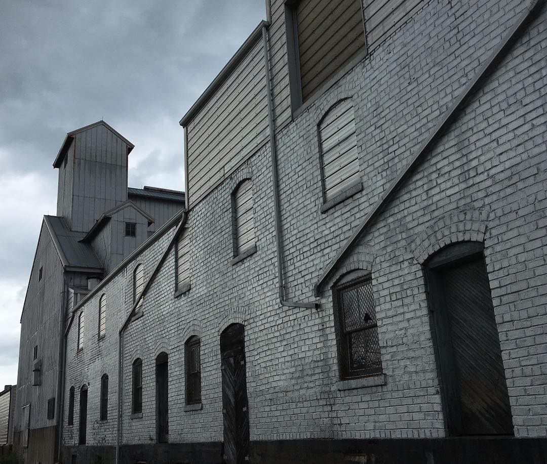
Part of the grain elevator complex in Morrison, Illinois, just east of the Mississippi and northeast of the Quad Cities.
I left my power cord back in Chicago, so I will keep this short. After a relaxed, not to say lazy, start of the day, we started rolling at 11. OK — that was kind of lazy.
Made our way out from the North Side out to through the western suburbs on Interstates 294 and 88. Got off of U.S. 30 to continue west at Rock Falls. Right there we had the only weather of the day, driving through a line of thunderstorms that apparently marked a cold front. It was much cooler and drier to the west — 74, for instance, in Morrison, Illinois — see above — where I stopped to check out the local grain elevator scene.
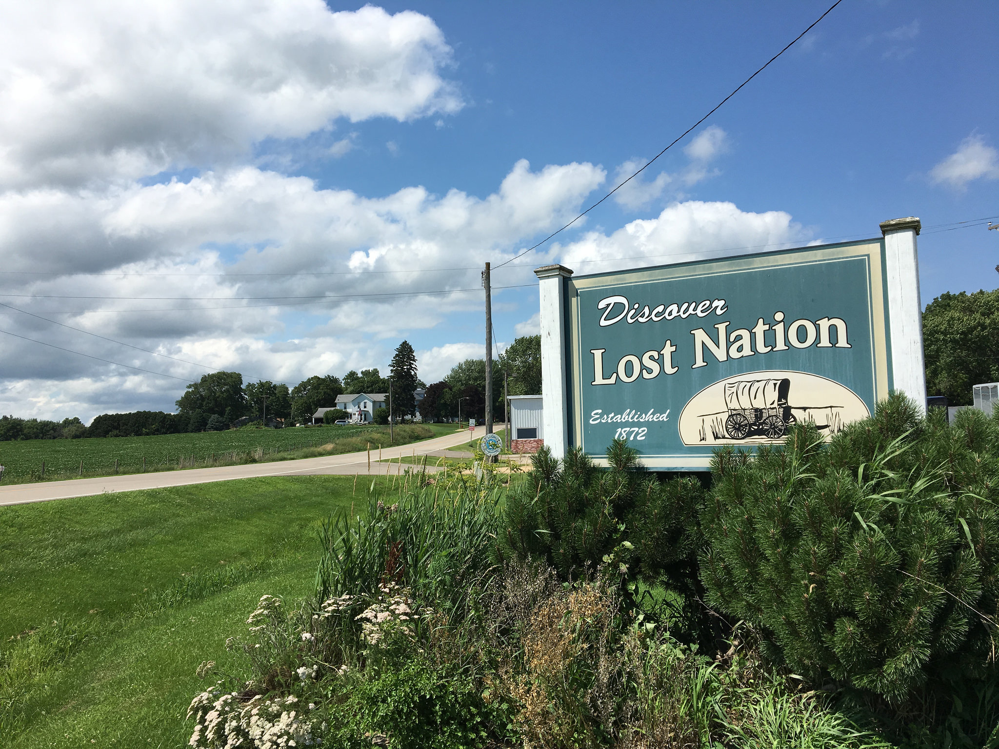
We stayed on U.S. 30 across the Mississippi, through Clinton, Iowa, and on to a hamlet called Calamus. A road sign pointed north to Lost Nation. I kept going, but pulled over half a mile on to consult an actual paper map to see what getting to Lost Nation might involve. Wandering for 8 or 10 miles on country roads, it looked like. We were not under the gun timewise — we were to meet Eamon and Sakura in West Des Moines (they were coming up from Cincinnati, part of their trek from New York to Seattle) — so I did a U-turn and headed up the backroads.
A town of 400 advertising ‘small city security with big city access.’
Lost Nation: The best picture would have been of the road signs pointing out the turn, as the town itself (population 400) proved unprepossessing in our 5-minute visit (it bills itself as offering “small city security with big city access). One wonders about the origins of the name, and the stories that have found their way into print suggest both pestilence and a fanciful-sounding Native American tale as the source.
Me, my expectations tend toward pestilence or worse. Not too far down the road, we passed a sign saying, “Limited government under God: Vote Republican.”
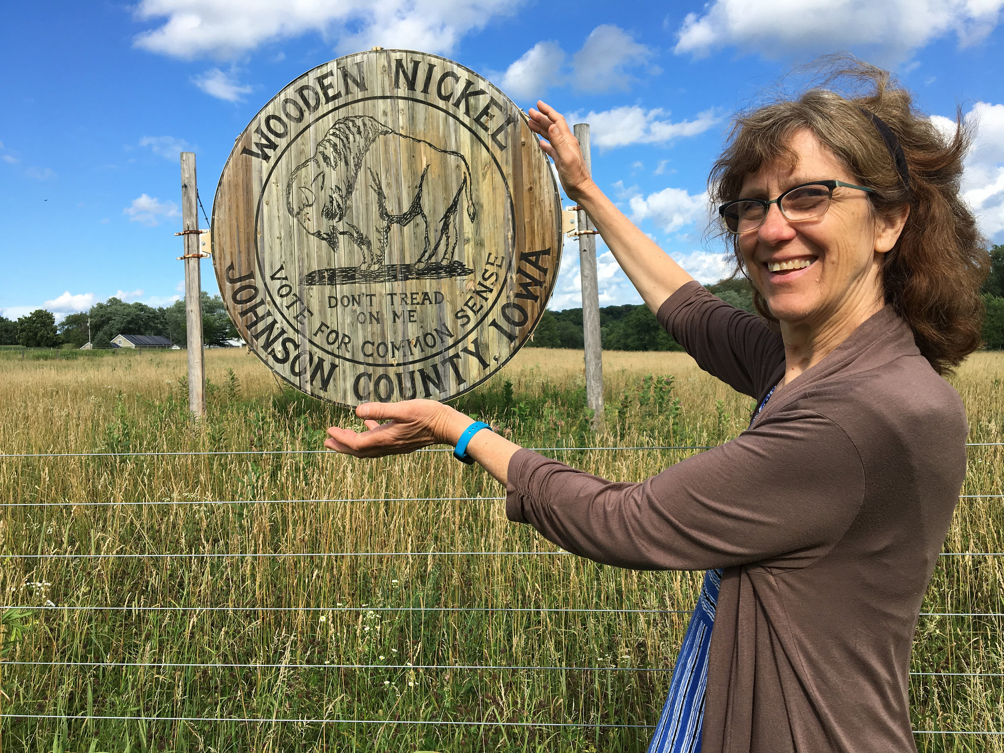
We stopped to see what locals advertise as the world’s biggest wooden nickel, just outside Iowa City. After that, we got on Interstate 80 for the rest of the trip west. Eamon and Sakura got to the hotel nearly at the same moment we did (they would have beaten us, but stopped by the Iowa state capitol building on the way). Then dinner. Then back to our hotel, the Sheraton, and back on the road early in the morning.
California woman with local socio-political attraction near Iowa City.
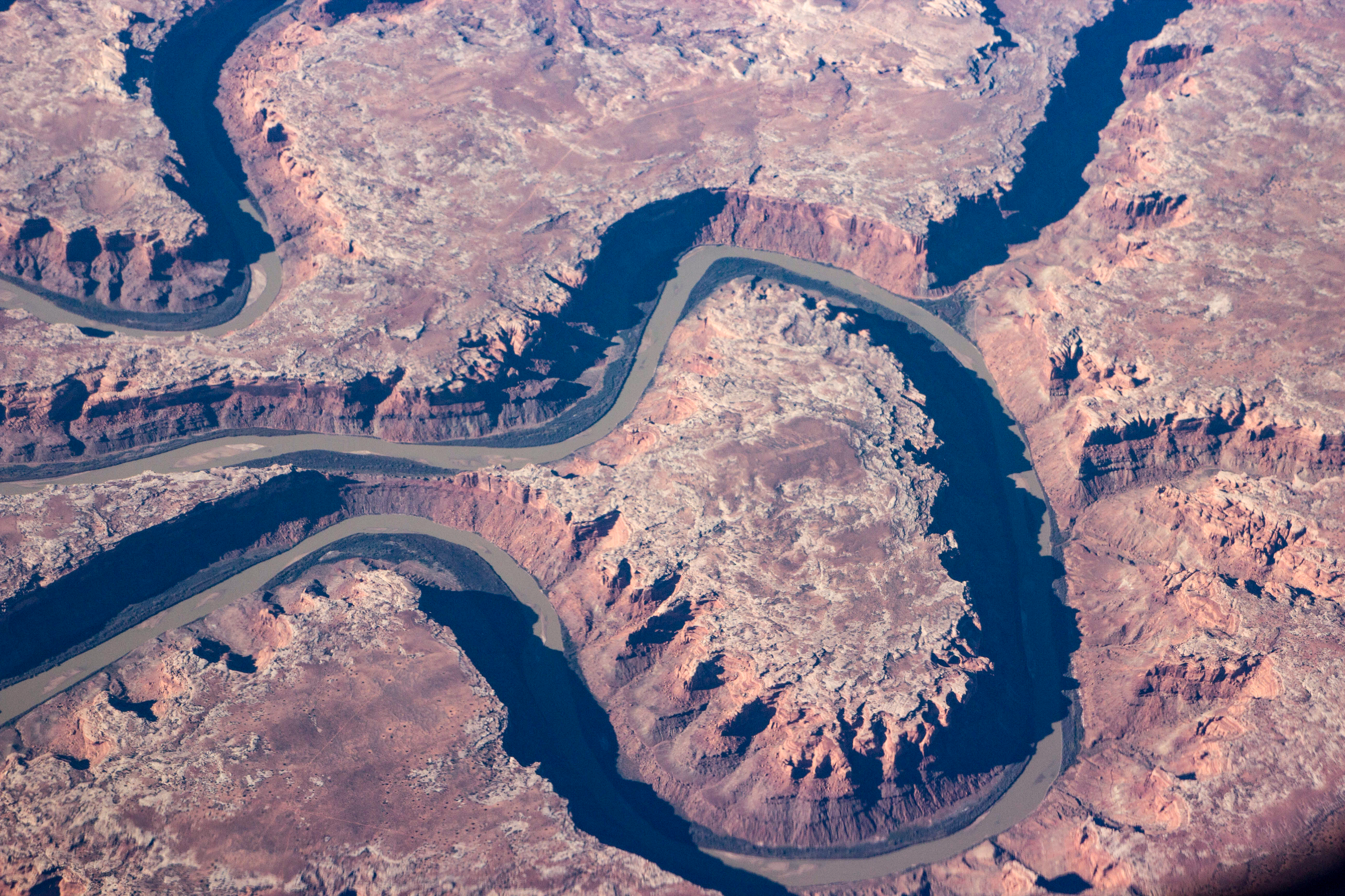
Above, a shot from a flight from Nashville to Oakland in April 2016. I always take a window seat. I hardly ever watch the in-flight movies. The the window is my in-flight movie.
Every once in a while, I’ll actually get a half-decent picture of some dramatic piece of landscape. I was reasonably sure that this was the Green River someplace in eastern Utah. Checking Google Maps and Gmaps Pedometer, this place is 25 miles due west of Moab and 28 miles south-southeast of Green River, Utah. The perspective is looking north from just south of the bend.
From the NASA writeup: “Bowknot was named by geologist John Wesley Powell in 1869 during one of his famous explorations of the rivers in the American West. The Green River flows south (toward the top of this image) and joins the Colorado River downstream. The combined flow of these rivers was responsible for cutting the Grand Canyon, some 325 kilometers (200 miles) away from Bowknot.”
And finally, here’s Powell’s journal entry, dated July 15, 1869, of traveling down this stretch of the Green River:
About six miles below noon camp we go around a great bend to the right, five miles in length, and come back to a point within a quarter of a mile of where we started. Then we sweep around another great bend to the left, making a circuit of nine miles, and come back to a point within six hundred yards of the beginning of the bend. In the two circuits we describe almost the figure 8. The men call it a bow knot of river so we name it Bow knot Bend. The line of the figure is fourteen miles in length.
There is an exquisite charm in our ride to day down this beautiful cañon. It gradually grows deeper with every mile of travel; the walls are symmetrically curved, and grandly arched; of a beautiful color, and reflected in the quiet waters in many places, so as to almost deceive the eye and suggest the thought, to the beholder, that he is looking into profound depths. We are all in fine spirits, feel very gay, and the badinage of the men is echoed from wall to wall. Now and then we whistle, or shout, or discharge a pistol, to listen to the reverberations among the cliffs.
At night we camp on the south side of the great Bow knot, and, as we eat our supper, which is spread on the beach, we name this Labyrinth Cañon.
I’ve written before — a while ago — about the terrible early days of June 1968.
I’m a little puzzled that I could be reflecting on the 50th anniversary of anything. I’m like the old guy in 1968 looking back on the end of the Great War.
But here we are. Fifty years ago on this date, immediately after declaring victory in the California primary, and just moments after 14-year-old me turned off the TV election coverage and went to bed, an assassin shot Robert Kennedy in Los Angeles.
If you listen to NPR’s “Morning Edition,” you might have heard this StoryCorps segment, which features a man who came to the mortally wounded Kennedy’s aid. If you were alive at the time, you remember the photograph of that scene.
The segment brought that night and that terrible loss back in a rush. The most poignant moment: Juan Romero, the hotel worker who tried to help Kennedy, saw the senator’s lips moving as he lay on the floor. Romero says he put his head down so he could hear Kennedy’s words. He was asking, “Is everybody OK?”