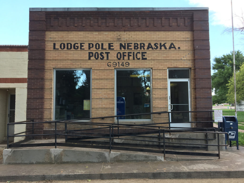
Starting midday Saturday from Sidney, Nebraska — a town of 6,000 just off Interstate 80 in the southwestern corner of the Nebraska panhandle — we drove east on U.S. 30 through the towns of Sunol and Lodgepole (or Lodge Pole, if you believe the lettering on the Post Office building there).
Lodgepole was one of my destinations on this trip. According to letters from one of my great-great-grandfathers, Timothy Jeremiah Hogan, his parents moved their family to this part of Nebraska in the mid-1860s to work on the Union Pacific railroad. Tim suggests they lived first in Lodgepole, then Sidney, 16 miles west, so the family would have the protection from hostile Indians in the area.
We hung around Lodgepole for maybe 30 or 45 minutes. I took pictures, naturally. We cruised by the most substantial building in town, the old brick public school — every small Nebraska town seems to have one. Then we were off again in the rain — we were caught in the beginning of a pretty persistent thunderstorm — and stayed west on Route 30, then turned north on Nebraska 27 to Oshkosh, on the North Platte River.
North of Oshkosh, the state blacktop ends and you begin a 60-mile stretch that begins with well-maintained dirt roads for roughly the first (southern) half of the drive and continues on a single lane of choppy asphalt for the second (northern) half.
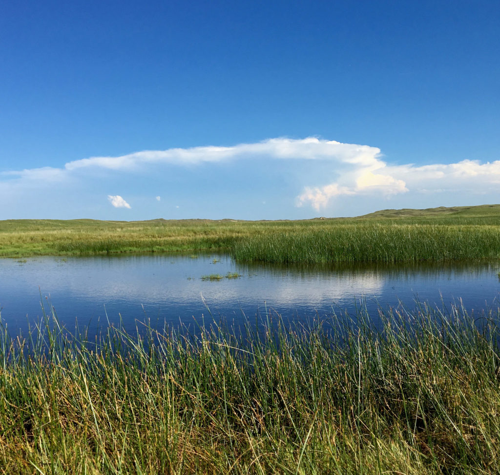
The reason you take that road, which goes through the Crescent Lake National Wildlife Refuge, is that it’s crossing one of the more remote parts of Nebraska’s Sand Hills.
The Sand Hills are a sweeping expanse of grass-covered dunes — about 20,000 square miles — said to have formed after the last ice age. And driving through on a road that twists and turns and somehow always seems to be climbing, it’s apparent you’re traveling through sand dunes being held in place by grasses and wildflowers (chief among the latter: black-eyed susans).
Anyway. I thought the Sand Hills would be the ideal place to watch the eclipse, and yesterday’s drive was to scout out the road. We saw a dozen, maybe 15 other cars, almost all with out-of-state plates, apparently doing the same. Passing ranches along the road, I had the same feeling of eclipse envy I experienced elsewhere on our trip — “Gee, these people live right here where the show is happening. Aren’t they lucky. I wish I could stay here.”
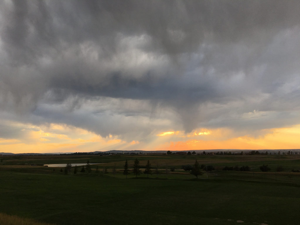
We got off that Crescent Lake road a little before 6 p.m. — another product of our late start — and headed east on Nebraska Highway 2, which runs for about 125 miles or so right through the heart of the Sand Hills. Our destination was Valentine, on U.S. 20 right up at the top of the state, and adding in that we crossed into Central time and lost and hour, we didn’t get off the road until 10 (it was all beautiful, though — even the lightning show to our east at dusk.
We checked into our hostelry, which I’ll call the Sketchy Rest, walked the dog, and then began checking on the latest Monday morning forecasts for the Sand Hills.
I want to say here that I am an inveterate, if not a sophisticated, reader of weather forecasts of all kinds. As I pored over forecast discussions and graphical forecasts and meteorological whatnot, the consensus from those who study computer models to understand upcoming weather was that it was likely to be cloudy in the Sand Hills on Monday morning. Part of me simply doesn’t want to believe that and found it hard to picture after experiencing one beautifully sunny follow another all the way through our trip. That included Saturday, when the Sand Hills were framed by distant, rising thunderheads but were spectacularly clear along our road.
The forecasts hadn’t improved by this morning (Sunday), so we went looking for options.
The forecast for Casper, Wyoming, was for clear, clear, clear skies. Plus, it’s close to the center of the eclipse path. What if we could find a place there?
I checked motels. There were a few room on offer online — $2,000 for a single night. No.
Kate, whom I believe is both charming and lucky (she wound up with me, after all), started to call motels. She found some friendly innkeepers, but no room.
I checked Craigslist. There was a single listing for a sort of in-law unit near the south end of Casper. No price listed. I got in touch with the person who posted the place. We talked. A price was agreed on (he happened to name the figure that Kate and I had previously agreed would be our maximum; more than I’d pay in any other circumstances, I think, but not a killer — and not anything like $2,000).
So we hit the road to Casper from Valentine — 325 miles on top of the 2,000 from the previous six days — rolling west on U.S. 20 about 1 p.m. It was a fast trip, with the usual dog- and picture-related stops, and we pulled in here just after (we gained an hour traveling back into Mountain time).
The sky when we got here? Starting to cloud up. Thunder was rolling. The light and storm clouds were beautiful. The stars are out tonight, though, and the forecast is still for sunny (and smoky) skies in the morning. Except for this one note from the regional forecast office, which noted the likelihood of some smoke in the air:
“One other feature to watch is (a) thinning band of higher clouds that is forecast by some of the guidance to be between the Wind River Basin and Casper around totality time. It may be clearing the Wind River Basin/Riverton vicinity in time and then possibly affect the Casper area between 11 and noon. May be a rather narrow band then but there could be some concern for viewing in this narrow cloud feature.”
Kate just reminded me that the moon will start crossing the sun’s disk here at 10:22 a.m MDT. Totality will occur at 11:43 a.m. I wonder where that cloud will be.