We drove from Dad’s place on the far North Side out toward Joliet, southwest of the city, to find the spot where the Des Plaines and Kankakee rivers come together to form the Illinois.
The first 99 percent of the route is straightforward: If you like, you can drive to within a few miles of the spot on Interstate highways. But we got off the expressway and took side roads to follow the dual channels of the Des Plaines and the Chicago Sanitary and Ship Canal. The side roads weren’t pastoral lanes; we drove past one tank farm and refinery and generating plant after another. Eventually we turned away from the Des Plaines and drove west and south through brand new subdivisions — some half built, some just surveyors’ markers outlining streets and lots for homes that will go up next year; one neighborhood with a long curving boulevard of fresh asphalt and a giant new playground and not a single home even under construction yet. We eventually passed through a place called Minooka, which must have been a quiet little crossroads once. We crossed a highway at a strip mall called Mallard Point and drove south about a mile to a T intersection where we met my brother John, his wife, Dawn, and their two kids (Sean and Leah) who had driven over to meet us from my other brother’s place).
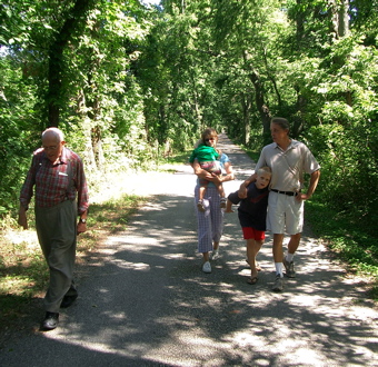
After wandering around on a couple of country roads, we finally figured out that the road to the confluence depicted on one of our maps was actually the towpath to the old Illinois and Michigan Canal — the link that in the mid-19th century connected Chicago and Lake Michigan and all points east to the Mississippi River and the interior of much of the United States. We hiked down the path for maybe three quarters of a mile, to where the conjoined rivers go through a lock and dam. A little short of the confluence, but close enough for today. Everyone was still smiling on our way back to the cars.

So, it’s really there? What possessed you to check this out? This is one of life’s great mysteries for me – since I was a small child.
Driving north on I-55 there’s a sign for the Illinois and Michigan Canal. It’s like one of those brown “it’s right here” kind of signs, as opposed to one of those green “exit here to see it” kind of signs. But, of course, barrelling down the highway, all I’ve ever seen are weeds along the side of the road. Where is it? Why can’t I see it? What am I doing wrong?
Is that why you all were smiling?
Oh, yes, it’s there. My dad had an itch to go out and see the confluence. He’s turning 84 this week, and I think he felt like there something important missing from his Chicagolander’s resumé. Me, too, I guess. I’ve always been vaguely aware that the rivers and the I&M Canal played a huge role in Chicago becoming what it did, but never was really clear on the history of it until reading “City of the Century” (Donald L. Miller) a couple years ago. So, it was a fun little history quest, I guess, and stumbling upon the canal was just a bonus.
Funny about the canal: It’s obvious once you realize what it is. But it’s easy to miss, even with all the signage out there. Of course, I recommend (highly) going out there. From northbound 55, here’s how you could do it: Exit 55 at Bluff Road (3rd exit north of the Kankakee River); head west to U.S. 6 and turn left (southwest); go three miles to Ridge Road and turn left (south; there’s a new strip mall on the right at this corner called Mallard Point); go 1 mile to the end of Ridge, where you hit Hansell Road; turn right (west) on Hansell; the road descends and winds down the low bluff; on the right side of the road, you’ll pass first an old cemetery next to a too-fancy modern house, then the Dollinger Farm, which a sign says a guy named Hansell founded in 1852. After a mile, you’ll come to a stop sign. Turning left, you’ll immediately cross a bridge — that’s the I&M Canal, right there — and you’ll see a small paved parking lot, again to the left after you cross the bridge. Follow the towpath from the parking lot out to Lock and Dam No. 10, about three-quarters of a mile up the Illinois River (which you can hear from the towpath).
(And actually, now that I know a little more about the lay of the land out there and can tell a little more about what the Google satellite pictures are actually showing, there’s an easier alternate if your goal is to see the confluence: After turning southwest on U.S. 6 off Bluff, go 1.6 miles to McKinley Woods Road and turn left (the turn is right where U.S. 6 begins a bend to the right); go south along McKinley Woods Road about 2.25 miles; it looks from the Google Map picture that the road winds down the bluff, then ends at a parking lot. It’s possible you can see the Kankakee coming into the Des Plaines from the top of the bluff. From the parking lot, it looks like about a three-quarter mile hike out to the point on the tow path where you could see the rivers coming together.
That’s MUCH more than I intended to write, and perhaps much more than you wanted to know, too.